Category:Depden
Aller à la navigation
Aller à la recherche
localité britannique du comté anglais de Suffolk  | |||||
| Téléverser des médias | |||||
| Nature de l’élément | |||||
|---|---|---|---|---|---|
| Lieu | St Edmundsbury, Suffolk, Angleterre de l'Est, Angleterre | ||||
| Réputé identique à | Depden (page en doublon, paroisse civile) | ||||
 | |||||
Sous-catégories
Cette catégorie comprend 4 sous-catégories, dont les 4 ci-dessous.
Média dans la catégorie « Depden »
Cette catégorie comprend 50 fichiers, dont les 50 ci-dessous.
-
 A143 Bury Road, Depden - geograph.org.uk - 4192960.jpg 3 072 × 2 116 ; 783 kio
-
 A143 near Clopton Green - geograph.org.uk - 3854526.jpg 640 × 480 ; 301 kio
-
 A143 towards Bury St Edmunds - geograph.org.uk - 5797015.jpg 1 024 × 684 ; 244 kio
-
 A143 towards Bury St Edmunds - geograph.org.uk - 5797022.jpg 1 024 × 684 ; 174 kio
-
 A143 towards Bury St Edmunds - geograph.org.uk - 5797029.jpg 1 024 × 684 ; 198 kio
-
 A143 towards Bury St Edmunds - geograph.org.uk - 5797036.jpg 1 024 × 684 ; 247 kio
-
 A143 west of Chedburgh - geograph.org.uk - 5842360.jpg 1 600 × 1 067 ; 312 kio
-
 A143 Wickhambrook - geograph.org.uk - 3854531.jpg 640 × 480 ; 362 kio
-
 Big Al's caff off the A143 - geograph.org.uk - 190441.jpg 640 × 427 ; 80 kio
-
 Bridleway Sign - geograph.org.uk - 2763033.jpg 768 × 1 024 ; 288 kio
-
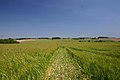
 Bridleway through the wheat - geograph.org.uk - 2022852.jpg 1 600 × 1 200 ; 689 kio
-
 Bucket And Bottle Head - geograph.org.uk - 2763028.jpg 1 024 × 768 ; 334 kio
-
 Bury Road, Chedburgh - geograph.org.uk - 5797043.jpg 1 024 × 684 ; 203 kio
-
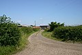
 Coblands Farm - geograph.org.uk - 1236478.jpg 640 × 480 ; 71 kio
-
 Coblands Farm, near Depden - geograph.org.uk - 190443.jpg 640 × 427 ; 59 kio
-
 Communications mast, near Great Wood - geograph.org.uk - 2483250.jpg 768 × 1 024 ; 134 kio
-
 Control plant, Rede Water Reservoir - geograph.org.uk - 2483279.jpg 1 024 × 768 ; 158 kio
-
 Depden Green, Depden - geograph.org.uk - 4192961.jpg 3 072 × 2 304 ; 1,14 Mio
-
 Driveway to Samples Farm, Great Ashfield - geograph.org.uk - 193348.jpg 640 × 427 ; 84 kio
-
 Elms Farm - geograph.org.uk - 2483321.jpg 1 024 × 768 ; 191 kio
-
 Elms Farm, Depden - geograph.org.uk - 2483313.jpg 1 024 × 768 ; 168 kio
-
 Entering Wickhambrook on the A143 Bury Road - geograph.org.uk - 4192988.jpg 2 965 × 2 227 ; 1,7 Mio
-
 Entrance to Coblands Farm - geograph.org.uk - 190442.jpg 640 × 427 ; 124 kio
-
 Footpath at Clopton Green - geograph.org.uk - 193655.jpg 640 × 427 ; 60 kio
-
 Footpath at Park Gate, Wickhambrook - geograph.org.uk - 190135.jpg 640 × 427 ; 146 kio
-
 Footpath from Clopton Green to Rede. - geograph.org.uk - 193658.jpg 640 × 427 ; 68 kio
-
 Footpath to Ashfield Green - geograph.org.uk - 186943.jpg 640 × 480 ; 113 kio
-
 Footpath to Badmondisfield Hall - geograph.org.uk - 190136.jpg 427 × 640 ; 100 kio
-
 Footpath to Dodd's Farm - geograph.org.uk - 193350.jpg 449 × 640 ; 99 kio
-
 Footpath to Purton Green - geograph.org.uk - 193645.jpg 640 × 427 ; 102 kio
-
 Footpath to Wickham Street - geograph.org.uk - 193657.jpg 640 × 427 ; 85 kio
-
 FWAG Notice - geograph.org.uk - 2763011.jpg 1 024 × 768 ; 208 kio
-
 Highest point - geograph.org.uk - 917909.jpg 640 × 480 ; 82 kio
-
 Long drive - geograph.org.uk - 917907.jpg 480 × 640 ; 63 kio
-
 Road leading to mast - geograph.org.uk - 5569102.jpg 1 200 × 1 600 ; 721 kio
-
 Rookery Farm, Depden - geograph.org.uk - 4006824.jpg 3 552 × 2 368 ; 2,46 Mio
-
 Scarecrows in the trees - geograph.org.uk - 2763015.jpg 1 024 × 768 ; 379 kio
-
 Stuck gate on bridleway - geograph.org.uk - 2022847.jpg 1 600 × 1 200 ; 617 kio
-
 The road through Depden Green - geograph.org.uk - 1407220.jpg 640 × 480 ; 66 kio
-
 Walkers along bridleway between fields - geograph.org.uk - 5570358.jpg 1 500 × 897 ; 1,31 Mio
-
 Water tower - geograph.org.uk - 3407080.jpg 4 320 × 3 240 ; 3,5 Mio
-
 Wickhambrook (A143) - geograph.org.uk - 3854528.jpg 640 × 480 ; 343 kio
-
 Wickhambrook Village Name sign - geograph.org.uk - 4192991.jpg 2 857 × 2 146 ; 2,2 Mio
-
 Black Wood - geograph.org.uk - 1480495.jpg 640 × 480 ; 68 kio
-
 Byway at Genesis Green - geograph.org.uk - 186946.jpg 640 × 480 ; 117 kio
-
 Conservation walk near Wickhambrook - geograph.org.uk - 190138.jpg 427 × 640 ; 104 kio
-
 Elms Farm, Depden - geograph.org.uk - 190440.jpg 640 × 427 ; 77 kio
-
 Fishpond at Cordell Hall - geograph.org.uk - 193644.jpg 640 × 427 ; 85 kio
-
 Footpath to Wickham House, Denston - geograph.org.uk - 193640.jpg 640 × 427 ; 67 kio
-
 Muddy byway, or 'green lane'. - geograph.org.uk - 190137.jpg 640 × 427 ; 140 kio


_-_geograph.org.uk_-_3854528.jpg)


