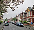
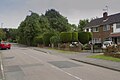
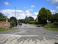
Category:Derby
Zur Navigation springen
Zur Suche springen

English: This category is about Derby, a city and unitary authority in the East Midlands region of England
- NOTE: There are many other places, etc. with Derby. See en:Derby (disambiguation)
Stadt in England   | |||||
| Medium hochladen | |||||
| Aussprache (Audiodatei) | |||||
|---|---|---|---|---|---|
| As en |
| ||||
| Steed | City of Derby, Derbyshire, Uast Madlunen, Ingelun | ||||
| Grünjlaanj |
| ||||
| Iinwenertaal |
| ||||
| Grate |
| ||||
| amtelk wääbsteed | |||||
 | |||||
Onerkategoriin
Uun detdiar kategorii stun 30 onerkategoriin faan 30 uun't gehial.
- Postcards of Derby (3 D)
1
- 1843 Royal Agricultural Show (18 D)
B
- BBC Radio Derby (6 D)
- Boden Pleasuance (1 D)
C
- Derby City Council (12 D)
D
- Derby Book Festival (21 D)
- Derby Royals F.C. (3 D)
H
L
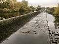
- Longbridge Weir (6 D)
R
T
- The Sanctuary (Derby) (3 D)
V
- The Venue (99 D)
W
- Whitehurst & Son (4 D)
Meedien uun kategorii "Derby"
Uun detdiar kategorii stun jodiar 200 datein faan 1.506 uun't gehial.
(leetst sidj (turag)) (naist sidj)-
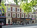
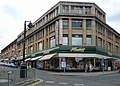
 15 Market Place, Derby - geograph.org.uk - 4173649.jpg 640 × 439; 169 KB
-
 17 Sitwell Street, Derby - geograph.org.uk - 4181379.jpg 534 × 640; 163 KB
-
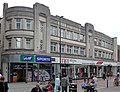
 19-24 Victoria Street, Derby - geograph.org.uk - 4181481.jpg 640 × 371; 133 KB
-
 1905c W G Paulson Townsend.jpg 1.344 × 2.031; 108 KB
-
 2-3 Market Place, Derby - geograph.org.uk - 4173633.jpg 640 × 502; 210 KB
-
 2-40 The Strand, Derby - geograph.org.uk - 4181651.jpg 468 × 640; 171 KB
-
 20 Iron Gate, Derby - geograph.org.uk - 4174515.jpg 593 × 640; 211 KB
-
 20-21 Cornmarket, Derby - geograph.org.uk - 4178124.jpg 469 × 640; 185 KB
-
 25-29 Wardwick, Derby - geograph.org.uk - 4181661.jpg 640 × 492; 252 KB
-
 3 St Mary's Gate, Derby - geograph.org.uk - 4174617.jpg 514 × 640; 182 KB
-
 3-4 Iron Gate, Derby - geograph.org.uk - 4174464.jpg 445 × 640; 170 KB
-
 34 Iron Gate, Derby - geograph.org.uk - 4174461.jpg 433 × 640; 188 KB
-
 34-38 Cornmarket, Derby - geograph.org.uk - 4178111.jpg 515 × 640; 201 KB
-
 35-36 St Mary's Gate, Derby - geograph.org.uk - 4175044.jpg 596 × 640; 221 KB
-
 40 Babington Lane, Derby - geograph.org.uk - 4178286.jpg 640 × 457; 159 KB
-
 40-42 St Mary's Gate, Derby - geograph.org.uk - 4187020.jpg 640 × 516; 184 KB
-
 7-11 St Peter's Street, Derby - geograph.org.uk - 4181442.jpg 640 × 490; 161 KB
-
 7-15 Wardwick, Derby - geograph.org.uk - 4181657.jpg 607 × 640; 171 KB
-
 8-14 St Helen's Street, Derby - geograph.org.uk - 4174974.jpg 487 × 640; 176 KB
-
 A back street car park - geograph.org.uk - 6265687.jpg 2.000 × 1.330; 1,76 MB
-
 A bench by the River Derwent - geograph.org.uk - 1058298.jpg 640 × 426; 114 KB
-
 A Block Mackworth College - geograph.org.uk - 5948836.jpg 832 × 608; 68 KB
-
 A busy traffic island - geograph.org.uk - 5313601.jpg 2.000 × 1.333; 1,85 MB
-
 A cycle and footpath - geograph.org.uk - 6242873.jpg 2.000 × 1.330; 2,72 MB
-
 A football pitch - geograph.org.uk - 5625517.jpg 2.000 × 1.333; 2,39 MB
-
 A footbridge by the railway line - geograph.org.uk - 6158197.jpg 2.000 × 1.330; 2,06 MB
-
 A grassy area in the centre of Derby - geograph.org.uk - 6158184.jpg 2.000 × 1.330; 2,89 MB
-
 A green off Perth Street - geograph.org.uk - 5434391.jpg 2.000 × 1.333; 2,48 MB
-
 A landscaped bank in the Arboretum - geograph.org.uk - 6270781.jpg 2.000 × 1.330; 3,74 MB
-
 A narrow alley off Iron Gate - geograph.org.uk - 5315839.jpg 1.333 × 2.000; 1,82 MB
-
 A not so quiet footpath - geograph.org.uk - 6145065.jpg 2.000 × 1.330; 3,21 MB
-
 A pair of old cottages - geograph.org.uk - 4353936.jpg 1.200 × 900; 201 KB
-
 A pale rainbow - geograph.org.uk - 6004612.jpg 1.351 × 2.000; 2,91 MB
-
 A pale rainbow - geograph.org.uk - 6004616.jpg 2.000 × 1.333; 2,2 MB
-
 A path in the centre of Derby - geograph.org.uk - 6242872.jpg 2.000 × 1.330; 2,79 MB
-
 A rainy day in Cedar Street - geograph.org.uk - 3954916.jpg 1.024 × 887; 1,02 MB
-
 A rainy day on Raynesway - geograph.org.uk - 5394714.jpg 2.000 × 1.333; 1,74 MB
-
 A road to the self storage building - geograph.org.uk - 6145083.jpg 2.000 × 1.330; 1,78 MB
-
 A September evening in Corporation Street - geograph.org.uk - 4180035.jpg 1.024 × 1.024; 1.022 KB
-
 A service Road - geograph.org.uk - 5626976.jpg 2.000 × 1.333; 1,8 MB
-
 A service Road in Mickleover - geograph.org.uk - 5626973.jpg 2.000 × 1.333; 2,45 MB
-
 A side entrance to the centre - geograph.org.uk - 6277896.jpg 2.000 × 1.330; 1,8 MB
-
 A soggy day in Derby - geograph.org.uk - 6145070.jpg 2.000 × 1.330; 2,04 MB
-
 A Springtime view of London Road - geograph.org.uk - 5395856.jpg 2.000 × 1.333; 3,14 MB
-
 A sunny day on the car park - geograph.org.uk - 6272107.jpg 2.000 × 1.330; 1,35 MB
-
 A train under Raynesway - geograph.org.uk - 5620835.jpg 1.280 × 960; 376 KB
-

-
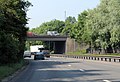 A38 bridge near University of Derby - geograph.org.uk - 4050288.jpg 1.600 × 1.098; 472 KB
-
 A38 bridge over River Derwent - geograph.org.uk - 5534992.jpg 1.600 × 1.199; 748 KB
-
 A38 entering Derby boundary - geograph.org.uk - 4569636.jpg 640 × 350; 103 KB
-
 A38 heading north east - geograph.org.uk - 4074181.jpg 640 × 483; 53 KB
-
-
 A516 joining A38 - geograph.org.uk - 4569675.jpg 640 × 286; 59 KB
-
 A516 overbridge from A38 north - geograph.org.uk - 4569651.jpg 640 × 329; 57 KB
-
 A52 Brian Clough Way - geograph.org.uk - 3753053.jpg 2.890 × 2.299; 1,32 MB
-
 A52 Wyvern transport improvements - geograph.org.uk - 5682541.jpg 1.280 × 960; 416 KB
-
 A52, Eastgate - geograph.org.uk - 4759313.jpg 640 × 356; 46 KB
-
 A6 at Pride Park in Derby - geograph.org.uk - 5656974.jpg 800 × 535; 86 KB
-
 Abbey Lodge Student Village - geograph.org.uk - 6066574.jpg 1.280 × 960; 354 KB
-
 Abbey Street - geograph.org.uk - 6290987.jpg 2.000 × 1.333; 2,31 MB
-
 Abiah Darby in Derby Mercury.jpg 304 × 338; 60 KB
-
 Access Road near 'The Stryne' - geograph.org.uk - 3413693.jpg 3.916 × 2.884; 2,7 MB
-
 Acorn Way - geograph.org.uk - 3572857.jpg 640 × 480; 84 KB
-
 Acrefield Way, Chellaston - geograph.org.uk - 6184177.jpg 1.024 × 768; 162 KB
-
 Albert Road - geograph.org.uk - 3572850.jpg 640 × 480; 55 KB
-
 Albert Road - geograph.org.uk - 3572854.jpg 640 × 480; 51 KB
-
 Albert St looking towards Victoria St - geograph.org.uk - 5290623.jpg 2.000 × 1.333; 1,83 MB
-
-
 All weather pitch - geograph.org.uk - 5349519.jpg 2.000 × 1.500; 2,12 MB
-
 Along Siddals Road - geograph.org.uk - 4180022.jpg 1.024 × 821; 767 KB
-
 Alvaston Park - geograph.org.uk - 3645494.jpg 1.280 × 960; 199 KB
-
 Alvaston Park BMX track - geograph.org.uk - 2654699.jpg 1.024 × 768; 162 KB
-
 Alvaston Park Science Garden information board, Derby - geograph.org.uk - 5647368.jpg 1.600 × 1.067; 308 KB
-
 Amber House, viewed from the riverside path - geograph.org.uk - 6164802.jpg 4.608 × 3.456; 3,2 MB
-
 Amen Alley and Iron Gate - geograph.org.uk - 4180214.jpg 838 × 1.024; 1,02 MB
-
 Amesbury Lane - geograph.org.uk - 5434414.jpg 2.000 × 1.333; 2,1 MB
-
 An Arboretum path - geograph.org.uk - 6270765.jpg 2.000 × 1.330; 3,3 MB
-
 An exhortation to walk - geograph.org.uk - 2500540.jpg 3.648 × 2.736; 5,36 MB
-
 An island to nowhere - geograph.org.uk - 5445838.jpg 2.000 × 1.333; 1,49 MB
-
 An unusual mile post - geograph.org.uk - 5587748.jpg 1.333 × 2.000; 1,81 MB
-
 Anglers Lane - geograph.org.uk - 944902.jpg 640 × 480; 119 KB
-
 Another service road - geograph.org.uk - 5626980.jpg 2.000 × 1.333; 1,63 MB
-
 Anvil Press - geograph.org.uk - 5817220.jpg 1.280 × 960; 275 KB
-
 Apartments on Ark Way - geograph.org.uk - 4074205.jpg 640 × 480; 68 KB
-

-
-
 Approaching Chaddesden - geograph.org.uk - 1919221.jpg 640 × 480; 51 KB
-
 Arboretum Square - geograph.org.uk - 6270795.jpg 2.000 × 1.330; 2,12 MB
-
 Argyle Street, St Lukes - geograph.org.uk - 6119135.jpg 1.024 × 768; 181 KB
-
 Arnold Street from Slack Lane, Derby - geograph.org.uk - 1700679.jpg 640 × 480; 34 KB
-
 Art beneath London Road, Derby - geograph.org.uk - 2933942.jpg 4.000 × 3.000; 5,15 MB
-
 Art in Derby city centre - geograph.org.uk - 6101326.jpg 2.000 × 1.333; 1,92 MB
-
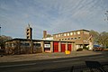 Ascot Drive fire station - geograph.org.uk - 282017.jpg 640 × 427; 196 KB
-
 Asda Car Park - geograph.org.uk - 5434517.jpg 2.000 × 1.333; 1,52 MB
-
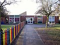 Ash Croft Primary School - geograph.org.uk - 3261544.jpg 1.200 × 900; 249 KB
-
 Ashbourne Road (A52), Mackworth - geograph.org.uk - 4580191.jpg 640 × 480; 65 KB
-
 Ashbourne Road Derby - geograph.org.uk - 5313595.jpg 2.000 × 1.333; 2,3 MB
-
 Ashbourne Road towards Mackworth - geograph.org.uk - 1837317.jpg 640 × 480; 61 KB
-
 Assembly Rooms, Market Place, Derby - geograph.org.uk - 4173915.jpg 640 × 383; 123 KB
-
 At the east end of the Arboretum - geograph.org.uk - 6270827.jpg 2.000 × 1.330; 3,38 MB
-
 B Block Mackworth College - geograph.org.uk - 5948842.jpg 832 × 608; 52 KB
-
 B5020 heading south, Mickleover - geograph.org.uk - 4074142.jpg 640 × 480; 68 KB
-
 Babbington Lane, Derby - geograph.org.uk - 6164708.jpg 4.608 × 3.456; 6,31 MB
-
 Babington House - geograph.org.uk - 5315480.jpg 1.333 × 2.000; 2,32 MB
-
 Babington Lane - geograph.org.uk - 6265722.jpg 2.000 × 1.330; 1,78 MB
-
 Babington Lane Derby - geograph.org.uk - 5315409.jpg 2.000 × 1.333; 2,06 MB
-
 Back Car Park of Markeaton Park, Derby (4427478916).jpg 1.600 × 1.200; 364 KB
-
 Baconsfield House, Coleraine Close - geograph.org.uk - 3036160.jpg 640 × 480; 113 KB
-
 Baker Street - geograph.org.uk - 3645462.jpg 1.280 × 960; 202 KB
-
 Balfour Beatty Site Derby - geograph.org.uk - 4880097.jpg 640 × 480; 72 KB
-
 Bank of the River Derwent - geograph.org.uk - 4755277.jpg 591 × 640; 83 KB
-
 Barnworth Close - geograph.org.uk - 5627028.jpg 2.000 × 1.333; 2,16 MB
-
 Bass Recreation Ground - geograph.org.uk - 6145048.jpg 2.000 × 1.330; 2,01 MB
-
 Beaufort Street, Chaddesden - geograph.org.uk - 3218956.jpg 1.024 × 768; 140 KB
-
 Beeley Close, Allestree - geograph.org.uk - 5876582.jpg 1.024 × 768; 147 KB
-
 Bembridge Drive, Alvaston - geograph.org.uk - 6081318.jpg 1.024 × 768; 148 KB
-
 Bench on River Side Path - geograph.org.uk - 1026700.jpg 640 × 426; 321 KB
-
 Bess of Hardwick's tomb in Derby Cathedral - geograph.org.uk - 4950523.jpg 3.759 × 5.011; 2,99 MB
-
 Between the bus station and the courts - geograph.org.uk - 6145027.jpg 2.000 × 1.330; 2,04 MB
-
 Bike riding area, Alvaston Park, Derby - geograph.org.uk - 2524333.jpg 2.430 × 1.824; 886 KB
-
 Birchover Way - Ferrers Avenue junction - geograph.org.uk - 5348534.jpg 2.000 × 1.333; 3,15 MB
-
 Bit of wasteland in farmland, Chaddesden, Derby - geograph.org.uk - 2502412.jpg 3.648 × 2.736; 6 MB
-
 Bloomfield Close - geograph.org.uk - 6270844.jpg 2.000 × 1.330; 2,57 MB
-
 Blossom time in Park Grove - geograph.org.uk - 3954859.jpg 1.024 × 894; 1,22 MB
-
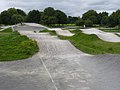 BMX circuit - geograph.org.uk - 3645489.jpg 1.280 × 960; 206 KB
-
 BMX cycle track - geograph.org.uk - 3069276.jpg 640 × 480; 57 KB
-
 Boarded up Debenhams - geograph.org.uk - 6101315.jpg 1.333 × 2.000; 2,24 MB
-
 Bonnie Prince Charles Walk, Markeaton Lane, Markeaton, Derby (4967957188).jpg 3.072 × 2.304; 1,13 MB
-
 Bonnie Prince Charlie Walk, Markeaton Lane, Markeaton, Derby (4967956410).jpg 3.072 × 2.304; 1,01 MB
-
 Bonny Prince Charlie re-enactment - geograph.org.uk - 5353238.jpg 2.000 × 1.328; 2,14 MB
-
 Borrowash Road - geograph.org.uk - 5452409.jpg 2.000 × 1.333; 2,18 MB
-
 Borrowash Road, Spondon - geograph.org.uk - 3160689.jpg 1.024 × 768; 173 KB
-
 Borrowash weir is dry - geograph.org.uk - 5972915.jpg 1.280 × 960; 407 KB
-
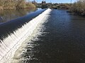 Borrowash weir is normal - geograph.org.uk - 6099338.jpg 1.024 × 768; 200 KB
-
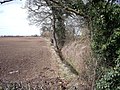 Boundary ditch and hedge - geograph.org.uk - 3388971.jpg 1.200 × 900; 356 KB
-
 Boundary markers, Uttoxeter Road - geograph.org.uk - 6066561.jpg 1.280 × 889; 380 KB
-
 Brackensdale Avenue - geograph.org.uk - 5341061.jpg 2.000 × 1.333; 2,82 MB
-
 Brackensdale Avenue - geograph.org.uk - 5341065.jpg 2.000 × 1.333; 2,69 MB
-
 Brian Clough Way (A52) - geograph.org.uk - 3572843.jpg 640 × 480; 57 KB
-
-
 Bridge to an island in the Derwent - geograph.org.uk - 5620824.jpg 1.280 × 960; 659 KB
-
 Bridlegate Lane - geograph.org.uk - 5520833.jpg 2.000 × 1.333; 2,18 MB
-
 Bridleway across Sinfin Moor (1) - geograph.org.uk - 6179576.jpg 1.024 × 768; 205 KB
-
 Bridleway across Sinfin Moor (2) - geograph.org.uk - 6182529.jpg 1.024 × 768; 199 KB
-
 Bridleway across Sinfin Moor (3) - geograph.org.uk - 6182534.jpg 1.024 × 768; 297 KB
-
 Bridleway across Sinfin Moor (4) - geograph.org.uk - 6182536.jpg 1.024 × 768; 400 KB
-
 Bridleway to Allestree - geograph.org.uk - 5283630.jpg 1.280 × 960; 624 KB
-
 Brierfield Way Mickleover - geograph.org.uk - 5312682.jpg 2.000 × 1.333; 2,63 MB
-
 Brighton Road, Crewton - geograph.org.uk - 3645474.jpg 1.280 × 960; 237 KB
-
 Brisbane Road, Mickleover - geograph.org.uk - 5873026.jpg 1.024 × 768; 160 KB
-
 Britannia Mill and Sturgess Fields, Derby (4537480829).jpg 1.200 × 1.600; 186 KB
-

-

-
 Brittannia Mill and Sturgess Fields, Derby (4537480703).jpg 1.200 × 1.600; 199 KB
-
 Broadway Derby - geograph.org.uk - 5341147.jpg 2.000 × 1.333; 3,75 MB
-
 Brook next to A 38, Derby - geograph.org.uk - 1656790.jpg 640 × 480; 147 KB
-
 Brough Street from Slack Lane, Derby - geograph.org.uk - 1700259.jpg 640 × 480; 35 KB
-
 Bryer's Heritage Farm - geograph.org.uk - 2251317.jpg 3.648 × 2.736; 5,76 MB
-
 Building development - geograph.org.uk - 3826932.jpg 640 × 480; 84 KB
-
 Building site, Sadlersquare, Derby - geograph.org.uk - 2557773.jpg 3.648 × 2.736; 4,19 MB
-
 Building the super hospital - geograph.org.uk - 5710756.jpg 2.048 × 1.360; 1,62 MB
-
 Bulleid Light Pacific at Derby, 1963 - geograph.org.uk - 4817773.jpg 2.241 × 1.388; 1,54 MB
-
 Bus garage, Ascot Drive, Wilmorton - geograph.org.uk - 6192632.jpg 1.024 × 768; 278 KB
-
 Bus station rear entrance - geograph.org.uk - 6145029.jpg 2.000 × 1.330; 1,49 MB
-
 Bus stop and shelter on London Road - geograph.org.uk - 5048586.jpg 640 × 480; 56 KB
-
 Bus stop and shelter on London Road - geograph.org.uk - 5048589.jpg 640 × 480; 54 KB
-
 Bus stop on Derby Road, Chaddesden - geograph.org.uk - 1919223.jpg 640 × 480; 73 KB
-
 Bus stop, Perth Street, Derby - geograph.org.uk - 2500531.jpg 3.648 × 2.736; 4,75 MB
-
 Bus to Westfield - geograph.org.uk - 721652.jpg 640 × 429; 87 KB
-
 Business Unit - geograph.org.uk - 1058430.jpg 640 × 426; 93 KB
-
 Business Units - geograph.org.uk - 1058410.jpg 640 × 426; 95 KB
-
 Businesses on Nottingham Road - geograph.org.uk - 6158191.jpg 2.000 × 1.330; 1,94 MB
-

-
 Butchers shop, Western Road - geograph.org.uk - 2841704.jpg 4.000 × 3.000; 2,6 MB
-
 Buzz Bingo - geograph.org.uk - 6276908.jpg 2.000 × 1.330; 2,07 MB
-
 By Sadlergate Bridge - geograph.org.uk - 6116765.jpg 2.000 × 1.333; 2,3 MB
-
 By the Dovedale Day Hospital - geograph.org.uk - 6265862.jpg 2.000 × 1.330; 2,13 MB
-
 Byers Heritage Farm, Markeaton Park - geograph.org.uk - 4666150.jpg 640 × 480; 542 KB
-
 C Block Mackworth College - geograph.org.uk - 5948848.jpg 832 × 608; 45 KB
-
 Cambridge Street - geograph.org.uk - 945102.jpg 640 × 480; 87 KB
-
 Campion Street, Derby (4346601312).jpg 1.600 × 1.200; 231 KB
-
 Campion Street, Derby - geograph.org.uk - 1700780.jpg 640 × 480; 40 KB
-
 Campion Street, Derby - geograph.org.uk - 1700800.jpg 640 × 480; 31 KB
-
 Campion Street, Derby - geograph.org.uk - 1705849.jpg 1.600 × 1.200; 235 KB
-
 Canada geese at Alvaston Park, Derby - geograph.org.uk - 5656592.jpg 800 × 474; 124 KB
-
 Canal Street - geograph.org.uk - 6276910.jpg 2.000 × 1.330; 2,13 MB
-
 Canal Street junction with Castleward Boulevard - geograph.org.uk - 6265667.jpg 2.000 × 1.330; 2,01 MB
-
 Canal Street, Derby - geograph.org.uk - 3200923.jpg 640 × 480; 65 KB
-
 Car dealership on Nottingham Road - geograph.org.uk - 3572875.jpg 640 × 480; 50 KB
-
 Car park - Markeaton Park - geograph.org.uk - 4863854.jpg 640 × 427; 52 KB
-
 Cardinal Square, Derby - geograph.org.uk - 2982447.jpg 640 × 338; 55 KB
-
 Cast street nameplate - geograph.org.uk - 2247236.jpg 640 × 377; 72 KB
-
 Castle Walk - geograph.org.uk - 6265678.jpg 2.000 × 1.330; 2,11 MB
-
 Castleward Boulevard, Derby - geograph.org.uk - 5598173.jpg 2.513 × 3.504; 1,47 MB
-
 Castleward redevelopment site - geograph.org.uk - 3480930.jpg 1.200 × 900; 173 KB
-
 Cathedral and bridge - geograph.org.uk - 2353153.jpg 1.280 × 830; 226 KB
-

-
 Cathedral tea shop cut mark - geograph.org.uk - 6282638.jpg 576 × 1.024; 208 KB
-
 CCTV, coat of arms and flagpole - geograph.org.uk - 2326866.jpg 1.600 × 1.200; 410 KB
-
 Cedar Terrace, Kedleston Road, Derby - geograph.org.uk - 1656731.jpg 640 × 480; 68 KB


,_Mackworth_-_geograph.org.uk_-_4580191.jpg)


.jpg)


.jpg)
.jpg)


_-_geograph.org.uk_-_3572843.jpg)
,_Derby_-_geograph.org.uk_-_1701289.jpg)


_-_geograph.org.uk_-_6179576.jpg)
_-_geograph.org.uk_-_6182529.jpg)
_-_geograph.org.uk_-_6182534.jpg)
_-_geograph.org.uk_-_6182536.jpg)


.jpg)


.jpg)


.jpg)


