Category:Dersingham
Zur Navigation springen
Zur Suche springen
English: Dersingham is a village and civil parish in the English county of Norfolk. It is situated some north-west of the city of Norwich, opening onto the Wash.
Norsk bokmål: Dersingham er en landsby og et verdslig sogn i Norfolk i England. Den ligger omkring 12 km nord for King's Lynn, ut mot The Wash.
Gemeinde in der englischen Grafschaft Norfolk  | |||||
| Medium hochladen | |||||
| Ist ein(e) | |||||
|---|---|---|---|---|---|
| Ort | King’s Lynn and West Norfolk, Norfolk, East of England, England | ||||
| Fläche |
| ||||
| Eventuell gleichwertig | Dersingham (Wikimedia-Dublette, Civil Parish in England) | ||||
 | |||||
Unterkategorien
Es werden 5 von insgesamt 5 Unterkategorien in dieser Kategorie angezeigt:
In Klammern die Anzahl der enthaltenen Kategorien (K), Seiten (S), Dateien (D)
Medien in der Kategorie „Dersingham“
Folgende 200 Dateien sind in dieser Kategorie, von 288 insgesamt.
(vorherige Seite) (nächste Seite)-
 'Tropics' hot food takeaway, Dersingham - geograph.org.uk - 6192865.jpg 1.024 × 755; 121 KB
-
 A clearing on Dersingham Common - geograph.org.uk - 2584923.jpg 640 × 480; 247 KB
-
 A large green tank - geograph.org.uk - 1916307.jpg 2.848 × 2.136; 3,05 MB
-
 A large patch of "wild rhubarb" - (Burdock^) - geograph.org.uk - 2527431.jpg 4.320 × 3.240; 5,51 MB
-
 A lot of flint in the soil - geograph.org.uk - 2601113.jpg 4.320 × 3.240; 5,59 MB
-
 A private garden in Dersingham - geograph.org.uk - 5535353.jpg 4.842 × 3.631; 4,47 MB
-
 A track past the rhododendron in the forest - geograph.org.uk - 3057268.jpg 1.500 × 1.000; 273 KB
-
 A148 west of Dersingham - geograph.org.uk - 5033283.jpg 2.029 × 1.237; 1,8 MB
-
 A149 along Ingoldisthorpe Common - geograph.org.uk - 5033280.jpg 1.836 × 1.162; 1,7 MB
-

-
 A149 heading north - geograph.org.uk - 5685461.jpg 640 × 428; 122 KB
-
 A149 heading north - geograph.org.uk - 5685515.jpg 640 × 428; 106 KB
-
 A149 heading north - geograph.org.uk - 5685520.jpg 640 × 428; 106 KB
-
 A149 looking north - geograph.org.uk - 3616801.jpg 640 × 481; 58 KB
-
 A149 nears roundabout for B1440 - geograph.org.uk - 3616724.jpg 640 × 479; 63 KB
-
 A149 towards Hunstanton - geograph.org.uk - 5576690.jpg 640 × 480; 90 KB
-
 A149 towards Hunstanton - geograph.org.uk - 5576696.jpg 640 × 480; 45 KB
-
 A149 west of Dersingham - geograph.org.uk - 5583641.jpg 640 × 480; 48 KB
-
 A149, northbound - geograph.org.uk - 5806683.jpg 640 × 425; 63 KB
-
 Airey Houses in Station Road, Dersingham - geograph.org.uk - 2584998.jpg 640 × 480; 189 KB
-
 Alexandra - geograph.org.uk - 5583646.jpg 640 × 480; 76 KB
-
 B1440 Lynn Road near Dersingham Common - geograph.org.uk - 4275620.jpg 1.600 × 1.168; 647 KB
-
 B1440 road approaching Dersingham Common - geograph.org.uk - 2584877.jpg 640 × 480; 281 KB
-
 B1440 Sandringham Road in Dersingham - geograph.org.uk - 4275625.jpg 1.600 × 1.161; 450 KB
-
 B1440 Sandringham Road in Dersingham Wood - geograph.org.uk - 4275649.jpg 1.600 × 1.222; 549 KB
-
 B1440, Dersingham - geograph.org.uk - 5821311.jpg 1.024 × 681; 125 KB
-
 Baled straw near Ling House, Anmer - geograph.org.uk - 4091744.jpg 4.320 × 3.240; 5,73 MB
-
 Barn by Hunstanton Rd - geograph.org.uk - 5815564.jpg 1.024 × 681; 209 KB
-

-

-
 Bird hide - geograph.org.uk - 2044019.jpg 1.600 × 1.200; 690 KB
-
 Black Darter, Dersingham Bog - geograph.org.uk - 5512954.jpg 1.546 × 1.600; 187 KB
-
 Bracken in Jocelyn's Wood, Dersingham - geograph.org.uk - 2584887.jpg 480 × 640; 288 KB
-
 Bracken near Dersingham - geograph.org.uk - 1517305.jpg 640 × 480; 88 KB
-
 Bridleway beside drain - geograph.org.uk - 5583650.jpg 640 × 480; 94 KB
-
 Broadlands Close - geograph.org.uk - 5806525.jpg 640 × 538; 79 KB
-
 Budgens store in Dersingham - geograph.org.uk - 4275616.jpg 1.600 × 1.207; 468 KB
-
 Buildings at Hill House Farm - geograph.org.uk - 2359833.jpg 800 × 536; 74 KB
-
 Bungalow in Station Road, Dersingham - geograph.org.uk - 2585000.jpg 640 × 480; 194 KB
-
 Bungalows, Hunstanton Rd - geograph.org.uk - 5806545.jpg 640 × 425; 58 KB
-
 Caravan site, Dersingham - geograph.org.uk - 5576699.jpg 640 × 480; 61 KB
-
 Carstone-built cottage, Dersingham - geograph.org.uk - 2584961.jpg 640 × 473; 177 KB
-
 Chapel Rd, B1410 - geograph.org.uk - 5821310.jpg 1.024 × 864; 214 KB
-
 Church of St Nicholas, Dersingham - geograph.org.uk - 2358989.jpg 800 × 536; 146 KB
-
 Churchyard gates - geograph.org.uk - 2358986.jpg 536 × 800; 152 KB
-

-
 Coach and Horses - geograph.org.uk - 3205485.jpg 640 × 480; 77 KB
-
 Coffee at Dersingham - geograph.org.uk - 5447556.jpg 640 × 453; 70 KB
-
 Concrete field access road near Dersingham - geograph.org.uk - 2527850.jpg 4.320 × 3.240; 5,35 MB
-
 Cottage on the B1440 road , Dersingham - geograph.org.uk - 2584879.jpg 640 × 480; 253 KB
-
 Cottages in Station Road, Dersingham - geograph.org.uk - 2584995.jpg 640 × 480; 174 KB
-
 Crop field off Ling House Road - geograph.org.uk - 5575917.jpg 640 × 480; 61 KB
-
 Crossroads at Doddshill - geograph.org.uk - 5577480.jpg 3.776 × 2.520; 4,24 MB
-
 Cut Mark 19 Manor Rd Dersingham - geograph.org.uk - 4563448.jpg 640 × 480; 111 KB
-
 Cut Mark 23 Chapel Rd Dersingham - geograph.org.uk - 4563491.jpg 640 × 480; 104 KB
-
 Cut Mark 60 Chapel Rd Dersingham - geograph.org.uk - 4563522.jpg 640 × 480; 114 KB
-

-
 Cut Mark St Nicholas' Church Dresingham - geograph.org.uk - 4563533.jpg 640 × 480; 144 KB
-

-
 Dead birch trees, Bypass Wood - geograph.org.uk - 5583638.jpg 640 × 480; 55 KB
-
 Dersingham bog heather.jpg 1.920 × 1.440; 1,73 MB
-
 Dersingham bog.jpg 1.691 × 1.172; 1,61 MB
-
 Dersingham Bypass A149 - geograph.org.uk - 5033300.jpg 1.932 × 1.216; 1,57 MB
-
 Dersingham Common - geograph.org.uk - 1517387.jpg 640 × 480; 77 KB
-
 Dersingham Common - geograph.org.uk - 2584924.jpg 640 × 480; 235 KB
-
 Dersingham Common - geograph.org.uk - 5806681.jpg 640 × 374; 115 KB
-
 Dersingham Common - geograph.org.uk - 5821369.jpg 1.024 × 601; 181 KB
-
 Dersingham Common - geograph.org.uk - 5821375.jpg 1.024 × 681; 278 KB
-
 Dersingham Common bench - geograph.org.uk - 1831927.jpg 1.024 × 768; 151 KB
-
 Dersingham Fen - geograph.org.uk - 5806690.jpg 640 × 322; 102 KB
-
 Dersingham Fen - geograph.org.uk - 5806701.jpg 1.024 × 522; 235 KB
-
 Dersingham ROC aircraft monitoring post - geograph.org.uk - 947729.jpg 3.008 × 2.000; 3,62 MB
-
 Dersingham ROC monitoring post - geograph.org.uk - 947704.jpg 3.008 × 2.000; 2,96 MB
-
 Dersingham Social Club - geograph.org.uk - 5821770.jpg 1.024 × 538; 111 KB
-
 Dersingham village Hunstanton Road - geograph.org.uk - 2845257.jpg 640 × 427; 79 KB
-
 Dersingham village sign along Hunstanton Road - geograph.org.uk - 4275584.jpg 1.600 × 1.078; 697 KB
-
 Dersingham, site of the mill, from the south-east - geograph.org.uk - 3282179.jpg 1.600 × 1.064; 317 KB
-
 Dersingham, south end of Mill Road - geograph.org.uk - 3283433.jpg 1.600 × 1.064; 243 KB
-
 Dersingham, track down from the hill from site of mill - geograph.org.uk - 3283439.jpg 1.600 × 1.064; 265 KB
-
 Dismantled railway line, Dersingham - geograph.org.uk - 2585040.jpg 640 × 480; 167 KB
-
 Drain near Dersingham - geograph.org.uk - 5576697.jpg 640 × 480; 64 KB
-
 Drainage ditch - geograph.org.uk - 876944.jpg 426 × 640; 83 KB
-
 Earl Close - geograph.org.uk - 5821353.jpg 1.024 × 681; 131 KB
-

-
 Eleven Acres (Plantation) on Ling House Road - geograph.org.uk - 2601093.jpg 4.320 × 3.240; 5,59 MB
-
 Elvis lives, Hunstanton Road, Dersingham - geograph.org.uk - 3283330.jpg 1.064 × 1.600; 398 KB
-

-
 Entrance To The Scenic Drive - geograph.org.uk - 1440947.jpg 640 × 480; 121 KB
-
 Entrance to Walden's Barns, Dersingham - geograph.org.uk - 3283403.jpg 1.600 × 1.064; 363 KB
-
 Farm machinery in field off - geograph.org.uk - 5575902.jpg 640 × 480; 65 KB
-
 Farm road heading south - geograph.org.uk - 1916321.jpg 2.848 × 2.136; 3,03 MB
-

-
 Farm Track - geograph.org.uk - 876959.jpg 640 × 426; 75 KB
-
 Farm Track - geograph.org.uk - 876973.jpg 640 × 426; 92 KB
-
 Farm track near Ling House, Anmer - geograph.org.uk - 4091737.jpg 4.320 × 3.240; 5,98 MB
-

-
 Field near Ling House - geograph.org.uk - 3206963.jpg 640 × 480; 65 KB
-
 Field near Shernborne - geograph.org.uk - 3206973.jpg 640 × 480; 69 KB
-
 Field off Shernborne Road - geograph.org.uk - 5575907.jpg 640 × 480; 49 KB
-
 Fire damaged silver birch wood near Dersingham in Norfolk - geograph.org.uk - 5665501.jpg 5.184 × 3.888; 4,92 MB
-
 Fire damaged silver birch wood near Dersingham, Norfolk - geograph.org.uk - 5665497.jpg 4.032 × 3.024; 2,27 MB
-

-

-
 Folly Hang viewing platform - geograph.org.uk - 963338.jpg 640 × 480; 98 KB
-
 Footpath on Dersingham Common - geograph.org.uk - 2584913.jpg 640 × 480; 232 KB
-
 Footpath on Dersingham Common - geograph.org.uk - 2584931.jpg 640 × 480; 313 KB
-
 Gated track by A149 - geograph.org.uk - 5806685.jpg 640 × 308; 88 KB
-
 Glebe Rd - geograph.org.uk - 5806536.jpg 640 × 426; 62 KB
-
 Glebe Road, Dersingham - geograph.org.uk - 4526369.jpg 1.024 × 768; 299 KB
-
 Gorse bush, Dersingham Common - geograph.org.uk - 5821370.jpg 1.024 × 681; 206 KB
-
 Grazing and woodland off the A149 - geograph.org.uk - 5576694.jpg 640 × 480; 87 KB
-
 Grazing and woodland off the A149 - geograph.org.uk - 5583643.jpg 640 × 480; 64 KB
-
 Grazing near Dersingham - geograph.org.uk - 1517358.jpg 640 × 480; 90 KB
-
 Hawthorn Drive - geograph.org.uk - 5821306.jpg 1.024 × 666; 137 KB
-
 Heading north along the Peddars Way - geograph.org.uk - 5454350.jpg 800 × 523; 143 KB
-
 Heath Rd - geograph.org.uk - 5821373.jpg 1.024 × 681; 174 KB
-
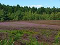
 Heather flowering on Dersingham Common - geograph.org.uk - 2584920.jpg 640 × 480; 237 KB
-
 Heathland pool at Dersingham Bog - geograph.org.uk - 5514104.jpg 1.600 × 1.200; 387 KB
-
 Hedgerow near Dersingham - geograph.org.uk - 3205491.jpg 640 × 480; 70 KB
-
 Hirkin Rd - geograph.org.uk - 5806520.jpg 640 × 425; 67 KB
-
 Horse riding in Norfolk - geograph.org.uk - 1916268.jpg 2.848 × 2.136; 3,25 MB
-
 Hunstanton 7 Miles - geograph.org.uk - 5576693.jpg 640 × 480; 63 KB
-
 Hunstanton Road in Dersingham - geograph.org.uk - 4275588.jpg 1.600 × 1.230; 503 KB
-
 Jocelyn's Wood - geograph.org.uk - 5821377.jpg 1.024 × 637; 280 KB
-
 Jocelyn's Wood - near Sandringham - geograph.org.uk - 2793432.jpg 640 × 481; 145 KB
-
 Jocelyn's Wood, Dersingham - geograph.org.uk - 2584891.jpg 640 × 480; 286 KB
-

-
 King's Lynn 9 - geograph.org.uk - 2667217.jpg 1.024 × 768; 308 KB
-
 Kingcups near Dersingham - geograph.org.uk - 778299.jpg 427 × 640; 116 KB
-
 Kings Lynn 8 - geograph.org.uk - 2667200.jpg 1.024 × 768; 341 KB
-
 Life Wood - geograph.org.uk - 5806547.jpg 640 × 426; 97 KB
-
 Life Wood - geograph.org.uk - 5806550.jpg 640 × 421; 106 KB
-
 Linda Collison Close - geograph.org.uk - 5806532.jpg 640 × 373; 54 KB
-
 Ling House Road - geograph.org.uk - 5575915.jpg 640 × 480; 49 KB
-
 Ling House Road towards Dersingham - geograph.org.uk - 1517186.jpg 640 × 480; 73 KB
-

-

-

-

-
 Looking north on the A149 - geograph.org.uk - 5576748.jpg 640 × 480; 72 KB
-
 Lush vegetation near a Norfolk track - geograph.org.uk - 2527412.jpg 4.320 × 3.240; 5,58 MB
-
 Lynn Rd, B1440 - geograph.org.uk - 5821357.jpg 1.024 × 681; 161 KB
-
 Manor Farm - geograph.org.uk - 3205488.jpg 640 × 480; 67 KB
-
 Manor Farm, Dersingham - geograph.org.uk - 5575911.jpg 640 × 480; 46 KB
-
 Manor Rd - geograph.org.uk - 5821361.jpg 1.024 × 681; 161 KB
-
 Milestone Lynn Rd-Heath Rd Dersingham - geograph.org.uk - 4563556.jpg 640 × 480; 164 KB
-
 Mill Cottages, Dersingham - geograph.org.uk - 2359877.jpg 800 × 536; 157 KB
-
 Mill House, near Dersingham - geograph.org.uk - 5577501.jpg 3.776 × 2.520; 3,68 MB
-
 Mill Road near Dersingham - geograph.org.uk - 1517332.jpg 640 × 480; 105 KB
-
 Mill Road, Dersingham - geograph.org.uk - 2359829.jpg 800 × 536; 159 KB
-
 Mill Road, Dersingham - geograph.org.uk - 2359890.jpg 800 × 536; 128 KB
-
 Mill Road, Dersingham. - geograph.org.uk - 446909.jpg 640 × 480; 94 KB
-
 Mill Road, Dersingham. - geograph.org.uk - 446913.jpg 640 × 480; 98 KB
-
 Minor road towards Shernborne - geograph.org.uk - 5575927.jpg 640 × 480; 49 KB
-
 Mountbatten Rd - geograph.org.uk - 5806513.jpg 640 × 426; 73 KB
-
 Mountbatten Rd - geograph.org.uk - 5821351.jpg 1.024 × 680; 114 KB
-
 National Cycle Route 1 - geograph.org.uk - 5575903.jpg 640 × 480; 54 KB
-

-
 New housing in Station Road, Dersingham - geograph.org.uk - 2584966.jpg 640 × 480; 163 KB
-

-
 Old Milepost - geograph.org.uk - 2667186.jpg 768 × 1.024; 374 KB
-
 Old Milestone - geograph.org.uk - 2667213.jpg 768 × 1.024; 291 KB
-
 Old Pre-Worboys Sign - geograph.org.uk - 3850192.jpg 683 × 1.024; 175 KB
-
 Open space by Hunstanton Rd - geograph.org.uk - 5821307.jpg 1.024 × 681; 199 KB
-
 Paddock near the church, Dersingham - geograph.org.uk - 1517313.jpg 640 × 480; 109 KB
-
 Pansey Drive - geograph.org.uk - 5806533.jpg 640 × 380; 45 KB
-
 Pasture - geograph.org.uk - 5815563.jpg 1.024 × 637; 147 KB
-
 Patched up with tarmac - geograph.org.uk - 1916287.jpg 2.848 × 2.136; 3,03 MB
-
 Path in Jocelyn's Wood, Dersingham - geograph.org.uk - 2584889.jpg 640 × 480; 284 KB
-
 Path in Jocelyn's Wood, Dersingham - geograph.org.uk - 2584893.jpg 640 × 480; 266 KB
-
 Philip Nurse Rd - geograph.org.uk - 5806522.jpg 640 × 426; 73 KB
-
 Picnic area on the Dersingham by-pass - geograph.org.uk - 1915525.jpg 2.848 × 2.136; 3,06 MB
-
 Playing field, Dersingham. - geograph.org.uk - 446202.jpg 640 × 480; 67 KB
-
 Post Office Lane, Dersingham - geograph.org.uk - 3282172.jpg 1.064 × 1.600; 355 KB
-
 Prohibited - geograph.org.uk - 1831929.jpg 768 × 1.024; 139 KB
-
 Public byway off Lynn Rd - geograph.org.uk - 5806511.jpg 640 × 422; 91 KB
-

-
 Riding towards the Decoy - geograph.org.uk - 1916263.jpg 2.848 × 2.136; 3,01 MB
-

-
 Road to Dersingham - geograph.org.uk - 549912.jpg 640 × 426; 73 KB
-

-
 Sandringham Country Park - geograph.org.uk - 1440942.jpg 640 × 480; 135 KB
-
 Sandringham Estate, aerial 2018 (3) - geograph.org.uk - 5837127.jpg 1.024 × 683; 175 KB
-

-
 Sea Shells not on the sea shore - geograph.org.uk - 877051.jpg 640 × 426; 83 KB
-
 Shell covered track west of Dersingham - geograph.org.uk - 2527668.jpg 4.320 × 3.240; 5,49 MB
-
 Shell Road - geograph.org.uk - 877028.jpg 640 × 426; 89 KB
-
 Shernborne Road - geograph.org.uk - 5575906.jpg 640 × 480; 60 KB
-

-
 Shernborne Road near Dersingham - geograph.org.uk - 1517540.jpg 640 × 480; 100 KB
-
 Shoe Service, Hunstanton Road, Dersingham - geograph.org.uk - 3283401.jpg 1.064 × 1.600; 435 KB
-
 Shouldham Close - geograph.org.uk - 5609845.jpg 4.827 × 3.218; 2,99 MB
-
 Signpost on The Peddars' Way - geograph.org.uk - 4091692.jpg 4.320 × 3.240; 5,46 MB
-
-
 St Nicholas Church - Dersingham, Norfolk - geograph.org.uk - 5970593.jpg 1.024 × 587; 191 KB
-
 St Nicholas Church Dersingham - geograph.org.uk - 4563537.jpg 640 × 480; 91 KB
-

-

-

-


_-_geograph.org.uk_-_2527431.jpg)


_on_Ling_House_Road_-_geograph.org.uk_-_2601093.jpg)


_off_Ling_House_Road_-_geograph.org.uk_-_5575918.jpg)


_-_geograph.org.uk_-_5837127.jpg)


_-_geograph.org.uk_-_1945813.jpg)