Category:Deserts and xeric shrublands
Vai alla navigazione
Vai alla ricerca
English: The Deserts and xeric shrublands terrestrial Biome — its ecoregions, habitats, and flora.
- For more information, see wikipedia (english text): Category: Deserts and xeric shrublands.
Español: Ecorregiones de desierto.
bioma terrestre | |||||
| Carica un file multimediale | |||||
| Istanza di |
| ||||
|---|---|---|---|---|---|
| |||||
Sottocategorie
Questa categoria contiene le 19 sottocategorie indicate di seguito, su un totale di 19.
File nella categoria "Deserts and xeric shrublands"
Questa categoria contiene 102 file, indicati di seguito, su un totale di 102.
-
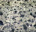
Baja California Desert.jpg 2 100 × 1 680; 1,46 MB
-
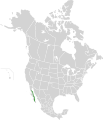
Major habitat type CAN USA.svg 1 712 × 1 992; 772 KB
-
NAMAP.jpg 1 024 × 768; 167 KB
-
1920s Cabin Built of Railroad Ties in The Mesquite Bosque at the DNR.png 4 519 × 3 342; 22,49 MB
-
2020-05-31-bosque-west-02.png 4 289 × 3 307; 22,64 MB
-
A Wide Dry Desert Wash at Red Rock Canyon NCA.webm 29 s, 1 920 × 1 080; 103,4 MB
-
Adrar 1997 16.jpg 1 068 × 705; 823 KB
-
Al-Qutayfah (distrito) 2001 06.jpg 991 × 660; 657 KB
-
Almería (provincia) 1976 01.jpg 1 042 × 649; 917 KB
-
Almería, El Alquián 1976 02.jpg 1 002 × 672; 1,05 MB
-
Almería, El Alquián 1976 03.jpg 1 036 × 689; 986 KB
-
Almería, El Alquián 1976 07.jpg 945 × 583; 799 KB
-
Bankside vegetation at Red Rock Wash in the Red Rock Canyon NCA.jpg 4 032 × 3 024; 9,42 MB
-
Biome map 13.svg 1 119 × 608; 5,27 MB
-
Bodie 1989 58.jpg 697 × 1 053; 924 KB
-
Bodie 1989 81.jpg 1 004 × 667; 846 KB
-
Bosque Interface With Sage.png 4 608 × 3 456; 30,47 MB
-
Branches of the Honey Mesquite in the Mesquite Bosque.png 4 608 × 3 456; 27,93 MB
-
Cachi 1994 04.jpg 1 068 × 707; 764 KB
-
Cadereyta, Queretaro (5761385112).jpg 3 648 × 2 736; 1,94 MB
-
Cardones 1.jpg 2 084 × 1 374; 1,78 MB
-
Chapada diamantina flora.jpg 1 600 × 1 200; 1,12 MB
-
Chinchón, yesar.jpg 1 120 × 997; 1,29 MB
-
Colorado Plateau Shrublands map.svg 1 712 × 1 992; 348 KB
-
Deliblatska pescara drenjina.jpg 1 200 × 900; 1,02 MB
-
Desertic Biomes in Australia.png 720 × 438; 35 KB
-
Desierto de Tar (2002) 01.jpg 1 022 × 677; 804 KB
-
Desierto de Tar (2002) 02.jpg 1 068 × 716; 833 KB
-
Desierto de Tar (2002) 03.jpg 1 068 × 716; 651 KB
-
Desierto de Tar (2002) 04.jpg 1 027 × 701; 784 KB
-
Dry Desert Stream Bed at Red Rock Canyon NCA.jpg 3 456 × 4 608; 9,67 MB
-
Falcón (2003) 01.jpg 1 068 × 707; 796 KB
-
Falcón (2003) 02.jpg 1 068 × 707; 1 014 KB
-
Gobi.png 793 × 687; 959 KB
-
Great Basin Shrub Steppe map.svg 1 712 × 1 992; 337 KB
-
Gulf of California Xeric Scrub map.svg 1 712 × 1 992; 347 KB
-
Habitat de Quedenfeldtia trachyblepharus dans le haut Atlas Marocain.JPG 3 648 × 2 048; 3,53 MB
-
Hasty summer.jpg 4 032 × 3 177; 2,85 MB
-
Honey Mesquite Flowers in the DBR's Mesquite Bosque.png 3 453 × 1 813; 10,57 MB
-
Inyo, California 1989 01.jpg 1 005 × 676; 1,01 MB
-
Inyo, California 1989 02.jpg 988 × 636; 928 KB
-
Jandía 1993 05.jpg 957 × 641; 934 KB
-
Jericoacoara (2007) 07.jpg 1 037 × 677; 1,05 MB
-
Karakum.png 954 × 728; 972 KB
-
Karas (2006) 17.jpg 1 062 × 709; 864 KB
-
Kermán, provincia (2000) 01.jpg 1 022 × 653; 811 KB
-
Kermán, provincia (2000) 02.jpg 1 042 × 709; 879 KB
-
Kunene (2006) 17.jpg 1 060 × 704; 934 KB
-
La Puna 1994 03.jpg 1 065 × 704; 818 KB
-
La Puna 1994 04.jpg 1 065 × 707; 1,06 MB
-
La Tihama 1987 02.jpg 1 018 × 652; 214 KB
-
Libyan Desert-Flash floods 4.jpg 3 872 × 2 592; 4,19 MB
-
Looking East Toward the Start of the Bosque at the DNR.png 4 032 × 3 024; 17,09 MB
-
Looking North Into The Mesquite Bosque at the DNR.png 4 430 × 3 062; 19,19 MB
-
Maipo 1.jpg 2 096 × 1 424; 3,66 MB
-
Matorral xerófilo (09-22).jpg 6 900 × 5 176; 11,33 MB
-
Mauritania, plantas 1997 01.jpg 1 051 × 677; 745 KB
-
Medanos de Coro (2003) 07.jpg 1 021 × 666; 822 KB
-
Meseta Central Matorral map.svg 1 712 × 1 992; 349 KB
-
Mesquite Bosque at The Desert National Wildlife Refuge.webm 1 min 44 s, 1 920 × 1 080; 774,02 MB
-
Mesquite Flat Sand Dunes 1989 03.jpg 1 057 × 698; 677 KB
-
Mezquital (matorral xerófilo) de Dolores Hidalgo, Guanajuato I.jpg 5 134 × 3 294; 4,93 MB
-
Mezquital (matorral xerófilo) de Dolores Hidalgo, Guanajuato II.jpg 3 580 × 2 388; 2,99 MB
-
Monument Valley 1989 03.jpg 1 022 × 675; 840 KB
-
Monument Valley 1989 27.jpg 1 032 × 666; 788 KB
-
Monument Valley 1989 28.jpg 1 033 × 673; 714 KB
-
Monument Valley 1989 30.jpg 698 × 1 050; 698 KB
-
Namib, aéreas (2006) 31.jpg 1 062 × 719; 969 KB
-
Northwest Looking View of the DNR Mesquite Bosque.png 4 608 × 3 456; 24,5 MB
-
Opuntia (nopal) - Semidesierto mexicano.jpg 6 278 × 8 371; 16,64 MB
-
Paisaje de semidesierto (Dolores Hidalgo, Guanajuato).jpg 7 694 × 5 769; 14,43 MB
-
Parque Nacional del Bosque Petrificado 1989 03.jpg 1 041 × 698; 1,01 MB
-
País Valenciano 1977 26.jpg 1 054 × 678; 897 KB
-
Puebla (estado) 1986 06.jpg 1 074 × 704; 877 KB
-
Puebla (estado) 1986 07.jpg 1 013 × 657; 708 KB
-
Quebrada del Toro 1994 17.jpg 968 × 682; 982 KB
-
Red Rock Wash At Red Rock Canyon National Conservation Area.webm 2 min 34 s, 1 920 × 1 080; 1,11 GB
-
Reserva Hopi 1989 02.jpg 1 012 × 670; 795 KB
-
Sahara 08.jpg 2 048 × 1 360; 1,3 MB
-
Sahara 09.jpg 4 288 × 2 848; 11,02 MB
-
Sahara ecoregion.svg 700 × 500; 181 KB
-
San Cristóbal 03.jpg 2 110 × 1 338; 3,48 MB
-
San Cristóbal 04.jpg 2 144 × 1 356; 2 MB
-
San Lucan Xeric Scrub map.svg 1 712 × 1 992; 343 KB
-
Sana'a - Ma'rib 1987 05.jpg 1 005 × 653; 885 KB
-
Seclantás 1994 05.jpg 710 × 1 063; 938 KB
-
Shoulder of Red Rock Wash in Red Rock Canyon NCA.jpg 4 608 × 3 456; 9,04 MB
-
Sonoran Desert map.svg 1 712 × 1 992; 345 KB
-
Southern Desert Shrubland (40617629070).jpg 3 491 × 3 753; 6,05 MB
-
Streambed of Red Rock Wash in the Red Rock Canyon NCA.jpg 4 608 × 3 456; 8,91 MB
-
Subotička peščara, dinski reljef.jpg 1 372 × 1 029; 388 KB
-
Tenerife 1977 11.jpg 1 060 × 705; 273 KB
-
The view above the desert wash called Red Rock Wash.jpg 4 032 × 2 891; 11,33 MB
-
Tioulit 1997 01.jpg 1 062 × 710; 929 KB
-
Tioulit 1997 02.jpg 1 071 × 707; 751 KB
-
Trancas Viejas, Dolores Hidalgo, Guanajuato - Paisaje semidesértico.jpg 3 387 × 1 612; 2,72 MB
-
Truck Driving on Southern Nevada Liteweight Road in The Mojave Desert.webm 2 min 50 s, 1 920 × 1 080; 788,58 MB
-
Valle de la Muerte 1989 01.jpg 1 055 × 678; 705 KB
-
Valle de la Muerte 1989 04.jpg 1 019 × 667; 913 KB
-
Vegetation on the bank of a dry desert wash.jpg 3 456 × 4 608; 10,54 MB
-
Westward look of the Mesquite Bosque at the DNR.png 4 608 × 3 456; 23,05 MB
-
AT1317 map.png 761 × 795; 22 KB


