Category:Detling
Vai alla navigazione
Vai alla ricerca
Bosanski: Detling je selo i civilna zajednica u Maindstonu u distriktu Kent, Engleska. Nalazi se na obroncima Sjevernih Downa 6,4 km udaljeno od grada.
English: Detling is a village and civil parish in the Maidstone District of Kent, England. The parish is located on the slope of the North Downs, north-east of the town, and on the Pilgrims' Way .
village in the United Kingdom  | |||||
| Carica un file multimediale | |||||
| Istanza di | |||||
|---|---|---|---|---|---|
| Luogo | Maidstone, Kent, Sud Est dell'Inghilterra, Inghilterra | ||||
 | |||||
Sottocategorie
Questa categoria contiene le 9 sottocategorie indicate di seguito, su un totale di 9.
2
- 2015 Detling transport show (202 F)
D
- Detling Airfield Memorial (2 F)
K
M
O
- Oasts in Detling (4 F)
S
W
- White Horse Wood (5 F)
File nella categoria "Detling"
Questa categoria contiene 200 file, indicati di seguito, su un totale di 222.
(pagina precedente) (pagina successiva)-
 A249 approaching the M20 - geograph.org.uk - 2500420.jpg 640 × 439; 63 KB
-
 A249, Detling Hill - geograph.org.uk - 2500387.jpg 640 × 345; 58 KB
-
 A249, going up Detling Hill - geograph.org.uk - 2273020.jpg 640 × 430; 66 KB
-
 A249, looking up Detling Hill - geograph.org.uk - 2273015.jpg 640 × 430; 63 KB
-
 A249, northbound traffic - geograph.org.uk - 2273018.jpg 640 × 430; 61 KB
-
 A249, Sittingbourne Road near Detling - geograph.org.uk - 3721105.jpg 640 × 480; 308 KB
-
 A249, southbound - geograph.org.uk - 2273013.jpg 640 × 430; 70 KB
-
 Abandoned Ford Anglia, Bredhurst Hurst - geograph.org.uk - 2710605.jpg 3 008 × 2 000; 3,35 MB
-
 Barn conversion, Broad Street Farm - geograph.org.uk - 149080.jpg 640 × 480; 124 KB
-
 Barn Conversion, Detling - geograph.org.uk - 2272833.jpg 640 × 430; 70 KB
-
 Barrier by the Pilgrims' Way - geograph.org.uk - 2273046.jpg 640 × 430; 97 KB
-
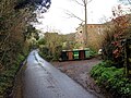
 Bin Day on Hockers Lane - geograph.org.uk - 1377483.jpg 640 × 427; 55 KB
-
 Broader Lane, near Detling - geograph.org.uk - 3587890.jpg 3 488 × 2 616; 2,25 MB
-
 Burleigh Villa, Detling - geograph.org.uk - 2272864.jpg 640 × 447; 79 KB
-
 Bus stop, Detling - geograph.org.uk - 2272844.jpg 640 × 430; 89 KB
-
 Coldblow Lane - geograph.org.uk - 18085.jpg 480 × 640; 103 KB
-
 Coopers Cottage, Detling - geograph.org.uk - 2272899.jpg 640 × 421; 55 KB
-
 Cottage , Pilgrims' Way, Detling - geograph.org.uk - 2272999.jpg 640 × 430; 68 KB
-
 Court Lane, near Detling - geograph.org.uk - 5541544.jpg 4 032 × 3 024; 3,23 MB
-
 Court Lane, near Detling - geograph.org.uk - 5541549.jpg 4 032 × 3 024; 2,92 MB
-
 Court Lane, near Detling - geograph.org.uk - 5541556.jpg 4 032 × 3 024; 3,27 MB
-
 Covered reservoir, Detling - geograph.org.uk - 2273021.jpg 640 × 430; 103 KB
-
 Cox Street - geograph.org.uk - 4990787.jpg 640 × 480; 181 KB
-
 Cox Street - geograph.org.uk - 4990800.jpg 640 × 480; 197 KB
-
 Cox Street - geograph.org.uk - 4990805.jpg 640 × 480; 221 KB
-
 Cox Street, near Detling - geograph.org.uk - 2037105.jpg 3 488 × 2 616; 2,25 MB
-
 Cox Street, near Detling - geograph.org.uk - 5541539.jpg 4 032 × 3 024; 4,67 MB
-
 CTRL towards London - geograph.org.uk - 3043164.jpg 640 × 480; 109 KB
-
 Detling Aerodrome Estate - geograph.org.uk - 133551.jpg 640 × 480; 110 KB
-
 Detling Aerodrome Estate - geograph.org.uk - 133552.jpg 640 × 480; 72 KB
-
 Detling Cricket Club - geograph.org.uk - 2272788.jpg 640 × 430; 90 KB
-
 Detling Hill.jpg 2 048 × 1 536; 747 KB
-
 Detling Post Office - geograph.org.uk - 2272866.jpg 640 × 430; 87 KB
-
 Detling Pre-School (Nursery) - geograph.org.uk - 2272884.jpg 640 × 430; 91 KB
-
 Detling Primary School - geograph.org.uk - 2272871.jpg 640 × 430; 102 KB
-
 Detling Village Hall - geograph.org.uk - 2273001.jpg 640 × 430; 91 KB
-
 Detling Village Hall - geograph.org.uk - 2273002.jpg 640 × 430; 77 KB
-
 Empty sheds - Kent County Showground - geograph.org.uk - 730055.jpg 640 × 480; 127 KB
-
 Entrance to Kent County Showground - geograph.org.uk - 730060.jpg 640 × 480; 84 KB
-
 Field on the edge of Detling - geograph.org.uk - 2272797.jpg 640 × 430; 56 KB
-
 Fingerpost near Detling - geograph.org.uk - 3587888.jpg 3 488 × 2 616; 2,22 MB
-
 Flint building, Detling - geograph.org.uk - 2272790.jpg 640 × 430; 64 KB
-
 Fodder crop by the Pilgrims' Way - geograph.org.uk - 2272783.jpg 640 × 430; 68 KB
-

-
 Fodder crops by Pilgrims' Way - geograph.org.uk - 2272782.jpg 640 × 430; 83 KB
-
 Footpath by the hedge, Detling - geograph.org.uk - 2272795.jpg 640 × 430; 81 KB
-
 Footpath into The Larches - geograph.org.uk - 2273051.jpg 640 × 430; 139 KB
-
 Footpath KH7 towards Grange Farm - geograph.org.uk - 3043099.jpg 640 × 480; 112 KB
-
 Footpath off Pilgrims' Way - geograph.org.uk - 2272789.jpg 640 × 430; 81 KB
-
 Footpath to Pilgrims' Way, Detling - geograph.org.uk - 2272793.jpg 640 × 430; 95 KB
-

-
 Footpath to Thurnham Church, Detling - geograph.org.uk - 2272799.jpg 640 × 430; 52 KB
-
 Forestry, Stockings Wood - geograph.org.uk - 4990635.jpg 640 × 480; 163 KB
-
 Forgotten Footpath - geograph.org.uk - 2399718.jpg 768 × 1 024; 336 KB
-
 Gateway and Garden Wall of East Court, Detling (01).jpg 3 157 × 4 118; 10,59 MB
-

-

-
 Gateway to The Larches, near Detling - geograph.org.uk - 3078235.jpg 640 × 480; 141 KB
-
 Harple Lane off Pilgrims' Way - geograph.org.uk - 2273028.jpg 640 × 430; 119 KB
-
 Harple Lane, Detling - geograph.org.uk - 1469922.jpg 640 × 480; 130 KB
-
 Harpole Farm, Detling - geograph.org.uk - 1088794.jpg 640 × 481; 76 KB
-
 Harpole Lane, Detling - geograph.org.uk - 4918644.jpg 3 264 × 2 448; 2,23 MB
-
 Hermitage Lane, Detling - geograph.org.uk - 4918622.jpg 3 264 × 2 448; 4,3 MB
-
 Hermitage Lane, near Detling - geograph.org.uk - 3587900.jpg 3 488 × 2 616; 2,14 MB
-
 Hermitage Lane, near Detling - geograph.org.uk - 3587906.jpg 3 488 × 2 616; 2,17 MB
-
 Hermitage Lane, near Detling - geograph.org.uk - 3587908.jpg 3 488 × 2 616; 2,2 MB
-

-
 Hockers Close, Detling - geograph.org.uk - 4918679.jpg 2 845 × 2 133; 1,33 MB
-
 Hockers Lane - geograph.org.uk - 1377491.jpg 640 × 427; 92 KB
-
 Hockers Lane Bridge, M20 - geograph.org.uk - 4572633.jpg 640 × 426; 50 KB
-
 Hockers Lane Bridge, Northbound M20 - geograph.org.uk - 3709866.jpg 640 × 480; 264 KB
-
 Hockers Lane goes over the M20 - geograph.org.uk - 4066096.jpg 1 600 × 1 200; 1,11 MB
-
 Hockers Lane, Detling - geograph.org.uk - 1469908.jpg 640 × 480; 53 KB
-
 Hockers Lane, Detling - geograph.org.uk - 4918657.jpg 3 264 × 2 448; 1,52 MB
-
 Hockers Lane, Detling - geograph.org.uk - 4918672.jpg 3 264 × 2 448; 2,63 MB
-
 Honey Hill Campsite - geograph.org.uk - 71727.jpg 640 × 480; 124 KB
-
 Horses grazing in an orchard - geograph.org.uk - 2272827.jpg 640 × 430; 71 KB
-
 House for sale, Detling - geograph.org.uk - 2272868.jpg 640 × 430; 69 KB
-
 Hurstwood Road, near Bredhurst - geograph.org.uk - 2037152.jpg 3 488 × 2 616; 2,09 MB
-
 Hurstwood Road, near Bredhurst - geograph.org.uk - 5541565.jpg 4 032 × 3 024; 4,09 MB
-
 Hurstwood Road, near Bredhurst - geograph.org.uk - 5541580.jpg 4 032 × 3 024; 4,32 MB
-
 Hurstwood Road, near Bredhurst - geograph.org.uk - 5541585.jpg 4 032 × 3 024; 4,35 MB
-
 Hurstwood Road, near Bredhurst - geograph.org.uk - 5541591.jpg 4 032 × 3 024; 4,33 MB
-
 If you go down to the woods today... - geograph.org.uk - 204707.jpg 480 × 640; 63 KB
-
 Interior of pillbox - geograph.org.uk - 133548.jpg 480 × 640; 148 KB
-
 Jade's Crossing crop.jpg 109 × 92; 4 KB
-
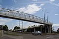
 Jade's Crossing, A249, Detling - Geograph 2273010.jpg 640 × 437; 72 KB
-
 Jade's Crossing, Detling - geograph.org.uk - 3043084.jpg 640 × 428; 82 KB
-
 Jade's Crossing, Detling - geograph.org.uk - 870646.jpg 640 × 480; 103 KB
-
 Jade's Crossing, Detling, Kent - geograph.org.uk - 41949.jpg 640 × 427; 70 KB
-
 Jade's Crossing, Sittingbourne Road - geograph.org.uk - 3721111.jpg 640 × 480; 326 KB
-
 Junction of Hermitage Lane and Broader Lane near Detling - geograph.org.uk - 3587902.jpg 3 488 × 2 616; 2,21 MB
-

-
 Kent County Showground - geograph.org.uk - 71649.jpg 640 × 408; 52 KB
-
 Kissing gate on the edge of Detling - geograph.org.uk - 2272824.jpg 640 × 430; 119 KB
-
 Lancasters over Detling Show Ground - geograph.org.uk - 4134086.jpg 640 × 427; 64 KB
-

-
 Mileage sign on M20 south of Detling - geograph.org.uk - 3489045.jpg 640 × 480; 85 KB
-
 North Downs Way - geograph.org.uk - 2273031.jpg 640 × 430; 117 KB
-
 North Downs Way near Detling - geograph.org.uk - 4737151.jpg 640 × 480; 67 KB
-
 North Downs Way near Detling - geograph.org.uk - 4737154.jpg 640 × 480; 100 KB
-
 North Downs Way signpost, Pilgrims' Way - geograph.org.uk - 2272787.jpg 640 × 430; 142 KB
-
 North Downs Way signpost, Pilgrims' Way - geograph.org.uk - 2273029.jpg 640 × 430; 123 KB
-
 North Downs Way, Detling - geograph.org.uk - 3078128.jpg 640 × 480; 140 KB
-
 North Downs Way, Detling - geograph.org.uk - 3078145.jpg 640 × 480; 151 KB
-
 North Downs Way, near Detling - geograph.org.uk - 3587911.jpg 3 488 × 2 616; 2,22 MB
-
 Orchard on the edge of Detling - geograph.org.uk - 2272828.jpg 640 × 430; 59 KB
-
 Orchard View, Detling - geograph.org.uk - 4918667.jpg 3 264 × 2 448; 1,99 MB
-
 Paras at Detling Show Ground - geograph.org.uk - 4134143.jpg 640 × 495; 181 KB
-
 Parking area on Detling Hill - geograph.org.uk - 5029060.jpg 2 048 × 1 536; 1,52 MB
-
 Parking area on Detling Hill - geograph.org.uk - 5029069.jpg 2 048 × 1 536; 1,43 MB
-
 Path towards Honeyhills Wood - geograph.org.uk - 3043186.jpg 640 × 480; 102 KB
-
 Pilgrims Way, Detling - geograph.org.uk - 3078109.jpg 640 × 480; 148 KB
-
 Pilgrims' Way - geograph.org.uk - 2273024.jpg 640 × 430; 93 KB
-
 Pilgrims' Way - geograph.org.uk - 2273039.jpg 640 × 430; 108 KB
-
 Pilgrims' Way entering Detling - geograph.org.uk - 2272786.jpg 640 × 430; 101 KB
-
 Pilgrims' Way, Detling - geograph.org.uk - 2273003.jpg 640 × 430; 73 KB
-
 Pill Box, Detling Hill.jpg 2 048 × 1 536; 664 KB
-
 Pillbox east of Binbury Lane - geograph.org.uk - 133550.jpg 640 × 450; 97 KB
-
 Pillbox on Binbury Lane - geograph.org.uk - 133547.jpg 640 × 480; 154 KB
-
 Princes Way, Detling - geograph.org.uk - 2272843.jpg 640 × 430; 72 KB
-
 Princes Way, Detling - geograph.org.uk - 4918656.jpg 3 264 × 2 448; 1,95 MB
-
 Prize porker - geograph.org.uk - 321429.jpg 425 × 640; 157 KB
-
 Purple Hill - geograph.org.uk - 1076647.jpg 640 × 481; 39 KB
-
 Reservoirs near Detling - geograph.org.uk - 3587896.jpg 3 488 × 2 616; 2,13 MB
-
 Scragged Oak Road, near Bredhurst - geograph.org.uk - 2037168.jpg 3 488 × 2 616; 2,11 MB
-
 Scragged Oak Road, near Detling - geograph.org.uk - 2037117.jpg 3 488 × 2 616; 3,39 MB
-
 Scragged Oak Road, near Detling - geograph.org.uk - 5541523.jpg 4 032 × 3 024; 4 MB
-
 Scragged Oak Road, near Detling - geograph.org.uk - 5541532.jpg 4 032 × 3 024; 4,49 MB
-
 Scragged Oak Road, near Detling - geograph.org.uk - 5541569.jpg 4 032 × 3 024; 4,33 MB
-
 Scragged Oak Road, near Detling - geograph.org.uk - 5541572.jpg 4 032 × 3 024; 3,43 MB
-
 Sheep by an orchard, Detling - geograph.org.uk - 2272804.jpg 640 × 430; 62 KB
-
 Sheep by the footpath - geograph.org.uk - 2272802.jpg 640 × 430; 55 KB
-
 Sheep on the edge of Detling - geograph.org.uk - 2272803.jpg 640 × 430; 58 KB
-
 Sittingbourne Road, Detling - geograph.org.uk - 5002332.jpg 2 048 × 1 536; 1,49 MB
-
 Sittingbourne Road, Detling - geograph.org.uk - 5005237.jpg 2 048 × 1 536; 870 KB
-
 Sittingbourne Road, Detling - geograph.org.uk - 5029038.jpg 2 048 × 1 536; 849 KB
-
 Small orchard , Detling - geograph.org.uk - 2272826.jpg 640 × 430; 107 KB
-
 South Eastern High Speed.jpg 2 739 × 2 017; 1,3 MB
-
 Southbound M20, Honeyhills Wood - geograph.org.uk - 3709839.jpg 640 × 480; 246 KB
-
 St Martin of Tours church, Detling - geograph.org.uk - 4737462.jpg 480 × 640; 68 KB
-
 Sweetcorn Field - geograph.org.uk - 1504794.jpg 640 × 480; 91 KB
-
 Sweetcorn Field near Harpole - geograph.org.uk - 1504796.jpg 640 × 427; 121 KB
-

-
 The Cock Horse pub in Detling - geograph.org.uk - 3203330.jpg 2 560 × 1 920; 1,1 MB
-
 The Cock Horse, Detling - geograph.org.uk - 1469903.jpg 640 × 480; 75 KB
-
 The Cock Horse, Detling - geograph.org.uk - 2272902.jpg 640 × 430; 79 KB
-
 The Cock Horse, Detling - geograph.org.uk - 2272905.jpg 640 × 430; 56 KB
-
 The North Downs Way near Detling - geograph.org.uk - 4923179.jpg 4 608 × 3 456; 5,28 MB
-
 The North Downs Way near Penny Spring Farm - geograph.org.uk - 4923185.jpg 4 608 × 3 456; 5,21 MB
-
 The road to nowhere, Detling - geograph.org.uk - 2272993.jpg 640 × 430; 71 KB
-
 The Street looking north - geograph.org.uk - 2272839.jpg 640 × 430; 69 KB
-
 The Street, Detling - geograph.org.uk - 1469915.jpg 640 × 480; 69 KB
-
 The Street, Detling - geograph.org.uk - 2272838.jpg 640 × 430; 48 KB
-
 The Street, Detling - geograph.org.uk - 4918604.jpg 3 264 × 2 448; 2,08 MB
-
 The Street, Detling - geograph.org.uk - 4918647.jpg 3 264 × 2 448; 1,53 MB
-
 The top of Detling Hill (A249) - geograph.org.uk - 2500380.jpg 640 × 379; 52 KB
-
 Two footpaths - geograph.org.uk - 2272801.jpg 640 × 430; 53 KB
-
 Unfurling fern fronds - geograph.org.uk - 162423.jpg 480 × 640; 142 KB
-

-
 Union Camp Detling Show ground - geograph.org.uk - 4134114.jpg 640 × 427; 158 KB
-
 Valley near Stockings Wood - geograph.org.uk - 3587878.jpg 3 488 × 2 616; 2,18 MB
-
 Valley near Stockings Wood - geograph.org.uk - 3587880.jpg 3 488 × 2 616; 2,24 MB
-
 Valley near Stockings Wood - geograph.org.uk - 3587882.jpg 3 488 × 2 616; 2,21 MB
-
 Valley near Stockings Wood - geograph.org.uk - 3587883.jpg 3 488 × 2 616; 2,25 MB
-
 Valley near Stockings Wood - geograph.org.uk - 3587884.jpg 3 488 × 2 616; 2,21 MB
-
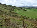
 View from North Downs - geograph.org.uk - 3043139.jpg 640 × 480; 130 KB
-

-
-
 VOR Beacon, Detling Hill - geograph.org.uk - 18098.jpg 640 × 332; 36 KB
-
 WealdfromDowns.JPG 640 × 480; 29 KB
-
 Weatherboarded cottage, Detling - geograph.org.uk - 2272841.jpg 640 × 430; 76 KB
-
 Well at the gate of The Hermitage - geograph.org.uk - 101871.jpg 480 × 640; 141 KB
-
 Well Cottage, Detling (01).jpg 4 408 × 3 262; 12,47 MB
-
 White Hill Road, Yelsted - geograph.org.uk - 4905938.jpg 3 264 × 2 448; 2,69 MB
-
 White Hill Road, Yelsted - geograph.org.uk - 4905968.jpg 3 264 × 2 448; 2,91 MB
-

-
 A millennium sculpture in Detling - geograph.org.uk - 1515915.jpg 640 × 427; 94 KB
-
 Arum Lily - geograph.org.uk - 162428.jpg 640 × 481; 157 KB
-
 Bearsted Golf Course - geograph.org.uk - 71730.jpg 640 × 480; 146 KB
-
 Beech buds - geograph.org.uk - 162413.jpg 640 × 480; 98 KB
-

-
 Bridleway from Coldblow to Friningham - geograph.org.uk - 18079.jpg 640 × 480; 116 KB
-
 Broader Lane - geograph.org.uk - 71652.jpg 640 × 480; 172 KB
-

-
 Cat's Mount - geograph.org.uk - 161919.jpg 640 × 480; 87 KB
-
 Cat's Mount - geograph.org.uk - 162407.jpg 640 × 480; 102 KB
-
 Celandine - geograph.org.uk - 149141.jpg 640 × 484; 151 KB
-
 Civiley wood and a strange platform - geograph.org.uk - 18064.jpg 640 × 331; 39 KB
-
 Coldharbour Lane - geograph.org.uk - 162418.jpg 480 × 640; 178 KB
-
 Country Park sign on North Downs - geograph.org.uk - 414446.jpg 640 × 427; 60 KB
-
 Cowslips - geograph.org.uk - 161926.jpg 480 × 640; 120 KB
-
 CTRL and M20 from Thurnham Lane - geograph.org.uk - 71712.jpg 640 × 480; 89 KB
-
 Entrance to Kent County Showground - geograph.org.uk - 730031.jpg 640 × 480; 87 KB
-

-
 Fallen tree on the North Downs Way - geograph.org.uk - 162405.jpg 480 × 640; 178 KB
-
 Fog on the Downs at Boxley Warren - geograph.org.uk - 100396.jpg 640 × 480; 72 KB
-
 Junction on the Pilgrim's Way - geograph.org.uk - 18057.jpg 640 × 480; 80 KB
-
 Line of Beeches - geograph.org.uk - 100484.jpg 640 × 480; 156 KB
-
 Longham Wood - geograph.org.uk - 71716.jpg 640 × 480; 75 KB


_-_geograph.org.uk_-_2272884.jpg)


.jpg)


_-_geograph.org.uk_-_2500380.jpg)


.jpg)


