Category:Discovery Islands
Zur Navigation springen
Zur Suche springen
Archipelago in British Columbia, Canada   | |||||
| Medium hochladen | |||||
| Ist ein(e) | |||||
|---|---|---|---|---|---|
| Ort | British Columbia, Kanada | ||||
| Liegt am oder im Gewässer | |||||
| Besteht aus |
| ||||
| offizielle Website | |||||
 | |||||
Unterkategorien
Es werden 17 von insgesamt 17 Unterkategorien in dieser Kategorie angezeigt:
In Klammern die Anzahl der enthaltenen Kategorien (K), Seiten (S), Dateien (D)
C
- Calm Channel (1 D)
- Cordero Channel (4 D)
D
F
- Frederick Arm (1 D)
H
- Hernando Island (2 D)
L
M
Q
S
- Sonora Island (4 D)
- Sutil Channel (4 D)
T
- Tully Island (2 D)
W
- West Thurlow Island (6 D)
Medien in der Kategorie „Discovery Islands“
Folgende 23 Dateien sind in dieser Kategorie, von 23 insgesamt.
-
 Carte Iles Discovery.svg 1.888 × 924; 166 KB
-
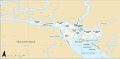 Map of the Discovery Islands.svg 1.888 × 924; 167 KB
-
 Aurora Explorer plies the Discovery Islands.jpg 1.024 × 768; 196 KB
-
 Carte baie Desolation fr.png 1.425 × 882; 310 KB
-
 Carte baie Knight.png 1.332 × 869; 349 KB
-
 Carte baies Desolation et Bute.svg 959 × 909; 64 KB
-
 Cortes Island banner Mansons Landing.jpg 2.450 × 350; 1,06 MB
-
 Cortes Island banner Whaletown.jpg 2.450 × 350; 665 KB
-
 Cortes Island sunrise.jpg 6.000 × 4.000; 14,12 MB
-
 Discovery Islands 201807.jpg 2.493 × 1.662; 1,96 MB
-
 Ferry of BC Ferries serving Quadra and Cortes islands.jpg 1.024 × 768; 197 KB
-
 Island in Desolation Sound, BC.jpg 6.395 × 3.429; 8,04 MB
-
 Locmap-DiscoveryPassage.png 330 × 273; 38 KB
-
 Locmap-MaurelleIsland.png 330 × 273; 37 KB
-
 Locmap-Redonda.png 330 × 273; 38 KB
-
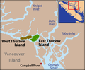 Locmap-ThurlowIslands.png 330 × 273; 38 KB
-

-
 Read Island oyster farms.jpg 1.024 × 768; 200 KB
-
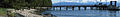
 Refuge Cove banner view of wharf.jpg 4.200 × 600; 1,65 MB
-
 Shoal Bay cabins on East Thurlow Island.jpg 1.024 × 768; 199 KB
-
 Shoal Bay off Cordero Channel.jpg 1.024 × 768; 190 KB
-
-


.jpg)


,_vicinity_of_(AL%2BCA_7800).jpg)
.jpg)