Category:Distington
Vai alla navigazione
Vai alla ricerca
village in the United Kingdom   | |||||
| Carica un file multimediale | |||||
| Istanza di | |||||
|---|---|---|---|---|---|
| Luogo | Copeland, Cumbria, Nord Ovest dell'Inghilterra, Inghilterra | ||||
| Considerato essere uguale a | Distington (pagina Wikimedia duplicata, parrocchia civile dell'Inghilterra) | ||||
 | |||||
Sottocategorie
Questa categoria contiene le 5 sottocategorie indicate di seguito, su un totale di 5.
C
- Common End, Cumbria (2 F)
D
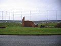
- Distington War Memorial (1 F)
G
- Gilgarran (1 F)
P
- Pica, Cumbria (1 F)
File nella categoria "Distington"
Questa categoria contiene 38 file, indicati di seguito, su un totale di 38.
-
 Barngill Bridge over Lowca Beck - geograph.org.uk - 5990877.jpg 1 024 × 683; 309 KB
-
 Benchmark on east parapet of Barngill Bridge - geograph.org.uk - 5990939.jpg 683 × 1 024; 325 KB
-
 Bridge name-date stone for Barngill Bridge - geograph.org.uk - 5990873.jpg 1 024 × 683; 321 KB
-
 Bridge over the river keekle - geograph.org.uk - 79416.jpg 640 × 480; 144 KB
-
 Car park, Distington Hall Crematorium - geograph.org.uk - 2557148.jpg 640 × 480; 114 KB
-
 Country lane near Gilgarren - geograph.org.uk - 4000586.jpg 3 296 × 2 472; 3,57 MB
-
 Cycle track bridge. - geograph.org.uk - 88976.jpg 640 × 480; 121 KB
-
 Distington (Joint) station, 1951 - geograph.org.uk - 5325690.jpg 2 363 × 1 381; 1 015 KB
-
 Distington Crematorium. - geograph.org.uk - 88994.jpg 640 × 480; 59 KB
-
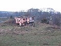 Farm Machinery - geograph.org.uk - 124740.jpg 640 × 480; 94 KB
-
 Keekle High Bridge - geograph.org.uk - 3942964.jpg 2 592 × 1 944; 2,18 MB
-
 Lowca Beck - geograph.org.uk - 516874.jpg 640 × 480; 144 KB
-

-
 Methodist Church, Distington - geograph.org.uk - 475401.jpg 640 × 480; 162 KB
-
 Moorland Powerlines. - geograph.org.uk - 88986.jpg 640 × 480; 50 KB
-
 Railway Bridge Abutments - geograph.org.uk - 4000583.jpg 3 296 × 2 472; 3,49 MB
-
 Road into Gilgarren - geograph.org.uk - 4000591.jpg 3 296 × 2 472; 3,61 MB
-
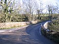
 Road junction - geograph.org.uk - 518655.jpg 640 × 480; 200 KB
-
 Sparse looking trees alongside a country lane - geograph.org.uk - 4000596.jpg 2 472 × 3 296; 3,25 MB
-
 Springhill House. - geograph.org.uk - 89801.jpg 640 × 480; 70 KB
-
 The Castle, Common End - geograph.org.uk - 518622.jpg 640 × 480; 222 KB
-
 The lane to Pica - geograph.org.uk - 3942940.jpg 2 592 × 1 944; 1,33 MB
-
 The remains of works near Wilson Park - geograph.org.uk - 3942952.jpg 2 592 × 1 944; 1,24 MB
-

-
 Croft End Farm and Footpath Entrance - geograph.org.uk - 79418.jpg 640 × 480; 54 KB
-

-
 Hidden gate - geograph.org.uk - 518624.jpg 640 × 480; 121 KB
-
 Kelmore Hills Farm entrance. - geograph.org.uk - 88996.jpg 640 × 480; 66 KB
-
 Lakes college sign. - geograph.org.uk - 88970.jpg 640 × 480; 60 KB
-
 Moresby moss track. - geograph.org.uk - 88985.jpg 640 × 480; 55 KB
-
 Park House Triangulation Pillar - geograph.org.uk - 516863.jpg 640 × 480; 228 KB
-
 Railway without train. - geograph.org.uk - 88980.jpg 640 × 480; 95 KB
-
 Road to Lowca Lowhouse - geograph.org.uk - 475480.jpg 640 × 480; 222 KB
-
 Road to Pica. - geograph.org.uk - 88990.jpg 640 × 480; 78 KB
-
 Roman road with layby. - geograph.org.uk - 88988.jpg 640 × 480; 58 KB
-
 Track to Moresby Moss. - geograph.org.uk - 88984.jpg 640 × 480; 79 KB
-
 Turn right for Pica. - geograph.org.uk - 88991.jpg 640 × 480; 83 KB
-
 Walled bridge. - geograph.org.uk - 88977.jpg 640 × 480; 139 KB


_station,_1951_-_geograph.org.uk_-_5325690.jpg)


