Category:Dodgeville, Wisconsin
Jump to navigation
Jump to search
fourth-class city in and county seat of Iowa County, Wisconsin, United States .jpg)  | |||||
| Upload media | |||||
| Instance of |
| ||||
|---|---|---|---|---|---|
| Location | Condado han Iowa, Wisconsin, Estados Unidos | ||||
| Founded by | |||||
| Inception |
| ||||
| Population |
| ||||
| Area |
| ||||
| Elevation above sea level |
| ||||
| official website | |||||
 | |||||
English: Media related to Dodgeville, Wisconsin, a city in and the county seat of Iowa County, Wisconsin, United States.
Mga ubos-nga-kaarangay
Ini nga kaarangay mayda han mga nasunod nga 2 nga mga ubos-nga-kaarangay, tikang hin 2 nga kabug-osan.
B
P
Media ha kaarangay nga "Dodgeville, Wisconsin"
An mga nasunod nga 29 ka mga fayl aada han hini nga kaarangay, tikang hin 29 nga kabug-osan.
-
 Bloomfield Manor Tower - panoramio.jpg 894 × 666; 153 nga KB
-
 Cell Tower near the House on the Rock - panoramio.jpg 4,000 × 3,000; 2.98 nga MB
-
 Communication Tower - panoramio (6).jpg 3,000 × 4,000; 2.22 nga MB
-
 Communication Tower in Wyoming Township - panoramio.jpg 4,000 × 3,000; 2.8 nga MB
-
 County Estate near Dodgeville - panoramio.jpg 4,000 × 3,000; 3.14 nga MB
-
 Dodgeville Communication Tower - panoramio.jpg 3,672 × 4,896; 5.27 nga MB
-
 Dodgeville Dairy Farm - panoramio.jpg 4,608 × 3,456; 5.91 nga MB
-
 Dodgeville Electrical substation - panoramio.jpg 4,608 × 2,941; 3.97 nga MB
-
 Dodgeville High School.jpg 3,946 × 3,772; 9.32 nga MB
-
 Dodgeville Street Light - panoramio.jpg 3,672 × 4,896; 7.59 nga MB
-
 Dodgeville Tower - panoramio.jpg 1,324 × 972; 275 nga KB
-
 Dodgeville, Wisconsin.jpg 5,350 × 2,939; 9.03 nga MB
-
 DodgevilleWisconsin1WIS23.jpg 1,936 × 1,288; 907 nga KB
-
 Downtown Dodgeville - panoramio.jpg 4,896 × 3,672; 6.13 nga MB
-
 Edmund Tower - panoramio.jpg 3,072 × 2,304; 1.8 nga MB
-
 Farm in Edmund - panoramio.jpg 4,000 × 3,000; 2.12 nga MB
-
 Folklore Village in the Distance - panoramio.jpg 4,896 × 3,672; 4.27 nga MB
-
 Hennessey Implement - panoramio.jpg 4,896 × 3,672; 5.88 nga MB
-
 Rural Dodgeville Cell Tower - panoramio.jpg 4,000 × 3,000; 1.7 nga MB
-
 Section Line Road Overpass - panoramio.jpg 4,896 × 3,672; 5.66 nga MB
-
 State Trunk Highway 23 - panoramio.jpg 4,896 × 3,672; 5.73 nga MB
-
 US Highway 18 in Dodgeville - panoramio.jpg 5,184 × 3,888; 5.58 nga MB
-
 US Highway 18 Overpass - panoramio.jpg 4,896 × 3,672; 5.75 nga MB
-
 US Highway 18 West of Dodgeville - panoramio (1).jpg 5,129 × 3,584; 5.16 nga MB
-
 US Highway 18 West of Dodgeville - panoramio (2).jpg 5,184 × 3,888; 6.41 nga MB
-
 US Highway 18 West of Dodgeville - panoramio (3).jpg 5,184 × 3,888; 5.42 nga MB
-
 WDMP 810 AM Outlaw Country D-99.3 Tower - panoramio.jpg 4,608 × 3,456; 5.72 nga MB
-
 WDMP 99.3 FM Outlaw Country D-99.3 - panoramio.jpg 4,608 × 3,456; 7.92 nga MB
-
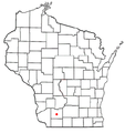 WIMap-doton-Dodgeville.png 292 × 310; 26 nga KB


.jpg)


.jpg)
.jpg)
.jpg)


