Category:Dom (mountain)
Salti al navigilo
Salti al serĉilo
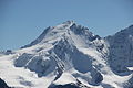
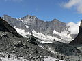
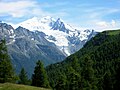
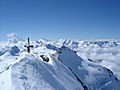
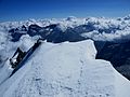
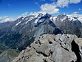
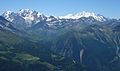
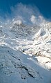
English: Dom
Italiano: Monte Dom
| Pozicio de la objekto | | Mapo de cxiuj koordinatoj per: OpenStreetMap |
|---|
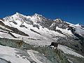
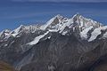
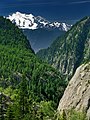
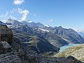
mountain in the Pennine Alps  | |||||
| Alŝuti plurmedion | |||||
| Estas | |||||
|---|---|---|---|---|---|
| Nomita laŭ |
| ||||
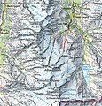
| Loko | Valezo, Svislando | ||||
| Montaro | |||||
| Elstaro |
| ||||
| Topographic isolation |
| ||||
| Supermara alteco |
| ||||
| Alia ol | |||||
 | |||||
Subkategorioj
Ĉi tiu kategorio havas la 3 jenajn subkategoriojn, el 3 entute.
Dosieroj en kategorio “Dom (mountain)”
La jenaj 118 dosieroj estas en ĉi tiu kategorio, el 118 entute.
-
 2008Nov08 1872 (3014154872).jpg 800 × 419; 116 KB
-
 2008Nov08 switzerland 1452 (3013320929).jpg 800 × 532; 164 KB
-
 Allalinhorn Swisstopo.jpg 1 035 × 1 080; 1,08 MB
-
 Alphubel, Täschhorn und Dom vom Mittelallalin.jpg 5 760 × 3 840; 7,2 MB
-
 Alphubelsummit.jpg 1 024 × 768; 184 KB
-
 Bellwald- Aussicht.jpg 2 560 × 1 920; 1,48 MB
-
 Bietschhorn with Täschhorn and Dom from Gornergrat.jpg 5 760 × 3 840; 7,35 MB
-
 Britanniahütte 2.jpg 1 280 × 753; 273 KB
-
 Britanniahütte.jpg 2 560 × 1 920; 1,39 MB
-
 Cloudy Täschhorn, Dom und Lenzspitze von Saas Fee.jpg 5 760 × 3 840; 5,4 MB
-
 Dog rose in front of Dom and Täschhorn (22245133113).jpg 5 184 × 3 456; 4,71 MB
-
 Dog rose in front of Dom and Täschhorn (22840311156).jpg 5 184 × 3 456; 3,9 MB
-
 Dog rose in front of Dom and Täschhorn (22866296215).jpg 5 184 × 3 456; 4,32 MB
-
 Dom & Täschhorn from Zermatt 2.JPG 5 184 × 3 456; 3,38 MB
-
 Dom & Täschhorn from Zermatt.JPG 5 184 × 3 456; 3,02 MB
-
 Dom (15079806798).jpg 5 184 × 3 456; 5,13 MB
-
 Dom (15264948772).jpg 5 184 × 3 456; 5,04 MB
-
 Dom (Mischabel).jpg 1 177 × 785; 624 KB
-
 Dom (mountain).jpg 2 560 × 1 920; 2,36 MB
-
 Dom - Zwischbergenpass (valo139).jpg 4 000 × 2 672; 4,24 MB
-
 Dom 2019.jpg 1 211 × 879; 479 KB
-
 Dom and mountain range from Saas-Fee.jpg 5 760 × 3 840; 6,79 MB
-
 Dom and Täschhorn (14770279447).jpg 5 184 × 3 456; 6,07 MB
-
 Dom and Täschhorn (22082921334).jpg 5 184 × 3 456; 5,78 MB
-
 Dom and Täschhorn (22726345872).jpg 5 184 × 3 456; 5,98 MB
-
 Dom and Täschhorn as seen from Gornergrat, Wallis, Switzerland, 2012 August.jpg 2 850 × 1 900; 3,91 MB
-
 Dom and Täschhorn from Gornergrat.jpg 5 760 × 3 840; 7,26 MB
-
 Dom and Täschhorn.JPG 2 169 × 1 461; 1,2 MB
-
 Dom East.jpg 1 600 × 1 200; 377 KB
-
 Dom from Nadelhorn - panoramio.jpg 1 200 × 886; 434 KB
-
 Dom from Zermatt.JPG 2 633 × 1 816; 1 018 KB
-
 Dom Glacier.jpg 1 266 × 797; 112 KB
-
 Dom Matterhorn.jpg 1 000 × 667; 180 KB
-
 Dom Mischabel.jpg 2 000 × 1 446; 565 KB
-
 Dom north west.jpg 1 600 × 1 200; 207 KB
-
 Dom north.jpg 2 272 × 1 704; 806 KB
-
 Dom North.jpg 1 024 × 768; 174 KB
-
 Dom of Mischabel.jpg 3 527 × 2 352; 4,75 MB
-
 Dom ridge.jpg 768 × 1 024; 359 KB
-
 Dom Saas Fee.jpg 1 772 × 1 181; 802 KB
-
 Dom summit.jpg 1 024 × 768; 369 KB
-
 Dom taschhorn.jpg 3 039 × 2 014; 911 KB
-
 Dom taschhorn2.jpg 1 502 × 949; 184 KB
-
 Dom und Täschhorn (vertikal).jpg 3 840 × 5 760; 7,34 MB
-
 Dom und Täschhorn mit Alphütte - Zermatt.jpg 3 840 × 5 760; 7,16 MB
-
 Dom von Westen morgens.jpg 866 × 850; 101 KB
-
 Dom zwischen Rheinwaldhorn und Güfernhorn (cropped).jpg 789 × 495; 53 KB
-
 Dom zwischen Rheinwaldhorn und Güfernhorn.jpg 1 114 × 1 629; 214 KB
-
 Dom, Dent Blanche & Grand Combin from Aiguille du Midi, 2010 July 2.JPG 5 184 × 3 006; 3,86 MB
-
 Dom, Dent Blanche & Grand Combin from Aiguille du Midi, 2010 July.JPG 5 184 × 3 456; 9,38 MB
-
 Dom, Täschhorn mountain range - Zermatt.jpg 5 760 × 3 840; 7,31 MB
-
 Dom, Täschhorn, Alphubel - Gornergrat.jpg 5 760 × 3 840; 7,38 MB
-
 Dom-Täschhorn-Alphubel.jpg 2 289 × 406; 374 KB
-
 Dom.jpg 1 280 × 960; 169 KB
-
 Dom01.jpg 1 200 × 900; 287 KB
-
 DomFromN.jpg 2 516 × 1 887; 2,16 MB
-
 DomMountainGlacier.jpg 3 648 × 2 736; 1,75 MB
-
 DomTaeschhorn.jpg 3 072 × 2 304; 2,09 MB
-
 DomTäschhorn.jpg 1 149 × 771; 158 KB
-
 ETH-BIB-Dom-Gruppe, von Obermoos bei Zermatt-Dia 247-04411.tif 3 175 × 2 889; 26,25 MB
-
 ETH-BIB-Feegletscher von Galenalp, Alphubel-Dom-Dia 247-03005.tif 3 320 × 2 838; 9,08 MB
-
 ETH-BIB-Feegletscher, Übersicht (Mitte) Alphubel, Täschhorn, Dom-Dia 247-12936.tif 3 648 × 2 784; 9,78 MB
-
 ETH-BIB-Feegletscher, Übersicht, Mitte (Täschhorn, Dom, Südlenzspitze)-Dia 247-12934.tif 3 660 × 2 772; 9,75 MB
-
 ETH-BIB-Gornergrat, Panorama Nord-Südwest, I., Mischabel (Dom-Alphudel)-Dia 247-12955.tif 3 636 × 2 844; 9,96 MB
-
 ETH-BIB-Saas-Fee Kapelle, mit Dom-Südlenzspitze-Dia 247-12939.tif 3 030 × 3 426; 9,99 MB
-
 Felskinn.jpg 2 560 × 1 920; 1,16 MB
-
 Fülhorn Richtung Matterhorn.jpg 700 × 525; 148 KB
-
 Gornergrat railway station and Dom with Täschhorn.jpg 5 760 × 3 840; 7,07 MB
-
 Hohberghorn, Stecknadelhorn, Nadelhorn, Dom and Täschhorn (22824408215).jpg 5 184 × 3 456; 5,85 MB
-
 Hohgwächte from matterhorm summer 20.jpg 908 × 1 210; 386 KB
-
 Hörnlihütte Panorama.jpg 17 942 × 2 795; 12,84 MB
-
 Imposantes Bergpanorama - CH-BAR - 3238894.tif 3 000 × 2 183; 1,21 MB
-
 Lenzspitze and Nadelhorn with Dom to the left.jpg 5 760 × 3 840; 7,06 MB
-
 Lenzspitze.jpg 500 × 333; 56 KB
-
 LtoR Nadelhorn 4327m Dom 4545m Täschhorn 4491m Breithorn 4164m.jpg 4 896 × 3 672; 6,5 MB
-
 LtoR Nadelhorn 4327m Dom 4545m Täschhorn 4491m.jpg 4 896 × 3 672; 6,59 MB
-
 Massa valley.jpg 3 000 × 4 000; 8,76 MB
-
 Mattmarksee Lenzspitze Dom Allalingletscher.jpg 4 000 × 3 000; 4,45 MB
-
 Mischabel 2008.jpg 1 199 × 978; 389 KB
-
 Mischabel Milan.jpg 1 400 × 900; 191 KB
-
 Mischabelgruppe im Herbst.jpg 6 000 × 4 000; 6,72 MB
-
 Mischabelgruppe pano2008.jpg 3 304 × 929; 1,09 MB
-
 Mount Dom.jpg 1 024 × 720; 340 KB
-
 Mounts Allalin, Feechoopf, Alphubel and Täschhorn.jpg 5 760 × 3 840; 6,07 MB
-
 Nadelhorn, Dom & Täschhorn.jpg 5 568 × 3 712; 12,09 MB
-
 Nadelhorn, Dom and Täschhorn.jpg 5 568 × 3 712; 14,55 MB
-
 Nadelhorn, Dom, Täschhorn, Bishorn & Weisshorn.jpg 5 568 × 3 584; 11,13 MB
-
 Oberrothorn Gipfel mit Dom und Täschhorn.jpg 1 216 × 912; 249 KB
-
 Oberrothorn Panorama 360.jpg 19 968 × 2 608; 9,09 MB
-
 Panorama Alpes depuis Bella Tola.jpg 24 506 × 5 325; 69,15 MB
-
 Rimpfischhorn - Nadelhorn mountain range from Hohsaas.jpg 5 760 × 3 840; 6,27 MB
-
 RoyLindmanDomCloudy.JPG 1 824 × 1 368; 548 KB
-
 RoyLindmanDomRanda 003.jpg 3 648 × 2 736; 1,67 MB
-
 RoyLindmanDomRanda 005.jpg 3 648 × 2 736; 1,92 MB
-
 RoyLindmanDomRanda 006.jpg 3 648 × 2 736; 1,73 MB
-
 RoyLindmanMettelhorn 005.jpg 3 648 × 2 736; 1,76 MB
-
 Saas-fee (51696843312).jpg 4 923 × 3 306; 2,46 MB
-
 Saas-Fee - mountains.jpg 8 787 × 2 694; 4,71 MB
-
 Saas-Fee Berger Winter.JPG 3 205 × 2 404; 1,54 MB
-
 Simplon mit Weissmies-Kette.jpg 920 × 547; 143 KB
-
 Snowy Dom and Lenzspitze in cloudy weather.jpg 5 760 × 3 840; 6,16 MB
-
 Spelterini Dom.jpg 2 200 × 1 631; 780 KB
-
 Thedom.jpg 1 600 × 2 602; 3,21 MB
-
 Triftalp.jpg 1 262 × 910; 212 KB
-
 Täschhorn - Dom - Lenzspitze.jpg 8 416 × 3 671; 7,51 MB
-
 Täschhorn - Dom.jpg 6 048 × 4 032; 18,05 MB
-
 Täschhorn, Dom and Lenzspitze from Hohsaas.jpg 5 760 × 3 840; 6,72 MB
-
 Täschhorn, Dom and Lenzspitze from Mittelallalin.jpg 5 760 × 3 840; 7,74 MB
-
 Täschhorn, Dom and Lenzspize in cloudy weather.jpg 3 840 × 5 760; 6,11 MB
-
 Valais Alps.jpg 660 × 433; 94 KB
-
 Weisshorn Dom und Rimpfischhorn von Cry d'Er.jpg 5 760 × 3 840; 4,32 MB
-
 Weisshorn und Dom 2-10-1023.jpg 5 760 × 3 840; 8,09 MB
-
 Weisshorn, Bietschhorn and Dom from Riffelberg.jpg 5 760 × 3 840; 6,33 MB
-
 Weissmies and Dom (48454621336).jpg 8 256 × 5 504; 34,19 MB
-
 Wisshorn Gipfelpanorama.jpg 39 424 × 2 848; 29,69 MB
-
 Zermatt down on summer 20.jpg 908 × 1 210; 587 KB
-
 Zermatt from schartzsee on summer 2020.jpg 908 × 1 210; 467 KB
-
 Zmutt Dom Täschhorn.jpg 4 000 × 3 000; 4,79 MB
.jpg)
.jpg)


.jpg)
.jpg)
.jpg)


.jpg)
.jpg)
.jpg)
.jpg)
.jpg)


.jpg)
.jpg)
.jpg)


.jpg)


.jpg)


.jpg)


.jpg)


.jpg)


