Category:Dowdeswell
Aller à la navigation
Aller à la recherche
Article Wikipédia principal : Dowdeswell.

localité britannique du comté anglais de Gloucestershire | |||||
| Téléverser des médias | |||||
| Nature de l’élément | |||||
|---|---|---|---|---|---|
| Lieu | Cotswold, Gloucestershire, Angleterre du Sud-Ouest, Angleterre | ||||
 | |||||
Sous-catégories
Cette catégorie comprend 3 sous-catégories, dont les 3 ci-dessous.
Média dans la catégorie « Dowdeswell »
Cette catégorie comprend 137 fichiers, dont les 137 ci-dessous.
-
 A seat with a view - geograph.org.uk - 2044360.jpg 3 008 × 2 000 ; 1,49 Mio
-
 A sight for sore eyes and weary feet - geograph.org.uk - 3431592.jpg 800 × 600 ; 163 kio
-

-
 A40 approaching Dowdeswell reservoir - geograph.org.uk - 2513965.jpg 640 × 480 ; 74 kio
-
 A40 at Dowdeswell Wood - geograph.org.uk - 2513963.jpg 640 × 480 ; 70 kio
-
 A40 at The Reservoir pub - geograph.org.uk - 2513968.jpg 640 × 480 ; 64 kio
-
 A40 east of Charlton Kings - geograph.org.uk - 4812931.jpg 1 600 × 901 ; 681 kio
-
 A436 approaching the Kilkenny junctions - geograph.org.uk - 2511672.jpg 640 × 480 ; 73 kio
-
 A436 heading east - geograph.org.uk - 3398054.jpg 640 × 480 ; 106 kio
-
 A436 heading east - geograph.org.uk - 3398057.jpg 640 × 480 ; 104 kio
-
 A436 heading east near Kilkenny - geograph.org.uk - 3398066.jpg 640 × 480 ; 88 kio
-
 A436 lay-by in Lineover Wood - geograph.org.uk - 3576834.jpg 1 024 × 768 ; 180 kio
-
 A436 near Lineover Wood - geograph.org.uk - 2511665.jpg 640 × 480 ; 74 kio
-
 Andoversford relay transmitter - geograph.org.uk - 4811318.jpg 1 600 × 1 600 ; 1,27 Mio
-
 Arable land at Castle Barn Farm - geograph.org.uk - 2188001.jpg 1 024 × 681 ; 260 kio
-
 Barn at Pegglesworth Home Farm - geograph.org.uk - 2043582.jpg 3 008 × 2 000 ; 1,46 Mio
-
 Bridleway approaching Pegglesworth Home Farm - geograph.org.uk - 2043562.jpg 3 008 × 2 000 ; 1,51 Mio
-
 Bridleway to Upper Dowdeswell - geograph.org.uk - 2188010.jpg 1 024 × 681 ; 227 kio
-
 Broken hydraulic ram in Lineover wood - geograph.org.uk - 3995117.jpg 1 024 × 768 ; 398 kio
-
 Castle Barn Farm - geograph.org.uk - 2043600.jpg 640 × 426 ; 97 kio
-
 Castle Barn Farm - geograph.org.uk - 2188006.jpg 1 024 × 681 ; 159 kio
-
 Clear fell at Dowdeswell - geograph.org.uk - 2043650.jpg 640 × 426 ; 106 kio
-
 Cotswold Way 040 - geograph.org.uk - 3907387.jpg 640 × 480 ; 157 kio
-
 Cotswold Way 041 - geograph.org.uk - 3907397.jpg 640 × 480 ; 123 kio
-
 Cotswold Way, Lineover Wood - geograph.org.uk - 2043682.jpg 3 008 × 2 000 ; 1,53 Mio
-
 Crossing the A40 and the Koloshi Restaurant - geograph.org.uk - 3431624.jpg 800 × 600 ; 153 kio
-
 Crossroads at Armscote House - geograph.org.uk - 2723230.jpg 800 × 600 ; 344 kio
-
 Crossroads near Heylens Farm - geograph.org.uk - 2648642.jpg 2 048 × 1 536 ; 2,18 Mio
-
 Dowdeswell Wood - geograph.org.uk - 4812997.jpg 1 600 × 1 200 ; 1 Mio
-
 Dowdeswell Wood Nature Reserve - geograph.org.uk - 3431437.jpg 800 × 600 ; 167 kio
-
 Earthwork bank, Upper Dowdeswell (geograph 6700197).jpg 1 024 × 576 ; 148 kio
-
 Entering Lineover Wood - geograph.org.uk - 3431703.jpg 800 × 600 ; 164 kio
-
 Entering Lineover Wood - geograph.org.uk - 3431730.jpg 800 × 600 ; 146 kio
-
 Entrance to Kilkenny viewpoint - geograph.org.uk - 1546228.jpg 640 × 480 ; 71 kio
-
 Farm driveway, Upper Colgate Farm - geograph.org.uk - 2189150.jpg 681 × 1 024 ; 202 kio
-
 Farmland and woodland - geograph.org.uk - 3398056.jpg 640 × 480 ; 83 kio
-
 Farmland at Dowdeswell - geograph.org.uk - 2190238.jpg 1 024 × 681 ; 256 kio
-
 Farmland, Dowdeswell - geograph.org.uk - 1557773.jpg 640 × 480 ; 150 kio
-
 Fence along the Dowdeswell Reservoir, Charlton Kings - geograph.org.uk - 3577276.jpg 1 600 × 1 200 ; 762 kio
-
 Field above Dowdeswell - geograph.org.uk - 4728952.jpg 6 000 × 4 000 ; 4,17 Mio
-
 Field above Dowdeswell - geograph.org.uk - 4728954.jpg 6 000 × 4 000 ; 4,82 Mio
-
 Fields below the A436 near Kilkenny - geograph.org.uk - 1971534.jpg 640 × 480 ; 99 kio
-
 Fields near Upper Dowdeswell - geograph.org.uk - 4122492.jpg 4 000 × 3 000 ; 3,03 Mio
-
 Footpath and farmland west of Kilkenny - geograph.org.uk - 3398063.jpg 640 × 480 ; 80 kio
-
 Footpath through Lineover Wood - geograph.org.uk - 2191060.jpg 1 024 × 681 ; 322 kio
-
 Footpath to Castle Barn Farm - geograph.org.uk - 4122490.jpg 4 000 × 3 000 ; 3,47 Mio
-
 Footpath to Lower Dowdeswell - geograph.org.uk - 2190240.jpg 1 024 × 681 ; 198 kio
-
 Heading back to Lineover Wood - geograph.org.uk - 3432554.jpg 800 × 600 ; 160 kio
-
 Heading down to the A40 - geograph.org.uk - 3431522.jpg 800 × 600 ; 161 kio
-
 Heading uphill to Lineover Hill - geograph.org.uk - 3431695.jpg 800 × 600 ; 196 kio
-
 Home Farm, Lower Dowdeswell (geograph 5861388).jpg 1 024 × 768 ; 300 kio
-
 Hotel on 436 west of Kilkenny - geograph.org.uk - 3576907.jpg 1 024 × 768 ; 171 kio
-
 House in the woods - geograph.org.uk - 3398053.jpg 640 × 480 ; 93 kio
-
 Kilkenny Viewpoint - geograph.org.uk - 3773392.jpg 1 024 × 680 ; 189 kio
-
 Lane towards Upper Dowdeswell - geograph.org.uk - 4812892.jpg 1 600 × 901 ; 714 kio
-
 Layby on the A436, Pegglesworth - geograph.org.uk - 5861474.jpg 2 048 × 1 536 ; 1,41 Mio
-
 Layby on the A436, Pegglesworth - geograph.org.uk - 5861477.jpg 2 048 × 1 536 ; 2,02 Mio
-
 Lineover Wood - geograph.org.uk - 3398046.jpg 640 × 480 ; 148 kio
-
 Lineover Wood - geograph.org.uk - 3431735.jpg 800 × 600 ; 161 kio
-
 Lineover Wood - geograph.org.uk - 3431794.jpg 800 × 600 ; 135 kio
-
 Lineover Wood - geograph.org.uk - 3432560.jpg 800 × 600 ; 157 kio
-
 Lineover Wood near the A436 - geograph.org.uk - 3432604.jpg 800 × 600 ; 161 kio
-
 Long Barrow near Castle Barn Farm - geograph.org.uk - 4122485.jpg 4 000 × 3 000 ; 3,32 Mio
-
 Long straight on the A436 - geograph.org.uk - 2511668.jpg 640 × 480 ; 76 kio
-
 Looking back along the Cotswold Way - geograph.org.uk - 3432583.jpg 800 × 600 ; 187 kio
-
 Lower Dowdeswell north entrance, 1 - geograph.org.uk - 4812901.jpg 1 600 × 901 ; 652 kio
-
 Lower Dowdeswell north entrance, 2 - geograph.org.uk - 4812907.jpg 1 600 × 901 ; 669 kio
-
 Mobile phone mast - geograph.org.uk - 3773387.jpg 680 × 1 024 ; 99 kio
-
 Near Salts Farm - geograph.org.uk - 3431576.jpg 800 × 600 ; 162 kio
-

-
 Old water supply in Upper Dowdeswell - geograph.org.uk - 4122497.jpg 3 892 × 2 919 ; 5,64 Mio
-

-
 Pasture above Cold Comfort - geograph.org.uk - 4811307.jpg 1 600 × 901 ; 727 kio
-
 Path in woodland - geograph.org.uk - 4812991.jpg 1 600 × 1 200 ; 1 020 kio
-
 Path into Lineover Wood - geograph.org.uk - 3397798.jpg 640 × 480 ; 125 kio
-
 Path into Lineover Wood - geograph.org.uk - 4728962.jpg 6 000 × 4 000 ; 5,22 Mio
-
 Path north towards the Dowdeswell valley - geograph.org.uk - 4812867.jpg 1 600 × 903 ; 646 kio
-
 Picnic table at the Kilkenny viewpoint - geograph.org.uk - 2067482.jpg 640 × 480 ; 96 kio
-
 Pile of tarmac on the A436, Pegglesworth - geograph.org.uk - 5861471.jpg 2 048 × 1 536 ; 1,57 Mio
-
 Pitmans flat A436 - geograph.org.uk - 1546233.jpg 640 × 495 ; 109 kio
-
 Rejoining the route after our dinner stop - geograph.org.uk - 3431687.jpg 800 × 600 ; 145 kio
-
 Road climbing towards St Paul's Epistle - geograph.org.uk - 1546220.jpg 640 × 481 ; 92 kio
-
 Road to Castle Barn Farm - geograph.org.uk - 2187994.jpg 1 024 × 681 ; 215 kio
-
 Rutted road to Castle Barn Farm - geograph.org.uk - 4811320.jpg 1 600 × 901 ; 672 kio
-
 Sheep above Dowdeswell - geograph.org.uk - 2043669.jpg 3 008 × 2 000 ; 1,48 Mio
-
 Sluice beside the Cotswold Way - geograph.org.uk - 3907391.jpg 640 × 480 ; 105 kio
-
 St Paul's Epistle - geograph.org.uk - 1546225.jpg 640 × 480 ; 105 kio
-
 Steep footpath to holly grove - geograph.org.uk - 1546193.jpg 640 × 480 ; 170 kio
-
 Steps leading to Ravensgate Hill - geograph.org.uk - 3432639.jpg 800 × 600 ; 162 kio
-
 Steps leading to the A436 - geograph.org.uk - 3432581.jpg 800 × 600 ; 156 kio
-
 Steps up into Lineover Wood - geograph.org.uk - 3431770.jpg 800 × 600 ; 170 kio
-
 Stile in Lineover Wood - geograph.org.uk - 4122479.jpg 3 000 × 4 000 ; 3,44 Mio
-
 The A40 by Dowdeswell Reservoir - geograph.org.uk - 3575578.jpg 1 600 × 1 200 ; 568 kio
-
 The Cotswold plateau, 1 - geograph.org.uk - 4811286.jpg 1 600 × 901 ; 744 kio
-
 The Cotswold plateau, 2 - geograph.org.uk - 4811288.jpg 1 600 × 901 ; 748 kio
-
 The Cotswold plateau, 3 - geograph.org.uk - 4811289.jpg 1 600 × 901 ; 739 kio
-
 The Cotswold Way above Dowdeswell - geograph.org.uk - 4728936.jpg 6 000 × 4 000 ; 5,42 Mio
-
 The Cotswold Way in Lineover Wood - geograph.org.uk - 3432576.jpg 800 × 600 ; 164 kio
-
 The Cotswold Way in Lineover Wood - geograph.org.uk - 4728967.jpg 6 000 × 4 000 ; 4,57 Mio
-
 The information board at Lineover Wood - geograph.org.uk - 3431708.jpg 800 × 600 ; 174 kio
-
 The Koloshi restaurant and bar - geograph.org.uk - 4812927.jpg 1 600 × 901 ; 632 kio
-
 The Old Barn in Upper Dowdeswell - geograph.org.uk - 4122495.jpg 4 000 × 3 000 ; 3,58 Mio
-
 The path alongside Dowdeswell Wood - geograph.org.uk - 3431517.jpg 800 × 600 ; 182 kio
-
 The path in Lineover Wood - geograph.org.uk - 3432564.jpg 800 × 600 ; 133 kio
-
 The path into Lineover Wood - geograph.org.uk - 3431758.jpg 800 × 600 ; 183 kio
-
 The path near Dowdeswell Reservoir - geograph.org.uk - 3431572.jpg 800 × 600 ; 180 kio
-
 The path runs alongside the A436 - geograph.org.uk - 3432586.jpg 800 × 600 ; 170 kio
-
 The path turns right back into Lineover Wood - geograph.org.uk - 3431829.jpg 800 × 600 ; 170 kio
-
 The route enters a clearing - geograph.org.uk - 3431782.jpg 800 × 600 ; 149 kio
-
 The run off from Dowdeswell Reservoir - geograph.org.uk - 3431599.jpg 800 × 600 ; 146 kio
-
 Track near Castle Barn Farm - geograph.org.uk - 2187991.jpg 1 024 × 681 ; 252 kio
-
 Tractor working straw, Castle Barn Farm - geograph.org.uk - 2043637.jpg 640 × 426 ; 115 kio
-
 Tree at Dowdeswell - geograph.org.uk - 2187983.jpg 1 024 × 681 ; 319 kio
-
 Tree beside a footpath - geograph.org.uk - 2190242.jpg 1 024 × 681 ; 199 kio
-
 Tree by the A436, Pegglesworth - geograph.org.uk - 5861470.jpg 2 048 × 1 536 ; 1,47 Mio
-
 Trees at St Paul's Epistle - geograph.org.uk - 3773385.jpg 1 024 × 680 ; 220 kio
-
 Trees by the A40, Dowdeswell - geograph.org.uk - 3577279.jpg 1 552 × 1 134 ; 732 kio
-
 Trees in Lineover Wood - geograph.org.uk - 4122476.jpg 4 000 × 3 000 ; 5,4 Mio
-
 Trees in Lineover Wood - geograph.org.uk - 4728947.jpg 6 000 × 4 000 ; 4,96 Mio
-
 Up the embankment to the A40 - geograph.org.uk - 3431622.jpg 800 × 600 ; 145 kio
-
 Upper Dowdeswell - geograph.org.uk - 4812896.jpg 1 600 × 901 ; 619 kio
-
 View east from the crossroads - geograph.org.uk - 2648650.jpg 2 048 × 1 536 ; 2,18 Mio
-
 View north from near the relay transmitter mast - geograph.org.uk - 4811314.jpg 1 600 × 901 ; 667 kio
-
 View to Dowdeswell Wood - geograph.org.uk - 2190243.jpg 1 024 × 681 ; 264 kio
-
 View to Lower Dowdeswell - geograph.org.uk - 4812886.jpg 1 600 × 1 200 ; 1,03 Mio
-
 View top the Malvern Hills - geograph.org.uk - 3773391.jpg 1 024 × 680 ; 123 kio
-
 Walker towards Lineover Wood - geograph.org.uk - 3431726.jpg 800 × 600 ; 150 kio
-
 Walking alongside Dowdeswell Wood Reserve - geograph.org.uk - 3431531.jpg 800 × 600 ; 172 kio
-
 Walking downhill towards the A40 - geograph.org.uk - 3431537.jpg 800 × 600 ; 185 kio
-
 Walking towards Ravensgate Hill - geograph.org.uk - 3432593.jpg 800 × 600 ; 178 kio
-
 Walking towards Ravensgate Hill - geograph.org.uk - 3432614.jpg 800 × 600 ; 148 kio
-
 Walking towards the A40 - geograph.org.uk - 3431618.jpg 800 × 600 ; 154 kio
-
 Whalleying straw, Castle Barn Farm - geograph.org.uk - 2043630.jpg 3 008 × 2 000 ; 1,54 Mio
-
 Wood Farm, Whittington - geograph.org.uk - 2189169.jpg 1 024 × 681 ; 137 kio
-
 Woodland near Castle Barn Farm - geograph.org.uk - 4122488.jpg 4 000 × 3 000 ; 3,82 Mio
-
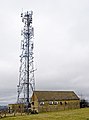 Andoversford Relay Transmitter - geograph.org.uk - 702429.jpg 474 × 640 ; 67 kio
-
 Communication Mast, St Paul's Epistle - geograph.org.uk - 48368.jpg 640 × 480 ; 49 kio


.jpg)


.jpg)


