Category:Draughton, Northamptonshire
Aller à la navigation
Aller à la recherche
English: Draughton is a village and civil parish in the West Northamptonshire district of the county of Northamptonshire in England. It is situated approximately one mile east of Maidwell at .
village britannique | |||||
| Téléverser des médias | |||||
| Nature de l’élément | |||||
|---|---|---|---|---|---|
| Lieu | West Northamptonshire, Northamptonshire, Midlands de l'Est, Angleterre | ||||
 | |||||
Sous-catégories
Cette catégorie comprend seulement la sous-catégorie ci-dessous.
D
Média dans la catégorie « Draughton, Northamptonshire »
Cette catégorie comprend 72 fichiers, dont les 72 ci-dessous.
-
 All is calm at former Harrington Airfield - geograph.org.uk - 4064440.jpg 640 × 427 ; 58 kio
-
 Artwork along the Brampton Valley Way - geograph.org.uk - 5317101.jpg 800 × 600 ; 197 kio
-
 Bend in Maidwell Road - geograph.org.uk - 5321895.jpg 800 × 554 ; 137 kio
-
 Brampton Valley - geograph.org.uk - 1879267.jpg 640 × 480 ; 85 kio
-
 Brampton Valley Way - geograph.org.uk - 1879248.jpg 480 × 640 ; 72 kio
-
 Brampton Valley Way - geograph.org.uk - 1879252.jpg 640 × 480 ; 57 kio
-
 Brampton Valley Way - geograph.org.uk - 1879259.jpg 480 × 640 ; 122 kio
-
 Brampton Valley Way - geograph.org.uk - 2667141.jpg 640 × 427 ; 151 kio
-
 Brampton Valley Way near Maidwell - geograph.org.uk - 5863240.jpg 1 024 × 768 ; 361 kio
-
 Brampton Valley Way, near Maidwell - geograph.org.uk - 5863251.jpg 1 024 × 768 ; 366 kio
-
 Bridleway beside Short Wood. - geograph.org.uk - 444073.jpg 640 × 480 ; 83 kio
-
 Bridleway by the Rape. - geograph.org.uk - 444061.jpg 640 × 480 ; 88 kio
-
 Bridleway looking to Brampton Valley Way - geograph.org.uk - 1516417.jpg 640 × 480 ; 89 kio
-
 Bridleway to Faxton. - geograph.org.uk - 456929.jpg 640 × 480 ; 134 kio
-
 Cottages in the village of Draughton - geograph.org.uk - 5321869.jpg 800 × 544 ; 96 kio
-
 Council Road Depot - geograph.org.uk - 5439073.jpg 480 × 640 ; 53 kio
-
 Country road near Draughton - geograph.org.uk - 4160103.jpg 640 × 622 ; 121 kio
-
 Derelict footbridge over Brampton Valley Way - geograph.org.uk - 5863256.jpg 1 024 × 768 ; 258 kio
-

-

-
 Draughton Cottages - geograph.org.uk - 5716384.jpg 1 600 × 1 161 ; 535 kio
-
 Draughton Road, near Maidwell - geograph.org.uk - 5863247.jpg 1 024 × 768 ; 309 kio
-
 Farmland next to the Brampton Valley Way - geograph.org.uk - 5318240.jpg 800 × 638 ; 104 kio
-
 Footpath over the Brampton Valley Way - geograph.org.uk - 5639275.jpg 640 × 480 ; 44 kio
-
 Footpath to Draughton village - geograph.org.uk - 5318223.jpg 800 × 600 ; 162 kio
-
 Green Lane Crossing - geograph.org.uk - 446293.jpg 640 × 477 ; 137 kio
-
 Harringworth airfield - geograph.org.uk - 5492282.jpg 480 × 640 ; 88 kio
-
 Horses near the village of Draughton - geograph.org.uk - 5321889.jpg 800 × 633 ; 111 kio
-
 Isolated farm buildings near Short Wood - geograph.org.uk - 3544372.jpg 4 320 × 3 240 ; 4,46 Mio
-
 Lamport Road in Draughton - geograph.org.uk - 5321864.jpg 800 × 568 ; 108 kio
-
 Lamport Road, Draughton - geograph.org.uk - 374393.jpg 640 × 379 ; 55 kio
-
 Maidwell Sewage Works - geograph.org.uk - 1879239.jpg 640 × 480 ; 60 kio
-
 Maidwell Trail - geograph.org.uk - 1878984.jpg 640 × 480 ; 119 kio
-
 Maidwell Trail - geograph.org.uk - 1878992.jpg 640 × 480 ; 48 kio
-
 Maidwell-Brampton Valley Way - geograph.org.uk - 4940164.jpg 1 600 × 1 200 ; 735 kio
-
 Memorial - geograph.org.uk - 3544402.jpg 4 320 × 3 240 ; 5,82 Mio
-
 Northants byway - geograph.org.uk - 5492281.jpg 640 × 480 ; 106 kio
-
 Old concrete road near to USAF memorial - geograph.org.uk - 3544412.jpg 4 320 × 3 240 ; 5,02 Mio
-
 Pool near the village of Draughton - geograph.org.uk - 5321857.jpg 800 × 521 ; 143 kio
-
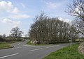
 Road junction near Harrington, Northamptonshire - geograph.org.uk - 5861199.jpg 1 024 × 768 ; 189 kio
-
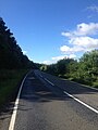
 Rural road near Harrington, Northamptonshire - geograph.org.uk - 5861207.jpg 1 024 × 768 ; 169 kio
-
 Scaldwell Lodge Farm - geograph.org.uk - 395122.jpg 640 × 480 ; 95 kio
-
 Seats along the Brampton Valley Way - geograph.org.uk - 5318255.jpg 800 × 600 ; 193 kio
-
 St Catherine's Church in Draughton - geograph.org.uk - 5321882.jpg 800 × 570 ; 120 kio
-
 The Rear of Scaldwell Lodge. - geograph.org.uk - 456890.jpg 640 × 480 ; 92 kio
-
 Towards Draughton - geograph.org.uk - 5492272.jpg 480 × 640 ; 63 kio
-
 Towards Draughton - geograph.org.uk - 5492273.jpg 480 × 640 ; 74 kio
-
 Towards Lamport - geograph.org.uk - 5492266.jpg 480 × 640 ; 58 kio
-
 Towards Maidwell - geograph.org.uk - 5492275.jpg 480 × 640 ; 62 kio
-

-
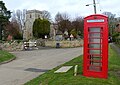
 Village Street. - geograph.org.uk - 365679.jpg 640 × 480 ; 97 kio
-
 A14 goes over Brampton Valley Way - geograph.org.uk - 375235.jpg 640 × 406 ; 53 kio
-
 Brampton Valley Way crossing River Brampton - geograph.org.uk - 446313.jpg 640 × 477 ; 144 kio
-
 Brampton Valley Way south of A14 - geograph.org.uk - 446278.jpg 640 × 477 ; 113 kio
-
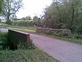
 Bridge on Bridleway. - geograph.org.uk - 444055.jpg 640 × 480 ; 172 kio
-
 Dividing of the Ways. - geograph.org.uk - 427731.jpg 640 × 480 ; 135 kio
-

-
 Faxton Grange. - geograph.org.uk - 456934.jpg 640 × 480 ; 98 kio
-
 Footpath follows Rough Track. - geograph.org.uk - 365810.jpg 640 × 480 ; 92 kio
-
 Gateway and Fields near Faxton Grange - geograph.org.uk - 395114.jpg 640 × 480 ; 74 kio
-
 Green Lane Crossing - geograph.org.uk - 446281.jpg 477 × 640 ; 140 kio
-
 Green Lane Crossing, Brampton Valley Way - geograph.org.uk - 375242.jpg 640 × 394 ; 91 kio
-
 Ha-Ha in front of Shortwood House. - geograph.org.uk - 444085.jpg 640 × 480 ; 81 kio
-
 Looking across the fields to Shortwood - geograph.org.uk - 388007.jpg 640 × 328 ; 39 kio
-
 Open Countryside. - geograph.org.uk - 365804.jpg 640 × 480 ; 90 kio
-
 Parting of the ways - geograph.org.uk - 393025.jpg 640 × 451 ; 74 kio
-
 Renovated Barn. - geograph.org.uk - 427728.jpg 640 × 480 ; 140 kio
-
 Reservoir near Draughton - geograph.org.uk - 374398.jpg 640 × 305 ; 55 kio
-
 Shortwood House. - geograph.org.uk - 444081.jpg 640 × 480 ; 79 kio
-
 Undisturbed Lake. - geograph.org.uk - 444099.jpg 640 × 480 ; 111 kio
-
 View to Short Wood. - geograph.org.uk - 444069.jpg 640 × 480 ; 107 kio
-
 View to Shortwood House. - geograph.org.uk - 444092.jpg 640 × 480 ; 66 kio


