Category:Draycott in the Clay
Aller à la navigation
Aller à la recherche
village britannique  | |||||
| Téléverser des médias | |||||
| Nature de l’élément | |||||
|---|---|---|---|---|---|
| Lieu | East Staffordshire, Staffordshire, Midlands de l'Ouest, Angleterre | ||||
 | |||||
Sous-catégories
Cette catégorie comprend 4 sous-catégories, dont les 4 ci-dessous.
Média dans la catégorie « Draycott in the Clay »
Cette catégorie comprend 60 fichiers, dont les 60 ci-dessous.
-
 ... the weather today in Draycott In The Clay - Post Office. (6813505019).jpg 4 340 × 3 260 ; 8,88 Mio
-
 A very impressive hedge on Moreton Lane - geograph.org.uk - 2685297.jpg 640 × 428 ; 71 kio
-
 Accommodation available at Granary Court - geograph.org.uk - 2666053.jpg 640 × 428 ; 64 kio
-
 Approaching the A515 at Draycott Island - geograph.org.uk - 2685283.jpg 640 × 428 ; 50 kio
-
 Ashacres Industrial Park near Sudbury - geograph.org.uk - 2936070.jpg 640 × 425 ; 75 kio
-
 Aston Bridge in the rain - geograph.org.uk - 2039633.jpg 1 024 × 768 ; 100 kio
-
 Aston Bridge on the A515 - geograph.org.uk - 2144189.jpg 640 × 411 ; 49 kio
-
 B 5017 near Marchington Industrial Estate - geograph.org.uk - 2119606.jpg 640 × 480 ; 77 kio
-
 Coton Lane - geograph.org.uk - 5097756.jpg 640 × 480 ; 60 kio
-
 Cottages on a steep hill - geograph.org.uk - 2119601.jpg 640 × 480 ; 125 kio
-
 Country houses - geograph.org.uk - 5868382.jpg 2 000 × 1 333 ; 1,9 Mio
-
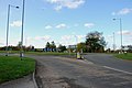
 Crossroads at Draycott in the Clay - geograph.org.uk - 5053285.jpg 4 000 × 3 000 ; 2,67 Mio
-

-
 Entrance to Saltbrook Meadow Farm - geograph.org.uk - 2685246.jpg 640 × 428 ; 84 kio
-
 Field entrance, Moreton - geograph.org.uk - 5097743.jpg 640 × 480 ; 94 kio
-
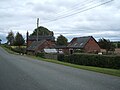
 Forest Farm - geograph.org.uk - 5564659.jpg 640 × 480 ; 57 kio
-
 Forest Road near Forest Farm - geograph.org.uk - 5564660.jpg 640 × 480 ; 62 kio
-
 Forest Road towards Hanbury - geograph.org.uk - 5564653.jpg 640 × 480 ; 58 kio
-
 Grazing and hedgerow - geograph.org.uk - 5097755.jpg 640 × 480 ; 52 kio
-
 Grazing and trees, Moreton Hall Farm - geograph.org.uk - 5097748.jpg 640 × 480 ; 62 kio
-
 Grazing towards Banktop Wood - geograph.org.uk - 5564656.jpg 640 × 480 ; 70 kio
-
 Grazing, Hall Flats - geograph.org.uk - 5097750.jpg 640 × 480 ; 52 kio
-
 Houses at Moreton - geograph.org.uk - 5583554.jpg 1 600 × 1 200 ; 318 kio
-
 Houses Behind the Trees, Moreton Lane - geograph.org.uk - 2685330.jpg 640 × 428 ; 134 kio
-
 Lane, Moreton - geograph.org.uk - 5097747.jpg 640 × 480 ; 88 kio
-
 Lights changing on Aston Bridge - geograph.org.uk - 5843320.jpg 1 469 × 1 102 ; 499 kio
-
 Looking to Finger Post on greaves Lane - geograph.org.uk - 2683747.jpg 640 × 428 ; 116 kio
-
 Milepost at SK1417529130.jpg 640 × 480 ; 265 kio
-
 Milepost at SK1561228758.jpg 640 × 480 ; 294 kio
-
 Moreton Lane - geograph.org.uk - 5097746.jpg 640 × 480 ; 55 kio
-
 Moreton Lane approaching the A515 - geograph.org.uk - 5097754.jpg 640 × 480 ; 56 kio
-
 Moreton Lane, Hall Flats - geograph.org.uk - 5097753.jpg 640 × 480 ; 77 kio
-
 No hold ups today at Sudbury Crossing - geograph.org.uk - 5843311.jpg 1 403 × 1 052 ; 463 kio
-
 On the A515 near The Firs - geograph.org.uk - 5843296.jpg 1 469 × 1 102 ; 536 kio
-
 Ordnance Survey Flush Bracket S9585 - geograph.org.uk - 5053266.jpg 4 000 × 3 000 ; 4,57 Mio
-
 Path leaving Banktop Wood - geograph.org.uk - 2119596.jpg 640 × 480 ; 101 kio
-
 Riddings Lane near Coton - geograph.org.uk - 5565074.jpg 1 280 × 960 ; 620 kio
-

-
 Road leaving Coton in the Clay - geograph.org.uk - 5843287.jpg 1 469 × 1 102 ; 522 kio
-
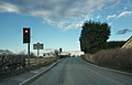
 Roundabout on the A515 - geograph.org.uk - 5843290.jpg 1 469 × 1 102 ; 478 kio
-
 Saltbrook Lane near Coton in the Clay - geograph.org.uk - 5592308.jpg 1 280 × 960 ; 376 kio
-
 Sowley House - geograph.org.uk - 5564650.jpg 640 × 480 ; 58 kio
-
 Sudbury Crossing signal box - geograph.org.uk - 4457775.jpg 4 320 × 3 240 ; 3,82 Mio
-
 Sudbury signal box - geograph.org.uk - 2122243.jpg 1 600 × 1 200 ; 324 kio
-
 Sudbury signal box and railway cottages. - geograph.org.uk - 462735.jpg 640 × 480 ; 94 kio
-
 Sudbury Transport Cafe - geograph.org.uk - 5868393.jpg 2 000 × 1 333 ; 1,59 Mio
-
 Texaco filling station south of Sudbury crossing - geograph.org.uk - 5843306.jpg 1 469 × 1 102 ; 499 kio
-
 The A515 near Densy Meadows Farm - geograph.org.uk - 5843299.jpg 1 469 × 1 102 ; 584 kio
-

-
 The level crossing at Sudbury, Derbyshire - geograph.org.uk - 2122268.jpg 1 600 × 1 200 ; 386 kio
-

-

-
 Towards Coton in the Clay - geograph.org.uk - 3933040.jpg 4 000 × 3 000 ; 2,01 Mio
-
 Traffic on Aston Bridge - geograph.org.uk - 4457808.jpg 4 320 × 3 240 ; 4,92 Mio
-
 View from Saltbrook Lane towards Row Hill - geograph.org.uk - 5592310.jpg 1 280 × 960 ; 404 kio
-

-
 Wartime Relic Pillbox at Aston Bridge - geograph.org.uk - 3931231.jpg 1 889 × 1 024 ; 915 kio
-
 Woodgate Farm, Stubby Lane, Woodgate - geograph.org.uk - 2666038.jpg 640 × 428 ; 65 kio
-
 Woodland paths in Banktop Wood - geograph.org.uk - 2119589.jpg 640 × 480 ; 170 kio
-
 WW2 pillbox near Sudbury Crossing - geograph.org.uk - 4457788.jpg 4 320 × 3 240 ; 5,36 Mio
.jpg)


