Category:Drumoig
Zur Navigation springen
Zur Suche springen
Weiler in Schottland  | |||||
| Medium hochladen | |||||
| Ist ein(e) | |||||
|---|---|---|---|---|---|
| Ort |
| ||||
 | |||||
Unterkategorien
Diese Kategorie enthält folgende Unterkategorie:
In Klammern die Anzahl der enthaltenen Kategorien (K), Seiten (S), Dateien (D)
V
- Vicarsford cemetery (3 D)
Medien in der Kategorie „Drumoig“
Folgende 14 Dateien sind in dieser Kategorie, von 14 insgesamt.
-
 Above Forgan - geograph.org.uk - 639779.jpg 640 × 398; 87 KB
-
 Arable land on Roseberry Hill - geograph.org.uk - 1434307.jpg 640 × 480; 102 KB
-
 Arable land, Easter Friarton - geograph.org.uk - 1435815.jpg 640 × 480; 98 KB
-
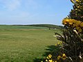
 Beyond the green - geograph.org.uk - 1277844.jpg 640 × 480; 68 KB
-
 Cowbackie Hill - geograph.org.uk - 1277824.jpg 640 × 480; 57 KB
-
 Cowbakie Farmland - geograph.org.uk - 639784.jpg 640 × 429; 103 KB
-
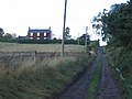 Easter Friarton - geograph.org.uk - 58845.jpg 640 × 480; 60 KB
-
 Entrance to Drumoig - geograph.org.uk - 1277812.jpg 640 × 480; 55 KB
-
 Golf course pond - geograph.org.uk - 1277851.jpg 640 × 480; 76 KB
-
 Kirkton Barns - geograph.org.uk - 58844.jpg 640 × 480; 74 KB
-
 Old Forgan Graveyard - geograph.org.uk - 98043.jpg 640 × 480; 111 KB
-
 Road to the range - geograph.org.uk - 1277808.jpg 640 × 480; 72 KB
-
 Tattie field, Easter Friarton. - geograph.org.uk - 58848.jpg 640 × 480; 68 KB
-
 Wheat below Roseberry Hill - geograph.org.uk - 1435817.jpg 640 × 480; 123 KB


