Category:Duchesne, Utah
Vai alla navigazione
Vai alla ricerca
comune statunitense dello Utah   | |||||
| Carica un file multimediale | |||||
| Istanza di | |||||
|---|---|---|---|---|---|
| Prende il nome da | |||||
| Luogo | Uintah and Ouray Indian Reservation, contea di Uintah, Utah, Stati Uniti d'America | ||||
| Situato sul mare / lago / fiume | |||||
| Data di fondazione o creazione |
| ||||
| Popolazione |
| ||||
| Superficie |
| ||||
| Altezza sul mare |
| ||||
| sito web ufficiale | |||||
 | |||||
English: Media related to Duchesne, Utah, a city in central Duchesne County, Utah, United States, that serves as the county seat.
Sottocategorie
Questa categoria contiene le 2 sottocategorie indicate di seguito, su un totale di 2.
B
I
File nella categoria "Duchesne, Utah"
Questa categoria contiene 8 file, indicati di seguito, su un totale di 8.
-
 CtyMapDuchesne.png 936 × 689; 49 KB
-
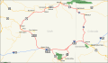 DinosaurDiamond map.svg 1 475 × 860; 769 KB
-
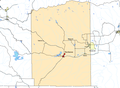
 Duchesne County Utah incorporated and unincorporated areas Duchesne highlighted.svg 1 070 × 741; 9,82 MB
-
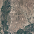 Duchesne Municipal Airport - aerial photo.png 1 280 × 1 280; 3,4 MB
-
 Duchesne Utah.JPG 3 072 × 2 304; 1,12 MB
-
 Duchesnecounty ut.png 577 × 817; 35 KB
-
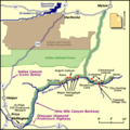 NineMileCanyon map.png 400 × 400; 28 KB
-
 UTMap-doton-Duchesne.PNG 238 × 300; 18 KB


Categorie:
- Cities in Utah
- County seats in Utah
- Populated places in Duchesne County, Utah
- Populated places on the Uintah and Ouray Indian Reservation
- Duchesne River
- Strawberry River (Utah)
- Populated places in the Uinta Basin
- Locations along U.S. Route 40 in Duchesne County, Utah
- Locations along U.S. Route 191 in Duchesne County, Utah
- Locations along Utah State Route 6 (1910-1977) in Duchesne County, Utah
- Locations along Utah State Route 33 (1927-1981) in Duchesne County, Utah
- Locations along Utah State Route 35 in Duchesne County, Utah
- Locations along Utah State Route 87
- Locations along Utah State Route 311
- Locations along the Dinosaur Diamond Prehistoric Highway in Duchesne County, Utah