Category:Dumbarton
ナビゲーションに移動
検索に移動
スコットランドの町  | |||||
| メディアをアップロード | |||||
| 分類 |
| ||||
|---|---|---|---|---|---|
| 場所 |
| ||||
| 人口 |
| ||||
| 先行 | |||||
| 以下と異なる | |||||
 | |||||

下位カテゴリ
このカテゴリに属する 25 個のサブカテゴリのうち、 25 個を表示しています。
A
- Artizan Bridge (9ファイル)
- Artizan Centre (3ファイル)
B
- Black Wood, West Dunbartonshire (7ファイル)
D
- Dumbarton Bridge, Dumbarton (15ファイル)
- Dumbarton Prison (16ファイル)
L
M
- Maryland Service Reservoir (2ファイル)
O
- Our Lady and St Patrick's High School (16ファイル)
P
R
S
- St Patrick's Church, Dumbarton (20ファイル)
T
- The Crags Circular Path (6ファイル)
- The Shore Circular Path, Dumbarton (4ファイル)
カテゴリ「Dumbarton」にあるメディア
このカテゴリに属する 325 個のファイルのうち、 200 個を表示しています。
(前のページ) (次のページ)-

-
 A spring - geograph.org.uk - 4487342.jpg 1,024 × 768;353キロバイト
-
 A View Over Dumbarton - geograph.org.uk - 2586808.jpg 1,600 × 1,200;325キロバイト
-
 A wet day in Dumbarton (25102131796).jpg 2,432 × 3,648;959キロバイト
-
 A82 to Crianlarich - geograph.org.uk - 3465810.jpg 4,608 × 3,456;6.33メガバイト
-
 A82-A813 Roundabout, Dumbarton - geograph.org.uk - 4912716.jpg 2,784 × 1,568;2.14メガバイト
-
 Access track at the disused Garshake waterworks - geograph.org.uk - 3129158.jpg 1,200 × 797;566キロバイト
-
 Accident Sign at Allied Distillers - geograph.org.uk - 430009.jpg 640 × 480;103キロバイト
-

-
 Admiralty Chart No 2007 River Clyde from Dumbarton to Glasgow, Published 1850.jpg 9,995 × 6,714;18.39メガバイト
-
 Admiralty Chart No 2007 River Clyde, Published 1914.jpg 16,181 × 11,019;70.08メガバイト
-
 An ancient track - geograph.org.uk - 4487264.jpg 1,024 × 768;266キロバイト
-
 An ancient track - geograph.org.uk - 4487291.jpg 1,024 × 768;229キロバイト
-
 Barloan Toll Roundabout - geograph.org.uk - 2772097.jpg 1,024 × 455;145キロバイト
-
 Bench beside Gruggies Burn - geograph.org.uk - 4713327.jpg 1,024 × 768;226キロバイト
-
 Between the River Leven and High Street, Dumbarton - geograph.org.uk - 5592806.jpg 1,024 × 768;166キロバイト
-
 Black Lair - geograph.org.uk - 2305165.jpg 1,600 × 800;279キロバイト
-
 Black Lair - geograph.org.uk - 2305168.jpg 1,600 × 533;200キロバイト
-
 Black Lair - geograph.org.uk - 2795849.jpg 640 × 427;73キロバイト
-
 Black Lair - geograph.org.uk - 6180929.jpg 1,024 × 683;229キロバイト
-
 Boat leaving the River Leven - geograph.org.uk - 3567728.jpg 640 × 480;140キロバイト
-
 Boat leaving the River Leven - geograph.org.uk - 3567730.jpg 640 × 480;145キロバイト
-
 Boat leaving the River Leven - geograph.org.uk - 3567732.jpg 640 × 480;142キロバイト
-
 Boer War Memorial - geograph.org.uk - 5225115.jpg 1,200 × 1,600;408キロバイト
-
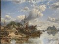
 Samuel Bough - Shipyard at Dumbarton (1855).jpg 6,687 × 5,021;15.38メガバイト
-
 Shipyard at Dumbarton RMG BHC1792.tiff 6,884 × 5,140;101.23メガバイト
-
 Broadmeadow Industrial Estate - geograph.org.uk - 5780438.jpg 1,024 × 640;168キロバイト
-
 Broadmeadow Industrial Estate - geograph.org.uk - 5785522.jpg 1,024 × 768;208キロバイト
-
 Buildings at base of Dumbarton Rock - geograph.org.uk - 6470778.jpg 1,799 × 1,199;485キロバイト
-
 Burmese cannon - geograph.org.uk - 5225143.jpg 1,600 × 1,269;476キロバイト
-
 Burmese cannon - geograph.org.uk - 5225146.jpg 1,600 × 1,333;492キロバイト
-
 Cairn at Castle Road - geograph.org.uk - 3565889.jpg 640 × 480;188キロバイト
-
 Cannons at Dumbarton Rock - geograph.org.uk - 6486438.jpg 1,799 × 1,199;328キロバイト
-
 Car park ^ children's playground north of Dumbarton East station - geograph.org.uk - 4174020.jpg 2,048 × 1,536;1.78メガバイト
-
 Cassier's magazine (1904) (14768645402).jpg 2,992 × 1,900;1.61メガバイト
-
 Castle Point development under construction - geograph.org.uk - 5216275.jpg 1,024 × 768;131キロバイト
-
 Castle Point development under construction - geograph.org.uk - 5216278.jpg 1,600 × 889;226キロバイト
-
 Castle Point development under construction - geograph.org.uk - 5216283.jpg 1,024 × 768;158キロバイト
-
 Castle Quay housing development - geograph.org.uk - 2795806.jpg 1,600 × 582;223キロバイト
-
 Castle Road and surroundings - geograph.org.uk - 5348761.jpg 1,600 × 800;302キロバイト
-
 Church Notice Board, Dumbarton - geograph.org.uk - 2727453.jpg 3,500 × 2,625;4.43メガバイト
-
 Church Street - geograph.org.uk - 2033530.jpg 517 × 640;132キロバイト
-
 Church Street and castle Street - geograph.org.uk - 2033533.jpg 640 × 480;123キロバイト
-
 Cleared area at Lomondgate - geograph.org.uk - 4449718.jpg 1,024 × 768;239キロバイト
-
 Cleared area at Lomondgate - geograph.org.uk - 4449732.jpg 1,024 × 768;273キロバイト
-
 Cleared area at Lomondgate - geograph.org.uk - 4449754.jpg 1,024 × 768;258キロバイト
-
 Cleared ground at the top of Garshake Road - geograph.org.uk - 6386524.jpg 1,024 × 640;185キロバイト
-
 Clyde from M8, Dumbarton.jpg 2,197 × 1,086;111キロバイト
-
 College Bow, Municipal Buildings, Dumbarton.jpg 4,896 × 2,752;3.75メガバイト
-
 Construction on site of Burgh Hall - geograph.org.uk - 5216258.jpg 1,600 × 1,089;240キロバイト
-
 Construction on site of Burgh Hall - geograph.org.uk - 5225068.jpg 1,600 × 1,200;284キロバイト
-
 Conveyor system at Chivas Brothers Ltd in Dumbarton.jpg 709 × 531;171キロバイト
-
 Covered reservoir at Garshake - geograph.org.uk - 2302355.jpg 640 × 640;148キロバイト
-
 Crosslet Road - geograph.org.uk - 2032614.jpg 640 × 480;123キロバイト
-
 Cycle path, north of railway bridge - geograph.org.uk - 1562558.jpg 640 × 480;128キロバイト
-
 Date stone below sentry box - geograph.org.uk - 3061184.jpg 1,024 × 768;312キロバイト
-
 Demolition of the County Buildings - geograph.org.uk - 6230968.jpg 1,600 × 1,200;416キロバイト
-
 Demolition of the County Buildings - geograph.org.uk - 6244550.jpg 1,600 × 800;326キロバイト
-
 Demolition of the County Buildings - geograph.org.uk - 6259888.jpg 1,600 × 800;345キロバイト
-
 Denny Civic Theatre - geograph.org.uk - 620296.jpg 640 × 480;68キロバイト
-
 Descriptive plaque - geograph.org.uk - 2389705.jpg 640 × 418;124キロバイト
-
 Descriptive plaque - geograph.org.uk - 2389744.jpg 640 × 616;210キロバイト
-
 Disused gatehouse, Allied Distillers site, Dumbarton - geograph.org.uk - 4174023.jpg 2,048 × 1,536;1.64メガバイト
-
 Disused railway bridge over Gruggies Burn - geograph.org.uk - 5666960.jpg 1,024 × 683;244キロバイト
-
 Disused tracks on the A814 - geograph.org.uk - 2032632.jpg 640 × 480;171キロバイト
-
 Dr Peter Denny statue, Municipal Buildings, Dumbarton.jpg 4,617 × 2,742;2.87メガバイト
-
 DSCN6779 1 Station Road Dumbarton.jpg 3,456 × 4,608;4.87メガバイト
-
 Dumbarton across Clyde.jpg 2,106 × 1,277;258キロバイト
-
 Dumbarton and Ben Lomond - geograph.org.uk - 634502.jpg 640 × 408;50キロバイト
-
 Dumbarton Bowling Club - geograph.org.uk - 2703835.jpg 1,024 × 410;98キロバイト
-
 Dumbarton Bridge - geograph.org.uk - 2192448.jpg 1,024 × 768;129キロバイト
-
 Dumbarton Bridge, streetlight (detail) - geograph.org.uk - 2249158.jpg 480 × 640;32キロバイト
-
 Dumbarton Bridges and Mount Diablo (296174904).jpg 3,872 × 2,592;2.24メガバイト
-
 Dumbarton Building Society plaque - geograph.org.uk - 2390217.jpg 640 × 532;168キロバイト
-
 Dumbarton Castle - Battlements and view to River Clyde - geograph.org.uk - 6486445.jpg 1,200 × 1,800;289キロバイト
-
 Dumbarton Castle - geograph.org.uk - 3758635.jpg 640 × 480;63キロバイト
-
 Dumbarton Castle 5.jpg 3,968 × 2,976;9.33メガバイト
-
 Dumbarton Castle 6.jpg 3,968 × 2,976;8.74メガバイト
-
 Dumbarton Foreshore - geograph.org.uk - 2586798.jpg 1,200 × 1,600;261キロバイト
-
 Dumbarton Foreshore - geograph.org.uk - 5348730.jpg 1,024 × 768;188キロバイト
-
 Dumbarton foreshore - geograph.org.uk - 5476378.jpg 1,600 × 1,000;402キロバイト
-
 Dumbarton Foreshore Walk - geograph.org.uk - 3061073.jpg 1,024 × 640;239キロバイト
-
 Dumbarton Foreshore Walk - geograph.org.uk - 4713314.jpg 1,024 × 768;253キロバイト
-
 Dumbarton Foreshore Walk - geograph.org.uk - 4713324.jpg 1,024 × 768;238キロバイト
-
 Dumbarton Foreshore Walk - geograph.org.uk - 6386463.jpg 1,024 × 768;329キロバイト
-
 Dumbarton Foreshore Walk - geograph.org.uk - 6386465.jpg 1,024 × 768;256キロバイト
-
 Dumbarton Foreshore, River Clyde - geograph.org.uk - 2724115.jpg 3,748 × 2,811;4.56メガバイト
-
 Dumbarton Foreshore, River Clyde. - geograph.org.uk - 84913.jpg 640 × 479;104キロバイト
-
 Dumbarton from Priestyard, Renfrewshire.jpg 1,920 × 800;393キロバイト
-
 Dumbarton from the air - geograph.org.uk - 2113733.jpg 640 × 480;216キロバイト
-
 Dumbarton from the rock - geograph.org.uk - 3567599.jpg 640 × 389;135キロバイト
-
 Dumbarton from the rock - geograph.org.uk - 3567615.jpg 640 × 480;175キロバイト
-
 Dumbarton Golf Course - geograph.org.uk - 5257728.jpg 1,600 × 1,067;406キロバイト
-
 Dumbarton Golf Course - geograph.org.uk - 5273917.jpg 1,024 × 768;160キロバイト
-
 Dumbarton Presbytery 1845.jpg 1,151 × 824;67キロバイト
-
 Dumbarton Quay - geograph.org.uk - 367413.jpg 600 × 400;287キロバイト
-
 Dumbarton Rock - geograph.org.uk - 2981590.jpg 1,024 × 512;117キロバイト
-
 Dumbarton Rock and Castle from the air - geograph.org.uk - 3452275.jpg 640 × 427;76キロバイト
-
 Dumbarton Rock from Langbank - geograph.org.uk - 6378268.jpg 1,024 × 643;248キロバイト
-
 Dumbarton Rock from Port Glasgow - geograph.org.uk - 2349434.jpg 640 × 294;85キロバイト
-
 Dumbarton Rock seen from the shore near Sandpoint - geograph.org.uk - 6180364.jpg 1,600 × 1,000;353キロバイト
-
 Dumbarton Rock, War Department boundary stone no. 1 - geograph.org.uk - 2977022.jpg 1,024 × 768;276キロバイト
-
 Dumbarton Rock, western side of the base - geograph.org.uk - 2976883.jpg 1,600 × 667;405キロバイト
-
 Dumbarton – (colored trees and ivy with b&w bench), 1938 (5242678314).jpg 2,820 × 1,845;520キロバイト
-

-
 Dumbarton-Loch Lomond Premier Inn - geograph.org.uk - 3952541.jpg 640 × 427;272キロバイト
-
 Dumbartonshire Rifle Sergeant.jpg 552 × 800;72キロバイト
-
 Dumbuck Crannog - geograph.org.uk - 5682519.jpg 1,600 × 800;296キロバイト
-
 Dumbuck Crannog - geograph.org.uk - 5682530.jpg 1,600 × 800;267キロバイト
-
 Dumbuck Crannog, piles and platform - geograph.org.uk - 5682544.jpg 1,600 × 1,200;432キロバイト
-
 Dumbuck Crannog, radial timbers - geograph.org.uk - 5682550.jpg 1,024 × 768;230キロバイト
-
 Dumbuck Perch Light - geograph.org.uk - 5682451.jpg 1,024 × 640;129キロバイト
-

-
 East End Park - the southern entrance - geograph.org.uk - 2258354.jpg 1,024 × 768;215キロバイト
-
 Embankment above shore at Levengrove - geograph.org.uk - 2272318.jpg 1,024 × 512;216キロバイト
-
 Embankment at Sandpoint - geograph.org.uk - 6180338.jpg 1,024 × 768;185キロバイト
-
 Embankment at Sandpoint - geograph.org.uk - 6180939.jpg 1,024 × 683;195キロバイト
-
 Engine of a wrecked boat - geograph.org.uk - 5476409.jpg 1,600 × 1,200;644キロバイト
-
 Exit to Morrisons - geograph.org.uk - 5515021.jpg 640 × 427;116キロバイト
-
 Flats, Risk Street - geograph.org.uk - 1471280.jpg 640 × 410;69キロバイト
-
 Flood storage pond at Garshake - geograph.org.uk - 6259894.jpg 1,024 × 683;180キロバイト
-
 Flood storage pond at Garshake - geograph.org.uk - 6259897.jpg 1,024 × 768;235キロバイト
-
 Footbridge over Gruggies Burn - geograph.org.uk - 2981566.jpg 640 × 480;121キロバイト
-
 Footbridge over the Murroch Burn - geograph.org.uk - 2707997.jpg 640 × 640;155キロバイト
-
 Footpath from New Dumbarton Cemetery - geograph.org.uk - 4743999.jpg 1,024 × 768;239キロバイト
-
 Footpath to New Dumbarton Cemetery - geograph.org.uk - 4744004.jpg 1,024 × 768;203キロバイト
-
 Footpath to New Dumbarton Cemetery - geograph.org.uk - 4744014.jpg 1,024 × 768;205キロバイト
-
 Footpath to Overburn Avenue - geograph.org.uk - 1930746.jpg 640 × 480;104キロバイト
-
 Footpath to Overburn Avenue - geograph.org.uk - 5535904.jpg 1,024 × 768;284キロバイト
-
 Footpath to the River Leven - geograph.org.uk - 5535913.jpg 1,024 × 768;278キロバイト
-
 Forestry track - geograph.org.uk - 3768037.jpg 1,024 × 857;680キロバイト
-
 Former site of Aitkenbar Primary School - geograph.org.uk - 6386497.jpg 1,600 × 800;312キロバイト
-
 Former site of Aitkenbar Primary School - geograph.org.uk - 6442459.jpg 1,024 × 640;134キロバイト
-
 Former site of Aitkenbar Primary School - geograph.org.uk - 6442461.jpg 1,024 × 640;157キロバイト
-
 Former site of Ballantine's Distillery - geograph.org.uk - 5356516.jpg 1,600 × 1,200;400キロバイト
-
 Former site of Dumbarton Burgh Hall - geograph.org.uk - 4832107.jpg 1,024 × 700;193キロバイト
-
 Former site of the County Buildings - geograph.org.uk - 6463516.jpg 1,600 × 889;293キロバイト
-
 Former site of the Elephant and Castle - geograph.org.uk - 5398628.jpg 1,600 × 889;375キロバイト
-
 Garrison Perch Light Beacon - geograph.org.uk - 3060985.jpg 640 × 480;82キロバイト
-
 Garshake Reservoir - geograph.org.uk - 2748152.jpg 1,024 × 585;199キロバイト
-
 Garshake Water Works, eastern building - geograph.org.uk - 2302264.jpg 640 × 480;104キロバイト
-
 Garshake Water Works, eastern building - geograph.org.uk - 2302273.jpg 640 × 356;86キロバイト
-
 Garshake Water Works, Pressure Filter Station - geograph.org.uk - 2302287.jpg 1,600 × 500;196キロバイト
-
 Glasgow Road crossing Gruggies Burn - geograph.org.uk - 2982171.jpg 640 × 480;123キロバイト
-
 Glasgow Road underpass - geograph.org.uk - 5262547.jpg 640 × 480;144キロバイト
-
 Glasgow Road underpass - geograph.org.uk - 5262548.jpg 640 × 480;130キロバイト
-
 Glencairn's Greit House (detail) - geograph.org.uk - 2703958.jpg 480 × 640;79キロバイト
-
 Gooseholm pumping station - geograph.org.uk - 2982156.jpg 1,024 × 427;156キロバイト
-
 Gruggies Burn - geograph.org.uk - 2258649.jpg 1,024 × 512;170キロバイト
-
 Gruggies Burn - geograph.org.uk - 2292023.jpg 640 × 480;127キロバイト
-
 Gruggies Burn - geograph.org.uk - 2292026.jpg 640 × 480;83キロバイト
-
 Gruggies Burn - geograph.org.uk - 2981579.jpg 640 × 480;66キロバイト
-
 Gruggies Burn - geograph.org.uk - 6386469.jpg 1,024 × 768;330キロバイト
-
 Gruggies Burn beside Buchanan Street - geograph.org.uk - 4713435.jpg 1,024 × 768;248キロバイト
-
 Gruggies Burn flowing under railway bridge - geograph.org.uk - 4713427.jpg 1,024 × 768;236キロバイト
-
 Industrial relics at Dumbarton foreshore - geograph.org.uk - 2981039.jpg 640 × 400;87キロバイト
-
 Industrial relics at Dumbarton foreshore - geograph.org.uk - 6144949.jpg 1,024 × 768;239キロバイト
-
 Industrial relics at Dumbarton foreshore - geograph.org.uk - 6144954.jpg 1,024 × 768;260キロバイト
-
 Interpretation panel at the Denny Tank Museum - geograph.org.uk - 5348648.jpg 1,024 × 768;288キロバイト
-
 Knoxland Primary School - geograph.org.uk - 2389925.jpg 640 × 480;153キロバイト
-
 Knoxland Square - geograph.org.uk - 5593878.jpg 1,024 × 732;271キロバイト
-
 Knoxland Square, Dumbarton - geograph.org.uk - 2722799.jpg 3,748 × 2,091;6.12メガバイト
-
 Landing of Queen Victoria at Dumbarton by Hope James Stewart.jpg 800 × 590;75キロバイト
-
 Leaf galls on Lime - geograph.org.uk - 5822187.jpg 1,600 × 1,200;344キロバイト
-
 Leven Perch - geograph.org.uk - 2976870.jpg 1,024 × 768;150キロバイト
-
 Levengrove Park - geograph.org.uk - 3566280.jpg 640 × 364;84キロバイト
-
 Manufacturing plant under construction - geograph.org.uk - 2708027.jpg 1,600 × 800;262キロバイト
-
 Manufacturing plant under construction - geograph.org.uk - 2708033.jpg 1,600 × 800;353キロバイト
-
 Manufacturing plant under construction - geograph.org.uk - 2708043.jpg 1,600 × 533;180キロバイト
-
 Max Firepower^ - geograph.org.uk - 2586828.jpg 1,600 × 1,200;479キロバイト
-
 McDonald's Club Festival - geograph.org.uk - 2032597.jpg 640 × 480;115キロバイト
-
 McDonald's Club Festival - geograph.org.uk - 2032601.jpg 640 × 324;81キロバイト
-
 McGills Dumbarton depot tour workshop (8439511570).jpg 2,048 × 1,536;596キロバイト
-
 Meadowbank Street - geograph.org.uk - 2034041.jpg 640 × 442;136キロバイト
-
 Memorial facade - geograph.org.uk - 2389731.jpg 640 × 480;134キロバイト
-

-
 Metal sculpture - geograph.org.uk - 2354362.jpg 768 × 1,024;296キロバイト
-

-
 Musk Mallow - geograph.org.uk - 5543699.jpg 1,600 × 1,200;636キロバイト
-
 New Council Offices, Dumbarton (geograph 5785532).jpg 1,024 × 647;145キロバイト
-
 New Dumbarton Cemetery - geograph.org.uk - 4449579.jpg 1,600 × 915;277キロバイト
-
 New Dumbarton Cemetery under construction - geograph.org.uk - 4277190.jpg 1,024 × 632;154キロバイト
-
 New Dumbarton Cemetery under construction - geograph.org.uk - 4277193.jpg 1,024 × 683;179キロバイト
-
 New Dumbarton Cemetery under construction - geograph.org.uk - 4307413.jpg 1,600 × 1,048;355キロバイト
-
 New Dumbarton Cemetery, memorial wall - geograph.org.uk - 4743960.jpg 1,024 × 768;171キロバイト
-
 New Dumbarton Cemetery, south-western part - geograph.org.uk - 4743962.jpg 1,024 × 768;224キロバイト
-
 New Dumbarton Cemetery, the lower entrance - geograph.org.uk - 5216736.jpg 1,600 × 1,067;254キロバイト
-
 New green beacon on the Lang Dyke - geograph.org.uk - 5682486.jpg 1,024 × 768;149キロバイト
-
 New red beacon in the Clyde - geograph.org.uk - 5682500.jpg 1,024 × 768;177キロバイト
-
 Newly built roundabout near Dumbarton - geograph.org.uk - 2152825.jpg 800 × 531;150キロバイト
-
 North Clyde shoreline - geograph.org.uk - 5592298.jpg 1,024 × 768;240キロバイト
-
 Nostoc commune on footbridge - geograph.org.uk - 2708011.jpg 1,024 × 768;263キロバイト
-
 Old Burgh Hall, detail - geograph.org.uk - 3594142.jpg 1,600 × 1,344;779キロバイト
-
 Old railway tracks - geograph.org.uk - 2033467.jpg 640 × 480;155キロバイト
-
 Old slipway at Dumbarton - geograph.org.uk - 3566020.jpg 640 × 480;154キロバイト
-
 Old slipway at Dumbarton foreshore - geograph.org.uk - 2981052.jpg 1,024 × 512;163キロバイト
-
 Old slipway at Dumbarton foreshore - geograph.org.uk - 2981058.jpg 1,024 × 427;123キロバイト
-
 Old well - geograph.org.uk - 2748125.jpg 640 × 569;122キロバイト
-
 Opening up of the Clyde Estuary - geograph.org.uk - 430638.jpg 640 × 480;42キロバイト
-
 Ordnance Survey One-Inch Sheet 72 Glasgow, Published 1945.jpg 14,410 × 11,422;22.28メガバイト
_-_geograph.org.uk_-_1128867.jpg)


.jpg)


.jpg)


_(14768645402).jpg)


_-_geograph.org.uk_-_2249158.jpg)
.jpg)


,_1938_(5242678314).jpg)


_-_geograph.org.uk_-_2703958.jpg)


.jpg)


.jpg)


