Category:Dunkerton, Somerset
Aller à la navigation
Aller à la recherche
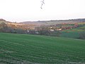
English: Dunkerton is a village in the civil parish of Dunkerton and Tunley south west of Bath, in the Bath and North East Somerset unitary authority, Somerset, England. The parish had a population of 502 in 2011.
localité britannique du comté anglais de Somerset  | |||||
| Téléverser des médias | |||||
| Nature de l’élément | |||||
|---|---|---|---|---|---|
| Lieu | Dunkerton and Tunley, Bath and North East Somerset, Somerset, Angleterre du Sud-Ouest, Angleterre | ||||
 | |||||
Sous-catégories
Cette catégorie comprend seulement la sous-catégorie ci-dessous.
A
Média dans la catégorie « Dunkerton, Somerset »
Cette catégorie comprend 11 fichiers, dont les 11 ci-dessous.
-
 Boundary Post, Dunkerton - geograph.org.uk - 1562772.jpg 640 × 480 ; 161 kio
-
 Boundary Post, Dunkerton - geograph.org.uk - 1562780.jpg 640 × 480 ; 174 kio
-
 Dunkerton aqueduct (disused) - geograph.org.uk - 773699.jpg 640 × 438 ; 101 kio
-
 Dunkerton viaduct (geograph 3390133).jpg 640 × 480 ; 129 kio
-
 Footpath from Withyditch to Dunkerton - geograph.org.uk - 365276.jpg 640 × 480 ; 59 kio
-
 Horse pasture near Dunkerton - geograph.org.uk - 776434.jpg 640 × 492 ; 72 kio
-
 Modern habitation on the Fosse Way - geograph.org.uk - 798189.jpg 640 × 486 ; 63 kio
-
 The Fosse Way - geograph.org.uk - 803722.jpg 640 × 503 ; 159 kio
-
 The turning to Dunkerton - geograph.org.uk - 776437.jpg 640 × 457 ; 67 kio
-
 Used car for sale - geograph.org.uk - 776447.jpg 640 × 448 ; 86 kio
-
 View from Tunley Road - geograph.org.uk - 748750.jpg 640 × 442 ; 147 kio


_-_geograph.org.uk_-_773699.jpg)
.jpg)


