Category:Dunnington, North Yorkshire
Vai alla navigazione
Vai alla ricerca
village and civil parish in York, North Yorkshire, United Kingdom  | |||||
| Carica un file multimediale | |||||
| Istanza di | |||||
|---|---|---|---|---|---|
| Luogo | City of York, North Yorkshire, Yorkshire e Humber, Inghilterra | ||||
 | |||||
Sottocategorie
Questa categoria contiene le 14 sottocategorie indicate di seguito, su un totale di 14.
B
- Bridleways in Dunnington CP (6 F)
- Buildings in Dunnington (12 F)
F
- Fields in Dunnington CP (43 F)
G
P
- Pubs in Dunnington (6 F)
R
- Rabbit Warren Wood (10 F)
S
- Shops in Dunnington (4 F)
Y
- York Maze (19 F)
File nella categoria "Dunnington, North Yorkshire"
Questa categoria contiene 40 file, indicati di seguito, su un totale di 40.
-
 Allotments near Dunnington - geograph.org.uk - 2102802.jpg 800 × 600; 164 KB
-
 Bales along Common Lane - geograph.org.uk - 425327.jpg 640 × 478; 193 KB
-
 Blue container - geograph.org.uk - 4104988.jpg 1 600 × 1 200; 697 KB
-
 Common Drain - geograph.org.uk - 1377618.jpg 640 × 480; 130 KB
-
 Common Drain from Elvington Lane - geograph.org.uk - 425258.jpg 478 × 640; 128 KB
-
 Derwent Valley Industrial estate - geograph.org.uk - 1347700.jpg 640 × 480; 65 KB
-
 Ditch along Elvington Lane - geograph.org.uk - 2202056.jpg 640 × 480; 198 KB
-
 Drain near Grimston Grange - geograph.org.uk - 6439922.jpg 1 024 × 683; 442 KB
-
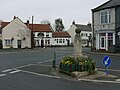 Village cross, Dunnington, North Yorks - geograph.org.uk - 403871.jpg 640 × 480; 122 KB
-
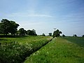
 Dunnington in spring - geograph.org.uk - 399231.jpg 640 × 478; 150 KB
-
 Field Boundary - geograph.org.uk - 425296.jpg 478 × 640; 234 KB
-
 Footpath to Grimston Grange - geograph.org.uk - 6439923.jpg 1 024 × 683; 680 KB
-
 Former rail line near Rabbit Warren (wood) - geograph.org.uk - 4076476.jpg 1 600 × 1 064; 597 KB
-
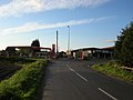
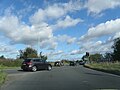
 Four Lanes End Junction A1079 - geograph.org.uk - 3166323.jpg 1 857 × 1 170; 473 KB
-
 From Elvington Lane - geograph.org.uk - 1377707.jpg 640 × 480; 146 KB
-
 From the velodrome - geograph.org.uk - 6439926.jpg 1 024 × 683; 428 KB
-
 Gypsywood Barn ^ Gypsywood Cottage Sign - geograph.org.uk - 4077917.jpg 1 600 × 1 064; 577 KB
-
 Honeysuckle at Scoreby Lodge - geograph.org.uk - 2451889.jpg 3 264 × 2 448; 2,4 MB
-
 Horse and cart - geograph.org.uk - 6123808.jpg 1 024 × 529; 428 KB
-
 Its Now or Never - geograph.org.uk - 1347710.jpg 640 × 480; 82 KB
-
 Junction with Hull Road - geograph.org.uk - 425324.jpg 640 × 478; 124 KB
-
 Minor Road - geograph.org.uk - 107784.jpg 640 × 480; 93 KB
-
 Minor Road - geograph.org.uk - 107786.jpg 640 × 480; 92 KB
-
 Old Milestone (geograph 6097996).jpg 466 × 640; 207 KB
-
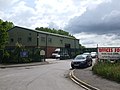
 Philip Welch car sale on the A1079, Dunnington - geograph.org.uk - 4084256.jpg 1 600 × 1 064; 835 KB
-
 Pylons off Elvington Lane - geograph.org.uk - 1294973.jpg 640 × 478; 159 KB
-
 Redundant gate beside Kexby Stray - geograph.org.uk - 4026759.jpg 1 600 × 1 200; 835 KB
-
 Scoreby Lodge - geograph.org.uk - 4026755.jpg 1 600 × 1 200; 803 KB
-
 South side of Dunnington - geograph.org.uk - 284933.jpg 479 × 640; 68 KB
-
 Sports Village Velodrome - geograph.org.uk - 6439929.jpg 1 024 × 683; 361 KB
-
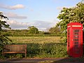 Telephone on Common End - geograph.org.uk - 425319.jpg 640 × 478; 165 KB
-
 The Olympic rings at Dunnington - geograph.org.uk - 3071866.jpg 800 × 600; 168 KB
-
 The Olympic rings at Dunnington - geograph.org.uk - 3071871.jpg 800 × 600; 146 KB
-
 Towards Grimston Grange - geograph.org.uk - 6439920.jpg 1 024 × 683; 490 KB
-
 Track across Now or Never - geograph.org.uk - 1551236.jpg 640 × 480; 61 KB
-
 Traffic at A64 Junction.jpg 2 560 × 1 920; 2,09 MB
-
 Trees in the autumn sun - geograph.org.uk - 284966.jpg 640 × 479; 48 KB
-
 University Velodrome - geograph.org.uk - 6439927.jpg 1 024 × 683; 384 KB
-
 Water tower - geograph.org.uk - 609037.jpg 640 × 478; 136 KB
-
 York Sport Velodrome - geograph.org.uk - 6439931.jpg 1 024 × 683; 342 KB


_-_geograph.org.uk_-_4076476.jpg)


.jpg)


