Category:Duns Tew
Aller à la navigation
Aller à la recherche
localité britannique du comté anglais d'Oxfordshire  | |||||
| Téléverser des médias | |||||
| Nature de l’élément | |||||
|---|---|---|---|---|---|
| Lieu | Cherwell, Oxfordshire, Angleterre du Sud-Est, Angleterre | ||||
| Population |
| ||||
| Superficie |
| ||||
| Réputé identique à | Duns Tew (page en doublon, paroisse civile) | ||||
| site officiel | |||||
 | |||||
English: Duns Tew is a village and civil parish about south of Banbury. With nearby Great Tew and Little Tew, Duns Tew is one of the three villages known locally as the "The Tews".
Sous-catégories
Cette catégorie comprend 2 sous-catégories, dont les 2 ci-dessous.
D
- Ridge House (2 F)
Média dans la catégorie « Duns Tew »
Cette catégorie comprend 36 fichiers, dont les 36 ci-dessous.
-
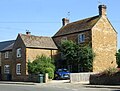 A house on Main Street - geograph.org.uk - 5865865.jpg 2 700 × 2 054 ; 547 kio
-
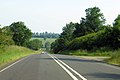
 A4260 northwest of Dane Hill Farm - geograph.org.uk - 3400042.jpg 3 648 × 2 736 ; 1,38 Mio
-
 A4260 south of Dedington - geograph.org.uk - 2689365.jpg 3 648 × 2 527 ; 1,26 Mio
-
 Concrete mixer near Duns Tew - geograph.org.uk - 1879429.jpg 3 648 × 2 736 ; 2,21 Mio
-
 White Horse Inn Public House - geograph.org.uk - 386104.jpg 640 × 425 ; 208 kio
-
 Duns Tew - general view - geograph.org.uk - 386111.jpg 640 × 425 ; 186 kio
-
 Duns Tew village hall, 6th April 2008 - geograph.org.uk - 949511.jpg 640 × 480 ; 102 kio
-
 Duns Tew village1.jpg 640 × 480 ; 129 kio
-
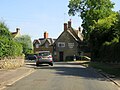
 Duns Tew-The White Horse Inn - geograph.org.uk - 6194140.jpg 1 600 × 1 200 ; 625 kio
-
 Farm building and field - geograph.org.uk - 385645.jpg 640 × 425 ; 178 kio
-
 Houses at Dane Hill along Oxford Road - geograph.org.uk - 4523498.jpg 1 024 × 710 ; 165 kio
-
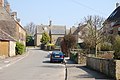
 Main Street in Duns Tew - geograph.org.uk - 5865853.jpg 2 700 × 2 025 ; 417 kio
-
 Main Street in Duns Tew - geograph.org.uk - 5865856.jpg 2 700 × 1 945 ; 460 kio
-
 Main Street in Duns Tew - geograph.org.uk - 5865861.jpg 2 700 × 2 025 ; 448 kio
-
 Mixed farming - geograph.org.uk - 1879422.jpg 3 648 × 2 736 ; 2,05 Mio
-
 Oxford Road on Dane Hill - geograph.org.uk - 4057855.jpg 1 500 × 999 ; 133 kio
-
 Oxford Road to Deddington - geograph.org.uk - 4057856.jpg 1 500 × 999 ; 114 kio
-
 Re Cycling point for Duns Tew - geograph.org.uk - 1879409.jpg 3 648 × 2 736 ; 2,16 Mio
-
 Road junction near Ilbury Bridge - geograph.org.uk - 5061703.jpg 1 024 × 680 ; 306 kio
-
 Road junction west of Duns Tew - geograph.org.uk - 1748211.jpg 640 × 480 ; 71 kio
-
 Road to Nether Worton - geograph.org.uk - 5061706.jpg 1 024 × 680 ; 269 kio
-
 Rural road to Duns Tew - geograph.org.uk - 5865852.jpg 2 700 × 2 025 ; 543 kio
-
 St Mary Magdalene Church - geograph.org.uk - 6817870.jpg 1 024 × 719 ; 193 kio
-
 Village street scene - geograph.org.uk - 1879405.jpg 3 648 × 2 736 ; 2,26 Mio
-
 White Horse Inn, Duns Tew on 6th April 2008 - geograph.org.uk - 949498.jpg 640 × 480 ; 75 kio
-
 Across the fields to Hill Farm - geograph.org.uk - 463894.jpg 640 × 480 ; 107 kio
-
 Bridleway bridge - geograph.org.uk - 452222.jpg 640 × 480 ; 157 kio
-
 Bridleway passes through hedge - geograph.org.uk - 452262.jpg 640 × 467 ; 116 kio
-
 Bridleways split - geograph.org.uk - 452255.jpg 640 × 493 ; 112 kio
-
 Feeding time near Duns Tew - geograph.org.uk - 386119.jpg 640 × 425 ; 184 kio
-
 Field opposite "Greenacres" - geograph.org.uk - 385640.jpg 640 × 425 ; 165 kio
-
 Field south of Duns Tew - geograph.org.uk - 385630.jpg 640 × 425 ; 179 kio
-
 Hill Farm, from Plumdon Lane - geograph.org.uk - 452126.jpg 640 × 383 ; 78 kio
-
 Lower Farm near Duns Tew - geograph.org.uk - 385620.jpg 640 × 425 ; 192 kio
-
 Seagrave's Covert - geograph.org.uk - 452213.jpg 640 × 480 ; 101 kio
-
 Very muddy bridge - geograph.org.uk - 452225.jpg 480 × 640 ; 120 kio


