Category:Dunstable
Zur Navigation springen
Zur Suche springen
Stadt in England  | |||||
| Medium hochladen | |||||
| Ist ein(e) | |||||
|---|---|---|---|---|---|
| Ort | Central Bedfordshire, Bedfordshire, East of England, England | ||||
| Einwohnerzahl |
| ||||
| Verschieden von | |||||
| Eventuell gleichwertig | Dunstable (Wikimedia-Dublette, Civil Parish in England) | ||||
| offizielle Website | |||||
 | |||||
English: Dunstable is a market town in Bedfordshire, England. It lies on the eastward tail spurs of the Chiltern Hills, 30 miles north of London. These geographical features form several steep chalk escarpments most noticeable when approaching Dunstable from the north.
Unterkategorien
Es werden 13 von insgesamt 13 Unterkategorien in dieser Kategorie angezeigt:
In Klammern die Anzahl der enthaltenen Kategorien (K), Seiten (S), Dateien (D)
C
- Chalk Hill (Dunstable) (2 D)
- Cottage Bottom Fields (2 D)
D
- Dunstable Priory (111 D)
G
- Grove House, Dunstable (4 D)
L
- Lancot Meadow (7 D)
M
- Marshe Almshouses (2 D)
P
- Postcards of Dunstable (2 D)
S
- Saracen's Head, Dunstable (2 D)
Medien in der Kategorie „Dunstable“
Folgende 200 Dateien sind in dieser Kategorie, von 269 insgesamt.
(vorherige Seite) (nächste Seite)-

-
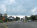
 4pm in High Street South - geograph.org.uk - 2659867.jpg 640 × 480; 67 KB
-
 A natural bowl - geograph.org.uk - 757913.jpg 640 × 480; 100 KB
-
-
 A5183 High Street South, Dunstable - geograph.org.uk - 5646582.jpg 640 × 428; 96 KB
-
 A5183 London Road, Dunstable - geograph.org.uk - 5646575.jpg 640 × 428; 100 KB
-
 A5183 London Road, Dunstable - geograph.org.uk - 5646577.jpg 640 × 428; 80 KB
-
 A5183-B5120 junction, Dunstable - geograph.org.uk - 5646609.jpg 640 × 428; 109 KB
-
 Access to Chalgrave golf club - geograph.org.uk - 411290.jpg 640 × 480; 57 KB
-
 Allen Close, Dunstable - geograph.org.uk - 5551522.jpg 3.264 × 2.448; 3,66 MB
-
 Allen Close, Dunstable - geograph.org.uk - 5551526.jpg 3.264 × 2.448; 4 MB
-
 Alley by Weatherfield School - geograph.org.uk - 2468420.jpg 2.592 × 1.944; 3,04 MB
-
 Asda car park on Court Drive, Dunstable - geograph.org.uk - 5060280.jpg 2.222 × 1.612; 1,03 MB
-
 Asda car park on Court Drive, Dunstable - geograph.org.uk - 5060281.jpg 2.278 × 1.694; 1,21 MB
-
 Ashton Middle School, Dunstable - geograph.org.uk - 2721027.jpg 1.470 × 1.960; 1,59 MB
-
 Ashton Square- Dunstable Eye Centre - geograph.org.uk - 2663931.jpg 640 × 480; 92 KB
-
 Badgers Gate, Dunstable - geograph.org.uk - 2501462.jpg 640 × 480; 70 KB
-
 Bedfordshire coat of arms at Dunstable Library.JPG 4.288 × 3.216; 5,16 MB
-
 Blow's Downs (May 2017).jpg 4.640 × 2.610; 6,56 MB
-
 Bus shelter in High Street South - geograph.org.uk - 2659840.jpg 640 × 480; 65 KB
-
 Bus stop in Dunstable town centre - geograph.org.uk - 2664363.jpg 640 × 480; 81 KB
-
 Bus stop in High Street North - geograph.org.uk - 2663940.jpg 480 × 640; 93 KB
-
 Bus stop on High Street North, Dunstable - geograph.org.uk - 6524688.jpg 1.884 × 1.224; 1,49 MB
-
 Byway from the Dunstable Road - geograph.org.uk - 3299994.jpg 1.600 × 1.067; 345 KB
-
 Byway track into Dunstable - geograph.org.uk - 3300003.jpg 1.200 × 1.600; 415 KB
-
 CAFEA UK in Dunstable, UK.png 339 × 200; 145 KB
-
 Canesworde Road - geograph.org.uk - 1074586.jpg 640 × 480; 77 KB
-
 Car park opposite Dunstable Priory - geograph.org.uk - 2659937.jpg 640 × 480; 73 KB
-
 Central Bedfordshire College, Dunstable.jpg 3.264 × 2.448; 1,68 MB
-
 Charity shop in Ashton Square - geograph.org.uk - 2663904.jpg 640 × 480; 92 KB
-
 Chiltern Way - geograph.org.uk - 1567184.jpg 640 × 480; 89 KB
-
 Christmas tree on High Street, Dunstable - geograph.org.uk - 6354502.jpg 1.260 × 1.906; 1,48 MB
-
 Christmas tree on High Street, Dunstable - geograph.org.uk - 6354505.jpg 1.834 × 1.134; 1,26 MB
-
 Church Gardens - geograph.org.uk - 3756150.jpg 800 × 600; 135 KB
-
 Church Street, Dunstable - geograph.org.uk - 4915418.jpg 1.996 × 1.464; 848 KB
-
 Church Street, Dunstable - geograph.org.uk - 5551533.jpg 3.264 × 2.448; 2,77 MB
-
 Climbing Blow's Downs - geograph.org.uk - 3088377.jpg 3.000 × 2.000; 2,41 MB
-
 Clock Tower - geograph.org.uk - 3755754.jpg 600 × 800; 86 KB
-
 Creasey Park, home of Dunstable Town FC - geograph.org.uk - 1721688.jpg 800 × 600; 108 KB
-

-
 Downs Road, Dunstable - geograph.org.uk - 5551529.jpg 3.264 × 2.448; 2,8 MB
-
 Dunstable , Aldi - geograph.org.uk - 5733109.jpg 6.000 × 4.000; 7,31 MB
-
 Dunstable , Alleyway - geograph.org.uk - 5733107.jpg 5.618 × 3.745; 5,71 MB
-
 Dunstable , Ashton Middle School - geograph.org.uk - 5733100.jpg 6.000 × 4.000; 6,66 MB
-
 Dunstable , Ashton Middle School - geograph.org.uk - 5733101.jpg 5.565 × 3.710; 6,71 MB
-
 Dunstable , Avenue - geograph.org.uk - 5733096.jpg 5.746 × 3.831; 7,5 MB
-
 Dunstable , Beefeater - geograph.org.uk - 5733124.jpg 5.590 × 3.727; 5,72 MB
-
 Dunstable , Boscombe Road A5505 - geograph.org.uk - 5733115.jpg 6.000 × 4.000; 7,29 MB
-
 Dunstable , Bramley Court - geograph.org.uk - 5733117.jpg 6.000 × 4.000; 5,66 MB
-
 Dunstable , B^M Home Store - geograph.org.uk - 5733118.jpg 6.000 × 4.000; 5,47 MB
-
 Dunstable , Central Bedfordshire College - geograph.org.uk - 5733119.jpg 5.699 × 3.799; 6,55 MB
-
 Dunstable , Church Street A505 - geograph.org.uk - 5733108.jpg 6.000 × 4.000; 5,47 MB
-
 Dunstable , Esso Petrol Station - geograph.org.uk - 5733097.jpg 5.706 × 3.804; 6,05 MB
-
 Dunstable , Evelyn Road - geograph.org.uk - 5733123.jpg 5.982 × 3.988; 6,77 MB
-
 Dunstable , Ewe ^ Lamb - geograph.org.uk - 5733121.jpg 6.000 × 4.000; 7,13 MB
-
 Dunstable , Grove Corner Young People's Centre - geograph.org.uk - 5733102.jpg 5.571 × 3.714; 6,66 MB
-
 Dunstable , Grove House Gardens - geograph.org.uk - 5733103.jpg 5.802 × 3.868; 7,03 MB
-
 Dunstable , High Street North, A505 - geograph.org.uk - 5733091.jpg 6.000 × 4.000; 5,76 MB
-
 Dunstable , High Street North, A505 - geograph.org.uk - 5733095.jpg 6.000 × 4.000; 7,14 MB
-
 Dunstable , High Street North, A505 - geograph.org.uk - 5733106.jpg 6.000 × 4.000; 5,61 MB
-
 Dunstable , High Street Shops - geograph.org.uk - 5733094.jpg 5.787 × 3.858; 5,96 MB
-
 Dunstable , Kingsbury Court - geograph.org.uk - 5733110.jpg 5.660 × 3.774; 7,25 MB
-
 Dunstable , Linden Road - geograph.org.uk - 5733122.jpg 5.840 × 3.893; 6,42 MB
-
 Dunstable , Luton Dunstable Busway - geograph.org.uk - 5733113.jpg 6.000 × 4.000; 5,77 MB
-
 Dunstable , Luton Road A505 - geograph.org.uk - 5733116.jpg 6.000 × 4.000; 5,92 MB
-
 Dunstable , McDonald's - geograph.org.uk - 5733114.jpg 6.000 × 4.000; 7,66 MB
-
 Dunstable , Park Street - geograph.org.uk - 5733098.jpg 6.000 × 4.000; 7,33 MB
-
 Dunstable , Pavement - geograph.org.uk - 5733104.jpg 6.000 × 4.000; 6,07 MB
-
 Dunstable , Poynters Road - geograph.org.uk - 5733125.jpg 6.000 × 4.000; 7,41 MB
-
 Dunstable , Prior View - geograph.org.uk - 5733112.jpg 5.625 × 3.750; 6,85 MB
-
 Dunstable , Queensway - geograph.org.uk - 5733105.jpg 5.545 × 3.697; 6,08 MB
-
 Dunstable , Ridgeway Avenue - geograph.org.uk - 5733120.jpg 6.000 × 4.000; 7,44 MB
-
 Dunstable , Safestore Self Storage - geograph.org.uk - 5733090.jpg 6.000 × 4.000; 5,7 MB
-
 Dunstable , The Wheatsheaf - geograph.org.uk - 5733099.jpg 5.970 × 3.980; 7,36 MB
-
 Dunstable , Watling Street A505 - geograph.org.uk - 5733088.jpg 5.948 × 3.965; 5,49 MB
-
 Dunstable Downs - geograph.org.uk - 5065621.jpg 639 × 426; 166 KB
-
 Dunstable Downs from Dale Road - geograph.org.uk - 4915391.jpg 1.970 × 1.428; 804 KB
-
 Dunstable Fire Station - geograph.org.uk - 5281861.jpg 2.304 × 1.728; 1.003 KB
-
 Dunstable fire station - geograph.org.uk - 584166.jpg 640 × 427; 202 KB
-
 Dunstable hatters members 2014-05-08 19-18.jpg 960 × 666; 185 KB
-
 Dunstable in Bloom - geograph.org.uk - 6524690.jpg 1.870 × 1.200; 994 KB
-
 Dunstable Laminates on Boscombe Road - geograph.org.uk - 5059524.jpg 2.214 × 1.600; 968 KB
-
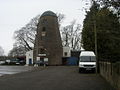 Dunstable Mill-geograph.org-2157006.jpg 640 × 480; 71 KB
-
 Dunstable normanking.jpg 600 × 403; 57 KB
-
 Dunstable North station site geograph-3426156-by-Ben-Brooksbank.jpg 2.395 × 1.572; 5,3 MB
-

-
 Dunstable War Memorial - geograph.org.uk - 2595045.jpg 640 × 480; 125 KB
-
 Dunstable, Aldbanks - geograph.org.uk - 145514.jpg 640 × 480; 92 KB
-
 Dunstable, Blow's Down or Downs - geograph.org.uk - 145589.jpg 640 × 480; 67 KB
-
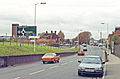
 Dunstable, Great Northern Road - geograph.org.uk - 147858.jpg 640 × 480; 82 KB
-
 Dunstable, Maiden Bower - geograph.org.uk - 145543.jpg 640 × 480; 117 KB
-
 Dunstable, Matthew Street - geograph.org.uk - 147848.jpg 640 × 480; 98 KB
-
 Dunstable, St. Peter's Priory Church - geograph.org.uk - 4690278.jpg 4.608 × 3.456; 6,33 MB
-

-
 Dunstable, The end of the line - geograph.org.uk - 145468.jpg 640 × 480; 155 KB
-
 Dunstable, The Halfway - geograph.org.uk - 145443.jpg 640 × 480; 85 KB
-
 Dunstable, The Icknield Way Path - geograph.org.uk - 145503.jpg 640 × 480; 100 KB
-

-
 Dunstablemap 1944.jpg 2.368 × 1.648; 457 KB
-
 Edward Street, Dunstable - geograph.org.uk - 5585056.jpg 1.280 × 851; 387 KB
-
 Eleanor Cross plaque - geograph.org.uk - 4156699.jpg 1.024 × 685; 232 KB
-
 Empty offices on High Street North, Dunstable - geograph.org.uk - 6524689.jpg 1.876 × 1.212; 1,37 MB
-
 Endowed School, Dunstable, from The Dunstaplelogia (1859).jpg 400 × 490; 87 KB
-
 Entrance to Grove House Gardens, Dunstable - geograph.org.uk - 2882728.jpg 1.600 × 1.200; 576 KB
-

-
 Estate agents in High Street North (i) - geograph.org.uk - 2664324.jpg 480 × 640; 100 KB
-

-
 Evelyn Road, Dunstable - geograph.org.uk - 695176.jpg 640 × 418; 55 KB
-
 Ewe ^ Lamb - geograph.org.uk - 4189881.jpg 640 × 480; 58 KB
-
 Fence around St Christophers Academy - geograph.org.uk - 6193018.jpg 1.024 × 768; 186 KB
-
 Flats on High Street, Dunstable - geograph.org.uk - 5279826.jpg 2.304 × 1.728; 866 KB
-
 Flats, Dunstable - geograph.org.uk - 5646616.jpg 640 × 428; 96 KB
-
 Footpath off Buttercup Lane - geograph.org.uk - 204336.jpg 523 × 640; 163 KB
-
 Four sculptures - Grove House Gardens - geograph.org.uk - 5585756.jpg 1.280 × 851; 373 KB
-

-
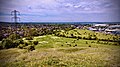
 GOC Dunstable Downs 117 Dunstable Downs (24543261089).jpg 4.288 × 3.216; 3,47 MB
-
 Green by Langdale Road, Dunstable - geograph.org.uk - 4917428.jpg 2.048 × 1.536; 1,56 MB
-
 Grove House Gardens - geograph.org.uk - 5584867.jpg 1.280 × 851; 694 KB
-
 Grove Park, Dunstable - geograph.org.uk - 5585726.jpg 1.280 × 851; 551 KB
-
 Grove Theatre.jpg 3.072 × 2.304; 1,16 MB
-
 GTheatre.JPG 3.072 × 2.304; 2,21 MB
-
 High Street Dunstable - geograph.org.uk - 6524692.jpg 1.884 × 1.224; 1,32 MB
-
 High Street North at the junction of Regent Street - geograph.org.uk - 2882727.jpg 1.600 × 1.200; 637 KB
-
 High Street North, Dunstable - geograph.org.uk - 2720013.jpg 2.000 × 1.500; 1,21 MB
-
 High Street North, Dunstable - geograph.org.uk - 2882713.jpg 1.600 × 1.200; 581 KB
-
 High Street North, Dunstable - geograph.org.uk - 2882716.jpg 1.594 × 1.170; 581 KB
-
 High Street North- Cube Bet - geograph.org.uk - 2664362.jpg 640 × 480; 77 KB
-
 High Street North- Santander - geograph.org.uk - 2664358.jpg 480 × 640; 78 KB
-
 High Street South, Dunstable - geograph.org.uk - 2882722.jpg 1.600 × 1.200; 561 KB
-
 High Street South, Dunstable - geograph.org.uk - 2882736.jpg 1.600 × 1.200; 507 KB
-
 High Street South- Alexander ^ Co - geograph.org.uk - 2659880.jpg 473 × 640; 70 KB
-
 High Street South- Noah's Ark - geograph.org.uk - 2659850.jpg 480 × 640; 80 KB
-
 High Street South- Norton House - geograph.org.uk - 2659856.jpg 480 × 640; 69 KB
-

-

-

-

-
 High Street, Dunstable, Bedfordshire (O57548).jpg 768 × 449; 75 KB
-
 High Street, Dunstable, Bedfordshire (O57549).jpg 553 × 768; 93 KB
-
 Holiday Inn Express, Dunstable - geograph.org.uk - 6226131.jpg 1.920 × 1.280; 1,04 MB
-
 Houghton Regis - Parish Map.jpg 1.109 × 876; 376 KB
-
 House in Princes Street, Dunstable - geograph.org.uk - 2258968.jpg 853 × 1.280; 330 KB
-
 Houses on Brewers Hill Road, Dunstable - geograph.org.uk - 2468417.jpg 2.592 × 1.944; 3,08 MB
-
 Houses on Jeans Way, Dunstable - geograph.org.uk - 4915397.jpg 2.048 × 1.536; 1,5 MB
-
 Houses on London Road, Dunstable - geograph.org.uk - 6161051.jpg 1.854 × 1.174; 1,51 MB
-
 Houses on Lowther Road, Dunstable - geograph.org.uk - 4915896.jpg 2.048 × 1.536; 1,49 MB
-
 Houses on Lowther Road, Dunstable - geograph.org.uk - 4917430.jpg 1.930 × 1.362; 1,26 MB
-
 Houses on the A5, Dunstable - geograph.org.uk - 5067855.jpg 2.254 × 1.660; 1,05 MB
-
 Housing estate on the edge of Dunstable - geograph.org.uk - 5551528.jpg 3.264 × 2.448; 3,43 MB
-
 Inscription on the Methodist Church - geograph.org.uk - 2659983.jpg 640 × 480; 69 KB
-

-
 Katherine Drive, Dunstable - geograph.org.uk - 5054964.jpg 2.304 × 1.728; 814 KB
-
 Kirby Road - geograph.org.uk - 2468423.jpg 2.592 × 1.944; 2,73 MB
-

-
 Liscombe Road, Dunstable - geograph.org.uk - 3088383.jpg 3.000 × 2.000; 2,75 MB
-
 Liscombe Road, Dunstable - geograph.org.uk - 4915379.jpg 2.046 × 1.532; 911 KB
-
 Lombardo's shop in Dunstable - geograph.org.uk - 4022609.jpg 640 × 360; 69 KB
-

-

-

-

-

-

-

-

-
 Looking NW along Canesworde Road - geograph.org.uk - 1074588.jpg 640 × 480; 50 KB
-

-
 Lowther Road, Dunstable - geograph.org.uk - 4917429.jpg 1.974 × 1.432; 731 KB
-
 Luton and Dunstable Hospital - geograph.org.uk - 1838969.jpg 640 × 480; 259 KB
-
 Luton Road (A505) - geograph.org.uk - 2156963.jpg 640 × 480; 70 KB
-
 Luton Road - geograph.org.uk - 2156913.jpg 640 × 480; 68 KB
-
 Luton Road Methodist Church - geograph.org.uk - 2156943.jpg 640 × 480; 59 KB
-
 Luton Road, Dunstable - geograph.org.uk - 4916791.jpg 1.990 × 1.454; 753 KB
-
 LutonDunstableBUA.png 1.618 × 850; 92 KB
-
 MillValeMiddleSchool.jpg 640 × 418; 62 KB
-
 Monumental inscription on the Chew almshouses, commemorating their endowment in 1723.jpg 5.927 × 8.272; 3,98 MB
-
 Mr Pizza on High Street North, Dunstable - geograph.org.uk - 6163356.jpg 1.920 × 1.280; 1,02 MB
-
 National Tyres, Dunstable - geograph.org.uk - 2882717.jpg 1.600 × 1.200; 488 KB
-
 New estate on High Street North, Dunstable - geograph.org.uk - 6524684.jpg 1.876 × 1.210; 1,64 MB
-
 New offices on Church Street, Dunstable - geograph.org.uk - 4915409.jpg 1.978 × 1.438; 857 KB
-
 Northern Dunstable from the air (geograph 4547146).jpg 3.264 × 2.448; 3,86 MB
-
 Ordnance Survey One-Inch Sheet 95 Luton, Published 1923.jpg 11.911 × 8.920; 10,75 MB
-
 OS Street View TL02SW.jpg 5.000 × 5.000; 5,44 MB
-
 Part of Dunstable centre - geograph.org.uk - 4022613.jpg 640 × 360; 51 KB
-
 Part of Dunstable Library - geograph.org.uk - 4022599.jpg 640 × 360; 59 KB
-
 Part of the High Street in Dunstable - geograph.org.uk - 4022603.jpg 640 × 360; 63 KB
-
 Pascombe Road at the junction of Drovers Way - geograph.org.uk - 5281860.jpg 2.304 × 1.728; 835 KB
-
 Pavement in West Street - geograph.org.uk - 2664355.jpg 480 × 640; 79 KB
-
 Pedestrian lights on London Road, Dunstable - geograph.org.uk - 2882711.jpg 1.600 × 1.200; 660 KB
-

-
 Play area - geograph.org.uk - 4189892.jpg 640 × 465; 70 KB
-
 Postbox by HSBC, West Street - geograph.org.uk - 2663981.jpg 640 × 480; 63 KB
-
 Poynter's Road Roundabout - geograph.org.uk - 5551556.jpg 2.887 × 2.166; 1,75 MB
-
 Poynters Rd - geograph.org.uk - 483672.jpg 640 × 480; 86 KB
-
 Poynters Road Roundabout - geograph.org.uk - 5551570.jpg 3.264 × 2.448; 2 MB
-
 Poynters Road, Dunstable - geograph.org.uk - 6194308.jpg 1.024 × 768; 177 KB
-
 Priory Heights, Dunstable - geograph.org.uk - 4915415.jpg 2.030 × 1.512; 912 KB
-
 Priory Heights, Dunstable - geograph.org.uk - 6199956.jpg 1.024 × 768; 152 KB
-
 Priory View Apartments, Dunstable - geograph.org.uk - 6199946.jpg 1.024 × 785; 148 KB
-
 Pub in High Street North - geograph.org.uk - 2664326.jpg 480 × 640; 84 KB


.jpg)


.jpg)


_-_geograph.org.uk_-_2664324.jpg)
_-_geograph.org.uk_-_2664349.jpg)


.jpg)


.jpg)
.jpg)


_-_geograph.org.uk_-_2156963.jpg)


.jpg)


