Category:Duntisbourne Abbots
Aller à la navigation
Aller à la recherche
village britannique  | |||||
| Téléverser des médias | |||||
| Nature de l’élément | |||||
|---|---|---|---|---|---|
| Lieu | Cotswold, Gloucestershire, Angleterre du Sud-Ouest, Angleterre | ||||
 | |||||
English: Duntisbourne Abbots is a village and civil parish located in the English county of Gloucestershire.
Sous-catégories
Cette catégorie comprend 4 sous-catégories, dont les 4 ci-dessous.
D
- Duntisbourne Leer (23 F)
S
Média dans la catégorie « Duntisbourne Abbots »
Cette catégorie comprend 114 fichiers, dont les 114 ci-dessous.
-
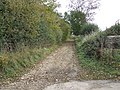
 A restricted byway above the Frome valley - geograph.org.uk - 2715117.jpg 1 024 × 680 ; 264 kio
-
 A417 - Duntisbourne Leer junction bridge - geograph.org.uk - 2091288.jpg 640 × 480 ; 63 kio
-

-
 A417 at the junction for Duntisbourne Leer - geograph.org.uk - 2091285.jpg 640 × 480 ; 62 kio
-
 A417 exit for Duntisbourne Abbots and Winstone - geograph.org.uk - 3676092.jpg 1 600 × 971 ; 248 kio
-
 A417 exit for Duntisbourne Leer - geograph.org.uk - 3676078.jpg 1 600 × 952 ; 215 kio
-
 A417 exit for Winstone - geograph.org.uk - 3696784.jpg 3 908 × 1 960 ; 1,44 Mio
-
 A417 just south of Duntisbourne Junction - geograph.org.uk - 5526496.jpg 640 × 433 ; 54 kio
-
 A417 near Duntisbourne Abbots - geograph.org.uk - 4241116.jpg 640 × 481 ; 43 kio
-
 A417, at Duntisbourne Leer junction - geograph.org.uk - 6264873.jpg 640 × 471 ; 50 kio
-
 A417, Duntisbourne Leer junction - geograph.org.uk - 6264872.jpg 640 × 480 ; 43 kio
-
 Allotments in Duntisbourne Abbots - geograph.org.uk - 2714211.jpg 1 024 × 680 ; 301 kio
-
 Approaching the entrance to Duntisbourne House - geograph.org.uk - 3780838.jpg 800 × 450 ; 273 kio
-
 Arable land near Duntisbourne Abbots - geograph.org.uk - 3771514.jpg 800 × 450 ; 224 kio
-
 Barn in a Cotswold landscape - geograph.org.uk - 4263644.jpg 1 024 × 680 ; 308 kio
-
 Bridges under the A417 - geograph.org.uk - 4267894.jpg 1 024 × 680 ; 265 kio
-
 Bull's Bank - geograph.org.uk - 2712210.jpg 1 024 × 680 ; 163 kio
-
 Bus Stop for Duntisbourne - geograph.org.uk - 5526475.jpg 640 × 453 ; 55 kio
-
 Bus stop on A417 near Cotswold Farm - geograph.org.uk - 3274878.jpg 1 024 × 768 ; 473 kio
-
 Byway by Long Furlong Barn - geograph.org.uk - 2710588.jpg 1 024 × 680 ; 292 kio
-
 Byway to Duntisbourne Abbots - geograph.org.uk - 3771501.jpg 800 × 450 ; 223 kio
-
 Byway to Parson's Hill and Miserden - geograph.org.uk - 3771505.jpg 800 × 450 ; 221 kio
-
 Chapel in Duntisbourne Abbots - geograph.org.uk - 2713957.jpg 1 024 × 680 ; 274 kio
-
 Clouds over the A417 - geograph.org.uk - 1635815.jpg 640 × 480 ; 65 kio
-
 Cotswold Farm - geograph.org.uk - 1104986.jpg 428 × 640 ; 114 kio
-
 Country road near Duntisbourne Abbots - geograph.org.uk - 2767784.jpg 640 × 480 ; 34 kio
-
 Course of the old A417 - geograph.org.uk - 4265162.jpg 800 × 531 ; 163 kio
-
 Crabtree Lane - geograph.org.uk - 5088904.jpg 2 592 × 1 944 ; 1,47 Mio
-
 Cricket field - geograph.org.uk - 4266156.jpg 1 024 × 680 ; 271 kio
-
 Deer above the Frome valley - geograph.org.uk - 2712042.jpg 680 × 1 024 ; 229 kio
-
 Ducks at Duntisbourne Leer - geograph.org.uk - 6057738.jpg 2 965 × 4 459 ; 1,83 Mio
-
 Duntisbourne Abbots, An attractive row of cottages - geograph.org.uk - 4927946.jpg 4 098 × 2 603 ; 7,67 Mio
-
 Duntisbourne Abbots, Cottages - geograph.org.uk - 4957511.jpg 3 679 × 2 455 ; 5,16 Mio
-
 Duntisbourne Abbots, Cottages from the path to the church - geograph.org.uk - 4957514.jpg 3 678 × 2 456 ; 4,42 Mio
-
 Duntisbourne Services southbound - geograph.org.uk - 5526462.jpg 640 × 470 ; 56 kio
-
 Duntisbourne valley - geograph.org.uk - 3772364.jpg 800 × 450 ; 243 kio
-

-
-
 Entrance to Cotswold Farm - geograph.org.uk - 4265154.jpg 800 × 531 ; 166 kio
-
 Entrance to Duntisbourne House - geograph.org.uk - 793757.jpg 640 × 426 ; 84 kio
-
 Entrance to Duntisbourne House, near Edgeworth - geograph.org.uk - 926106.jpg 640 × 480 ; 140 kio
-
 Entrance to the Old Rectory, Duntisbourne Abbots - geograph.org.uk - 2714206.jpg 1 024 × 680 ; 245 kio
-
 Farmland at Cotswold Park - geograph.org.uk - 4265151.jpg 800 × 531 ; 127 kio
-
 Footpath north from Longhill Road - geograph.org.uk - 3773622.jpg 800 × 450 ; 239 kio
-
 Ford at Halfpenny Hill - geograph.org.uk - 3683988.jpg 3 872 × 2 592 ; 1,3 Mio
-
 Former sheep pens - geograph.org.uk - 2712224.jpg 1 024 × 680 ; 233 kio
-
 Headland track - geograph.org.uk - 2710593.jpg 1 024 × 680 ; 270 kio
-
 Junction for Duntisbourne Leer - geograph.org.uk - 5526482.jpg 640 × 410 ; 49 kio
-
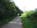
 Lane heading in to Duntisbourne Abbots - geograph.org.uk - 2767728.jpg 640 × 480 ; 70 kio
-
 Lane to Jackbarrow - geograph.org.uk - 3771518.jpg 800 × 450 ; 229 kio
-
 Letter box, near Edgeworth - geograph.org.uk - 793520.jpg 426 × 640 ; 87 kio
-
 Longhill Road - geograph.org.uk - 3773629.jpg 800 × 450 ; 243 kio
-
 Northbound A417 - geograph.org.uk - 3696788.jpg 4 608 × 2 237 ; 2,38 Mio
-
 Nutbeam farm - geograph.org.uk - 1553964.jpg 640 × 480 ; 52 kio
-
 Oak tree below Halfpenny Hill - geograph.org.uk - 4264040.jpg 531 × 800 ; 190 kio
-
 Oil seed rape, near Duntisbourne Abbots - geograph.org.uk - 793514.jpg 640 × 426 ; 96 kio
-
 Old Road - geograph.org.uk - 1515787.jpg 640 × 480 ; 122 kio
-
 Old Road to Duntisbourne Abbotts - geograph.org.uk - 1539152.jpg 640 × 480 ; 139 kio
-

-

-
 Pasture near Duntisbourne House, Edgeworth - geograph.org.uk - 926266.jpg 640 × 480 ; 126 kio
-
 Pavilion near Duntisbourne Abbots - geograph.org.uk - 170205.jpg 640 × 426 ; 105 kio
-
 Poppies near Duntisbourne Abbots - geograph.org.uk - 2437652.jpg 1 024 × 768 ; 212 kio
-
 Poppies near Duntisbourne Abbots - geograph.org.uk - 2437657.jpg 1 024 × 768 ; 192 kio
-
 Postbox, Duntisbourne Abbots - geograph.org.uk - 1002329.jpg 640 × 481 ; 188 kio
-
 Red berries - geograph.org.uk - 4265145.jpg 531 × 800 ; 149 kio
-
 Replanted hedge - geograph.org.uk - 2715120.jpg 1 024 × 680 ; 235 kio
-
 Restricted byway - geograph.org.uk - 2715122.jpg 1 024 × 680 ; 236 kio
-
 Restricted byway at Duntisbourne Abbots - geograph.org.uk - 2715129.jpg 1 024 × 680 ; 224 kio
-
 Restricted byway near Duntiosbourne Abbots - geograph.org.uk - 2715126.jpg 1 024 × 680 ; 242 kio
-
 Restricted byway near Duntisbourne Abbots - geograph.org.uk - 2715430.jpg 1 024 × 680 ; 277 kio
-
 Restricted byway west of Duntisbourne Abbots - geograph.org.uk - 2715432.jpg 1 024 × 680 ; 369 kio
-
 Restricted byway, Duntisbourne Abbots - geograph.org.uk - 2712220.jpg 1 024 × 680 ; 207 kio
-
 Right of way near Cotswold Park - geograph.org.uk - 4263665.jpg 800 × 531 ; 166 kio
-
 Road junction in Duntisbourne Abbots - geograph.org.uk - 2714215.jpg 1 024 × 680 ; 270 kio
-
 Road junction, Duntisbourne Abbots - geograph.org.uk - 925949.jpg 640 × 480 ; 151 kio
-
 Road junction, Duntisbourne Abbots - geograph.org.uk - 925964.jpg 640 × 480 ; 105 kio
-
 Road parallel to the A417 - geograph.org.uk - 5112359.jpg 1 600 × 1 200 ; 411 kio
-
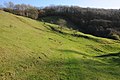 Rough Copse and the Frome valley - geograph.org.uk - 2715114.jpg 1 024 × 680 ; 227 kio
-
 Route to the A417 - geograph.org.uk - 1104979.jpg 640 × 427 ; 80 kio
-
 Runners on a Cotswold track - geograph.org.uk - 2712097.jpg 1 024 × 680 ; 236 kio
-
 Selscomb Wood - geograph.org.uk - 1105004.jpg 640 × 427 ; 90 kio
-
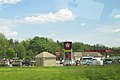
 Service Station - geograph.org.uk - 6241870.jpg 3 648 × 2 736 ; 2,94 Mio
-
 Services off of the A417 - geograph.org.uk - 5112362.jpg 1 600 × 1 174 ; 263 kio
-
 Slip road from A417 to Duntisbourne Leer - geograph.org.uk - 3274885.jpg 1 024 × 768 ; 473 kio
-
 Slip road to A417 services - geograph.org.uk - 3274873.jpg 1 024 × 768 ; 431 kio
-
 Southbound A417 - geograph.org.uk - 3410727.jpg 640 × 480 ; 383 kio
-
 Southbound A417, Junction for Duntisbourne Leer - geograph.org.uk - 3410733.jpg 640 × 480 ; 440 kio
-
 Southbound Services A417 - geograph.org.uk - 1863954.jpg 640 × 426 ; 55 kio
-
 Steep country lane - geograph.org.uk - 3780843.jpg 800 × 450 ; 254 kio
-
 Steep lane through woodland - geograph.org.uk - 3769295.jpg 800 × 600 ; 396 kio
-
 Stubble field, Duntisbourne Abbots - geograph.org.uk - 2712214.jpg 1 024 × 680 ; 256 kio
-
 The A417 one third of a mile before services - geograph.org.uk - 3047536.jpg 1 024 × 640 ; 106 kio
-
 The Hoar Stone - geograph.org.uk - 960047.jpg 640 × 438 ; 113 kio
-
 The lane to Edgeworth - geograph.org.uk - 5088893.jpg 2 592 × 1 944 ; 1,44 Mio
-
 The road to Edgeworth - geograph.org.uk - 926275.jpg 640 × 480 ; 172 kio
-
 Three hydrant covers - geograph.org.uk - 3771522.jpg 800 × 450 ; 257 kio
-
 Track and byway to Woodmancote - geograph.org.uk - 4262153.jpg 1 024 × 680 ; 347 kio
-
 Track and right of way - geograph.org.uk - 4264039.jpg 531 × 800 ; 185 kio
-
 Track near Cotswold Farm - geograph.org.uk - 4265143.jpg 1 024 × 680 ; 330 kio
-
 Track past Cotswold Farm - geograph.org.uk - 1104996.jpg 640 × 427 ; 87 kio
-
 Track to the west of Duntisbourne Abbots - geograph.org.uk - 2712230.jpg 1 024 × 680 ; 190 kio
-
 Trees and a track - geograph.org.uk - 2712086.jpg 680 × 1 024 ; 269 kio
-
 Unsuitable for motors - geograph.org.uk - 1001790.jpg 640 × 481 ; 209 kio
-
 Valley at Duntisbourne Abbots - geograph.org.uk - 2712967.jpg 1 024 × 680 ; 188 kio
-
 Victorian postbox, Duntisbourne House - geograph.org.uk - 926142.jpg 480 × 640 ; 163 kio
-
 View across Cotswold Park - geograph.org.uk - 4264037.jpg 1 024 × 680 ; 307 kio
-
 View to Cotswold Park - geograph.org.uk - 4265148.jpg 800 × 531 ; 127 kio
-
 Watery Lane - geograph.org.uk - 1001800.jpg 481 × 640 ; 153 kio
-
 Well Hill, Duntisbourne Abbots.jpg 4 000 × 3 000 ; 4,51 Mio
-
 Ford at Duntisbourne Abbots - geograph.org.uk - 658801.jpg 640 × 480 ; 105 kio
-
 Looking south through an open section of parkland - geograph.org.uk - 464849.jpg 640 × 477 ; 113 kio
-
 Natural verge - geograph.org.uk - 464860.jpg 477 × 640 ; 148 kio
-
 Track north from Haileys Hill Cottage - geograph.org.uk - 301355.jpg 640 × 480 ; 168 kio


