Category:Dyffryn Ardudwy
Aller à la navigation
Aller à la recherche

Deutsch: Dyffryn Ardudwy liegt im Nordwesten von Wales, 40 m über dem Meeresspiegel auf dem flachen Hang von Moelfre in einem von einer Mauer und einer Waldfläche umschlossenen Areal am Rand des Dorfes, das ihm seinen Namen gab.
établissement humain du Gwynedd, pays de Galles, Royaume-Uni  | |||||
| Téléverser des médias | |||||
| Nature de l’élément | |||||
|---|---|---|---|---|---|
| Lieu | Gwynedd, pays de Galles | ||||
 | |||||
Sous-catégories
Cette catégorie comprend 8 sous-catégories, dont les 8 ci-dessous.
B
- Bwlch y Rhiwgyr (30 F)
D
- Dyffryn Ardudwy Burial Chambers (19 F)
L
- Llyn Bodlyn (7 F)
P
- Pont Scethin (8 F)
T
Média dans la catégorie « Dyffryn Ardudwy »
Cette catégorie comprend 504 fichiers, dont les 200 ci-dessous.
(page précédente) (page suivante)-
 'Cars will be clamped' - geograph.org.uk - 4720005.jpg 480 × 640 ; 184 kio
-
 A beach to themselves - geograph.org.uk - 4719720.jpg 640 × 480 ; 176 kio
-
 A distant view of the Rhinogydd - geograph.org.uk - 4720201.jpg 640 × 480 ; 233 kio
-
 A Hill Fort - geograph.org.uk - 527057.jpg 640 × 480 ; 81 kio
-
 A snowy descent from Diffwys - geograph.org.uk - 3400125.jpg 1 600 × 1 142 ; 477 kio
-
 A study in land use - geograph.org.uk - 4716924.jpg 640 × 480 ; 208 kio
-
 A train for Pwllheli departing from Talybont - geograph.org.uk - 6117419.jpg 1 024 × 576 ; 468 kio
-
 A view over Cwm Bodlyn - geograph.org.uk - 6118146.jpg 1 024 × 576 ; 357 kio
-
 A496 at Coed-y-Bachau - geograph.org.uk - 3700419.jpg 640 × 307 ; 48 kio
-
 A496 at Taltreuddyn entrance - geograph.org.uk - 3700381.jpg 640 × 436 ; 55 kio
-
 A496 Bridge - geograph.org.uk - 2177737.jpg 3 456 × 2 304 ; 4,16 Mio
-
 Abandoned building beside the track to Llyn Bodlyn - geograph.org.uk - 6117511.jpg 1 024 × 576 ; 356 kio
-
 Abaty Egryn Abbey - geograph.org.uk - 3922774.jpg 3 264 × 2 448 ; 3,68 Mio
-
 Above Egryn Abbey Farm - May 2013 - panoramio.jpg 4 000 × 3 000 ; 1,9 Mio
-
 Above the caravan belt - geograph.org.uk - 6117428.jpg 1 024 × 769 ; 446 kio
-
 Above the High Water Line at Dyffryn - geograph.org.uk - 4719873.jpg 640 × 480 ; 193 kio
-
 Access road to Dyffryn Seaside Estate - geograph.org.uk - 1080254.jpg 640 × 480 ; 160 kio
-
 Access to the beach - geograph.org.uk - 4718277.jpg 640 × 480 ; 166 kio
-
 Across Llanbedr airfield from Taltreuddyn - geograph.org.uk - 3207202.jpg 640 × 461 ; 69 kio
-
 Across the fields to Sunnysands Caravan Park - geograph.org.uk - 3207247.jpg 640 × 446 ; 81 kio
-
 Across the fields towards Cwm Ystumgwern - geograph.org.uk - 3210221.jpg 640 × 480 ; 69 kio
-
 Across the fields towards Faeldre - geograph.org.uk - 3210227.jpg 640 × 480 ; 68 kio
-
 Adfeilion ger Hendre-Eirian - Ruins near Hendre-Eirian - geograph.org.uk - 3904348.jpg 3 264 × 2 448 ; 3,95 Mio
-
 Afon Ysgethin - geograph.org.uk - 2355329.jpg 1 600 × 1 200 ; 634 kio
-
 Afon Ysgethin - geograph.org.uk - 3903134.jpg 3 264 × 2 448 ; 3,76 Mio
-
 Afon Ysgethin - geograph.org.uk - 4724653.jpg 480 × 640 ; 165 kio
-
 Afon Ysgethin - geograph.org.uk - 6112538.jpg 1 024 × 769 ; 760 kio
-
 Afon Ysgethin emerges from the dunes - geograph.org.uk - 2887864.jpg 1 600 × 1 200 ; 498 kio
-
 Afon Ysgethin flowing down to Tal-y-bont - geograph.org.uk - 6112517.jpg 768 × 768 ; 596 kio
-
 An old woman in front of her house, Dyffryn Ardudwy (1875) NLW3361581.jpg 604 × 459 ; 77 kio
-
 An unusual sight in Gwynedd - geograph.org.uk - 5782741.jpg 4 032 × 3 024 ; 2,02 Mio
-

-
 April on Diffwys - geograph.org.uk - 3400113.jpg 1 600 × 1 200 ; 308 kio
-
 Ardudwy from the Diffwys ridge - geograph.org.uk - 1755073.jpg 1 024 × 768 ; 285 kio
-
 Ascending in Bwlch y Rhiwgyr - geograph.org.uk - 6112804.jpg 1 024 × 576 ; 432 kio
-
 Barmouth 3 - geograph.org.uk - 2152020.jpg 1 600 × 1 200 ; 659 kio
-
 Barmouth 4 - geograph.org.uk - 2152010.jpg 1 600 × 1 200 ; 796 kio
-
 Barmouth 5 - geograph.org.uk - 2151469.jpg 1 600 × 1 200 ; 626 kio
-
 Barn and the sea - geograph.org.uk - 4721061.jpg 640 × 480 ; 209 kio
-
 Beach from Trawsdir - 1st June 2013 - panoramio.jpg 4 000 × 3 000 ; 2,07 Mio
-
 Beach looking north - geograph.org.uk - 2887915.jpg 1 600 × 1 200 ; 287 kio
-
 Beach of stone and sand - geograph.org.uk - 2887834.jpg 1 600 × 1 200 ; 421 kio
-
 Beach road Dyffryn Ardudwy.jpg 1 944 × 2 592 ; 1,46 Mio
-
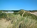
 Benar Beach looking towards the sand dunes of Morfa Dyffryn - geograph.org.uk - 4664740.jpg 4 288 × 3 216 ; 3,08 Mio
-
 Beneath Moelfre - geograph.org.uk - 6118138.jpg 1 024 × 576 ; 470 kio
-
 Bennar Beach - geograph.org.uk - 6270262.jpg 1 600 × 1 067 ; 161 kio
-
 Bennar beach, Gwynedd - geograph.org.uk - 4754396.jpg 4 288 × 3 216 ; 2,79 Mio
-
 Bennar Beach... the boardwalk through the sand dunes - geograph.org.uk - 4664757.jpg 2 560 × 1 920 ; 3,54 Mio
-
 Boardwalk from the beach - geograph.org.uk - 4719907.jpg 640 × 480 ; 220 kio
-
 Boardwalk to Beach - panoramio.jpg 3 968 × 2 976 ; 5,14 Mio
-
 Boulder field on the moorland shelf - geograph.org.uk - 531470.jpg 640 × 320 ; 73 kio
-
 Boundary Stone - geograph.org.uk - 4891102.jpg 640 × 480 ; 129 kio
-
 Bridge at Tal-y-bont - geograph.org.uk - 3700584.jpg 640 × 477 ; 78 kio
-
 Bron y Foel Isaf Burial Chamber - geograph.org.uk - 3181214.jpg 1 751 × 1 159 ; 607 kio
-
 Bryn Castell - geograph.org.uk - 1752290.jpg 1 024 × 768 ; 222 kio
-
 Bryn Heulog junction off A496 - geograph.org.uk - 3700398.jpg 640 × 399 ; 42 kio
-
 Bryniau Uwchben Pont Fadog - Hills above Pont Fadog - geograph.org.uk - 2264988.jpg 3 264 × 2 448 ; 3,51 Mio
-
 Bwlch Cwmmaria - geograph.org.uk - 3904484.jpg 3 264 × 2 448 ; 3,72 Mio
-
 Bwlch y Rhiwgyr - geograph.org.uk - 1752999.jpg 1 024 × 768 ; 288 kio
-
 Bwlch y Rhiwgyr - geograph.org.uk - 2264956.jpg 3 264 × 2 448 ; 3,57 Mio
-
 Byrdir - geograph.org.uk - 3904233.jpg 3 600 × 2 400 ; 3,97 Mio
-
 Cadwgan Hotel - geograph.org.uk - 2512240.jpg 3 648 × 2 736 ; 3,18 Mio
-
 Cae amaethyddol ger Caeryffynnon - Farmland near Caeryffynnon - geograph.org.uk - 3904295.jpg 3 600 × 2 400 ; 3,98 Mio
-
 Caeau Amaethyddol - Agricultural Fields - geograph.org.uk - 2265011.jpg 3 264 × 2 448 ; 3,73 Mio
-
 Caerddaniel Caravan Park - June 2013 - panoramio.jpg 4 000 × 3 000 ; 1,89 Mio
-
 Cairn just below summit - geograph.org.uk - 2278877.jpg 640 × 480 ; 83 kio
-
 Cambrian Coast Line to Pwllheli - geograph.org.uk - 2888517.jpg 1 600 × 1 200 ; 548 kio
-
 Camping site closed - geograph.org.uk - 4721015.jpg 640 × 480 ; 278 kio
-
 Capel Egryn - disused Calvinist Methodist chapel - geograph.org.uk - 4722154.jpg 640 × 480 ; 191 kio
-
 Capel Egryn - geograph.org.uk - 6279262.jpg 1 600 × 1 067 ; 239 kio
-

-
 Capel Egryn from the Hendre-Eirian track - geograph.org.uk - 529267.jpg 640 × 334 ; 60 kio
-

-
 Car park for Morfa Dyffryn - geograph.org.uk - 4719980.jpg 640 × 480 ; 278 kio
-
 Car Park View - geograph.org.uk - 2177739.jpg 1 704 × 2 272 ; 859 kio
-
 Caravan site near Dalar Farm - geograph.org.uk - 3207241.jpg 640 × 480 ; 62 kio
-
 Caravans on the Cambrian Coast - geograph.org.uk - 4722141.jpg 640 × 480 ; 212 kio
-
 Carnedd Gron - Stone circle - geograph.org.uk - 3904377.jpg 3 264 × 2 448 ; 3,71 Mio
-
 Carnedd Gron - Stone circle - geograph.org.uk - 3904384.jpg 3 264 × 2 448 ; 3,71 Mio
-
 Carneddau Hengwm - geograph.org.uk - 3904398.jpg 3 264 × 2 448 ; 3,68 Mio
-
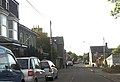 Centre of Dyffryn Ardudwy - geograph.org.uk - 3700403.jpg 640 × 440 ; 54 kio
-
 Chalets in the Holiday Village - geograph.org.uk - 2891713.jpg 1 600 × 1 200 ; 353 kio
-
 Cofiant am y Parch Richard Humphreys.djvu 5 100 × 6 601, 307 pages ; 9,96 Mio
-
 Copa Moelfre - Moelfre Summit - geograph.org.uk - 3904146.jpg 3 264 × 2 448 ; 3,54 Mio
-
 Corner near Cors-y-Gedol Hall - geograph.org.uk - 6269818.jpg 1 067 × 1 600 ; 579 kio
-
 Cors y Gedol Burial Chamber - geograph.org.uk - 3181202.jpg 1 687 × 1 158 ; 531 kio
-
 Cors-uchaf farmstead (ruin) - geograph.org.uk - 6117513.jpg 1 024 × 576 ; 363 kio
-
 Craig y Grut - geograph.org.uk - 3903222.jpg 3 264 × 2 448 ; 3,81 Mio
-
 Crib y Rhiw - geograph.org.uk - 1962388.jpg 1 280 × 960 ; 321 kio
-
 Crib-y-Rhiw - geograph.org.uk - 3903076.jpg 3 264 × 2 448 ; 3,66 Mio
-
 Crib-y-Rhiw - geograph.org.uk - 3903087.jpg 3 264 × 2 448 ; 3,58 Mio
-
 Cryptocephalus aureolus, Dyffryn, North Wales, May 2010 - Flickr - janetgraham84.jpg 1 500 × 1 080 ; 728 kio
-
 Cwm Bodlyn - geograph.org.uk - 3909815.jpg 3 600 × 2 400 ; 4,01 Mio
-
 Cwm Ysgethin - geograph.org.uk - 2265020.jpg 3 264 × 2 448 ; 3,73 Mio
-
 Damaged section of wall - geograph.org.uk - 2485940.jpg 1 824 × 1 368 ; 1,3 Mio
-
 Diffwys - geograph.org.uk - 3903094.jpg 3 264 × 2 448 ; 3,47 Mio
-
 Diffwys seen from Penmaenpool - geograph.org.uk - 4337625.jpg 828 × 572 ; 553 kio
-
 Don't get your feet wet... - geograph.org.uk - 4719784.jpg 640 × 480 ; 144 kio
-
 Drainage water outlet - geograph.org.uk - 2891678.jpg 1 600 × 1 200 ; 350 kio
-
 Dry stone wall near Llyn Erddyn - geograph.org.uk - 2483665.jpg 640 × 480 ; 99 kio
-
 Dry stone walls and hills - geograph.org.uk - 4722118.jpg 640 × 480 ; 243 kio
-
 Dry-stone wall patterns - geograph.org.uk - 1080206.jpg 640 × 480 ; 221 kio
-
 Dyffryn Ardudwy Level Crossing - geograph.org.uk - 1080291.jpg 640 × 480 ; 213 kio
-
 Dyffryn Ardudwy Railway Station - geograph.org.uk - 4717002.jpg 640 × 480 ; 200 kio
-
 Dyffryn Ardudwy station - geograph.org.uk - 3207223.jpg 640 × 480 ; 96 kio
-
 Dyffryn Ardudwy Station - geograph.org.uk - 3504344.jpg 640 × 480 ; 108 kio
-
 Dyffryn Ardudwy, UK - panoramio (1).jpg 4 608 × 3 456 ; 4,95 Mio
-
 Dyffryn Ardudwy, UK - panoramio (2).jpg 4 608 × 3 456 ; 5,19 Mio
-
 Dyffryn Ardudwy, UK - panoramio (3).jpg 3 456 × 2 142 ; 2,44 Mio
-
 Dyffryn Ardudwy, UK - panoramio (4).jpg 4 608 × 3 456 ; 3,44 Mio
-
 Dyffryn Ardudwy, UK - panoramio (5).jpg 4 608 × 3 456 ; 4,26 Mio
-
 Dyffryn Ardudwy, UK - panoramio (6).jpg 4 420 × 3 316 ; 4,22 Mio
-
 Dyffryn Ardudwy, UK - panoramio (7).jpg 4 608 × 3 456 ; 5,06 Mio
-
 Dyffryn Ardudwy, UK - panoramio (8).jpg 4 608 × 3 456 ; 5,66 Mio
-
 Dyffryn Ardudwy, UK - panoramio (9).jpg 4 608 × 3 456 ; 4,32 Mio
-
 Dyffryn Ardudwy, UK - panoramio.jpg 4 000 × 2 250 ; 2,21 Mio
-
 Dyffryn burial chamber.jpg 1 944 × 2 592 ; 1,95 Mio
-
 Dyffryn Seaside Estate - geograph.org.uk - 2085299.jpg 2 304 × 1 728 ; 1,51 Mio
-

-
 Egryn - May 2013 - panoramio.jpg 4 000 × 3 000 ; 1,58 Mio
-
 Egryn Abbey Farm - 30th May 2013 - panoramio (1).jpg 4 000 × 3 000 ; 2,28 Mio
-
 Egryn Abbey Farm - 30th May 2013 - panoramio.jpg 4 000 × 3 000 ; 1,88 Mio
-
 Egryn Abbey farm - and sea - May 2013 - panoramio.jpg 4 000 × 3 000 ; 1,68 Mio
-
 Egryn Abbey Farm from the hillside. - geograph.org.uk - 529750.jpg 640 × 383 ; 76 kio
-
 Egryn Abbey turning from A496 - geograph.org.uk - 3700595.jpg 640 × 335 ; 31 kio
-
 Egryn brook running to the beach - May 2013 - panoramio.jpg 4 000 × 3 000 ; 2,02 Mio
-
 Egryn Calvinistic Methodist Sunday School (disused) - geograph.org.uk - 5508627.jpg 4 184 × 2 789 ; 4,22 Mio
-
 Emerging onto the A496 road at Tal-y-bont - geograph.org.uk - 4716955.jpg 640 × 480 ; 253 kio
-
 Entering Cwm Ystumgwern from the north - geograph.org.uk - 3700392.jpg 640 × 391 ; 58 kio
-
 Entrance to the Dyffryn Seaside Estate - geograph.org.uk - 4719986.jpg 640 × 480 ; 163 kio
-

-
 Entrance to Trawsdir caravan site - geograph.org.uk - 3700589.jpg 640 × 369 ; 28 kio
-
 Evening from Trawsdir - 1st June 2013 - panoramio.jpg 4 000 × 3 000 ; 1,18 Mio
-
 Evening train passing below Trawsdir camp ground - 1st June 2013 - panoramio.jpg 4 000 × 3 000 ; 2,18 Mio
-
 Excellent sandy beach - geograph.org.uk - 2891688.jpg 1 600 × 1 200 ; 251 kio
-
 F11 junior is hungry - geograph.org.uk - 6118136.jpg 768 × 768 ; 574 kio
-
 Farm buildings at Sebonig - geograph.org.uk - 529853.jpg 640 × 192 ; 37 kio
-
 Farm buildings near Trawsdir, Barmouth - May 2013 - panoramio.jpg 4 000 × 3 000 ; 2,51 Mio
-
 Farm track leading to Tal-y-bont - geograph.org.uk - 4720997.jpg 640 × 480 ; 304 kio
-

-
 Farmland and sea - Egryn Abbey - May 2013 - panoramio.jpg 4 000 × 3 000 ; 1,72 Mio
-
 Fence corner at Morfa Dyffryn - geograph.org.uk - 1080218.jpg 640 × 480 ; 188 kio
-
 Fferm Egryn Farm - geograph.org.uk - 529333.jpg 640 × 480 ; 99 kio
-
 Ffermdy Hendre-Eirian Farmhouse - geograph.org.uk - 529708.jpg 640 × 480 ; 103 kio
-
 Ffordd di-ddosbarth- Unclassified road - geograph.org.uk - 3904263.jpg 3 600 × 2 400 ; 4,02 Mio
-
 Ffordd Gors - geograph.org.uk - 6269822.jpg 1 067 × 1 600 ; 464 kio
-
 Ffordd Porthmyn - Drovers Road - geograph.org.uk - 2264980.jpg 3 264 × 2 448 ; 3,58 Mio
-
 Ffordd yr Orsaf (Station Road) - geograph.org.uk - 6279773.jpg 1 600 × 1 067 ; 274 kio
-
 Field corner kissing gate - geograph.org.uk - 2483571.jpg 640 × 480 ; 148 kio
-
 Field near the Dyffren Seaside Estate - geograph.org.uk - 2615745.jpg 3 264 × 2 448 ; 3,02 Mio
-
 Field north of Byrdir - geograph.org.uk - 1298464.jpg 640 × 428 ; 106 kio
-
 Fields at Llanaber, Barmouth - 30th May 2013 - panoramio.jpg 4 000 × 3 000 ; 2,12 Mio
-
 Fields at Ynys Gwrtheyrn - geograph.org.uk - 3207221.jpg 640 × 400 ; 52 kio
-
 Fields near Pentre Mawr - geograph.org.uk - 3207232.jpg 640 × 480 ; 56 kio
-
 Fight between fresh ^ salt water - geograph.org.uk - 2887809.jpg 640 × 480 ; 99 kio
-
 First sight of Llyn Bodlyn on the road from Tal-y-bont - geograph.org.uk - 6118153.jpg 1 024 × 576 ; 379 kio
-
 Footpath and Afon Ysgethin - geograph.org.uk - 6112545.jpg 1 024 × 769 ; 757 kio
-
 Footpath beside Afon Ysgethin - geograph.org.uk - 6112520.jpg 1 024 × 576 ; 517 kio
-
 Footpath out of Dyffryn Ardudwy - geograph.org.uk - 2483555.jpg 640 × 480 ; 110 kio
-
 Footpath out of Dyffryn Ardudwy - geograph.org.uk - 2483563.jpg 640 × 480 ; 112 kio
-
 Ford and footbridge below Llyn Erddyn - geograph.org.uk - 2483696.jpg 640 × 480 ; 98 kio
-
 Frongaled Farm - geograph.org.uk - 2483748.jpg 640 × 480 ; 102 kio
-
 Frongaled Farm - geograph.org.uk - 2483751.jpg 640 × 480 ; 55 kio
-
 Frozen, flooded farmland - geograph.org.uk - 1080250.jpg 640 × 480 ; 171 kio
-
 Gate on the footpath beside Afon Ysgethin - geograph.org.uk - 6112521.jpg 768 × 768 ; 528 kio
-
 Gate on the footpath in Cwm Ysgethin - geograph.org.uk - 2483671.jpg 640 × 480 ; 68 kio
-
 Gate on the path through the dunes - geograph.org.uk - 4716946.jpg 640 × 480 ; 162 kio
-
 Gate on the road - geograph.org.uk - 1298512.jpg 640 × 428 ; 94 kio
-
 Gate on the track above Pont Fadog - geograph.org.uk - 2483712.jpg 640 × 480 ; 83 kio
-

-
 Gated road - Snowdonia - May 2013 - panoramio.jpg 4 000 × 3 000 ; 1,48 Mio
-
 Giât yn y wal - Gate in the wall - geograph.org.uk - 3904175.jpg 3 264 × 2 448 ; 3,78 Mio
-
 Golden Sheep (21811943363).jpg 4 890 × 3 260 ; 13,49 Mio
-
 Golden Sheep (22246253629).jpg 3 648 × 5 472 ; 15,83 Mio
-
 Grazing behind the dunes - geograph.org.uk - 2891727.jpg 1 600 × 1 200 ; 390 kio
-
 Hill in the mist - from above Egryn - May 2013 - panoramio.jpg 4 000 × 3 000 ; 1,03 Mio
-
 Hills above Egryn Abbey - May 2013 - panoramio.jpg 4 000 × 3 000 ; 1,96 Mio
-
 Hillside above Egryn Abbey - 30th May 2013 - panoramio.jpg 4 000 × 3 000 ; 1,72 Mio
-
 Hillside wall - geograph.org.uk - 531838.jpg 640 × 605 ; 141 kio
-
 Holiday traffic streams past Capel Egryn - geograph.org.uk - 529272.jpg 640 × 480 ; 69 kio
-
 Houses at Pentre Mawr from railway - geograph.org.uk - 3210185.jpg 640 × 309 ; 36 kio
-
 Islaw Bwlch Cwmmaria - Below Bwlch Cwmmaria - geograph.org.uk - 3922972.jpg 3 264 × 2 448 ; 3,7 Mio
-
 Islaw Diffwys - Below Diffwys - geograph.org.uk - 3909806.jpg 3 600 × 2 400 ; 4,11 Mio
-
 Kite Karting - geograph.org.uk - 1409218.jpg 640 × 480 ; 53 kio
-
 Lane from Dyffryn Ardudwy station - geograph.org.uk - 3207216.jpg 640 × 449 ; 74 kio
-
 Lane from Morfa Dyffryn to Dyffryn Ardudwy - geograph.org.uk - 1080274.jpg 640 × 480 ; 190 kio
-
 Lane junction at Bellaport - geograph.org.uk - 5782767.jpg 4 032 × 3 024 ; 2,26 Mio
-
 Lane leading to Bron-y-foel farm - geograph.org.uk - 1298485.jpg 640 × 428 ; 80 kio
-
 Lane to Dyffryn Seaside estate - geograph.org.uk - 3207229.jpg 640 × 498 ; 65 kio
-
 Large chapel building in Dyffryn Ardudwy - geograph.org.uk - 2483549.jpg 640 × 480 ; 87 kio
-
 Launching a boat on beach below Egryn Abbey - Barmouth - May 2013 - panoramio.jpg 4 000 × 3 000 ; 1,91 Mio
-
 Llanaber Beach - 1st June 2013 - panoramio (1).jpg 4 000 × 3 000 ; 1,81 Mio
-
 Llanaber Beach - 1st June 2013 - panoramio.jpg 4 000 × 3 000 ; 1,43 Mio
-
 Llanaber Beach, Barmouth - 1st June 2013 - panoramio.jpg 4 000 × 3 000 ; 1,62 Mio
-
 Llanaber Beach, Barmouth - evening - June 2013 - panoramio.jpg 4 000 × 3 000 ; 1,11 Mio
-
 Llawlech - geograph.org.uk - 3903195.jpg 3 264 × 2 448 ; 3,59 Mio
-
 Llethrau Moelfre - Slopes of Moelfre - geograph.org.uk - 3904122.jpg 3 264 × 2 448 ; 3,72 Mio
-
 Llwybyr cyhoeddus uwchben Pont Scethin - Footpath above Pont Scethin - geograph.org.uk - 3903155.jpg 3 264 × 2 448 ; 3,72 Mio
-
 Llyn Bodlyn - geograph.org.uk - 3903121.jpg 3 264 × 2 448 ; 3,63 Mio
-
 Llyn Bodlyn and its ruined boathouse - geograph.org.uk - 6118156.jpg 1 024 × 576 ; 511 kio


_NLW3361581.jpg)


_-_geograph.org.uk_-_6117513.jpg)


.jpg)
.jpg)
.jpg)
.jpg)
.jpg)
.jpg)
.jpg)
.jpg)
.jpg)


.jpg)


_-_geograph.org.uk_-_5508627.jpg)


_-_geograph.org.uk_-_6279773.jpg)


.jpg)
.jpg)


.jpg)


