Category:Ealing (locality)
Zur Navigation springen
Zur Suche springen
Stadtteil von London  | |||||
| Medium hochladen | |||||
| Ist ein(e) | |||||
|---|---|---|---|---|---|
| Ort |
| ||||
| Verschieden von | |||||
| offizielle Website | |||||
 | |||||
Unterkategorien
Es werden 33 von insgesamt 33 Unterkategorien in dieser Kategorie angezeigt:
In Klammern die Anzahl der enthaltenen Kategorien (K), Seiten (S), Dateien (D)
A
C
E
- Ealing Broadway Shopping Centre (18 D)
- Ealing High Street (7 D)
- Ealing Rock (3 D)
H
- Haven Green (38 D)
L
- Lammas Park (29 D)
M
N
P
- Polish Christmas in London (3 D)
S
T
- The Questors Theatre (2 D)
W
Medien in der Kategorie „Ealing (locality)“
Folgende 200 Dateien sind in dieser Kategorie, von 228 insgesamt.
(vorherige Seite) (nächste Seite)-
 'He Ow Hue', Ealing (closed) - geograph.org.uk - 3166950.jpg 640 × 428; 114 KB
-
 18 inch newtonian telescope back yard Ealing London Andrew Ainslie Common.png 1.233 × 713; 561 KB
-

-
 1955coverGoughIsland.jpg 1.236 × 837; 296 KB
-
 Albert Road, Ealing - geograph.org.uk - 5802312.jpg 640 × 480; 83 KB
-
 Alley To Walpole Park - geograph.org.uk - 2864725.jpg 683 × 1.024; 240 KB
-
 Arcadia Centre with animated clock - geograph.org.uk - 680378.jpg 480 × 640; 111 KB
-
 Ascott Avenue - geograph.org.uk - 4048926.jpg 640 × 430; 95 KB
-
 Ascott Avenue - geograph.org.uk - 4048937.jpg 640 × 430; 103 KB
-
 Ascott Avenue - geograph.org.uk - 4048942.jpg 640 × 430; 81 KB
-
 Ascott Road - geograph.org.uk - 4049157.jpg 640 × 430; 85 KB
-
 Ashbourne Road - geograph.org.uk - 4198485.jpg 4.000 × 3.000; 3,98 MB
-
 Ashbourne Road, Ealing - geograph.org.uk - 4424597.jpg 2.304 × 1.728; 845 KB
-
 Au Morandarte Flickr DSC00039 (9667504070).jpg 3.072 × 2.304; 2,93 MB
-
 Au Morandarte Flickr IMG 6962 (15193334105).jpg 3.888 × 2.592; 4,23 MB
-
 Balcon Court, Boileau Road - geograph.org.uk - 3238211.jpg 1.600 × 1.200; 698 KB
-
 Barnes Pikle, Ealing - geograph.org.uk - 4413996.jpg 1.728 × 2.304; 663 KB
-
 Beaconsfield Rd - geograph.org.uk - 4039468.jpg 640 × 430; 96 KB
-
 Beaconsfield Rd - geograph.org.uk - 4039474.jpg 640 × 430; 101 KB
-
 Beaconsfield Rd - geograph.org.uk - 4039475.jpg 640 × 430; 104 KB
-
 Birch Grove, Ealing Common - geograph.org.uk - 4121748.jpg 4.000 × 3.000; 4,15 MB
-
 Birch Grove, Ealing Common - geograph.org.uk - 4121754.jpg 3.639 × 2.867; 1,03 MB
-
 Blakesley Avenue, London W5 - geograph.org.uk - 1750460.jpg 1.000 × 666; 147 KB
-
 Blandford Road, Ealing - geograph.org.uk - 4446650.jpg 2.304 × 1.728; 825 KB
-
 Boileau Road, Ealing - geograph.org.uk - 3238213.jpg 1.600 × 1.200; 660 KB
-
 Boileau Road, Ealing - geograph.org.uk - 4424318.jpg 2.304 × 1.728; 830 KB
-
 Boileau Road, Ealing - geograph.org.uk - 4424400.jpg 2.304 × 1.728; 828 KB
-
 Bond Street, Ealing - geograph.org.uk - 4240910.jpg 2.560 × 1.920; 1,41 MB
-
 Brunswick Road - geograph.org.uk - 3686859.jpg 4.608 × 3.456; 7,13 MB
-
 Cairn Avenue, Ealing - geograph.org.uk - 4435465.jpg 2.304 × 1.728; 787 KB
-
 Cairns Avenue - geograph.org.uk - 4039640.jpg 640 × 430; 86 KB
-
 Castle Bar Park - Cavendish Avenue - geograph.org.uk - 2881153.jpg 640 × 480; 165 KB
-
 Castlebar Hill roundabout - geograph.org.uk - 1297612.jpg 640 × 426; 92 KB
-
 Castlebar Park, Ealing - geograph.org.uk - 2864711.jpg 640 × 444; 97 KB
-
 Castlebar Park, near Ealing - geograph.org.uk - 5802305.jpg 640 × 480; 77 KB
-
 Castlebar Park, W5 - geograph.org.uk - 2864704.jpg 640 × 448; 78 KB
-
 Castlebar Road at the junction of Montpelier Road - geograph.org.uk - 4471602.jpg 2.304 × 1.728; 813 KB
-
 Castlebar Road, Ealing - geograph.org.uk - 5861787.jpg 1.024 × 768; 300 KB
-
 Castlebar Road, Ealing, London W5 - geograph.org.uk - 6120086.jpg 800 × 600; 121 KB
-
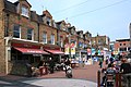
 Christmas at Pitshanger Lane - geograph.org.uk - 299759.jpg 640 × 450; 123 KB
-
 Church Lane, Ealing - geograph.org.uk - 5189399.jpg 3.843 × 2.562; 1,83 MB
-
 Churchfield Road, Ealing - geograph.org.uk - 2470631.jpg 600 × 800; 379 KB
-
 Clarendon Road, Ealing - geograph.org.uk - 3398638.jpg 640 × 480; 132 KB
-
 Clarendon Road, Ealing - geograph.org.uk - 4301905.jpg 2.304 × 1.728; 845 KB
-
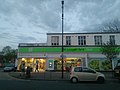 Co-operative Food.jpg 4.160 × 3.120; 2,88 MB
-
 Corner of Brunswick Road and North Circular Road, Ealing - geograph.org.uk - 2214134.jpg 1.600 × 1.200; 313 KB
-
 Corringway, Ealing - geograph.org.uk - 4424608.jpg 2.304 × 1.728; 832 KB
-
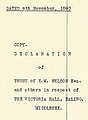 Cover of Victoria Hall 1893 Trust Deed.jpg 551 × 752; 283 KB
-
 Craven Avenue, looking east - geograph.org.uk - 5558958.jpg 4.032 × 3.024; 5,19 MB
-
 Crossroads on Culmington Road, Ealing - geograph.org.uk - 4435486.jpg 2.304 × 1.728; 816 KB
-
 Culmington Road - geograph.org.uk - 2471720.jpg 800 × 600; 465 KB
-
 Culmington Road, Ealing - geograph.org.uk - 4435488.jpg 2.304 × 1.728; 794 KB
-
 Deans Villas, Mattock lane, Ealing - geograph.org.uk - 684345.jpg 640 × 428; 56 KB
-
 Ealing - Windermere Road - geograph.org.uk - 5185515.jpg 4.608 × 3.456; 6,2 MB
-
 Ealing Broadway Box.JPG 1.012 × 1.462; 306 KB
-
 Ealing Broadway down express geograph-2913926-by-Ben-Brooksbank.jpg 2.398 × 1.448; 1,39 MB
-
 Ealing buildings (1) - geograph.org.uk - 6365564.jpg 4.320 × 3.240; 3,67 MB
-
 Ealing buildings (28) - geograph.org.uk - 6368657.jpg 4.320 × 3.240; 3,29 MB
-
 Ealing buildings (31) - geograph.org.uk - 6369255.jpg 3.235 × 3.235; 1,57 MB
-
 Ealing buildings (40) - geograph.org.uk - 6370075.jpg 3.924 × 2.942; 1,99 MB
-
 Ealing buildings (41) - geograph.org.uk - 6370079.jpg 2.697 × 3.596; 1,69 MB
-
 Ealing buildings (42) - geograph.org.uk - 6370081.jpg 3.133 × 4.177; 2,22 MB
-
 Ealing buildings (43) - geograph.org.uk - 6370095.jpg 4.213 × 3.159; 2,61 MB
-
 Ealing features (1) - geograph.org.uk - 6365565.jpg 4.320 × 3.240; 3,99 MB
-
 Ealing features (7) - geograph.org.uk - 6367063.jpg 2.814 × 3.752; 2,05 MB
-
 Chapel ealing green 682.JPG 2.004 × 2.580; 2,27 MB
-
 Ealing houses (1) - geograph.org.uk - 6365560.jpg 4.320 × 3.240; 2,88 MB
-
 Ealing houses (10) - geograph.org.uk - 6367919.jpg 4.049 × 3.036; 2,87 MB
-
 Ealing houses (11) - geograph.org.uk - 6367920.jpg 4.320 × 3.240; 4,08 MB
-
 Ealing houses (12) - geograph.org.uk - 6367925.jpg 4.177 × 3.133; 2,27 MB
-
 Ealing houses (13) (geograph 6367931).jpg 2.919 × 3.893; 1,28 MB
-
 Ealing houses (14) (geograph 6367932).jpg 4.319 × 3.239; 2,23 MB
-
 Ealing houses (28) - geograph.org.uk - 6369244.jpg 4.320 × 3.240; 2,72 MB
-
 Ealing houses (30) (geograph 6370068).jpg 4.320 × 3.240; 3,01 MB
-
 Ealing houses (31) - geograph.org.uk - 6370086.jpg 4.213 × 3.159; 2,85 MB
-
 Ealing houses (32) - geograph.org.uk - 6370098.jpg 4.320 × 3.240; 2,51 MB
-
 Ealing houses (33) - geograph.org.uk - 6370106.jpg 4.320 × 3.240; 4,27 MB
-
 Ealing houses (34) - geograph.org.uk - 6370111.jpg 3.240 × 4.320; 3,98 MB
-
 Ealing houses (35) - geograph.org.uk - 6370114.jpg 4.320 × 3.239; 2,86 MB
-
 Ealing houses (36) - geograph.org.uk - 6370117.jpg 4.320 × 3.240; 2,56 MB
-
 Ealing houses (37) (geograph 6370743).jpg 4.171 × 3.128; 2,72 MB
-
 Ealing houses (38) - geograph.org.uk - 6370756.jpg 4.223 × 3.167; 2,61 MB
-
 Ealing houses (7) - geograph.org.uk - 6367006.jpg 4.077 × 3.057; 2,87 MB
-
 Ealing houses (8) (geograph 6367071).jpg 4.320 × 3.240; 3,54 MB
-
 Ealing houses (8) - geograph.org.uk - 6367012.jpg 3.240 × 4.320; 2,54 MB
-
 Ealing houses (9) - geograph.org.uk - 6367079.jpg 3.240 × 4.320; 3,66 MB
-
 Ealing houses.jpg 2.304 × 1.728; 836 KB
-
 Ealing streetlamp 1905.JPG 1.617 × 3.647; 962 KB
-
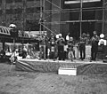
 Ealing Town Centre Building Work, 2018.jpg 11.664 × 4.988; 7,32 MB
-
 Ealing village PB29 SVM end.jpg 922 × 1.546; 283 KB
-

-
 Ealing, Main line railway - geograph.org.uk - 204522.jpg 640 × 480; 152 KB
-
 Ealing, Montpelier Park, W5 - geograph.org.uk - 92411.jpg 640 × 425; 140 KB
-
 Edward VII postbox on Mount Avenue, Ealing - geograph.org.uk - 6120389.jpg 3.170 × 5.176; 2,98 MB
-
 Elers Road - geograph.org.uk - 2470619.jpg 600 × 800; 390 KB
-
 Elizabeth II postbox on Madeley Road, Ealing - geograph.org.uk - 6120451.jpg 2.850 × 4.718; 2,23 MB
-
 Elm Grove Rd - geograph.org.uk - 4048932.jpg 640 × 430; 102 KB
-
 Empire Ealing by Mark Hillary.jpg 2.592 × 1.944; 726 KB
-
 Flats in Hanger Vale Lane - geograph.org.uk - 1842421.jpg 640 × 497; 112 KB
-

-
 Glencairn Drive, Ealing - geograph.org.uk - 5802322.jpg 640 × 480; 93 KB
-
 Gordon Rd - geograph.org.uk - 2951433.jpg 640 × 430; 94 KB
-
 Gordon Road - geograph.org.uk - 2864606.jpg 1.024 × 683; 284 KB
-
 Gordon Road at the junction of Carlton Road - geograph.org.uk - 4587184.jpg 2.304 × 1.728; 802 KB
-
 Gordon Road, Ealing - geograph.org.uk - 2865341.jpg 640 × 454; 102 KB
-
 Grange Park, Ealing - geograph.org.uk - 3130248.jpg 1.600 × 1.064; 636 KB
-
 Hamilton Road at the junction of the North Circular - geograph.org.uk - 4173958.jpg 2.304 × 1.728; 836 KB
-
 Hamilton Road, Ealing - geograph.org.uk - 5189820.jpg 4.128 × 3.096; 3,67 MB
-
 Hamilton Road, Ealing - geograph.org.uk - 5189821.jpg 4.128 × 3.096; 3,55 MB
-
 Hamilton Road, Ealing - geograph.org.uk - 5190326.jpg 1.600 × 1.175; 606 KB
-
 Hamilton Road, Ealing - geograph.org.uk - 5702513.jpg 1.280 × 851; 523 KB
-
 Hanger Vale Lane - geograph.org.uk - 1842346.jpg 1.280 × 960; 793 KB
-
 Hanger Vale Lane from Boileau Road - geograph.org.uk - 4424342.jpg 2.304 × 1.728; 808 KB
-
 Hanger Vale Lane, Ealing - geograph.org.uk - 4424351.jpg 2.304 × 1.728; 807 KB
-
 Harrow View Road, Ealing - geograph.org.uk - 4594370.jpg 2.304 × 1.728; 860 KB
-
 Haven Green, W5 (2) - geograph.org.uk - 135835.jpg 640 × 480; 111 KB
-
 Haven Lane, Ealing - geograph.org.uk - 2214136.jpg 1.600 × 1.200; 483 KB
-
 Haven Lane, Ealing - geograph.org.uk - 5190308.jpg 1.600 × 1.174; 455 KB
-
 Haven Lane, Ealing - geograph.org.uk - 5794820.jpg 640 × 480; 88 KB
-
 Heathcroft, W5 - geograph.org.uk - 3169125.jpg 640 × 480; 147 KB
-
 Houses in Audley Rd - geograph.org.uk - 4178501.jpg 640 × 480; 74 KB
-
 Houses in Madeley Road, Ealing - geograph.org.uk - 680391.jpg 640 × 480; 105 KB
-
 Houses in Queen's Drive - geograph.org.uk - 4122013.jpg 4.000 × 3.000; 4,28 MB
-
 Houses on Albert Road, Ealing - geograph.org.uk - 5802316.jpg 640 × 480; 82 KB
-

-
 Houses on Madeley Road, London W5 - geograph.org.uk - 6120082.jpg 800 × 557; 84 KB
-
 Houses on Montpelier Road - geograph.org.uk - 5360543.jpg 1.024 × 683; 173 KB
-
 Houses on St Mary's Rd - geograph.org.uk - 4039477.jpg 640 × 430; 116 KB
-
 Houses on Woodville Road, Ealing - geograph.org.uk - 2865575.jpg 640 × 480; 74 KB
-
-
-

-
 Kenilworth Rd - geograph.org.uk - 4048911.jpg 640 × 430; 82 KB
-
 Kenilworth Rd - geograph.org.uk - 4048917.jpg 640 × 430; 88 KB
-
 Kerrison Place - geograph.org.uk - 4048879.jpg 640 × 430; 80 KB
-
 Kerrison Place - geograph.org.uk - 4048885.jpg 640 × 430; 73 KB
-
 Kerrison Rd - geograph.org.uk - 4048889.jpg 640 × 430; 75 KB
-
 Lammas Park Gardens, Ealing - geograph.org.uk - 4435558.jpg 2.304 × 1.728; 862 KB
-
 Lammas Park Rd - geograph.org.uk - 4039472.jpg 640 × 430; 79 KB
-
 Lindfield Road, Ealing - geograph.org.uk - 3398535.jpg 640 × 480; 131 KB
-
 Liverpool Road at the junction of Warwick Road - geograph.org.uk - 4446540.jpg 2.304 × 1.728; 831 KB
-
 Looking into Windermere Road - geograph.org.uk - 3662212.jpg 800 × 600; 117 KB
-
-
 Madeley Road W5 - geograph.org.uk - 3171766.jpg 640 × 480; 85 KB
-
 Madeley Road, Ealing - geograph.org.uk - 4474215.jpg 2.304 × 1.728; 837 KB
-
 Madeley Road, Ealing - geograph.org.uk - 5794821.jpg 640 × 480; 88 KB
-
 Madeley Road, Ealing - geograph.org.uk - 6120453.jpg 5.184 × 3.888; 3,31 MB
-
 Madeley Road, London W5 - geograph.org.uk - 2214664.jpg 4.320 × 3.240; 4 MB
-
 Madeley Road, London W5 - geograph.org.uk - 6120083.jpg 800 × 600; 135 KB
-
 Marlborough Road, Ealing - geograph.org.uk - 4446659.jpg 2.304 × 1.728; 829 KB
-
 Mattock Lane - geograph.org.uk - 2874604.jpg 1.024 × 674; 284 KB
-
 Mattock Lane, Ealing - geograph.org.uk - 4413766.jpg 2.304 × 1.728; 845 KB
-
 Mattock Lane, Ealing - geograph.org.uk - 4413771.jpg 2.304 × 1.728; 824 KB
-
 Mattock Lane, Ealing - geograph.org.uk - 4413784.jpg 2.304 × 1.728; 831 KB
-
 Meadvale Road, Ealing, W5 - geograph.org.uk - 1295205.jpg 640 × 426; 102 KB
-
 Metroline bus route 607.jpg 3.072 × 2.304; 2,96 MB
-
 Milepost, Uxbridge Road, Ealing Common.jpg 2.448 × 3.264; 3,6 MB
-
 Montpelier Park, Ealing - geograph.org.uk - 4467911.jpg 2.304 × 1.728; 842 KB
-
 Montpelier Park, Ealing - geograph.org.uk - 4467913.jpg 2.304 × 1.728; 793 KB
-
 Montpelier Park, Ealing - geograph.org.uk - 4467914.jpg 2.304 × 1.728; 807 KB
-
 Montpelier Road, Ealing - geograph.org.uk - 4473932.jpg 2.304 × 1.728; 814 KB
-
 Montpelier Road, Ealing - geograph.org.uk - 4473958.jpg 2.304 × 1.728; 812 KB
-
 Mount Avenue, Ealing - geograph.org.uk - 4575064.jpg 2.304 × 1.728; 787 KB
-
 Mount Avenue, Ealing - geograph.org.uk - 6120391.jpg 5.184 × 3.888; 6,18 MB
-
 Mount Avenue, Ealing, W5 - geograph.org.uk - 1229244.jpg 640 × 426; 118 KB
-
 Mount Park Road - geograph.org.uk - 2469851.jpg 800 × 600; 350 KB
-
 Mount Park Road, Ealing - geograph.org.uk - 4264840.jpg 2.560 × 1.920; 1,68 MB
-
 Mount Park Road, Ealing - geograph.org.uk - 5794814.jpg 640 × 480; 112 KB
-

-
 North View, Brentham Garden Suburb - geograph.org.uk - 2214124.jpg 1.600 × 1.200; 560 KB
-
 Oak Road, Ealing - geograph.org.uk - 3531437.jpg 3.888 × 2.592; 1,94 MB
-
 Oak Tree - geograph.org.uk - 1725049.jpg 640 × 480; 99 KB
-
 Old Ealing - geograph.org.uk - 86323.jpg 640 × 480; 124 KB
-
 Old fire station ealing 788.jpg 2.872 × 2.436; 2,24 MB
-
 Old sign on Mattock Lane, Ealing - geograph.org.uk - 4413846.jpg 2.304 × 1.728; 805 KB
-
 Oldtownhall 766.JPG 2.348 × 2.476; 1,29 MB
-
 Opening the Ealing Broadway Centre - geograph.org.uk - 697136.jpg 640 × 564; 96 KB
-
 Oxford Road - geograph.org.uk - 2874698.jpg 1.024 × 683; 247 KB
-
 Path by the North Circular, Ealing - geograph.org.uk - 4424599.jpg 2.304 × 1.728; 769 KB
-
 Pitshanger Lane, Ealing - geograph.org.uk - 2864690.jpg 640 × 477; 109 KB
-
 Pitshanger Lane, Ealing - geograph.org.uk - 3398624.jpg 640 × 480; 138 KB
-
 Pitshanger Lane, Ealing - geograph.org.uk - 3530691.jpg 3.720 × 2.408; 1,7 MB
-
 Pitshanger Lane, Ealing - geograph.org.uk - 5802328.jpg 640 × 480; 99 KB
-
 Pitshanger Lane, Ealing, London W5 - geograph.org.uk - 6120090.jpg 800 × 600; 138 KB
-
 Place House, Little Ealing.jpg 2.458 × 1.805; 3,25 MB
-
 Princes Gardens, Ealing - geograph.org.uk - 3398538.jpg 640 × 480; 160 KB
-
 Queen Anne's Garden - geograph.org.uk - 4048949.jpg 640 × 430; 94 KB
-
 Queen Anne's Garden - geograph.org.uk - 4048964.jpg 640 × 430; 60 KB
-
 Queen's Walk, Ealing - geograph.org.uk - 5802325.jpg 640 × 480; 100 KB
-
 Ranelagh Rd - geograph.org.uk - 4039578.jpg 640 × 430; 66 KB
-
 Ranelagh Road, Ealing - geograph.org.uk - 4446664.jpg 2.304 × 1.728; 825 KB
-
 Real IRA bomb damage in Ealing.jpg 1.600 × 1.200; 1,1 MB
-
 Richmond Road at the junction of Warwick Road - geograph.org.uk - 4446536.jpg 2.304 × 1.728; 844 KB
-
 Richmond Road, Ealing - geograph.org.uk - 4446589.jpg 2.304 × 1.728; 815 KB
-
 Save Our Victoria Hall Projected on to Ealing Town Hall.jpg 6.007 × 3.379; 12,92 MB
-
 Semi-detached houses, Neville Road, W5 - geograph.org.uk - 5700566.jpg 1.600 × 1.068; 515 KB
-
 Shops on Boileau Road, Ealing - geograph.org.uk - 4424311.jpg 2.304 × 1.728; 828 KB
-
 Shops on Pitshanger Road, Ealing - geograph.org.uk - 3398621.jpg 640 × 480; 97 KB
-
 Spring Bridge Road - geograph.org.uk - 2864617.jpg 1.024 × 709; 221 KB
-
_-_geograph.org.uk_-_3166950.jpg)

.jpg)


.jpg)
.jpg)


_-_geograph.org.uk_-_6365564.jpg)
_-_geograph.org.uk_-_6368657.jpg)
_-_geograph.org.uk_-_6369255.jpg)
_-_geograph.org.uk_-_6370075.jpg)
_-_geograph.org.uk_-_6370079.jpg)
_-_geograph.org.uk_-_6370081.jpg)
_-_geograph.org.uk_-_6370095.jpg)
_-_geograph.org.uk_-_6365565.jpg)
_-_geograph.org.uk_-_6367063.jpg)

_-_geograph.org.uk_-_6365560.jpg)
_-_geograph.org.uk_-_6367919.jpg)
_-_geograph.org.uk_-_6367920.jpg)
_-_geograph.org.uk_-_6367925.jpg)
_(geograph_6367931).jpg)
_(geograph_6367932).jpg)
_-_geograph.org.uk_-_6369244.jpg)
_(geograph_6370068).jpg)
_-_geograph.org.uk_-_6370086.jpg)
_-_geograph.org.uk_-_6370098.jpg)
_-_geograph.org.uk_-_6370106.jpg)
_-_geograph.org.uk_-_6370111.jpg)
_-_geograph.org.uk_-_6370114.jpg)
_-_geograph.org.uk_-_6370117.jpg)
_(geograph_6370743).jpg)
_-_geograph.org.uk_-_6370756.jpg)
_-_geograph.org.uk_-_6367006.jpg)
_(geograph_6367071).jpg)
_-_geograph.org.uk_-_6367012.jpg)
_-_geograph.org.uk_-_6367079.jpg)


_-_geograph.org.uk_-_135835.jpg)


&uselang=de&filefrom=Sunnyside+Rd+-+geograph.org.uk+-+4039655.jpg#mw-category-media)