Category:East Barming
Aller à la navigation
Aller à la recherche
English: East Barming is a village in the civil parish of Barming in the Maidstone District of Kent, England. The village is located on the A26 road out of Maidstone, three miles (4.8km) from the town centre, and is virtually part of its built-up area.
localité britannique du comté anglais du Kent  | |||||
| Téléverser des médias | |||||
| Nature de l’élément | |||||
|---|---|---|---|---|---|
| Lieu | Barming, Maidstone, Kent, Angleterre du Sud-Est, Angleterre | ||||
 | |||||
Sous-catégories
Cette catégorie comprend 2 sous-catégories, dont les 2 ci-dessous.
B
- The Bull, East Barming (2 F)
E
Média dans la catégorie « East Barming »
Cette catégorie comprend 33 fichiers, dont les 33 ci-dessous.
-

-
 A26 Tonbridge Road, East Barming - geograph.org.uk - 1621054.jpg 640 × 480 ; 53 kio
-
 Benches near the Barming Bridge - geograph.org.uk - 1622821.jpg 535 × 640 ; 114 kio
-
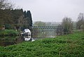 Boat by Barming Bridge - geograph.org.uk - 1265814.jpg 640 × 430 ; 71 kio
-
 Custumale Roffense Fleuron T098260-5.png 1 809 × 2 530 ; 173 kio
-

-
 1st Snowdrops of the Year - geograph.org.uk - 1137068.jpg 481 × 640 ; 134 kio
-
 East Barming - geograph.org.uk - 262.jpg 640 × 480 ; 81 kio
-

-
 Former Trolley Bus Terminus, East Barming - geograph.org.uk - 1331765.jpg 640 × 424 ; 77 kio
-
 Hall Place - geograph.org.uk - 1139206.jpg 640 × 481 ; 121 kio
-
 Land Use Change - geograph.org.uk - 779772.jpg 640 × 480 ; 138 kio
-
 Looking south across Barming Bridge - geograph.org.uk - 1265821.jpg 640 × 430 ; 111 kio
-
 North of Barming Heath - geograph.org.uk - 260.jpg 640 × 480 ; 76 kio
-
 Oaken Wood - geograph.org.uk - 147122.jpg 640 × 427 ; 74 kio
-
-
 Railway Bridge over South St - geograph.org.uk - 1265820.jpg 640 × 430 ; 108 kio
-
 Railway Bridge over South Street - geograph.org.uk - 1143981.jpg 640 × 481 ; 84 kio
-
 Railway building on the Medway Valley line - geograph.org.uk - 1265919.jpg 640 × 430 ; 82 kio
-
 River Medway - geograph.org.uk - 147101.jpg 640 × 427 ; 86 kio
-
 River Medway from Barming Bridge - geograph.org.uk - 66056.jpg 2 048 × 1 536 ; 695 kio
-
 St Helens Lane, Kettle Corner - geograph.org.uk - 1558147.jpg 640 × 480 ; 87 kio
-
 Water Tower, Barming Heath - geograph.org.uk - 1137037.jpg 640 × 481 ; 81 kio
-

-
 Beech Farm, West Farleigh - geograph.org.uk - 199519.jpg 1 024 × 768 ; 233 kio
-
 Farleigh Green - geograph.org.uk - 779740.jpg 640 × 480 ; 120 kio
-
 Farleigh Lane, Maidstone, Kent - geograph.org.uk - 187924.jpg 640 × 480 ; 265 kio
-
 Farleigh Lane, Maidstone, Kent - geograph.org.uk - 187931.jpg 640 × 480 ; 335 kio
-
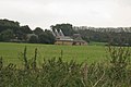
 Hall Place Farm and St Margaret's Church - geograph.org.uk - 147136.jpg 640 × 427 ; 64 kio
-
 Kentish Farm - geograph.org.uk - 194976.jpg 640 × 480 ; 72 kio
-
 Orchards in the Medway valley - geograph.org.uk - 162811.jpg 640 × 427 ; 131 kio
-
 Recreation Ground, Barming - geograph.org.uk - 22311.jpg 640 × 480 ; 88 kio
-
 The Good Intent - geograph.org.uk - 48910.jpg 1 967 × 1 368 ; 462 kio
_-_geograph.org.uk_-_1265813.jpg)


