Category:East European Plain
Vai alla navigazione
Vai alla ricerca
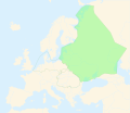
Pianura dell'Europa orientale   | |||||
| Carica un file multimediale | |||||
| Istanza di |
| ||||
|---|---|---|---|---|---|
| Parte di |
| ||||
| Luogo | Europa orientale | ||||
 | |||||
Sottocategorie
Questa categoria contiene le 4 sottocategorie indicate di seguito, su un totale di 4.
B
C
D
S
File nella categoria "East European Plain"
Questa categoria contiene 36 file, indicati di seguito, su un totale di 36.
-

-
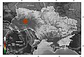
 Donets Ridge on the Map of Ukraine (English).jpg 1 400 × 954; 526 KB
-
 Europa voll flach.png 2 046 × 1 664; 3,1 MB
-
 Europe landforms East European Lowlands.svg 841 × 731; 481 KB
-
 European plain.png 800 × 651; 579 KB
-
 Karte der Landschaften der Osteuropäischen Ebene.png 2 046 × 1 664; 3,17 MB
-
 Lagekarte Baltischer Landrücken.png 1 473 × 1 198; 1 002 KB
-
 Lagekarte Dnepr-Becken.png 1 473 × 1 198; 1,58 MB
-
 Lagekarte Donezplatte.png 2 046 × 1 664; 2,96 MB
-
 Lagekarte Finnische Seenplatte.png 2 046 × 1 664; 2,96 MB
-
 Lagekarte Jergenihügel.png 2 046 × 1 664; 2,96 MB
-
 Lagekarte Kaspische Senke.png 2 046 × 1 664; 2,98 MB
-
 Lagekarte KaspischeSenke-sv.png 2 046 × 1 664; 2,98 MB
-
 Lagekarte Manytschniederung.png 2 046 × 1 664; 2,97 MB
-
 Lagekarte Mittelrussische Platte.png 2 046 × 1 664; 2,97 MB
-
 Lagekarte Moskauer Höhenrücken.png 2 046 × 1 664; 2,97 MB
-
 Lagekarte Nordrussischer Landrücken.png 2 046 × 1 664; 2,97 MB
-
 Lagekarte Nordrussisches Tiefland.png 2 046 × 1 664; 2,97 MB
-
 Lagekarte Palessje.png 2 046 × 1 664; 2,97 MB
-
 Lagekarte Podolische Platte.png 1 473 × 1 198; 1,04 MB
-
 Lagekarte Smolensker Höhen.png 2 046 × 1 664; 2,97 MB
-
 Lagekarte Timanrücken.png 2 046 × 1 664; 2,97 MB
-
 Lagekarte Waldaihöhen.png 2 046 × 1 664; 2,97 MB
-
 Lagekarte Weißrussischer Höhenrücken.png 2 046 × 1 664; 2,97 MB
-
 Lagekarte Wolgaplatte.png 2 046 × 1 664; 2,96 MB
-
 Ukraine Avratyn highland en.jpg 1 400 × 954; 734 KB
-
 Ukraine Dnieper highland en.jpg 1 400 × 954; 533 KB
-
 Ukraine Podolian highland en.jpg 1 400 × 954; 536 KB
-
 Ukraine Polissya depression en.jpg 1 400 × 954; 540 KB
-
 Ukraine Priazovska Highland.jpg 1 400 × 954; 687 KB
-
 Ukraine Pridniprovska nizovina.jpg 1 400 × 954; 709 KB
-
 Ukraine Slovechno-Ovruch highland en.jpg 1 400 × 954; 520 KB
-
 Ukraine Volin highland en.jpg 1 400 × 954; 531 KB
-
 Zakarpatye lowland.jpg 1 400 × 954; 637 KB
-
 Уфимское плато.JPG 4 000 × 3 000; 5,68 MB
-
 Юго-Восток физико географический.png 1 228 × 746; 1 MB
,_etc%27_(11149856616).jpg)
.jpg)


