Category:East Ferry
Aller à la navigation
Aller à la recherche
village britannique  | |||||
| Téléverser des médias | |||||
| Nature de l’élément | |||||
|---|---|---|---|---|---|
| Lieu | West Lindsey, Lincolnshire, Midlands de l'Est, Angleterre | ||||
 | |||||
Sous-catégories
Cette catégorie comprend 2 sous-catégories, dont les 2 ci-dessous.
E
- East Ferry War Memorial (4 F)
L
- Laughton Forest (33 F)
Média dans la catégorie « East Ferry »
Cette catégorie comprend 114 fichiers, dont les 114 ci-dessous.
-
 A bend in High Street - geograph.org.uk - 4177088.jpg 640 × 480 ; 66 kio
-
 A clearing in Laughton Forest - geograph.org.uk - 2338885.jpg 800 × 600 ; 281 kio
-
 A glimpse of the River Trent - geograph.org.uk - 4177092.jpg 640 × 480 ; 70 kio
-
 A minor road junction in Laughton Forest - geograph.org.uk - 2338915.jpg 800 × 600 ; 297 kio
-
 A track heading west to Laughton Forest - geograph.org.uk - 2340483.jpg 800 × 600 ; 303 kio
-
 A159 towards Gainsborough - geograph.org.uk - 3917662.jpg 640 × 480 ; 71 kio
-
 A159 towards Scunthorpe - geograph.org.uk - 3917656.jpg 640 × 480 ; 95 kio
-
 Barn Owston Ferry Isle of Axholme North Lincolnshire - geograph.org.uk - 5594076.jpg 4 608 × 3 456 ; 3,72 Mio
-
 Blocked track on East Ferry North Carrs - geograph.org.uk - 2445130.jpg 1 024 × 768 ; 187 kio
-
 Boat moored on the River Trent - geograph.org.uk - 5429653.jpg 800 × 540 ; 114 kio
-
 Bridleway across Scotton Common - geograph.org.uk - 2210535.jpg 1 024 × 768 ; 317 kio
-
 Clearing on Scotton Common - geograph.org.uk - 2210483.jpg 1 024 × 768 ; 140 kio
-
 Cross Trails in Laughton Forest - geograph.org.uk - 498922.jpg 640 × 480 ; 140 kio
-
 Crossing tracks on Scotton Common - geograph.org.uk - 5226071.jpg 1 024 × 768 ; 266 kio
-
 Crossing tracks on Scotton Common - geograph.org.uk - 5230317.jpg 1 024 × 768 ; 256 kio
-
 Cyclist on East Ferry Road - geograph.org.uk - 5402108.jpg 700 × 800 ; 161 kio
-
 Cyclists on East Ferry Road - geograph.org.uk - 5401922.jpg 800 × 684 ; 152 kio
-
 Cyclists on East Ferry Road - geograph.org.uk - 5424620.jpg 800 × 544 ; 153 kio
-
 Drain and sluice to the River Trent - geograph.org.uk - 3964827.jpg 3 088 × 2 056 ; 3,71 Mio
-
 Drainhead Farm next to the River Trent - geograph.org.uk - 5428679.jpg 800 × 639 ; 151 kio
-
 East Ferry - geograph.org.uk - 1060736.jpg 640 × 427 ; 65 kio
-
 East Ferry - geograph.org.uk - 2311960.jpg 1 280 × 959 ; 535 kio
-
 East Ferry by The River Trent - geograph.org.uk - 4713989.jpg 5 090 × 3 492 ; 5,44 Mio
-
 East Ferry Lincolnshire-Geograph-1679386-by-roger-geach.jpg 640 × 415 ; 52 kio
-
 East Ferry Road - geograph.org.uk - 3917631.jpg 640 × 480 ; 58 kio
-
 East Ferry Road - geograph.org.uk - 3917632.jpg 640 × 480 ; 79 kio
-
 East Ferry Road - geograph.org.uk - 3917638.jpg 640 × 480 ; 91 kio
-
 East Ferry Road - geograph.org.uk - 3963294.jpg 3 088 × 2 056 ; 2,59 Mio
-
 East Ferry Road - geograph.org.uk - 4177053.jpg 640 × 480 ; 51 kio
-
 East Ferry Road - geograph.org.uk - 4177060.jpg 640 × 480 ; 72 kio
-

-
 East Ferry Road in the Laughton Woods - geograph.org.uk - 5424619.jpg 800 × 600 ; 210 kio
-
 East Ferry Road next to the River Trent - geograph.org.uk - 5428665.jpg 800 × 563 ; 84 kio
-
 East Ferry Road towards East Ferry - geograph.org.uk - 5429612.jpg 800 × 463 ; 104 kio
-
 East Ferry Road towards Laughton - geograph.org.uk - 2338859.jpg 800 × 600 ; 305 kio
-
 East Ferry track - geograph.org.uk - 1060739.jpg 640 × 427 ; 62 kio
-
 East Ferry War Memorial - geograph.org.uk - 4177074.jpg 640 × 480 ; 94 kio
-
 Entering East Ferry - geograph.org.uk - 4177063.jpg 640 × 480 ; 62 kio
-
 Farm buildings East Ferry - geograph.org.uk - 4177070.jpg 640 × 480 ; 54 kio
-
 Farmland, Redgate Farm - geograph.org.uk - 3917629.jpg 640 × 480 ; 80 kio
-
 Flat farmland east of East Ferry - geograph.org.uk - 4177079.jpg 640 × 480 ; 54 kio
-
 Flat farmland near East Ferry - geograph.org.uk - 4177068.jpg 640 × 439 ; 54 kio
-
 Flat farmland near Ings Farm - geograph.org.uk - 4177049.jpg 640 × 385 ; 40 kio
-
 Flat farmland near the River Trent - geograph.org.uk - 4177085.jpg 640 × 480 ; 57 kio
-
 Flood Defence Bank - geograph.org.uk - 55331.jpg 640 × 480 ; 67 kio
-
 Footpath and Cycle Route - geograph.org.uk - 2235622.jpg 800 × 600 ; 397 kio
-
 Former R.A.F. Blyton, aerial 2014 - geograph.org.uk - 4100306.jpg 640 × 397 ; 42 kio
-
 High Street, East Ferry - geograph.org.uk - 4177072.jpg 640 × 480 ; 50 kio
-
 House on High Street, East Ferry - geograph.org.uk - 4177071.jpg 640 × 480 ; 58 kio
-
 Jenny Hern Pumping Station - geograph.org.uk - 142709.jpg 640 × 426 ; 112 kio
-
 Jenny Hern Pumping Station - geograph.org.uk - 143111.jpg 640 × 426 ; 79 kio
-
 Jetty on the River Trent - geograph.org.uk - 4177076.jpg 640 × 480 ; 62 kio
-
 Laughton Highland Drain - geograph.org.uk - 2118873.jpg 640 × 427 ; 99 kio
-
 Laughton Highland Drain - geograph.org.uk - 3967560.jpg 3 088 × 2 056 ; 4,34 Mio
-
 Laughton Highland Drain sluice - geograph.org.uk - 2118876.jpg 640 × 427 ; 78 kio
-
 Laughton Wood, aerial 2014 - geograph.org.uk - 3881891.jpg 1 024 × 683 ; 107 kio
-
 Laughton Woods - geograph.org.uk - 3917634.jpg 478 × 640 ; 95 kio
-
 Laughton Woods - geograph.org.uk - 3917636.jpg 478 × 640 ; 134 kio
-
 Laughton Woods - geograph.org.uk - 3917640.jpg 478 × 640 ; 105 kio
-
 Laughton Woods at Hardwick Hill - geograph.org.uk - 5424616.jpg 800 × 600 ; 234 kio
-
 Lone Tree - geograph.org.uk - 2447900.jpg 1 024 × 768 ; 123 kio
-
 Looking across the River Trent at Owston Ferry - geograph.org.uk - 6265589.jpg 4 000 × 3 000 ; 4,99 Mio
-
 Looking across the River Trent at Owston Ferry - geograph.org.uk - 6265591.jpg 4 000 × 3 000 ; 4,89 Mio
-
 Minor road heading east from East Ferry - geograph.org.uk - 4177082.jpg 640 × 480 ; 80 kio
-
 Old Mill near Drain Head Farm - geograph.org.uk - 142789.jpg 640 × 480 ; 106 kio
-
 Overgrown drain, East Ferry South Carr - geograph.org.uk - 2445097.jpg 1 024 × 768 ; 230 kio
-
 Owston Ferry Mill and the River Trent - geograph.org.uk - 5429667.jpg 800 × 479 ; 98 kio
-
 Owston Ferry, aerial - geograph.org.uk - 3096163.jpg 640 × 427 ; 68 kio
-
 Parting rides - geograph.org.uk - 2210470.jpg 1 024 × 768 ; 257 kio
-
 Path into woodland - geograph.org.uk - 3917653.jpg 640 × 480 ; 125 kio
-
 Pen in the woods - geograph.org.uk - 2210290.jpg 1 024 × 768 ; 198 kio
-
 Pheasant feeder by South Carr Drain - geograph.org.uk - 1291064.jpg 640 × 480 ; 248 kio
-
 Pin Hill on East Ferry Road near Laughton - geograph.org.uk - 2338892.jpg 800 × 600 ; 340 kio
-
 Rainford's Corner - geograph.org.uk - 3917654.jpg 640 × 480 ; 114 kio
-
 Redgate Farm Labourers' Cottages - geograph.org.uk - 2219608.jpg 500 × 375 ; 81 kio
-
 Ride on Scotton Common - geograph.org.uk - 5230566.jpg 1 024 × 768 ; 271 kio
-
 Ride through Laughton Wood - geograph.org.uk - 2210542.jpg 1 024 × 768 ; 172 kio
-
 River Trent - geograph.org.uk - 143118.jpg 640 × 426 ; 91 kio
-
 River Trent at Owston Ferry - geograph.org.uk - 4762217.jpg 3 072 × 1 728 ; 3,2 Mio
-
 River Trent flood bank - geograph.org.uk - 4177058.jpg 640 × 480 ; 87 kio
-
 River Trent flood bank - geograph.org.uk - 4177077.jpg 640 × 480 ; 77 kio
-
 River Trent flood bank - geograph.org.uk - 4177094.jpg 640 × 480 ; 67 kio
-
 River Trent flood defences at East Ferry - geograph.org.uk - 5429672.jpg 800 × 514 ; 90 kio
-
 River Trent near Owston Ferry - geograph.org.uk - 4177055.jpg 640 × 480 ; 79 kio
-
 River Trent to Jenny Hurn Pump - geograph.org.uk - 1250526.jpg 640 × 480 ; 59 kio
-
 River Trent towards Owston Ferry - geograph.org.uk - 3963281.jpg 3 088 × 2 056 ; 2,12 Mio
-
 Scotton common. - geograph.org.uk - 5098242.jpg 640 × 480 ; 131 kio
-
 Showers not far away - geograph.org.uk - 1312550.jpg 640 × 427 ; 52 kio
-
 South Carr, East Ferry 1 - geograph.org.uk - 1291050.jpg 640 × 480 ; 218 kio
-
 South Carr, East Ferry 2 - geograph.org.uk - 1291053.jpg 640 × 480 ; 227 kio
-
 South Carr, East Ferry 3 - geograph.org.uk - 1291067.jpg 640 × 480 ; 204 kio
-
 The High Street in East Ferry - geograph.org.uk - 5402127.jpg 713 × 800 ; 266 kio
-
 The river Trent and countryside - geograph.org.uk - 1312541.jpg 640 × 427 ; 66 kio
-
 The road to Hardwick Grange Farm - geograph.org.uk - 2682701.jpg 1 024 × 768 ; 265 kio
-
 Track in Laughton Woods - geograph.org.uk - 3917649.jpg 640 × 480 ; 133 kio
-
 Track through Laughton Wood - geograph.org.uk - 2210538.jpg 1 024 × 768 ; 173 kio
-
 Track through Laughton Woods - geograph.org.uk - 3917650.jpg 640 × 480 ; 106 kio
-
 Track through Laughton Woods, Scotton Common - geograph.org.uk - 3917642.jpg 640 × 480 ; 101 kio
-
 Track through woodland, Scotton Common - geograph.org.uk - 3917646.jpg 640 × 480 ; 107 kio
-
 Track to Hardwick Grange Farm - geograph.org.uk - 3917635.jpg 640 × 480 ; 92 kio
-
 Track to Hardwick Grange Farm - geograph.org.uk - 3962682.jpg 4 272 × 2 848 ; 7,73 Mio
-
 Trent view - geograph.org.uk - 1060945.jpg 640 × 427 ; 57 kio
-
 Trisantona II - geograph.org.uk - 2118270.jpg 640 × 427 ; 98 kio
-
 Unnamed Road towards Laughton Woods - geograph.org.uk - 3967553.jpg 2 976 × 1 981 ; 4,34 Mio
-
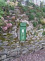 Victorian postbox at East Ferry - geograph.org.uk - 1417534.jpg 480 × 640 ; 383 kio
-
 View across The Trent to East Ferry - geograph.org.uk - 4713985.jpg 3 849 × 5 050 ; 5,27 Mio
-
 View towards Kelfield Grange and Ings Farm - geograph.org.uk - 2445121.jpg 1 024 × 768 ; 154 kio
-
 War memorial at East Ferry - geograph.org.uk - 5429646.jpg 677 × 800 ; 191 kio
-
 Warping Drain Owston Ferry - geograph.org.uk - 711599.jpg 640 × 480 ; 87 kio
-
 Waterlogged ride - geograph.org.uk - 5230574.jpg 1 024 × 768 ; 310 kio
-
 Woodland Track - geograph.org.uk - 3962455.jpg 2 774 × 4 161 ; 6,02 Mio
-
 Woodland track. - geograph.org.uk - 5098237.jpg 640 × 480 ; 123 kio
-
 Woodland, Scotton Common - geograph.org.uk - 3917644.jpg 480 × 640 ; 92 kio
-
 East Ferry - geograph.org.uk - 58226.jpg 640 × 427 ; 64 kio


