Category:East Garston
Aller à la navigation
Aller à la recherche
English: Images of East Garston, Berkshire, England. For more details see East Garston.
village britannique Aug2006.jpg) | |||||
| Téléverser des médias | |||||
| Nature de l’élément | |||||
|---|---|---|---|---|---|
| Lieu | West Berkshire, Berkshire, Angleterre du Sud-Est, Angleterre | ||||
| Population |
| ||||
| Superficie |
| ||||
| site officiel | |||||
 | |||||
Sous-catégories
Cette catégorie comprend 2 sous-catégories, dont les 2 ci-dessous.
A
E
- East Garston War Memorial (2 F)
Média dans la catégorie « East Garston »
Cette catégorie comprend 162 fichiers, dont les 162 ci-dessous.
-
 1 mile to Junction 14, M4 - geograph.org.uk - 3351972.jpg 640 × 286 ; 40 kio
-
 At the brow of Gold Hill - geograph.org.uk - 5807274.jpg 1 024 × 763 ; 257 kio
-
 B4000 angles back towards Ermin Street - geograph.org.uk - 3067811.jpg 3 648 × 2 736 ; 2,04 Mio
-
 B4000 junction with Goodings Lane - geograph.org.uk - 3067816.jpg 3 586 × 2 669 ; 1,56 Mio
-
 Bay Tree Cottage, East Garston, Berkshire - geograph.org.uk - 4528259.jpg 800 × 588 ; 163 kio
-
 Bridge over the M4 - geograph.org.uk - 3655759.jpg 640 × 430 ; 27 kio
-
 Bridges over the River Lambourn, East Garston, Berkshire.jpg 2 048 × 1 536 ; 1,57 Mio
-
 Buildings at Pounds Farm - geograph.org.uk - 6032033.jpg 4 956 × 3 001 ; 3,46 Mio
-
 Bus stops on Hillside, East Garston - geograph.org.uk - 3394557.jpg 3 403 × 2 452 ; 1,27 Mio
-
 Buttressed wall and entrance to house at Poughley Farm - geograph.org.uk - 3012282.jpg 2 560 × 1 920 ; 1,13 Mio
-
 Byway and farmland, East Garston - geograph.org.uk - 4373379.jpg 640 × 480 ; 214 kio
-
 Byway near Maidencourt Farm - geograph.org.uk - 5462065.jpg 3 888 × 2 592 ; 2,95 Mio
-
 Byway, East Garston - geograph.org.uk - 893104.jpg 640 × 480 ; 133 kio
-
 Chair in Blunsdon's Copse - geograph.org.uk - 5248416.jpg 1 200 × 1 600 ; 1,03 Mio
-
 Cherry Cottage, East Garston, Berkshire - geograph.org.uk - 4532394.jpg 1 600 × 1 159 ; 485 kio
-
 Cloud patterns, East Garston, Berkshire - geograph.org.uk - 4453639.jpg 800 × 497 ; 68 kio
-
 Cornbaggers, East Garston, Berkshire - geograph.org.uk - 4523686.jpg 1 600 × 1 064 ; 677 kio
-
 Cottage, East Garston, Berkshire - geograph.org.uk - 4522839.jpg 572 × 640 ; 165 kio
-
 Cottages, East Garston - geograph.org.uk - 4191679.jpg 640 × 480 ; 137 kio
-
 Dew Pond in the Valley - geograph.org.uk - 4928789.jpg 1 024 × 744 ; 275 kio
-
 Dismantled Railway - geograph.org.uk - 3292383.jpg 640 × 480 ; 135 kio
-
 Dismantled Railway - geograph.org.uk - 3292390.jpg 640 × 480 ; 140 kio
-
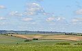
 Downland Farming near East Garston - geograph.org.uk - 6052319.jpg 5 152 × 3 864 ; 2,66 Mio
-
 Downland Fields at Old Warren - geograph.org.uk - 3371370.jpg 2 391 × 1 713 ; 747 kio
-
 Downland, East Garston, Berkshire - geograph.org.uk - 4450265.jpg 610 × 800 ; 92 kio
-
 Downland, East Garston, Berkshire - geograph.org.uk - 4523650.jpg 800 × 502 ; 107 kio
-
 Dry River Lambourn, East Garston, Berkshire.jpg 2 592 × 1 944 ; 2,13 Mio
-
 East Garston - geograph.org.uk - 230173.jpg 640 × 478 ; 161 kio
-
 East Garston - geograph.org.uk - 2316481.jpg 3 888 × 2 592 ; 1,43 Mio
-
 East Garston back road. - geograph.org.uk - 1354966.jpg 640 × 480 ; 61 kio
-
 East Garston Down, East Garston, Berkshire.jpg 2 592 × 1 944 ; 1,61 Mio
-
 East Garston in October - geograph.org.uk - 5937876.jpg 768 × 1 024 ; 271 kio
-
 East Garston station site geograph-3444028-by-Ben-Brooksbank.jpg 2 395 × 1 575 ; 3,7 Mio
-
 East Garston, Back Street - geograph.org.uk - 5943011.jpg 775 × 1 024 ; 180 kio
-
 East Garston, cottages in Station Road - geograph.org.uk - 5943213.jpg 748 × 1 024 ; 177 kio
-
 East Garston, stream-bed of the Lambourn, October 2018 - geograph.org.uk - 5940723.jpg 765 × 1 024 ; 335 kio
-
 Eastbound M4 Approaching Junction 14 - geograph.org.uk - 3415264.jpg 640 × 480 ; 384 kio
-
 Eastbound M4, Exit Sliproad at Junction 14 - geograph.org.uk - 3415266.jpg 640 × 480 ; 386 kio
-
 Eastbury Bottom - geograph.org.uk - 1550299.jpg 640 × 425 ; 189 kio
-
 EastGarstonCottages(AndrewSmith)Aug2006.jpg 640 × 478 ; 156 kio
-
 Farm Road on Warren Down - geograph.org.uk - 5033677.jpg 4 000 × 3 000 ; 2,04 Mio
-
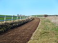
 Farm track above East Garston - geograph.org.uk - 887515.jpg 640 × 480 ; 135 kio
-
 Farmland above East Garston - geograph.org.uk - 230241.jpg 640 × 480 ; 167 kio
-
 Farmland at Jimmy's Farm - geograph.org.uk - 230232.jpg 640 × 480 ; 168 kio
-
 Farmland near Great Shefford - geograph.org.uk - 5462093.jpg 3 888 × 2 592 ; 4,43 Mio
-
 Farmland, approaching Dore's Farm - geograph.org.uk - 230109.jpg 640 × 478 ; 173 kio
-
 Farmland, East Garston - geograph.org.uk - 230155.jpg 640 × 478 ; 135 kio
-
 Farmland, East Garston - geograph.org.uk - 2845003.jpg 640 × 480 ; 147 kio
-
 Farmland, East Garston - geograph.org.uk - 2845018.jpg 640 × 480 ; 125 kio
-
 Farmland, East Garston - geograph.org.uk - 4373376.jpg 640 × 480 ; 185 kio
-
 Farmland, East Garston - geograph.org.uk - 4373454.jpg 640 × 480 ; 179 kio
-
 Farmland, East Garston - geograph.org.uk - 497738.jpg 640 × 480 ; 237 kio
-
 Farmland, East Garston - geograph.org.uk - 6080529.jpg 1 024 × 768 ; 286 kio
-
 Farmland, East Garston - geograph.org.uk - 6190334.jpg 1 024 × 683 ; 229 kio
-
 Farmland, East Garston - geograph.org.uk - 893025.jpg 640 × 480 ; 169 kio
-
 Farmland, Fawley - geograph.org.uk - 6190328.jpg 1 024 × 683 ; 220 kio
-
 Fencepost, Signpost and Old Ploughshare - geograph.org.uk - 6032274.jpg 5 152 × 3 864 ; 5,07 Mio
-
 Field of wheat - geograph.org.uk - 3983896.jpg 640 × 480 ; 112 kio
-
 Fields near Eastbury Grange - geograph.org.uk - 6034046.jpg 1 600 × 1 200 ; 572 kio
-
 Footpath by Old Warren - geograph.org.uk - 2205509.jpg 640 × 480 ; 84 kio
-
 Footpath near Eastbury Grange - geograph.org.uk - 6034054.jpg 4 943 × 3 401 ; 2,98 Mio
-
 Footpath to Fawley - geograph.org.uk - 2205490.jpg 640 × 480 ; 86 kio
-
 Footpath to Old Warren - geograph.org.uk - 2205473.jpg 640 × 480 ; 112 kio
-
 Footpath, East Garston, Berkshire - geograph.org.uk - 4450258.jpg 800 × 598 ; 240 kio
-
 Front Street, East Garston, Berkshire - geograph.org.uk - 4533383.jpg 1 600 × 1 104 ; 545 kio
-
 Gate on the Horseway - geograph.org.uk - 6032428.jpg 4 712 × 3 285 ; 1,63 Mio
-
 Goodings Lane, East Garston - geograph.org.uk - 3012266.jpg 2 560 × 1 920 ; 1,11 Mio
-
 Grassland, East Garston - geograph.org.uk - 2223630.jpg 640 × 427 ; 141 kio
-
 Hillside passes River Mead - geograph.org.uk - 3394559.jpg 3 146 × 2 338 ; 1,02 Mio
-
 House Hill - geograph.org.uk - 2309584.jpg 640 × 480 ; 106 kio
-
 Ivy on a Pole - geograph.org.uk - 4251424.jpg 1 600 × 1 041 ; 312 kio
-
 Jimmies Farm, East Garston - geograph.org.uk - 6055044.jpg 4 483 × 2 786 ; 1,49 Mio
-
 Lane north of East Garston - geograph.org.uk - 6055041.jpg 4 330 × 2 965 ; 1,93 Mio
-
 Lone Barry Farm - geograph.org.uk - 893082.jpg 640 × 480 ; 167 kio
-
 Looking south from Pounds Farm, East Garsten, Berkshire.jpg 2 048 × 1 536 ; 776 kio
-
 Lorne Hill Farm - geograph.org.uk - 2312497.jpg 3 704 × 2 592 ; 1,2 Mio
-
 M4 looking east from road bridge near Poughley Farm - geograph.org.uk - 3012289.jpg 2 560 × 1 920 ; 1,1 Mio
-
 M4 Road bridge - geograph.org.uk - 3636504.jpg 2 289 × 1 431 ; 1,48 Mio
-
 M4 roadbridge - Poughley - geograph.org.uk - 2507888.jpg 3 648 × 2 736 ; 1,3 Mio
-
 M4 towards London - geograph.org.uk - 4220848.jpg 640 × 480 ; 138 kio
-
 M4 westbound at Knight's Farm - geograph.org.uk - 4240163.jpg 640 × 480 ; 40 kio
-
 M4 westbound, wild animals for 13 miles - geograph.org.uk - 3636417.jpg 2 232 × 1 416 ; 1,72 Mio
-
 M4, Poughley - geograph.org.uk - 3415260.jpg 640 × 480 ; 366 kio
-
 Motorway bridge near Poughley - geograph.org.uk - 2293114.jpg 640 × 306 ; 37 kio
-
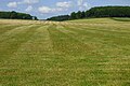
 Mowing the gallops, East Garston, Berkshire - geograph.org.uk - 4450271.jpg 626 × 800 ; 107 kio
-
 Newbury Road southwest of Maidencourt Farm - geograph.org.uk - 3394558.jpg 3 432 × 2 638 ; 1,23 Mio
-
 Oats, East Garston - geograph.org.uk - 887503.jpg 640 × 480 ; 131 kio
-
 Oats, East Garston - geograph.org.uk - 892986.jpg 640 × 480 ; 138 kio
-
 Oats, East Garston - geograph.org.uk - 893038.jpg 640 × 480 ; 125 kio
-
 Old railway, East Garston - geograph.org.uk - 230182.jpg 478 × 640 ; 203 kio
-
 Pasture, East Garston - geograph.org.uk - 4373545.jpg 640 × 480 ; 152 kio
-
 Path heading towards East Garston - geograph.org.uk - 3292408.jpg 640 × 480 ; 82 kio
-
 Path to Dore's Farm - geograph.org.uk - 6418156.jpg 5 096 × 3 215 ; 2,3 Mio
-
 Pound's Farm House, East Garston, Berkshire - geograph.org.uk - 4450260.jpg 800 × 660 ; 205 kio
-
 Racehorse Gallop, East Garston - geograph.org.uk - 6032436.jpg 5 152 × 3 864 ; 3,14 Mio
-
 Restricted Byway (with restrictions) - geograph.org.uk - 6032494.jpg 3 590 × 2 602 ; 1,32 Mio
-
 Restricted Byway - geograph.org.uk - 2206235.jpg 640 × 480 ; 82 kio
-
 Riding up the lane - geograph.org.uk - 6055050.jpg 3 603 × 2 252 ; 1 013 kio
-
 River Lambourn - geograph.org.uk - 3292401.jpg 640 × 480 ; 127 kio
-
 River Lambourn - geograph.org.uk - 3292415.jpg 640 × 480 ; 150 kio
-
 River Lambourn at East Garston - geograph.org.uk - 2321911.jpg 1 600 × 1 200 ; 539 kio
-
 River Lambourn in East Garston, Berkshire.jpg 4 896 × 2 752 ; 5,5 Mio
-
 River Lambourn, East Garston, Berkshire.jpg 2 048 × 1 536 ; 1,37 Mio
-
 Road to Old Warren - geograph.org.uk - 3371383.jpg 2 560 × 1 920 ; 1,63 Mio
-
 Roller at Lower Poughley - geograph.org.uk - 5248395.jpg 3 546 × 2 693 ; 2,15 Mio
-
 Roller, Fence and Pole - geograph.org.uk - 6032259.jpg 3 864 × 4 338 ; 1,67 Mio
-
 Site of an old bridge - geograph.org.uk - 4251425.jpg 1 600 × 1 018 ; 419 kio
-
 Small Pool in a Field - geograph.org.uk - 6418162.jpg 5 472 × 3 648 ; 2,61 Mio
-
 The Lambourn at Maidencourt Farm - geograph.org.uk - 5462010.jpg 3 645 × 2 592 ; 3,28 Mio
-
 The road to Pounds Farm - geograph.org.uk - 6052314.jpg 4 874 × 3 369 ; 2,66 Mio
-
 Towards Warren Farm - geograph.org.uk - 1550302.jpg 640 × 427 ; 181 kio
-
 Track and farmland, East Garston - geograph.org.uk - 2844992.jpg 640 × 480 ; 145 kio
-
 Track and farmland, East Garston - geograph.org.uk - 2844998.jpg 640 × 480 ; 204 kio
-
 Track and farmland, East Garston - geograph.org.uk - 2845006.jpg 640 × 480 ; 116 kio
-
 Track near Old Warren - geograph.org.uk - 1550305.jpg 640 × 426 ; 187 kio
-
 Track, Fences, Grass - geograph.org.uk - 6032268.jpg 4 985 × 3 189 ; 1,84 Mio
-

-

-
 Trees by a Track - geograph.org.uk - 5461981.jpg 3 888 × 2 592 ; 2,95 Mio
-
 View towards Cranes Copse - geograph.org.uk - 3026145.jpg 4 592 × 3 056 ; 4,58 Mio
-
 Village house, East Garston, Berkshire - geograph.org.uk - 4522800.jpg 800 × 542 ; 124 kio
-
 West Berkshire , M4 Motorway - geograph.org.uk - 5725419.jpg 6 000 × 4 000 ; 7,35 Mio
-
 West Berkshire , M4 Motorway - geograph.org.uk - 5725420.jpg 5 716 × 3 811 ; 6,16 Mio
-
 West Berkshire , M4 Motorway - geograph.org.uk - 5725421.jpg 5 821 × 3 881 ; 6,89 Mio
-
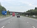
 Westbound M4 - geograph.org.uk - 6373564.jpg 1 024 × 512 ; 135 kio
-
 Westbound M4 - geograph.org.uk - 6375313.jpg 1 024 × 512 ; 134 kio
-
 What's left of the Lambourn - geograph.org.uk - 4252029.jpg 1 600 × 1 292 ; 618 kio
-
 Wheat Field, Maidencourt Farm - geograph.org.uk - 5462003.jpg 3 888 × 2 592 ; 3,12 Mio
-
 Wheat, East Garston - geograph.org.uk - 893119.jpg 640 × 480 ; 149 kio
-
 Wheat, East Garston - geograph.org.uk - 893122.jpg 640 × 480 ; 157 kio
-
 Winter Fields at Pounds Farm - geograph.org.uk - 6032029.jpg 1 600 × 926 ; 337 kio
-
 Woodland, East Garston - geograph.org.uk - 2844076.jpg 640 × 480 ; 178 kio
-
 Above Fieldridge Lane - geograph.org.uk - 230089.jpg 640 × 478 ; 154 kio
-
 Beeches, Pound's Farm - geograph.org.uk - 228698.jpg 480 × 640 ; 207 kio
-
 Below Potter's Cottage - geograph.org.uk - 230097.jpg 640 × 478 ; 159 kio
-
 Beside Fieldridge Lane - geograph.org.uk - 230079.jpg 640 × 478 ; 168 kio
-

-
 Bottom Copse - geograph.org.uk - 230132.jpg 640 × 478 ; 149 kio
-
 Downland near Eastbury - geograph.org.uk - 228692.jpg 640 × 480 ; 143 kio
-
 Downs, East Garston - geograph.org.uk - 230233.jpg 640 × 480 ; 131 kio
-
 East Garston trig - geograph.org.uk - 708123.jpg 640 × 480 ; 92 kio
-
 Eastbury Down - geograph.org.uk - 228693.jpg 640 × 480 ; 196 kio
-
 Farmland above East Garston - geograph.org.uk - 230242.jpg 640 × 480 ; 143 kio
-
 Farmland above East Garston - geograph.org.uk - 230243.jpg 640 × 480 ; 161 kio
-
 Farmland between Shefford and East Garston - geograph.org.uk - 230019.jpg 640 × 478 ; 196 kio
-
 Farmland, Coldborough - geograph.org.uk - 230185.jpg 640 × 478 ; 165 kio
-
 Fisher's Farm - geograph.org.uk - 118177.jpg 640 × 481 ; 51 kio
-
 From Fieldridge Lane - geograph.org.uk - 230064.jpg 640 × 478 ; 135 kio
-
 Furze Border - geograph.org.uk - 230234.jpg 640 × 480 ; 145 kio
-
 Gallop, East Garston Down - geograph.org.uk - 230230.jpg 640 × 480 ; 164 kio
-
 In a valley near East Garston - geograph.org.uk - 230105.jpg 640 × 478 ; 152 kio
-
 Lambourn valley farmland - geograph.org.uk - 230029.jpg 640 × 478 ; 178 kio
-
 Lane, Eastbury Fields - geograph.org.uk - 230227.jpg 640 × 480 ; 148 kio
-
 Near South Hidden Farm - geograph.org.uk - 230033.jpg 640 × 478 ; 190 kio
-
 Near South Hidden Farm - geograph.org.uk - 230040.jpg 640 × 478 ; 119 kio
-
 Pastures, East Garston Woodlands - geograph.org.uk - 230112.jpg 640 × 478 ; 169 kio
-
 Pound's Farmhouse - geograph.org.uk - 228702.jpg 640 × 480 ; 191 kio
-
 Track above Jimmy's Farm - geograph.org.uk - 230231.jpg 480 × 640 ; 151 kio
-
 Valley above Wesfield Farm - geograph.org.uk - 230160.jpg 640 × 478 ; 128 kio
-
 Westfield Farm - geograph.org.uk - 230163.jpg 640 × 478 ; 167 kio
-
 Winterdown Bottom - geograph.org.uk - 230229.jpg 640 × 480 ; 140 kio
-
 Woodland, East Garston Woodlands - geograph.org.uk - 230117.jpg 640 × 478 ; 167 kio


Aug2006.jpg)


_-_geograph.org.uk_-_6032494.jpg)


