Category:East Layton
Aller à la navigation
Aller à la recherche
localité britannique du comté anglais de North Yorkshire  | |||||
| Téléverser des médias | |||||
| Nature de l’élément | |||||
|---|---|---|---|---|---|
| Lieu | Richmond, Yorkshire du Nord, Yorkshire-et-Humber, Angleterre | ||||
 | |||||
English: East Layton is a village and civil parish in the Richmondshire district of North Yorkshire, England, close to the border with County Durham and a few miles west of Darlington.
Sous-catégories
Cette catégorie comprend seulement la sous-catégorie ci-dessous.
C
- Christ Church, East Layton (3 F)
Média dans la catégorie « East Layton »
Cette catégorie comprend 34 fichiers, dont les 34 ci-dessous.
-
 Bench Mark, Greenless Lane - geograph.org.uk - 2537640.jpg 480 × 640 ; 109 kio
-
 Bridleway signpost, at the entrance to Brancas Farm - geograph.org.uk - 5311349.jpg 1 024 × 768 ; 180 kio
-
 Burnt House, with new plantation - geograph.org.uk - 2179838.jpg 3 840 × 2 880 ; 1,43 Mio
-
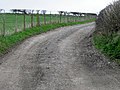 Driveway near Caldwell - geograph.org.uk - 2537848.jpg 640 × 480 ; 99 kio
-
 East Layton Parish Church - geograph.org.uk - 3666704.jpg 2 880 × 3 520 ; 2,44 Mio
-
 East Layton Quoits and Social Club - geograph.org.uk - 3668825.jpg 4 000 × 2 000 ; 1,24 Mio
-
 Farm Buildings at entrance to East Layton - geograph.org.uk - 4463386.jpg 4 000 × 2 666 ; 2,81 Mio
-
 Farm buildings at Layton Fields - geograph.org.uk - 5311337.jpg 1 024 × 768 ; 134 kio
-
 Farmland west of New House - geograph.org.uk - 5311353.jpg 1 024 × 768 ; 176 kio
-
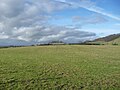
 Farmland, East Layton - geograph.org.uk - 2675416.jpg 640 × 480 ; 167 kio
-
 Farmland, East Layton - geograph.org.uk - 2758896.jpg 640 × 480 ; 162 kio
-
 Farmland, East Layton - geograph.org.uk - 2758900.jpg 640 × 480 ; 159 kio
-
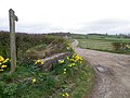
 Gate Entrance , Dated 1886. - geograph.org.uk - 168664.jpg 640 × 479 ; 103 kio
-
 Gate, Greenless Lane - geograph.org.uk - 2537659.jpg 640 × 481 ; 99 kio
-
 Greenless Lane, north of Brancas Farm - geograph.org.uk - 5311358.jpg 1 024 × 614 ; 102 kio
-
 Lambing time near Caldwell - geograph.org.uk - 2537543.jpg 640 × 480 ; 109 kio
-
 Mainsgill Farm - geograph.org.uk - 3108832.jpg 640 × 430 ; 31 kio
-
 Milk churn stand, Greenless Lane - geograph.org.uk - 2537793.jpg 640 × 480 ; 79 kio
-
 New House Farm - geograph.org.uk - 4463357.jpg 4 000 × 2 667 ; 1,94 Mio
-
 Pasture and farm road, East Layton - geograph.org.uk - 2675358.jpg 640 × 480 ; 143 kio
-
 Pasture near Caldwell - geograph.org.uk - 2536355.jpg 640 × 480 ; 91 kio
-
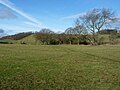
 Rural scene near East Layton - geograph.org.uk - 5585773.jpg 4 320 × 2 808 ; 2,67 Mio
-
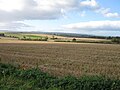 Stubble field - geograph.org.uk - 4733287.jpg 640 × 480 ; 74 kio
-
 The track to New House - geograph.org.uk - 5311316.jpg 1 024 × 768 ; 141 kio
-
 Tree on a field boundary, north-west of Brancas Farm - geograph.org.uk - 5312487.jpg 1 024 × 768 ; 106 kio
-
 Tree on a parish boundary north-east of New House - geograph.org.uk - 5311320.jpg 1 024 × 615 ; 83 kio
-
 Trees along Caldwell Beck - geograph.org.uk - 5311333.jpg 1 024 × 768 ; 150 kio
-
 Trees and shrubs along Caldwell Beck - geograph.org.uk - 5311328.jpg 1 024 × 769 ; 193 kio
-
 West Lane to West Layton - geograph.org.uk - 5585766.jpg 4 114 × 2 959 ; 3,86 Mio
-
 West Lane. - geograph.org.uk - 184010.jpg 640 × 479 ; 113 kio
-
 Winter food - geograph.org.uk - 2179855.jpg 4 320 × 3 240 ; 5,15 Mio
-
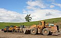 Muckshifters machinery Forcett. - geograph.org.uk - 499407.jpg 640 × 399 ; 97 kio
-
 Violet Grange Farm. - geograph.org.uk - 159989.jpg 640 × 292 ; 68 kio
-
 West Lane , East Layton - geograph.org.uk - 259980.jpg 640 × 479 ; 119 kio


