Category:Eastbourne
Hopp til navigering
Hopp til søk
town in East Sussex, England  | |||||
| Last opp mediefiler | |||||
| Forekomst av | |||||
|---|---|---|---|---|---|
| Plassering | Eastbourne, East Sussex, Sørøst-England, England | ||||
| Folketall |
| ||||
| Areal |
| ||||
| Høyde over havet |
| ||||
| Forskjellig fra | |||||
| offisielt nettsted | |||||
 | |||||

Eastbourne is a town in East Sussex, England.
Underkategorier
Denne kategorien har følgende 35 underkategorier, av totalt 35.
- 2015 in Eastbourne (8 filer)
- 2016 in Eastbourne (9 filer)
- Maps of Eastbourne (11 filer)
- Eastbourne in art (6 filer)
B
- Bowl barrow 150m south of Well Combe (4 filer)
- Bowl barrow 200m south-east of Well Combe (3 filer)
- Bowl barrow west of Well Combe (2 filer)
C
- Cross dyke on Pashley Hill (6 filer)
E
- Eastbourne College (5 filer)
- Eastbourne Miniature Steam Railway (16 filer)
- Eastbourne Redoubt (26 filer)
H
- Hawthorns Eastbourne Retirement Home (7 filer)
- Hodcombe Farm, Eastbourne (19 filer)
O
P
- Princes Park, Eastbourne (20 filer)
R
- Royal Eastbourne Golf Club (3 filer)
S
T
- Towner Gallery (1 side, 8 filer)
W
- Eastbourne Wastewater Treatment Works (8 filer)
Filer i kategorien «Eastbourne»
Følgende 200 filer er i denne kategorien, av totalt 4 528.
(forrige side) (neste side)-
 "Little Chelsea", Eastbourne - geograph.org.uk - 2268064.jpg 640 × 480; 77 KB
-
 "The Spyglass" - geograph.org.uk - 6262498.jpg 640 × 480; 247 KB
-
 "Wedderburn Rd 472534" sub-station - geograph.org.uk - 1883467.jpg 640 × 428; 110 KB
-
 "What unearthed" - geograph.org.uk - 6262500.jpg 480 × 640; 237 KB
-
 'Angela's', gift shop, Eastbourne - geograph.org.uk - 3447660.jpg 1 600 × 1 180; 319 KB
-
 'Barbers Jazz fm', Hampden Park, Eastbourne - geograph.org.uk - 3061926.jpg 1 600 × 1 171; 320 KB
-
 'Fantasia' pavilion, Eastbourne Pier, 2009 - geograph.org.uk - 6502733.jpg 1 024 × 685; 346 KB
-
 'Save the Stripes' walk to Beachy Head, 2017 - geograph.org.uk - 5798312.jpg 3 264 × 2 448; 3,15 MB
-
 'Sea View' apartments, Eastbourne - geograph.org.uk - 3538220.jpg 1 295 × 1 600; 430 KB
-
 'Z Bends' Parking Sign Eastbourne Downland - geograph.org.uk - 6211117.jpg 3 648 × 2 736; 1,47 MB
-
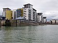
 1, Harbour Quay - geograph.org.uk - 5939549.jpg 3 000 × 4 000; 1,58 MB
-
 1-5 Sandwich Mews - geograph.org.uk - 4409648.jpg 3 540 × 2 655; 1,62 MB
-
 1-5 Sandwich Mews - geograph.org.uk - 4409650.jpg 5 329 × 2 840; 2,36 MB
-
 1-5 Sandwich Mews - geograph.org.uk - 4409651.jpg 2 670 × 3 560; 2,14 MB
-
 10 Claremont - geograph.org.uk - 2731823.jpg 480 × 640; 63 KB
-
 101-117 South St, Eastbourne.jpg 4 608 × 3 456; 3,86 MB
-
 101-119 South St, Eastbourne.jpg 4 608 × 3 456; 4,16 MB
-
 10943966273 - Flickr - flintman45.jpg 5 131 × 3 367; 11,01 MB
-
 Lower South Street, Eastbourne, Sussex (1862).jpg 1 048 × 667; 122 KB
-
 Caffyns 12 The Colonnade, Eastbourne, 1904.jpg 1 886 × 1 133; 361 KB
-
 2 Lieutenant James Hope Nelson (8115561772).jpg 579 × 800; 48 KB
-
 20, St Leonard's Place - geograph.org.uk - 4430972.jpg 1 620 × 1 080; 1,06 MB
-
 2nd Royal Sussex Regiment monument, Eastbourne - geograph.org.uk - 6320600.jpg 1 280 × 1 059; 930 KB
-
 44 The Goffs - geograph.org.uk - 2498300.jpg 480 × 640; 180 KB
-
 4th Sussex Battery memorial - geograph.org.uk - 6322795.jpg 1 280 × 1 619; 1,58 MB
-
 6-a Brita Esperanto-Kongreso Eastbourne 1913.jpg 954 × 894; 372 KB
-
 68 Pound Cannon outside the Redoubt Fortress, Eastbourne - geograph.org.uk - 3938463.jpg 4 896 × 3 672; 6,69 MB
-
 71-75, Pevensey Bay Road - geograph.org.uk - 4453879.jpg 4 000 × 3 000; 3,82 MB
-
 A 259 descent into Eastbourne - geograph.org.uk - 3134692.jpg 3 264 × 2 448; 3,56 MB
-
 A bowl barrow in a graveyard of similar bowl barrows - geograph.org.uk - 6503861.jpg 5 472 × 3 648; 5,57 MB
-
 A busy Sunday at Sovereign Harbour - geograph.org.uk - 2363615.jpg 1 600 × 1 061; 404 KB
-
 A corner of Langney Cemetery - geograph.org.uk - 2697131.jpg 640 × 480; 131 KB
-
 A corner of Sovereign Harbour - geograph.org.uk - 3625492.jpg 640 × 427; 98 KB
-
 A distant view of Eastbourne - geograph.org.uk - 4553382.jpg 1 024 × 768; 244 KB
-
-
-

-
 A flint wall - geograph.org.uk - 4949127.jpg 640 × 426; 69 KB
-
 A foggy day in Eastbourne - geograph.org.uk - 4730088.jpg 4 896 × 3 672; 5,29 MB
-
 A footbridge over a drain - geograph.org.uk - 3462267.jpg 1 095 × 1 011; 302 KB
-
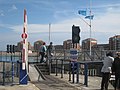
 A jetty in the North Harbour - geograph.org.uk - 2987465.jpg 1 500 × 990; 127 KB
-
 A Leyland Panther bus in Grand Parade - geograph.org.uk - 3686917.jpg 1 024 × 768; 103 KB
-
 A line of trees with ash dieback on the crest of the Downs - geograph.org.uk - 6518390.jpg 5 472 × 3 648; 5,97 MB
-
 A log stack of ash dieback timber near the South Downs Way - geograph.org.uk - 6494702.jpg 5 472 × 3 648; 5,21 MB
-
 A meeting of the ways - geograph.org.uk - 4379936.jpg 800 × 531; 110 KB
-

-
 A red box on Hill Road - geograph.org.uk - 2596485.jpg 640 × 428; 72 KB
-
 A remnant of Snow - geograph.org.uk - 2199919.jpg 480 × 640; 75 KB
-
 A signpost and a seat - geograph.org.uk - 1909118.jpg 640 × 428; 79 KB
-
 A signpost and a seat - geograph.org.uk - 4766574.jpg 640 × 428; 139 KB
-
 A South Downs path - geograph.org.uk - 2051085.jpg 611 × 443; 135 KB
-
 A stroll along the promenade - geograph.org.uk - 3494854.jpg 4 373 × 2 911; 3,51 MB
-
 A track near Holywell - geograph.org.uk - 4215360.jpg 2 592 × 1 944; 1,86 MB
-
 A walk along the cliffs - geograph.org.uk - 3494166.jpg 4 247 × 2 903; 4,14 MB
-
 A way through the reefs - geograph.org.uk - 1909071.jpg 640 × 428; 78 KB
-

-
 A2021, Willingdon Roundabout - geograph.org.uk - 4766893.jpg 640 × 577; 74 KB
-
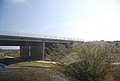
 A22 bridge over the railway - geograph.org.uk - 2418099.jpg 640 × 430; 46 KB
-
 A22 flyover - geograph.org.uk - 1816372.jpg 640 × 430; 114 KB
-
 A22 heading out of Eastbourne - geograph.org.uk - 2697782.jpg 640 × 428; 63 KB
-
 A22 road, near Eastbourne.jpg 2 592 × 1 944; 1,19 MB
-
 A2270 - geograph.org.uk - 4766898.jpg 640 × 426; 64 KB
-
-

-
 A2270 leaving Eastbourne - geograph.org.uk - 4772994.jpg 640 × 426; 67 KB
-
 A2280 bridge - geograph.org.uk - 4733627.jpg 640 × 426; 45 KB
-
 A2280 flyover - geograph.org.uk - 4950603.jpg 640 × 426; 77 KB
-
 A2280, Cross Levels Way - geograph.org.uk - 1816398.jpg 640 × 397; 95 KB
-
 A2280, Cross Levels Way - geograph.org.uk - 1826370.jpg 640 × 468; 83 KB
-
 A22eastbourne.jpg 2 048 × 1 536; 743 KB
-
 A259 - geograph.org.uk - 4766934.jpg 640 × 426; 55 KB
-
 A259 - geograph.org.uk - 4766965.jpg 640 × 426; 61 KB
-
 A259 between East Dean and Eastbourne - geograph.org.uk - 4924586.jpg 3 264 × 1 840; 1,27 MB
-
 A259 near East Dean - geograph.org.uk - 4924582.jpg 3 264 × 1 840; 1,48 MB
-
 A259 near East Dean Down - geograph.org.uk - 5520175.jpg 4 896 × 3 672; 6,62 MB
-
 A259 towards East Dean - geograph.org.uk - 3051388.jpg 2 256 × 1 496; 755 KB
-
 A259 towards Pevensey Bay - geograph.org.uk - 2842374.jpg 640 × 480; 46 KB
-
 A259 towards Pevensey Bay - geograph.org.uk - 2842375.jpg 640 × 480; 45 KB
-
 A259 Upperton Road, Eastbourne - geograph.org.uk - 5520872.jpg 3 456 × 4 608; 2,06 MB
-
 A259, B2103 junction - geograph.org.uk - 4766951.jpg 640 × 426; 44 KB
-
 A259, East Dean Rd - geograph.org.uk - 4766942.jpg 640 × 426; 41 KB
-
 A259, East Dean Rd - geograph.org.uk - 4766962.jpg 640 × 426; 53 KB
-
 A259, eastbound - geograph.org.uk - 4772965.jpg 640 × 426; 34 KB
-
 A259, Victoria Drive junction - geograph.org.uk - 4772969.jpg 640 × 426; 69 KB
-
 A259-B2103 Junction - geograph.org.uk - 3788057.jpg 640 × 480; 60 KB
-
 AA box at Eastbourne Promenade - geograph.org.uk - 6685551.jpg 3 024 × 4 032; 2,39 MB
-
 AA Phone Box - geograph.org.uk - 5304708.jpg 3 642 × 3 751; 4,43 MB
-
 AA Telephone Box near the Wish Tower - geograph.org.uk - 5510679.jpg 2 592 × 1 944; 1,39 MB
-
 Above Beachy Head - geograph.org.uk - 2003957.jpg 640 × 428; 217 KB
-
 Above Eastbourne - geograph.org.uk - 2199935.jpg 640 × 480; 57 KB
-
 Above Eastbourne - geograph.org.uk - 2768749.jpg 1 600 × 1 196; 375 KB
-
 Access Across Lock - geograph.org.uk - 1886276.jpg 1 024 × 768; 172 KB
-
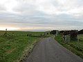 Access Road to Bullock Down Farm - geograph.org.uk - 2199943.jpg 640 × 480; 58 KB
-
 Across Bramble Bottom to New Barn - geograph.org.uk - 1910750.jpg 640 × 428; 67 KB
-

-
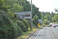
 Advertising Hoarding near Eastbourne Station - geograph.org.uk - 4913221.jpg 3 200 × 1 800; 967 KB
-
 Aegon International, Devonshire Park - geograph.org.uk - 4036641.jpg 9 000 × 2 732; 7,72 MB
-
 Albro Building on Darley Road, Eastbourne - geograph.org.uk - 4828205.jpg 1 200 × 799; 313 KB
-
 Aldi, Eastbourne - geograph.org.uk - 5051579.jpg 3 941 × 2 635; 2,1 MB
-

-
 Alexandra House - geograph.org.uk - 1833177.jpg 640 × 415; 76 KB
-
 Alfriston House - geograph.org.uk - 2559482.jpg 480 × 640; 163 KB
-
 Alfriston House - geograph.org.uk - 2559483.jpg 480 × 640; 143 KB
-
 All Saints, Eastbourne - geograph.org.uk - 6024922.jpg 1 000 × 879; 302 KB
-
 All Saints, Eastbourne - geograph.org.uk - 6024925.jpg 1 000 × 681; 441 KB
-
 All Saints, Eastbourne - geograph.org.uk - 6135697.jpg 4 465 × 3 349; 4,34 MB
-
 Alley from Latimer Road - geograph.org.uk - 976419.jpg 480 × 640; 88 KB
-
 Alley towards Hampden Park station - geograph.org.uk - 2697707.jpg 640 × 480; 161 KB
-
 Alleyway between the Goffs and Michel Grove - geograph.org.uk - 5484500.jpg 3 456 × 4 608; 1,53 MB
-
 Alleyway from Gildredge Park to Compton Place Road - geograph.org.uk - 5533215.jpg 4 896 × 3 672; 5,61 MB
-
 Alleyway from Gore Park Road to St. Mary's Road, Eastbourne - geograph.org.uk - 5536813.jpg 3 456 × 4 608; 2,24 MB
-
 Alleyway leading to Hampden Park Station - geograph.org.uk - 5480725.jpg 4 896 × 3 672; 5,76 MB
-
 Allotments off Flitching Road - geograph.org.uk - 5307641.jpg 6 000 × 2 963; 3,8 MB
-
 Allotments, Meads, Eastbourne - geograph.org.uk - 2478968.jpg 1 600 × 1 126; 699 KB
-
 Alongside the Eastbourne Downs Golf Course - geograph.org.uk - 3006121.jpg 3 316 × 2 578; 1,29 MB
-
 Amberley on Grange Road, Eastbourne - geograph.org.uk - 4829276.jpg 1 200 × 799; 300 KB
-
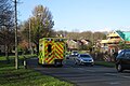 Ambulance on King's Drive - geograph.org.uk - 4757190.jpg 3 228 × 2 152; 2,58 MB
-
 An Eastbourne bus in Gildredge Road - geograph.org.uk - 3750922.jpg 2 204 × 1 830; 875 KB
-
 An Eastbourne bus in Seaside Road - geograph.org.uk - 3688434.jpg 1 474 × 1 232; 305 KB
-
 An Eastbourne bus in Terminus Road - geograph.org.uk - 3688450.jpg 1 477 × 1 232; 285 KB
-
 An Eastbourne bus near the railway station - geograph.org.uk - 3701849.jpg 1 484 × 1 232; 268 KB
-
 An eroding coast at Holywell, Eastbourne - geograph.org.uk - 6363532.jpg 5 472 × 3 648; 7,81 MB
-
 An old chalk quarry, Bullock Down - geograph.org.uk - 4949121.jpg 640 × 426; 55 KB
-
 An old gravel pit, Eastbourne Levels - geograph.org.uk - 2118681.jpg 640 × 430; 107 KB
-
 Angel at Ocklyne Cemetery - geograph.org.uk - 2559551.jpg 427 × 640; 116 KB
-
 Animals Act 1971 sign - geograph.org.uk - 2422420.jpg 640 × 480; 96 KB
-
 Annington Road junction with Ringwood Road Eastbourne - geograph.org.uk - 3663846.jpg 3 264 × 2 448; 3,47 MB
-
 Anonymous Postbox, King Edward's Parade, Eastbourne - geograph.org.uk - 6654316.jpg 2 238 × 2 901; 1,69 MB
-
 Another Shipping Boat - geograph.org.uk - 5239389.jpg 4 608 × 3 456; 4,44 MB
-
 Antenna - geograph.org.uk - 3076665.jpg 480 × 640; 438 KB
-

-

-
 Antiques Roadshow, Eastbourne Bandstand - geograph.org.uk - 3473528.jpg 480 × 640; 100 KB
-
 Antiques Roadshow, Eastbourne Bandstand - geograph.org.uk - 3473529.jpg 640 × 480; 126 KB
-
 Apartheid, Eastbourne promenade - geograph.org.uk - 2697241.jpg 640 × 480; 101 KB
-
 Apartments at Sovereign Harbour - geograph.org.uk - 1886016.jpg 14 408 × 2 300; 7,68 MB
-
 Apartments at Sovereign Harbour - geograph.org.uk - 3616686.jpg 3 264 × 2 448; 3,67 MB
-
 Apartments in Eastbourne - geograph.org.uk - 2962958.jpg 1 500 × 1 000; 227 KB
-
 Apartments on Bermuda Place - geograph.org.uk - 2725083.jpg 640 × 480; 97 KB
-

-
 Apartments on Marina Road - geograph.org.uk - 5189880.jpg 3 648 × 2 736; 2,04 MB
-
 Apartments on Pacific Drive - geograph.org.uk - 1886124.jpg 1 024 × 768; 209 KB
-
 Apartments, Duke's Drive - geograph.org.uk - 4955294.jpg 640 × 426; 72 KB
-
 Apartments, Duke's Drive - geograph.org.uk - 4955297.jpg 640 × 426; 68 KB
-
 Apartments, Sovereign Harbour - geograph.org.uk - 3223533.jpg 640 × 430; 80 KB
-
 Apartments, Sovereign Harbour - geograph.org.uk - 3226280.jpg 640 × 430; 59 KB
-
 Apartments, Sovereign Harbour - geograph.org.uk - 3226360.jpg 640 × 430; 69 KB
-

-
 Approaching Beachy Head - geograph.org.uk - 3802089.jpg 2 048 × 1 536; 385 KB
-
 Approaching Belle Tout lighthouse from the west - geograph.org.uk - 6265376.jpg 1 024 × 754; 106 KB
-
 Approaching Downside - geograph.org.uk - 2819657.jpg 640 × 427; 132 KB
-
 Approaching East Dean - geograph.org.uk - 2003899.jpg 640 × 427; 278 KB
-
 Approaching Ocklynge Cemetery Chapel - geograph.org.uk - 4760346.jpg 640 × 480; 78 KB
-
 Approaching Sovereign Harbour - geograph.org.uk - 4648321.jpg 3 000 × 3 000; 2,78 MB
-
 Approaching Sovereign Harbour - geograph.org.uk - 4648324.jpg 4 000 × 3 000; 3,25 MB
-

-
 Arch on the Beachy Head cliffs - geograph.org.uk - 4608598.jpg 1 390 × 973; 871 KB
-

-
 Archeological excavation on Butts Brow, Eastbourne - geograph.org.uk - 6548196.jpg 5 472 × 3 648; 5,74 MB
-
 Arms of Eastbourne Borough Council.svg 500 × 602; 181 KB
-
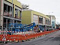
 Arndale Centre Redevelopment - geograph.org.uk - 5866651.jpg 1 600 × 1 200; 293 KB
-
 Arndale Centre roofs - geograph.org.uk - 2735514.jpg 640 × 480; 70 KB
-
 Arndale shopping centre car park, Ashford Road - geograph.org.uk - 5404456.jpg 4 000 × 3 000; 2,63 MB
-
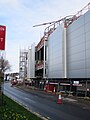
 Arndale shopping centre redevelopment - geograph.org.uk - 5404441.jpg 5 037 × 2 427; 2,01 MB
-
 Arndale shopping centre redevelopment - geograph.org.uk - 5404442.jpg 5 864 × 2 513; 2,79 MB
-
 Arndale shopping centre redevelopment - geograph.org.uk - 5404443.jpg 5 897 × 1 984; 2,78 MB
-
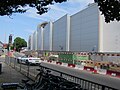
 Arndale shopping centre redevelopment - geograph.org.uk - 5404446.jpg 4 000 × 3 000; 2,13 MB
-
 Arndale Shopping Centre redevelopment - geograph.org.uk - 5473746.jpg 3 062 × 2 708; 762 KB
-
 Arndale shopping centre redevelopment - geograph.org.uk - 5749914.jpg 4 000 × 3 000; 1,94 MB
-
 Arndale shopping centre redevelopment - geograph.org.uk - 5749915.jpg 4 000 × 3 000; 1,93 MB
-
 Arndale shopping centre redevelopment - geograph.org.uk - 5749916.jpg 4 000 × 3 000; 1,86 MB
-
 Arndale shopping centre redevelopment - geograph.org.uk - 5749917.jpg 3 000 × 4 000; 1,6 MB
-
 Arndale shopping centre redevelopment - geograph.org.uk - 5832277.jpg 4 000 × 3 000; 2,01 MB
-
 Arndale shopping centre redevelopment - geograph.org.uk - 5832278.jpg 4 000 × 3 000; 2,84 MB
-
 Arndale shopping centre redevelopment - geograph.org.uk - 5832279.jpg 4 000 × 3 000; 2,54 MB
-
 Arndale shopping centre redevelopment - geograph.org.uk - 5832283.jpg 4 000 × 3 000; 3,27 MB
-
 Arndale shopping centre redevelopment - geograph.org.uk - 5832284.jpg 4 000 × 3 000; 2,86 MB
-
 Arndale shopping centre redevelopment, Ashford Road - geograph.org.uk - 5404448.jpg 4 000 × 3 000; 2,49 MB
-
 Arndale shopping centre redevelopment, Ashford Road - geograph.org.uk - 5404449.jpg 5 573 × 3 272; 2,65 MB
-
 Arndale shopping centre redevelopment, Ashford Road - geograph.org.uk - 5404450.jpg 4 000 × 2 994; 2,07 MB
-
 Arndale shopping centre redevelopment, Terminus Road - geograph.org.uk - 5404452.jpg 4 000 × 3 000; 2,2 MB
-
 Arndale shopping centre redevelopment, Terminus Road - geograph.org.uk - 5404453.jpg 4 000 × 3 000; 2,67 MB
-
 Arndale shopping centre redevelopment, Terminus Road - geograph.org.uk - 5404454.jpg 4 000 × 3 000; 2,62 MB
-
 Arnworth Court, Furness Road, Eastbourne - geograph.org.uk - 3035732.jpg 3 264 × 2 448; 1,68 MB
-
 Around Eastbourne (24604939220).jpg 3 456 × 5 184; 6,52 MB
-
 Ascham Place - geograph.org.uk - 4828087.jpg 1 200 × 799; 372 KB
-
 Ascham Place - geograph.org.uk - 4828091.jpg 1 200 × 799; 363 KB
-
 Asda - Eastbourne - geograph.org.uk - 1932669.jpg 1 600 × 1 200; 316 KB
-
 Asda fuel station - geograph.org.uk - 6443657.jpg 3 996 × 2 664; 2,33 MB
-
 Asda, Eastbourne - geograph.org.uk - 4453875.jpg 4 000 × 3 000; 2,77 MB
-
 Asda, Sovereign Harbour Retail Park - geograph.org.uk - 2096394.jpg 640 × 427; 56 KB
-
 Asda, Sovereign Harbour, Eastbourne - geograph.org.uk - 3028359.jpg 4 320 × 3 240; 4,06 MB
-
 Ash dieback affecting woodland at Babylon Down, Eastbourne - geograph.org.uk - 6522039.jpg 5 472 × 3 648; 4,69 MB
-
 Ash dieback in Paradise Wood, Eastbourne - geograph.org.uk - 6495996.jpg 5 472 × 3 648; 7,11 MB
-

-

-

-
 Ash dieback sign and trees with ash dieback near Eastbourne - geograph.org.uk - 6511127.jpg 5 379 × 3 586; 4,28 MB
-
 Ash dieback stack of logs awaiting collection - geograph.org.uk - 6536088.jpg 5 472 × 3 648; 5,86 MB
-
 Ash dieback stack of timber on the crest of the South Downs - geograph.org.uk - 6497310.jpg 5 472 × 3 648; 5,64 MB


.jpg)

.jpg)


_-_geograph.org.uk_-_4760481.jpg)
_-_geograph.org.uk_-_4760482.jpg)
_-_geograph.org.uk_-_4760483.jpg)


.jpg)


