Category:Eaux-Bonnes
Here nagîvasyonê
Here lêgerînê
commune in Pyrénées-Atlantiques, France  .svg)  | |||||
| Medya bar bike | |||||
| Bilêvkirin (deng) | |||||
|---|---|---|---|---|---|
| Mînakek ji bo | |||||
| Cih |
| ||||
| Gelhe |
| ||||
| Rûerd |
| ||||
| Bilindahiya ji rûyê avê |
| ||||
 | |||||
Binkategorî
Di vê kategoriyê de 18 binkategorî hene. Jêr 18 binkategorî tên nîşandan.
B
- Bridges in Eaux-Bonnes (4 F)
C
- Cascade du Valentin (5 F)
G
- Gourette (45 F)
H
- Historical images of Eaux-Bonnes (197 F)
L
- Lac d'Anglas (4 F)
- Lac d'Uzious (1 F)
- Lac du Lavedan (1 F)
- Lacs de Louesque (2 F)
M
- Maps of Eaux-Bonnes (9 F)
- Mateo de Murga y Michelena (1 F)
P
- Pic de Ger (8 F)
- Pène Médaa (2 F)
S
- Streets in Eaux-Bonnes (15 F)
T
Medya di kategoriya "Eaux-Bonnes" de
Di vê kategoriyê de 25 dane hene. Jêr 25 dane tên nîşandan.
-
 Auf dem Plateau de Bouy 1987 (PIVF2125).jpg 4026 x 2680; 3,49 MB
-
 Auf dem Plateau de Bouy 1998 (Ct170830).jpg 3330 x 2071; 4,19 MB
-
 Blason ville fr Eaux-Bonnes (Pyrénées-Atlantiques).svg 600 x 660; 57 KB
-
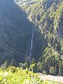 Cascade du ruisseau Valentin, vers Gourette - panoramio.jpg 2448 x 3264; 1,31 MB
-
 Eaux-Bonnes 1987 (PIVF1924).jpg 4040 x 2693; 3,29 MB
-
 Eaux-Bonnes 1991 (LM21210).jpg 2935 x 4534; 3,71 MB
-
 Eaux-Bonnes 1992 (LM21621).jpg 3257 x 2171; 3,9 MB
-
 Eaux-Bonnes 1995 (LM23407).jpg 3833 x 2557; 4,45 MB
-
 Eauxbonnes16.jpg 1536 x 2048; 2,26 MB
-
 Eauxbonnes17.jpg 1536 x 2048; 1,34 MB
-
 Eauxbonnes18.jpg 1305 x 1655; 641 KB
-
 EB vue generale.JPG 1098 x 1919; 702 KB
-
 EB25.JPG 1536 x 2048; 1,06 MB
-
 Entre Gourette et Eaux Bonnes 1998 (Ct170831).jpg 3279 x 2186; 5,15 MB
-
 Lac d'Anglas.jpg 2592 x 1952; 1,24 MB
-
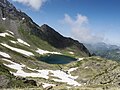 Le Lac d'Anglas.jpg 3648 x 2736; 7,6 MB
-
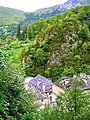
 Le pont de pierre, Eaux-Bonnes (10622793444).jpg 440 x 245; 34 KB
-
 Paravalanche avant Gourette - panoramio.jpg 3264 x 1542; 1,47 MB
-
 Paravalanche, à 5km du sommet, dans une partie raide de l'Aubisque - panoramio.jpg 2731 x 2057; 1,73 MB
-
 Plaque commémorative YMCA, Eaux-Bonnes, Pyrénées atlantiques DSC07752.jpg 3864 x 5152; 13,01 MB
-

-
 Population - Municipality code 64204.svg 475 x 355; 13 KB
-
 Vue en aval de Gourette - panoramio.jpg 3261 x 1523; 3,13 MB
-
 Vue sur le pic de Ger et le Grand Gabizos - panoramio.jpg 3264 x 1903; 1,22 MB
-
 Vue vers l'est dans la vallée, à 7km du sommet - panoramio.jpg 3264 x 1603; 1,26 MB
.jpg)
.jpg)

.jpg)
.jpg)
.jpg)
.jpg)


.jpg)


.jpg)


