Category:Eilean Bàn, Lochalsh
Vai alla navigazione
Vai alla ricerca
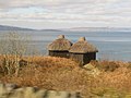
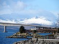
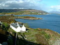
Eilean Bàn (Scottish Gaelic meaning White Island) is a six acre island off the coast of mainland Scotland, between Kyle of Lochalsh and the Isle of Skye, in Highland council area. It supports a column of the Skye Bridge.
isola del Regno Unito .jpg) | |||||
| Carica un file multimediale | |||||
| Istanza di | |||||
|---|---|---|---|---|---|
| Parte di | |||||
| Luogo | Highland, Highlands, Scozia | ||||
| Situato sul mare / lago / fiume | |||||
 | |||||
Sottocategorie
Questa categoria contiene un'unica sottocategoria, indicata di seguito.
K
- Kyleakin Lighthouse (50 F)
File nella categoria "Eilean Bàn, Lochalsh"
Questa categoria contiene 14 file, indicati di seguito, su un totale di 14.
-
 Eilean Ban from the Skye bridge - geograph.org.uk - 3519836.jpg 750 × 563; 102 KB
-
 Eilean Ban Lighthouse - geograph.org.uk - 2388925.jpg 1 600 × 1 074; 299 KB
-
 Eilean Ban. - geograph.org.uk - 903511.jpg 640 × 480; 90 KB
-
 Eilean Bàn before the Skye Bridge - geograph.org.uk - 2425696.jpg 5 184 × 3 360; 1,19 MB
-
 Eilean Bàn from the lighthouse - geograph.org.uk - 2501010.jpg 640 × 423; 370 KB
-
 Eilean Bàn MG 3636.jpg 2 816 × 1 880; 1,67 MB
-
 Eilean Bàn viewed from Kyle of Lochalsh - geograph.org.uk - 1191653.jpg 640 × 480; 172 KB
-
 Eilean Bàn, Lochalsh.jpg 3 888 × 2 592; 3,63 MB
-
 Eileanban.jpg 640 × 480; 93 KB
-
EileanBan.ogg 1,5 s; 30 KB
-

-
 The A87 heading across Eilean Ban - geograph.org.uk - 1354751.jpg 640 × 480; 67 KB
-
 View north west over the Inner Sound - geograph.org.uk - 1380347.jpg 1 000 × 669; 253 KB
-