Category:El Tanque
Salta a la navigazzion
Và a cercà
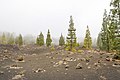
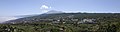
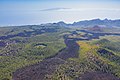
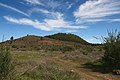
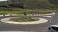
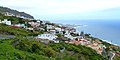
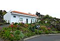
English: Pictures of the municipality El Tanque in the northwest of Tenerife one of the islands of the Canary Islands in Spain. El Tanque is near the municipalities Los Silos, Garachico and Icod de los Vinos
comune spagnolo  .svg)  | |||||
| Carega su un fail audio / video | |||||
| L'è un(a) | |||||
|---|---|---|---|---|---|
| Part de | |||||
| Sit | Ìsole Canarie, Spagna | ||||
| Capo de governo |
| ||||
| Popolazzion |
| ||||
| Area |
| ||||
| Altezza in sul mar |
| ||||
| sit ofizzial | |||||
 | |||||
Sotocategorie
Quella categoria chì la gh'ha 9 sot-categorie chì de sota, su un numer complessiv de 9.
E
- Erjos de El Tanque (3 F)
M
- Mirador Lomo Molino (7 F)
R
S
- San José de Los Llanos (6 F)
Z
- Zanata Stone (3 F)
Fail in la categoria "El Tanque"
Quella categoria chì la gh'ha denter 35 i fail riportad chì de sota, su un total de 35.
-
 Escudo de El Tanque (Santa Cruz de Tenerife).svg 512 × 931; 75 KByte
-
 Escudo de El Tanque.png 270 × 500; 125 KByte
-
 Tenerife municipio El Tanque.svg 200 × 200; 33 KByte
-
 TF ElTanque.png 224 × 193; 2 KByte
-
 Aschefeld im Nationalpark Teide auf Teneriffa, Spanien (48225209846).jpg 3 799 × 2 528; 5,71 MByte
-
 Bauernhotel auf dem Weg zum Vulkan Chinyero auf Teneriffa, Spanien (48225169601).jpg 4 160 × 2 768; 7,93 MByte
-
 Blumen zwischen Lavagestein im Nationalpark Teide auf Teneriffa, Spanien (48225205061).jpg 4 160 × 2 768; 10,27 MByte
-
 Circular Chinyero loop trail on Tenerife, Spain (48225264502).jpg 4 160 × 2 768; 7,98 MByte
-
 Des micasa - panoramio.jpg 640 × 360; 127 KByte
-
 El parque - panoramio - ROBISON-1953@HOTMAIL….jpg 640 × 360; 128 KByte
-
 El parque - panoramio.jpg 640 × 360; 123 KByte
-
 El parqueen trebejo - panoramio.jpg 640 × 360; 124 KByte
-
 EL ROQUE DE GARACHICO - panoramio.jpg 2 048 × 1 536; 1,22 MByte
-
 El Tanque, 2018.jpg 2 576 × 688; 664 KByte
-
 El Tanque.jpg 3 372 × 1 767; 1,77 MByte
-
 En trebejo - panoramio.jpg 360 × 640; 121 KByte
-
 Era Partidos de Franquis.jpg 3 898 × 2 594; 8,98 MByte
-
 Erstarrte Lava am Teide-Krater auf Teneriffa, Spanien (48225500007).jpg 5 464 × 3 640; 17,36 MByte
-
 Frozen lava flow from Chinyero volcano on Tenerife, Spain (48225192836).jpg 5 472 × 3 648; 11,58 MByte
-
 Frozen lava streams through pine trees in Teide National Park on Tenerife, Spain (48225502927).jpg 5 464 × 3 640; 15,73 MByte
-
 Hiking trail through pine trees on the way to Chinyero volcano on Tenerife, Spain (48225240827).jpg 4 160 × 2 768; 10,69 MByte
-
 HOTEL RURAL LOS PARTIDOS DE FRANQLUIN - panoramio.jpg 640 × 360; 123 KByte
-
 Karte Gemeinde El Tanque 2022.png 3 000 × 2 487; 570 KByte
-
 Luftbild vom Teide-Krater im Nationalpark Teide auf Teneriffa, Spanien (48225497072).jpg 5 464 × 3 640; 16,46 MByte
-
 Luftbild vom Vulkan Chinyero auf Teneriffa, Spanien (48225246682).jpg 5 464 × 3 070; 13,6 MByte
-
 Lunar landscape near Chinyero volcano on Tenerife, Spain (48225275022).jpg 12 548 × 3 650; 40,34 MByte
-
 Misty hat on Pico del Teide 3718m - panoramio.jpg 1 296 × 976; 401 KByte
-
 Montaña del Banco (El Tanque).jpg 3 898 × 2 594; 8,68 MByte
-
 Montaña Negra (El Tanque).jpg 4 168 × 1 327; 4,71 MByte
-
 Panorama los Partidos de Franquis.jpg 6 769 × 2 463; 15,23 MByte
-
 Rotonda del pino del loro - panoramio.jpg 640 × 360; 124 KByte
-
 Teneriffa - El Tanque - panoramio.jpg 4 320 × 2 160; 1,99 MByte
-
 Teneriffa - El Tanque – Herrliche Blütenpracht an der TF-421 - panoramio.jpg 4 320 × 3 240; 4,17 MByte
-
 Teneriffa - El Tanque – TF-421 - panoramio.jpg 4 140 × 2 794; 2,53 MByte
-
 Teneriffa - Nordküste von Garachico über El Tanque in Richtung Puerto de la Cruz - panoramio.jpg 4 320 × 1 759; 1,08 MByte


.jpg)
.jpg)
.jpg)
.jpg)


.jpg)
.jpg)
.jpg)
.jpg)


.jpg)
.jpg)

.jpg)


.jpg)
.jpg)