Category:Ellenhall
Aller à la navigation
Aller à la recherche
English: Ellenhall is a small Staffordshire village roughly 2.5 miles south of Eccleshall originally comprising part of the extensive estates of the Earl of Lichfield. The village consists of a scattered community of cottages, a hall, and several farms. Ellenhall has no shop, public house or post office.
village britannique | |||||
| Téléverser des médias | |||||
| Nature de l’élément | |||||
|---|---|---|---|---|---|
| Lieu | Stafford, Staffordshire, Midlands de l'Ouest, Angleterre | ||||
| Réputé identique à | Ellenhall (page en doublon, paroisse civile) | ||||
 | |||||
Sous-catégories
Cette catégorie comprend 3 sous-catégories, dont les 3 ci-dessous.
Média dans la catégorie « Ellenhall »
Cette catégorie comprend 65 fichiers, dont les 65 ci-dessous.
-
 A Quiet Lane in the Country - geograph.org.uk - 434440.jpg 427 × 640 ; 113 kio
-
 Across Pasture to Herd of Cows - geograph.org.uk - 2554388.jpg 640 × 428 ; 78 kio
-
 B5405 At Knightley - geograph.org.uk - 470925.jpg 640 × 429 ; 84 kio
-
 B5405 at Knightley - geograph.org.uk - 470929.jpg 640 × 429 ; 77 kio
-
 B5405 at Lawnhead - geograph.org.uk - 470922.jpg 640 × 429 ; 86 kio
-
 B5405 near to Seighford RAF Base - geograph.org.uk - 2468753.jpg 640 × 428 ; 65 kio
-
 B5405 westbound near Lawnhead - geograph.org.uk - 3551802.jpg 640 × 481 ; 79 kio
-
 Barn at Yewtree Farm - geograph.org.uk - 594826.jpg 640 × 480 ; 254 kio
-
 Bridlepath to the Ruins of Ranton Abbey - geograph.org.uk - 2468676.jpg 640 × 428 ; 110 kio
-
 Broadheath to Ellenhall Road - geograph.org.uk - 2554264.jpg 640 × 428 ; 60 kio
-
 Country Road to B5405 - geograph.org.uk - 2554417.jpg 640 × 428 ; 117 kio
-
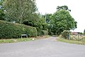
 Crossroads, Ellenhall - geograph.org.uk - 2554353.jpg 640 × 391 ; 59 kio
-
 Drive up to Woodland View Cottage - geograph.org.uk - 2468739.jpg 640 × 428 ; 107 kio
-
 Ellenhall Farm - geograph.org.uk - 6459091.jpg 800 × 600 ; 128 kio
-
 Ellenhall Hall.jpg 1 479 × 1 073 ; 300 kio
-
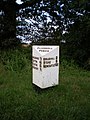 Ellenhall milestone - geograph.org.uk - 921394.jpg 480 × 640 ; 111 kio
-
 Ellenhall village - geograph.org.uk - 2293230.jpg 1 600 × 1 143 ; 340 kio
-
 Entering Ellenhall - geograph.org.uk - 6459092.jpg 800 × 557 ; 140 kio
-
 Entrance to Marsh Lane, Ellenhall - geograph.org.uk - 2554343.jpg 640 × 428 ; 91 kio
-
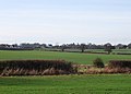
 Farmland behind Ladford Fields - geograph.org.uk - 2293223.jpg 1 600 × 1 143 ; 317 kio
-
 Farmland off Bridle Lane - geograph.org.uk - 6459082.jpg 800 × 600 ; 62 kio
-
 Field entrance and footpath - geograph.org.uk - 6459107.jpg 640 × 455 ; 67 kio
-

-
 Field entrance off unnamed lane, Ellenhall - geograph.org.uk - 6459097.jpg 800 × 600 ; 130 kio
-
 Field of Sweetcorn, Track and Hedge - geograph.org.uk - 2554455.jpg 640 × 428 ; 84 kio
-
 Grazing towards Park House Farm - geograph.org.uk - 6459106.jpg 800 × 600 ; 117 kio
-
 Grazing, Broad Heath - geograph.org.uk - 6459086.jpg 800 × 600 ; 87 kio
-
 Grazing, Ellenhall - geograph.org.uk - 6459095.jpg 800 × 600 ; 144 kio
-
 Hilltop Farm - geograph.org.uk - 2468691.jpg 640 × 428 ; 116 kio
-
 Lane from Ellenhall to Lawnhead - geograph.org.uk - 6459100.jpg 640 × 491 ; 124 kio
-
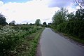
 Lane out of Ellenhall - geograph.org.uk - 434390.jpg 640 × 429 ; 87 kio
-
 Lane to Ellenhall - geograph.org.uk - 434382.jpg 640 × 429 ; 70 kio
-
 Lane to Knightley Dale - geograph.org.uk - 470927.jpg 640 × 429 ; 50 kio
-
 Lane to Lawnhead - geograph.org.uk - 434447.jpg 427 × 640 ; 93 kio
-
 Lane towards Ellenhall Park Farm and the A519 - geograph.org.uk - 6459111.jpg 800 × 600 ; 155 kio
-
 Leaving the Park - geograph.org.uk - 434463.jpg 427 × 640 ; 126 kio
-
 Looking across the Spurley Brook towards Walton - geograph.org.uk - 2293215.jpg 1 600 × 1 143 ; 334 kio
-
 Looking back to Broadheath - geograph.org.uk - 2554336.jpg 640 × 428 ; 85 kio
-
 Milepost 7 miles from Stafford.jpg 265 × 400 ; 38 kio
-
 Narrow Track - geograph.org.uk - 2554301.jpg 640 × 428 ; 124 kio
-
 Old Building, Ellenhall - geograph.org.uk - 2554372.jpg 640 × 395 ; 63 kio
-
 On the Way to the Park - geograph.org.uk - 434472.jpg 640 × 427 ; 116 kio
-
 On the Way to Woodseaves - geograph.org.uk - 470919.jpg 640 × 429 ; 70 kio
-
 Open Gate to Grass Field - geograph.org.uk - 2554428.jpg 640 × 428 ; 92 kio
-
 Overgrown Ditch and Pastureland - geograph.org.uk - 2554277.jpg 640 × 428 ; 104 kio
-
 Pond at Yewtree Farm - geograph.org.uk - 594810.jpg 640 × 480 ; 240 kio
-
 Road from Broad Heath to Ellenhall - geograph.org.uk - 6459090.jpg 800 × 600 ; 101 kio
-
 Road goes off to Whitley Heath - geograph.org.uk - 2554396.jpg 640 × 428 ; 104 kio
-
 Road passing Ellenhall Farm, Ellenhall - geograph.org.uk - 6459094.jpg 800 × 600 ; 131 kio
-
 Track (bridleway) towards Ladford Trading Park - geograph.org.uk - 6459083.jpg 800 × 600 ; 210 kio
-
 Track into Walton's Rough - geograph.org.uk - 434418.jpg 640 × 427 ; 146 kio
-
 Track to Nowhere - geograph.org.uk - 2554320.jpg 640 × 428 ; 96 kio
-
 Walton Hurst - geograph.org.uk - 2293234.jpg 1 600 × 1 143 ; 350 kio
-
 Where Now^ - geograph.org.uk - 434366.jpg 427 × 640 ; 125 kio
-
 B5405 Towards Woodseaves - geograph.org.uk - 262429.jpg 640 × 427 ; 78 kio
-
 Cottage at Lawnhead - geograph.org.uk - 470921.jpg 640 × 429 ; 77 kio
-
 Ellenhall Park - geograph.org.uk - 269123.jpg 640 × 480 ; 106 kio
-
 Farmland near Ladfordfield Ind Est - geograph.org.uk - 277860.jpg 640 × 480 ; 71 kio
-
 Lane to nowhere - geograph.org.uk - 262461.jpg 640 × 427 ; 108 kio
-
 Lodge Farm - geograph.org.uk - 269883.jpg 640 × 480 ; 86 kio
-
 Public Rooms - geograph.org.uk - 262454.jpg 640 × 427 ; 88 kio
-
 Public Telephone Box - geograph.org.uk - 377154.jpg 350 × 640 ; 83 kio
-
 Ranton Hall Looking East - geograph.org.uk - 142224.jpg 640 × 427 ; 98 kio
-
 Spurleybrook - geograph.org.uk - 269131.jpg 480 × 640 ; 99 kio
-
 Whitley Heath - geograph.org.uk - 269880.jpg 480 × 640 ; 102 kio


_towards_Ladford_Trading_Park_-_geograph.org.uk_-_6459083.jpg)


