Category:Ellerbeck
Aller à la navigation
Aller à la recherche
localité britannique du comté anglais de North Yorkshire  | |||||
| Téléverser des médias | |||||
| Nature de l’élément | |||||
|---|---|---|---|---|---|
| Lieu | Hambleton, Yorkshire du Nord, Yorkshire-et-Humber, Angleterre | ||||
 | |||||
Média dans la catégorie « Ellerbeck »
Cette catégorie comprend 41 fichiers, dont les 41 ci-dessous.
-
 A19 - exit to A684 - geograph.org.uk - 2647283.jpg 640 × 428 ; 77 kio
-
 A19 - Tyne Tunnel 48 - geograph.org.uk - 2647259.jpg 640 × 428 ; 73 kio
-
 A19 bridge over the A684 - geograph.org.uk - 3278685.jpg 640 × 480 ; 79 kio
-
 A19 crosses A684 - geograph.org.uk - 5902395.jpg 4 205 × 2 901 ; 2,51 Mio
-
 A19 heading north - geograph.org.uk - 4824569.jpg 640 × 428 ; 107 kio
-
 A19 heading north - geograph.org.uk - 4824596.jpg 640 × 428 ; 95 kio
-
 A684 heading east - geograph.org.uk - 3278677.jpg 1 200 × 900 ; 287 kio
-
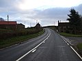 A684 heading east at Ellerbbeck - geograph.org.uk - 3278680.jpg 1 200 × 900 ; 265 kio
-
 A684 road accessing the A19 - geograph.org.uk - 3278684.jpg 1 200 × 900 ; 274 kio
-
 A684, Ellerbeck - geograph.org.uk - 3031539.jpg 640 × 576 ; 116 kio
-
 Across the valley of Cod Beck - geograph.org.uk - 2387149.jpg 3 264 × 2 448 ; 1,51 Mio
-
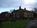
 Beech Hill Farm - geograph.org.uk - 3278678.jpg 1 200 × 900 ; 240 kio
-
 Byway Ford at Ellerbeck - geograph.org.uk - 3806959.jpg 3 872 × 2 592 ; 4,86 Mio
-
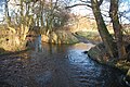
 Cod Beck, Ellerbeck - geograph.org.uk - 3278681.jpg 1 200 × 900 ; 307 kio
-
 Country road - geograph.org.uk - 4735596.jpg 640 × 480 ; 32 kio
-
 Crossing Cod Beck - geograph.org.uk - 2387142.jpg 2 448 × 3 264 ; 2,88 Mio
-
 Ellerbeck QLD 4816, Australia - panoramio.jpg 4 608 × 3 456 ; 3,23 Mio
-
 Ellerbeck.jpg 640 × 480 ; 62 kio
-
 Farmland off the A19 - geograph.org.uk - 3278689.jpg 1 200 × 900 ; 235 kio
-
 Farmland, Bridge End Farm - geograph.org.uk - 3278682.jpg 1 200 × 900 ; 308 kio
-
 Farmland, Little Beech Hill - geograph.org.uk - 3277475.jpg 800 × 600 ; 137 kio
-
 Farmland, Sandpit Hill - geograph.org.uk - 3278688.jpg 1 200 × 900 ; 291 kio
-
 Featherbed Lane - geograph.org.uk - 3277477.jpg 640 × 480 ; 58 kio
-
 Featherbed Lane view - geograph.org.uk - 5771647.jpg 2 048 × 1 536 ; 752 kio
-
 Featherbed Lane view 2 - geograph.org.uk - 5771648.jpg 2 048 × 1 536 ; 1,01 Mio
-
 Field entrance off the A684 slip road - geograph.org.uk - 3278686.jpg 1 200 × 900 ; 297 kio
-
 Ford at Ellerbeck - geograph.org.uk - 3806913.jpg 3 872 × 2 592 ; 4,69 Mio
-
 Ford at Ellerbeck - geograph.org.uk - 3806939.jpg 3 872 × 2 592 ; 4,91 Mio
-
 House at Lane End - geograph.org.uk - 4166866.jpg 1 500 × 1 125 ; 1,65 Mio
-
 Lane heading east, Little Beech Hill - geograph.org.uk - 3277476.jpg 800 × 600 ; 142 kio
-
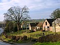
 Little Bridge Farm, Ellerbeck - geograph.org.uk - 3278679.jpg 1 200 × 900 ; 267 kio
-
 Looking up to Beech Hill - geograph.org.uk - 471007.jpg 640 × 383 ; 70 kio
-
 Pasture at Bridge End Farm - geograph.org.uk - 5902400.jpg 4 320 × 2 814 ; 2,49 Mio
-
 Ploughed field, Beech Hill - geograph.org.uk - 3278676.jpg 1 200 × 900 ; 285 kio
-
 Road junction near Ellerbeck - geograph.org.uk - 5902611.jpg 4 206 × 2 741 ; 2,11 Mio
-
 Slip road onto the A19 northbound - geograph.org.uk - 3278687.jpg 640 × 480 ; 54 kio
-
 Slip road onto the A19 northbound - geograph.org.uk - 3278690.jpg 1 200 × 900 ; 276 kio
-
 Track to Bridge End Farm - geograph.org.uk - 3278683.jpg 1 200 × 900 ; 309 kio
-
 Track to Mount House - geograph.org.uk - 3278691.jpg 1 200 × 900 ; 291 kio
-
 A684 slip road at Ellerbeck - geograph.org.uk - 323108.jpg 640 × 480 ; 61 kio
-
 Junction of Featherbed Lane with the A684 - geograph.org.uk - 277683.jpg 640 × 384 ; 59 kio


