Category:Ellerton, East Riding of Yorkshire
Aller à la navigation
Aller à la recherche
English: Ellerton is a village in the East Riding of Yorkshire, England. It is situated approximately 8 miles (13 km) north west of the market town of Howden and 8 miles (13 km) south west of the market town of Pocklington.
village britannique   | |||||
| Téléverser des médias | |||||
| Nature de l’élément | |||||
|---|---|---|---|---|---|
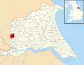
| Lieu | East Riding of Yorkshire, Yorkshire de l'Est, Yorkshire-et-Humber, Angleterre | ||||
 | |||||
Sous-catégories
Cette catégorie comprend 2 sous-catégories, dont les 2 ci-dessous.
A
Média dans la catégorie « Ellerton, East Riding of Yorkshire »
Cette catégorie comprend 227 fichiers, dont les 200 ci-dessous.
(page précédente) (page suivante)-
 "South View" - geograph.org.uk - 206038.jpg 640 × 480 ; 108 kio
-
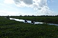
 A dike off Main Road, towards Laytham - geograph.org.uk - 2289749.jpg 800 × 600 ; 324 kio
-
 A Field On Short Acre Lane - geograph.org.uk - 208270.jpg 640 × 480 ; 107 kio
-
 A Memorial Seat - geograph.org.uk - 208283.jpg 640 × 480 ; 105 kio
-
 Along Charity Lane - geograph.org.uk - 5364292.jpg 640 × 427 ; 284 kio
-
 Along Cottom Lane - geograph.org.uk - 3078462.jpg 640 × 480 ; 154 kio
-
 Along Ings Lane - geograph.org.uk - 5365484.jpg 640 × 427 ; 249 kio
-
 Along Long Lane - geograph.org.uk - 3078997.jpg 640 × 480 ; 115 kio
-
 Along Ruddings Lane - geograph.org.uk - 5364296.jpg 427 × 640 ; 278 kio
-
 Animal pen - geograph.org.uk - 5265570.jpg 1 024 × 768 ; 198 kio
-
 Approaching Long Rampart - geograph.org.uk - 5364009.jpg 640 × 427 ; 203 kio
-
 At the bend in Long Lane - geograph.org.uk - 5265586.jpg 1 024 × 768 ; 170 kio
-
 Aughton - geograph.org.uk - 3078951.jpg 640 × 480 ; 128 kio
-
 Aughton Castle - geograph.org.uk - 6392683.jpg 1 024 × 768 ; 287 kio
-
 Aughton Hall - geograph.org.uk - 5272079.jpg 1 024 × 768 ; 330 kio
-
 Aughton House, Aughton Ruddings - geograph.org.uk - 5266646.jpg 1 024 × 768 ; 159 kio
-
 Aughton Plantation - geograph.org.uk - 5265564.jpg 1 024 × 768 ; 146 kio
-
 B1228 to Sutton on Derwent and York - geograph.org.uk - 178532.jpg 640 × 480 ; 92 kio
-
 B1228 towards Ellerton - geograph.org.uk - 2035757.jpg 640 × 480 ; 77 kio
-
 B1228 towards Sutton upon Derwent - geograph.org.uk - 2359294.jpg 1 600 × 1 200 ; 388 kio
-
 Barleyfield - geograph.org.uk - 178530.jpg 640 × 480 ; 60 kio
-
 Bench beside Bowland Lane - geograph.org.uk - 5364102.jpg 427 × 640 ; 301 kio
-
 Bench by Firkin Mouth Drain - geograph.org.uk - 5269014.jpg 1 024 × 768 ; 196 kio
-
 Birk Lane - geograph.org.uk - 5365508.jpg 640 × 427 ; 238 kio
-
 Boot and Shoe Inn - geograph.org.uk - 3543585.jpg 4 124 × 2 160 ; 1,45 Mio
-
 Bottoms Drain - geograph.org.uk - 5365505.jpg 640 × 427 ; 267 kio
-
 Bowland Lane - geograph.org.uk - 2359236.jpg 1 600 × 1 200 ; 614 kio
-
 Bowland Lane - geograph.org.uk - 5266530.jpg 1 024 × 768 ; 101 kio
-
 Bowland Lane near Bottoms Drain - geograph.org.uk - 5364293.jpg 640 × 427 ; 230 kio
-
 Bridges Lane - geograph.org.uk - 1299247.jpg 640 × 480 ; 94 kio
-
 Bridges Lane - geograph.org.uk - 5365403.jpg 640 × 427 ; 261 kio
-
 Bridleway near Aughton House - geograph.org.uk - 5364300.jpg 640 × 427 ; 247 kio
-
 Bridleway to Laytham - geograph.org.uk - 5264816.jpg 1 024 × 768 ; 142 kio
-
 Charity Lane - geograph.org.uk - 5265108.jpg 1 024 × 768 ; 239 kio
-
 Charity Lane - geograph.org.uk - 5364288.jpg 640 × 427 ; 282 kio
-
 Cottom Lane - geograph.org.uk - 1299268.jpg 640 × 480 ; 69 kio
-
 Cottom Lane - geograph.org.uk - 3078461.jpg 640 × 480 ; 114 kio
-
 Cottom Lane - geograph.org.uk - 5365499.jpg 427 × 640 ; 284 kio
-
 Cow beside the bridleway - geograph.org.uk - 5364317.jpg 640 × 427 ; 237 kio
-
 Cow pasture - geograph.org.uk - 5364313.jpg 640 × 427 ; 248 kio
-
 Cow Pasture Lane - geograph.org.uk - 3078451.jpg 640 × 480 ; 128 kio
-
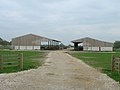
 Cow Pasture Lane and an assemblage of farm equipment - geograph.org.uk - 5272777.jpg 1 024 × 768 ; 207 kio
-
 Cow Pasture Lane, Ellerton - geograph.org.uk - 2359221.jpg 1 600 × 1 200 ; 499 kio
-
 Cow Pasture Lane, Ellerton - geograph.org.uk - 308370.jpg 640 × 480 ; 141 kio
-
 Crossing cow pasture - geograph.org.uk - 5364314.jpg 640 × 427 ; 251 kio
-
 Crossing fields - geograph.org.uk - 5364319.jpg 640 × 427 ; 226 kio
-
 Crossing fields - geograph.org.uk - 5364321.jpg 640 × 427 ; 293 kio
-
 Derwent House Farm - geograph.org.uk - 5365503.jpg 640 × 427 ; 218 kio
-

-
 Double gate on Cow Pasture Lane, Ellerton - geograph.org.uk - 5272776.jpg 1 024 × 768 ; 302 kio
-
 Drainage ditch (dry) Laytham Park - geograph.org.uk - 2035735.jpg 640 × 480 ; 137 kio
-
 Drainage ditch beside Birk Lane (B1228) - geograph.org.uk - 2359193.jpg 1 600 × 1 200 ; 668 kio
-
 Drainage ditch beside Long Lane - geograph.org.uk - 2359208.jpg 1 600 × 1 200 ; 780 kio
-
 Ellerton - geograph.org.uk - 3078454.jpg 640 × 480 ; 123 kio
-
 Ellerton and Aughton UK parish locator map.svg 1 425 × 1 107 ; 1,68 Mio
-
 Ellerton Church - geograph.org.uk - 6236460.jpg 1 024 × 768 ; 219 kio
-
 Ellerton Common - geograph.org.uk - 1299262.jpg 640 × 480 ; 42 kio
-
 Ellerton Common - geograph.org.uk - 2359223.jpg 1 600 × 1 200 ; 430 kio
-
 Ellerton Common - geograph.org.uk - 308367.jpg 640 × 480 ; 112 kio
-
 Ellerton Ings - geograph.org.uk - 5272009.jpg 1 024 × 768 ; 154 kio
-
 Ellerton Ings - geograph.org.uk - 5272785.jpg 1 024 × 768 ; 250 kio
-
 Ellerton Ings and Ellerton church - geograph.org.uk - 5272034.jpg 1 024 × 768 ; 150 kio
-
 Ellerton Ings under water - geograph.org.uk - 5272028.jpg 1 024 × 768 ; 140 kio
-
 Ellerton Methodist chapel - geograph.org.uk - 3543581.jpg 4 320 × 3 240 ; 2,03 Mio
-
 Ellerton Pond - geograph.org.uk - 208305.jpg 640 × 480 ; 107 kio
-
 Ellerton Pond - geograph.org.uk - 278006.jpg 640 × 383 ; 56 kio
-
 Ellerton Village Pond - geograph.org.uk - 5364017.jpg 640 × 427 ; 238 kio
-
 Ellerton Village Pond.jpg 640 × 480 ; 87 kio
-
 Ellerton Village.jpg 640 × 480 ; 101 kio
-
 End of Ruddings Lane - geograph.org.uk - 5364298.jpg 640 × 427 ; 306 kio
-
 Entering Ellerton - geograph.org.uk - 5364015.jpg 640 × 427 ; 231 kio
-
 Entrance to Blue Slates Farm - geograph.org.uk - 5266644.jpg 1 024 × 768 ; 253 kio
-
 Entrance to Springfield Farm - geograph.org.uk - 5365405.jpg 640 × 427 ; 235 kio
-
 Entrance to The Oaks Golf Club - geograph.org.uk - 5729143.jpg 1 024 × 768 ; 187 kio
-
 Farm animals grazing by the River Derwent - geograph.org.uk - 432480.jpg 640 × 480 ; 86 kio
-
 Farm building, Pond Farm - geograph.org.uk - 2359296.jpg 1 600 × 1 200 ; 290 kio
-
 Farm buildings near Blue Slates Farm - geograph.org.uk - 5266535.jpg 1 024 × 768 ; 177 kio
-
 Farm buildings near Ellerton - geograph.org.uk - 2359229.jpg 1 600 × 1 200 ; 409 kio
-
 Farm buildings, Blue Slates Farm - geograph.org.uk - 2359242.jpg 1 600 × 1 200 ; 372 kio
-
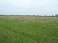
 Farmland - geograph.org.uk - 308383.jpg 640 × 480 ; 121 kio
-
 Farmland beside the B1228 - geograph.org.uk - 5365439.jpg 640 × 427 ; 233 kio
-
 Farmland from Fog Lane - geograph.org.uk - 308374.jpg 640 × 480 ; 87 kio
-
 Farmland from Fog Lane - geograph.org.uk - 308377.jpg 640 × 362 ; 46 kio
-
 Farmland near Ruddings Lane - geograph.org.uk - 5364294.jpg 640 × 427 ; 253 kio
-
 Farmland off Fog Lane - geograph.org.uk - 2359299.jpg 1 600 × 1 200 ; 447 kio
-
 Farmland off Long Lane - geograph.org.uk - 2359211.jpg 1 600 × 1 200 ; 305 kio
-
 Farmland off the B1228 - geograph.org.uk - 2359290.jpg 1 600 × 1 200 ; 444 kio
-
 Farmland, Aughton - geograph.org.uk - 2359215.jpg 1 600 × 1 200 ; 489 kio
-
 Farmland, Aughton Common - geograph.org.uk - 2359199.jpg 1 600 × 1 200 ; 466 kio
-
 Farmland, Laytham Park - geograph.org.uk - 2035739.jpg 640 × 480 ; 64 kio
-
 Farmland, Pond Farm - geograph.org.uk - 2359297.jpg 1 600 × 1 200 ; 327 kio
-
 Field boundary off Long Lane - geograph.org.uk - 5269588.jpg 1 024 × 768 ; 146 kio
-
 Field edge, Aughton Ruddings - geograph.org.uk - 5266648.jpg 1 024 × 768 ; 186 kio
-
 Field entrance off Fog Lane - geograph.org.uk - 5365436.jpg 640 × 427 ; 247 kio
-
 Field entrance off Short Acre Lane - geograph.org.uk - 2359231.jpg 1 600 × 1 200 ; 494 kio
-
 Field off Fog Lane - geograph.org.uk - 5265236.jpg 1 024 × 768 ; 133 kio
-
 Field off Long Lane - geograph.org.uk - 5265576.jpg 1 024 × 768 ; 118 kio
-
 Field off Townend Road - geograph.org.uk - 3078958.jpg 640 × 480 ; 128 kio
-
 Fields off the Laytham road - geograph.org.uk - 5364567.jpg 640 × 427 ; 234 kio
-
 Fields towards Aughton Ruddings - geograph.org.uk - 875314.jpg 640 × 480 ; 50 kio
-
 Firkin Mouth Drain - geograph.org.uk - 5265112.jpg 1 024 × 768 ; 133 kio
-
 Fishing on the Derwent - geograph.org.uk - 5365483.jpg 640 × 427 ; 218 kio
-
 Flooding on Aughton Ings - geograph.org.uk - 5272084.jpg 1 024 × 768 ; 219 kio
-
 Fog Lane (B1228) - geograph.org.uk - 2359300.jpg 1 600 × 1 200 ; 403 kio
-
 Fog Lane - geograph.org.uk - 1299242.jpg 640 × 480 ; 41 kio
-
 Footpath going to the other side of the hedge - geograph.org.uk - 5975790.jpg 4 608 × 3 456 ; 4,13 Mio
-
 Golf course, Aughton Common - geograph.org.uk - 2359206.jpg 1 600 × 1 200 ; 280 kio
-
 Grass field and woodland near North Ross - geograph.org.uk - 5266653.jpg 1 024 × 768 ; 127 kio
-
 Grass field with molehills - geograph.org.uk - 5269592.jpg 1 024 × 768 ; 147 kio
-
 Haylage bales at Blue Slates Farm - geograph.org.uk - 496888.jpg 640 × 480 ; 124 kio
-
 Hedgerow between Fields - geograph.org.uk - 496889.jpg 640 × 480 ; 87 kio
-
 Hole in the churchyard wall - geograph.org.uk - 5268946.jpg 1 024 × 768 ; 231 kio
-
 Honey for sale - geograph.org.uk - 5364019.jpg 640 × 427 ; 255 kio
-
 Houses in Aughton - geograph.org.uk - 5365504.jpg 640 × 427 ; 223 kio
-
 Ings Drain, Ellerton - geograph.org.uk - 2359226.jpg 1 600 × 1 200 ; 517 kio
-
 Ings from the Church - geograph.org.uk - 5365492.jpg 640 × 427 ; 234 kio
-
 Ings Lane (track) - geograph.org.uk - 2359227.jpg 1 600 × 1 200 ; 390 kio
-
 Ings Lane - geograph.org.uk - 5365451.jpg 640 × 427 ; 236 kio
-
 Ings Lane - geograph.org.uk - 5365486.jpg 640 × 427 ; 219 kio
-
 Ings Lane, Ellerton - geograph.org.uk - 5272015.jpg 1 024 × 768 ; 210 kio
-
 Ings Lane, Ellerton - geograph.org.uk - 5272022.jpg 1 024 × 768 ; 265 kio
-
 Ings Lane, Ellerton - geograph.org.uk - 5272039.jpg 1 024 × 768 ; 261 kio
-
 Ings Lane, Ellerton - geograph.org.uk - 5272848.jpg 1 024 × 768 ; 277 kio
-
 Jump into the field beside Charity Drain - geograph.org.uk - 5937044.jpg 1 600 × 1 200 ; 747 kio
-
 Junction with Main Street - geograph.org.uk - 5365502.jpg 640 × 427 ; 250 kio
-
 Leaving Ellerton - geograph.org.uk - 206041.jpg 640 × 480 ; 105 kio
-
 Long Lane - geograph.org.uk - 5268635.jpg 1 024 × 768 ; 212 kio
-
 Long Lane towards Laytham - geograph.org.uk - 2359200.jpg 1 600 × 1 200 ; 500 kio
-
 Long Lane towards Laytham - geograph.org.uk - 2359212.jpg 1 600 × 1 200 ; 460 kio
-
 Long Rampart (road) towards East Cottingwith - geograph.org.uk - 2517848.jpg 800 × 600 ; 170 kio
-
 Long Rampart - geograph.org.uk - 178534.jpg 640 × 480 ; 65 kio
-
 Long Rampart Crossroads - geograph.org.uk - 1299238.jpg 640 × 368 ; 48 kio
-
 Looking downstream - geograph.org.uk - 5365454.jpg 640 × 427 ; 220 kio
-
 Main Road towards Laytham - geograph.org.uk - 2289676.jpg 800 × 600 ; 274 kio
-
 Main Street from Back Lane - geograph.org.uk - 5365495.jpg 640 × 427 ; 212 kio
-
 Meander on the Derwent - geograph.org.uk - 5365480.jpg 640 × 427 ; 190 kio
-
 Methodist Chapel, Ellerton - geograph.org.uk - 2359218.jpg 1 600 × 1 200 ; 439 kio
-
 Methodist Chapel, Ellerton.jpg 640 × 480 ; 109 kio
-
 Mill House - geograph.org.uk - 5364076.jpg 640 × 427 ; 229 kio
-
 Minor road towards East Cottingwith - geograph.org.uk - 2359306.jpg 1 600 × 1 200 ; 353 kio
-
 Minor road towards Ross Moor - geograph.org.uk - 2035751.jpg 640 × 480 ; 81 kio
-
 Minor road towards the B1228 - geograph.org.uk - 2359230.jpg 1 600 × 1 200 ; 391 kio
-
 Moat at Aughton - geograph.org.uk - 5272227.jpg 1 024 × 768 ; 151 kio
-
 Motte at Aughton - geograph.org.uk - 5272067.jpg 1 024 × 768 ; 239 kio
-
 North Ross - geograph.org.uk - 5364656.jpg 640 × 427 ; 239 kio
-
 Old Mill Silhouette - geograph.org.uk - 208297.jpg 640 × 480 ; 109 kio
-
 On Track With The Harvest - geograph.org.uk - 214701.jpg 640 × 480 ; 111 kio
-
 Over crop to Aughton Ruddings Grange - geograph.org.uk - 5975795.jpg 4 608 × 3 456 ; 3,99 Mio
-
 Pasture off Bowland Lane - geograph.org.uk - 2359235.jpg 1 600 × 1 200 ; 539 kio
-
 Pinholes Lane from Ruddings Lane - geograph.org.uk - 496891.jpg 640 × 480 ; 136 kio
-
 Pond Farm on Fog Lane - geograph.org.uk - 2517842.jpg 800 × 600 ; 203 kio
-
 Pylon crosses Long Lane - geograph.org.uk - 3078979.jpg 640 × 480 ; 117 kio
-
 Ready For The Chop - geograph.org.uk - 208299.jpg 640 × 480 ; 99 kio
-
 Recently cleaned drain - geograph.org.uk - 5285678.jpg 1 024 × 768 ; 173 kio
-
 River Derwent - geograph.org.uk - 6237373.jpg 1 024 × 768 ; 198 kio
-
 River Derwent and flood meadow - geograph.org.uk - 5365481.jpg 640 × 427 ; 215 kio
-
 River Derwent near Aughton Clough - geograph.org.uk - 6237374.jpg 1 024 × 768 ; 196 kio
-
 River Derwent near Ellerton ings - geograph.org.uk - 1551787.jpg 640 × 480 ; 86 kio
-
 River Derwent north of Bubwith - geograph.org.uk - 6237375.jpg 1 024 × 768 ; 171 kio
-
 Road from Ellerton - geograph.org.uk - 5364010.jpg 640 × 427 ; 211 kio
-
 Road Junction, Near Welton - geograph.org.uk - 1604590.jpg 640 × 480 ; 56 kio
-
 Road near Charity Drain - geograph.org.uk - 5364566.jpg 640 × 427 ; 222 kio
-
 Road to Blue Slates Farm - geograph.org.uk - 5364286.jpg 640 × 427 ; 234 kio
-
 Road to East Cottingwith - geograph.org.uk - 178541.jpg 640 × 480 ; 82 kio
-
 Road to Ellerton from the B1228 - geograph.org.uk - 178536.jpg 640 × 480 ; 84 kio
-
 Roller beside Bowland Lane - geograph.org.uk - 5364170.jpg 640 × 427 ; 226 kio
-
 Rosewood Farm, Aughton Ruddings - geograph.org.uk - 5266645.jpg 1 024 × 768 ; 159 kio
-
 Rough grazing near Blue Slates Farm - geograph.org.uk - 5265109.jpg 1 024 × 768 ; 171 kio
-
 Short Acre Lane - geograph.org.uk - 2359232.jpg 1 600 × 1 200 ; 394 kio
-
 Shortacre Lane - geograph.org.uk - 5364082.jpg 640 × 427 ; 256 kio
-
 Shortacre Lane - geograph.org.uk - 5364094.jpg 640 × 427 ; 234 kio
-
 Signpost - geograph.org.uk - 178537.jpg 640 × 480 ; 50 kio
-
 Sike Bridge - geograph.org.uk - 6236452.jpg 1 024 × 768 ; 220 kio
-
 South Acre Farm - geograph.org.uk - 5937056.jpg 1 600 × 1 200 ; 490 kio
-
 South View Farm - geograph.org.uk - 1299250.jpg 640 × 480 ; 78 kio
-
 Springfield Farm - geograph.org.uk - 5266650.jpg 1 024 × 768 ; 285 kio
-
 Springfield Farm off Bridges Lane - geograph.org.uk - 2517841.jpg 800 × 600 ; 215 kio
-
 St Mary's Church, Ellerton - geograph.org.uk - 2359219.jpg 1 600 × 1 200 ; 392 kio
-
 St. Mary's Church - geograph.org.uk - 3078456.jpg 640 × 480 ; 105 kio
-
 St. Mary's Church - geograph.org.uk - 5365489.jpg 640 × 427 ; 245 kio
-
 Start of Long Lane - geograph.org.uk - 3078962.jpg 640 × 480 ; 175 kio
-
 Still Life On Ellerton Pond - geograph.org.uk - 208306.jpg 640 × 480 ; 105 kio
-
 Stubble field and trees of Ings Lane, Ellerton - geograph.org.uk - 5272233.jpg 1 024 × 768 ; 266 kio
-
 Sugar Beet - geograph.org.uk - 208294.jpg 640 × 480 ; 101 kio
-
 Sugar beet pile and conveyor. Ellerton - geograph.org.uk - 5266518.jpg 1 024 × 768 ; 115 kio
-
 The B1228 - geograph.org.uk - 214704.jpg 640 × 480 ; 103 kio
-
 The B1228 Towards Howden - geograph.org.uk - 214702.jpg 640 × 480 ; 107 kio
-
 The churchyard at Ellerton - geograph.org.uk - 2749450.jpg 1 024 × 768 ; 139 kio
-
 The junction of Ings Lane and Cow Pasture Lane - geograph.org.uk - 5272782.jpg 1 024 × 768 ; 201 kio
-
 The Oaks Golf Club - geograph.org.uk - 5365509.jpg 640 × 427 ; 232 kio
-
 The Old Mill, Ellerton - geograph.org.uk - 5265558.jpg 1 024 × 768 ; 110 kio
-
 The River Derwent in flood - geograph.org.uk - 5271997.jpg 1 024 × 712 ; 157 kio
-

-
 The Southern Road To Ellerton - geograph.org.uk - 214709.jpg 640 × 480 ; 99 kio
-
 The Weres, Ellerton - geograph.org.uk - 2359216.jpg 1 600 × 1 200 ; 611 kio
-
 Towards Aughton House - geograph.org.uk - 5364312.jpg 640 × 427 ; 254 kio
-
 Towards Ellerton Church - geograph.org.uk - 5365487.jpg 640 × 427 ; 210 kio
-
 Towards the Derwent - geograph.org.uk - 3078459.jpg 640 × 480 ; 89 kio
-
 Towards the River Derwent - geograph.org.uk - 5365452.jpg 640 × 427 ; 224 kio
-
 Track across farmland - geograph.org.uk - 5365440.jpg 640 × 427 ; 207 kio


_Laytham_Park_-_geograph.org.uk_-_2035735.jpg)
_-_geograph.org.uk_-_2359193.jpg)


_-_geograph.org.uk_-_2359300.jpg)


_-_geograph.org.uk_-_2359227.jpg)


_towards_East_Cottingwith_-_geograph.org.uk_-_2517848.jpg)


