Category:Elsing
Aller à la navigation
Aller à la recherche
English: Elsing is a village and civil parish in the English county of Norfolk. It is situated some 6 miles north-east of the town of East Dereham and 12 miles north-west of the city of Norwich.
localité britannique du comté anglais de Norfolk  | |||||
| Téléverser des médias | |||||
| Nature de l’élément | |||||
|---|---|---|---|---|---|
| Lieu | Breckland, Norfolk, Angleterre de l'Est, Angleterre | ||||
| Population |
| ||||
| Superficie |
| ||||
| Réputé identique à | Elsing (page en doublon, paroisse civile) | ||||
 | |||||
Sous-catégories
Cette catégorie comprend 7 sous-catégories, dont les 7 ci-dessous.
E
- Elsing Mill (3 F)
H
- Elsing Hall (2 F)
M
P
- Peaseland Green (9 F)
S
T
- The Mermaid Inn, Elsing (6 F)
Média dans la catégorie « Elsing »
Cette catégorie comprend 91 fichiers, dont les 91 ci-dessous.
-
 A newly planted Woodland Trust wood in Norfolk. - geograph.org.uk - 154480.jpg 640 × 480 ; 120 kio
-
 Back Lane, Elsing - geograph.org.uk - 732923.jpg 640 × 428 ; 88 kio
-
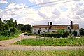
 Barns by Hall Farm - geograph.org.uk - 4274518.jpg 640 × 480 ; 149 kio
-
 Bend in Elsing Road - geograph.org.uk - 5540997.jpg 640 × 480 ; 77 kio
-
 Bridge over Penny Spot Beck - geograph.org.uk - 5540989.jpg 640 × 480 ; 130 kio
-
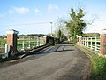
 Bridge over the River Wensum - geograph.org.uk - 4279286.jpg 640 × 480 ; 171 kio
-
 Bridge over the River Wensum - geograph.org.uk - 5005380.jpg 2 256 × 1 496 ; 912 kio
-
 Bridge over the River Wensum at Elsing - geograph.org.uk - 4274556.jpg 640 × 480 ; 155 kio
-
 Bridleway off Hall Road - geograph.org.uk - 4274519.jpg 640 × 436 ; 127 kio
-
 Brook near Elsing Hall - geograph.org.uk - 4279374.jpg 640 × 480 ; 192 kio
-
-
 Cottage Farm (farmhouse) - geograph.org.uk - 4274517.jpg 640 × 568 ; 296 kio
-
 Country road at Peaseland Green - geograph.org.uk - 4279441.jpg 640 × 480 ; 137 kio
-
 Cows by the River Wensum - geograph.org.uk - 5005382.jpg 2 256 × 1 496 ; 919 kio
-
 Crop field, Elsing - geograph.org.uk - 5540995.jpg 640 × 480 ; 74 kio
-
 Crop fields by Fustyweed - geograph.org.uk - 4274563.jpg 640 × 480 ; 231 kio
-
 Crossroads near Primrose Green - geograph.org.uk - 4279464.jpg 640 × 480 ; 134 kio
-
 Driveway to Marsh Cottage - geograph.org.uk - 4274561.jpg 640 × 480 ; 248 kio
-
 Elizabeth II postbox, Peaseland Green - geograph.org.uk - 5542602.jpg 2 136 × 2 848 ; 1,38 Mio
-
 Elsing - cottage by Beech Walk - geograph.org.uk - 6013991.jpg 5 184 × 2 920 ; 5,06 Mio
-
 Elsing - Please drive carefully - geograph.org.uk - 4277029.jpg 640 × 480 ; 191 kio
-
 Elsing - St Mary's Church - geograph.org.uk - 6013987.jpg 5 184 × 2 920 ; 4,84 Mio
-
 Elsing Chapel.JPG 3 608 × 2 682 ; 1,83 Mio
-
 Elsing village entrance sign - geograph.org.uk - 2236644.jpg 640 × 480 ; 61 kio
-
 Elsing village entrance sign - geograph.org.uk - 2236695.jpg 640 × 480 ; 86 kio
-
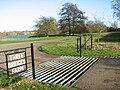
 Elsing War Memorial - geograph.org.uk - 5559311.jpg 2 592 × 3 456 ; 3,24 Mio
-
 Elsing, St Mary - geograph.org.uk - 6363005.jpg 4 608 × 3 456 ; 5,28 Mio
-
 Entrance to Three Bridges Farm - geograph.org.uk - 4274548.jpg 640 × 480 ; 159 kio
-
 Farm track near Peaseland Green - geograph.org.uk - 5541232.jpg 640 × 480 ; 68 kio
-
 Field of rape through the gate in the wall - geograph.org.uk - 4277051.jpg 640 × 480 ; 152 kio
-
 Footpath markers beside Hall Road - geograph.org.uk - 4274520.jpg 640 × 474 ; 122 kio
-
 Fork in the River Wensum - geograph.org.uk - 4274558.jpg 640 × 571 ; 181 kio
-
 Fustyweed village entrance sign - geograph.org.uk - 2236689.jpg 640 × 480 ; 114 kio
-
 Gated track (bridleway) off Elsing Road - geograph.org.uk - 5540990.jpg 640 × 480 ; 71 kio
-
 Gateway in a wall - geograph.org.uk - 4277024.jpg 640 × 480 ; 184 kio
-

-
 Hall Road towards Elsing - geograph.org.uk - 5004912.jpg 2 256 × 1 496 ; 2,76 Mio
-
 Heading south east from Elsing - geograph.org.uk - 5541231.jpg 640 × 480 ; 68 kio
-
 Houses in Rectory Road - geograph.org.uk - 4274523.jpg 568 × 640 ; 196 kio
-
 Houses on Church Street, Elsing - geograph.org.uk - 5541006.jpg 640 × 480 ; 58 kio
-
 Junction on Hall Road - geograph.org.uk - 5004934.jpg 2 217 × 1 470 ; 2,57 Mio
-
 K6 telephone box in Mill Street - geograph.org.uk - 4274553.jpg 640 × 480 ; 154 kio
-
 K6 telephone box in Mill Street - geograph.org.uk - 4274554.jpg 480 × 640 ; 184 kio
-
 Lake at Three Bridges Farm - geograph.org.uk - 4274549.jpg 640 × 462 ; 122 kio
-
 Lake at Three Bridges Farm - geograph.org.uk - 4274550.jpg 640 × 396 ; 91 kio
-
 Minor road to Sparham Hole - geograph.org.uk - 4274564.jpg 640 × 480 ; 220 kio
-
 Nissen huts as farm buildings at Green farm - geograph.org.uk - 4279447.jpg 640 × 480 ; 96 kio
-
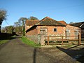
 Old disused barns at Hall Farm - geograph.org.uk - 4279404.jpg 640 × 480 ; 111 kio
-
 Pastures by Elsing Mill - geograph.org.uk - 4274560.jpg 640 × 480 ; 223 kio
-
 Rural road near Primrose Green - geograph.org.uk - 5541244.jpg 640 × 480 ; 65 kio
-
 Rural road, Peaseland Green - geograph.org.uk - 5541240.jpg 640 × 480 ; 75 kio
-
 Shady lane, better known as Hall Road - geograph.org.uk - 4277017.jpg 640 × 480 ; 92 kio
-
 Smashed postbox - geograph.org.uk - 4279386.jpg 480 × 640 ; 220 kio
-
 Smashed postbox near Hall Farm - geograph.org.uk - 4279399.jpg 640 × 480 ; 159 kio
-
 Snail shells inside a smashed postbox - geograph.org.uk - 4279391.jpg 480 × 640 ; 136 kio
-
 The Driveway To Hunters Hall - geograph.org.uk - 292912.jpg 640 × 480 ; 89 kio
-
 The Driveway To Penny Spot Farm - geograph.org.uk - 292941.jpg 640 × 480 ; 104 kio
-
 The Driveway To Wensum Farm - geograph.org.uk - 275702.jpg 640 × 480 ; 99 kio
-
 The Road To Elsing - geograph.org.uk - 292947.jpg 640 × 480 ; 85 kio
-
 The Road To Swanton Morley - geograph.org.uk - 292915.jpg 640 × 480 ; 97 kio
-
 The Road To Swanton Morley - geograph.org.uk - 296659.jpg 640 × 480 ; 101 kio
-
 Three Bridges Farm on the edge of Lyng - geograph.org.uk - 527941.jpg 640 × 413 ; 69 kio
-
 Track to Penny Spot Farm - geograph.org.uk - 5540992.jpg 640 × 480 ; 127 kio
-
 Two Five-Barred Gates - geograph.org.uk - 275699.jpg 640 × 480 ; 99 kio
-
 View along Elsing Lane - geograph.org.uk - 4274562.jpg 640 × 480 ; 188 kio
-
 Wensum Way, permissive path and Wensum bridge - geograph.org.uk - 4279280.jpg 640 × 480 ; 195 kio
-
 Willows growing beside the River Wensum - geograph.org.uk - 4274559.jpg 640 × 480 ; 148 kio
-
 Yes, that really is its name^ - geograph.org.uk - 551196.jpg 640 × 480 ; 179 kio
-
 A Glutinous Gateway - geograph.org.uk - 275696.jpg 640 × 480 ; 97 kio
-
 A Harvester - geograph.org.uk - 275302.jpg 640 × 480 ; 99 kio
-
 A Shaded Road - geograph.org.uk - 292926.jpg 640 × 480 ; 96 kio
-
 Cottage at the hamlet of Fustyweed - geograph.org.uk - 551193.jpg 640 × 456 ; 97 kio
-
 Duck And Dodge To Enter - geograph.org.uk - 275310.jpg 640 × 480 ; 99 kio
-

-
 Hedgebound - geograph.org.uk - 296658.jpg 640 × 480 ; 105 kio
-
 Hiding In The Wood - geograph.org.uk - 275290.jpg 640 × 480 ; 96 kio
-
 Lives Up To Its Name - geograph.org.uk - 275311.jpg 640 × 480 ; 98 kio
-
 No Entry - geograph.org.uk - 275313.jpg 640 × 480 ; 97 kio
-

-
 The Road From Swanton Morley - geograph.org.uk - 275691.jpg 640 × 480 ; 97 kio
-
 The Road From Swanton Morley - geograph.org.uk - 275697.jpg 640 × 480 ; 100 kio
-
 The Road To Elsing - geograph.org.uk - 275686.jpg 640 × 480 ; 99 kio
-
 The Road To Elsing - geograph.org.uk - 275693.jpg 640 × 480 ; 98 kio
-
 The Road To Elsing - geograph.org.uk - 292917.jpg 640 × 480 ; 92 kio
-
 The Road To Elsing - geograph.org.uk - 296656.jpg 640 × 480 ; 92 kio
-
 The Road To Etling Green - geograph.org.uk - 296641.jpg 640 × 480 ; 84 kio
-
 The Road To Peaseland Green - geograph.org.uk - 296634.jpg 640 × 480 ; 89 kio
-
 Towards Hunters Hall - geograph.org.uk - 292920.jpg 640 × 480 ; 97 kio
-
 Transition - geograph.org.uk - 292933.jpg 640 × 480 ; 94 kio
-
 Turning Circle - geograph.org.uk - 275692.jpg 640 × 480 ; 98 kio
-
 Wensum Farm - geograph.org.uk - 296654.jpg 640 × 480 ; 97 kio


_-_geograph.org.uk_-_4274517.jpg)


_off_Elsing_Road_-_geograph.org.uk_-_5540990.jpg)


