Category:Embleton, Cumbria
Aller à la navigation
Aller à la recherche
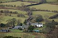
English: Embleton is a small village and civil parish in the Allerdale district in Cumbria, England. It is located east of Cockermouth on the A66 road, and within the boundaries of the Lake District National Park. As of the 2001 census the parish had a population of 297.
localité britannique du comté anglais de Cumbria  | |||||
| Téléverser des médias | |||||
| Nature de l’élément | |||||
|---|---|---|---|---|---|
| Lieu |
| ||||
 | |||||
Sous-catégories
Cette catégorie comprend 3 sous-catégories, dont les 3 ci-dessous.
Média dans la catégorie « Embleton, Cumbria »
Cette catégorie comprend 78 fichiers, dont les 78 ci-dessous.
-
 A wet A66 by Embleton - geograph.org.uk - 3092483.jpg 640 × 468 ; 37 kio
-
 Approaching Embleton from the west - geograph.org.uk - 3003521.jpg 2 592 × 1 944 ; 2,23 Mio
-
 B5292 entering Lorton Vale - geograph.org.uk - 4200764.jpg 1 280 × 851 ; 259 kio
-
 B5292 heading towards Armaside How - geograph.org.uk - 6335141.jpg 2 000 × 1 130 ; 2,23 Mio
-

-
 Brumston Bridge over Wythop Beck - geograph.org.uk - 2247572.jpg 800 × 530 ; 218 kio
-
 Buildings at Highside Farm - geograph.org.uk - 3239830.jpg 1 024 × 768 ; 371 kio
-
 Byerstead - geograph.org.uk - 5998503.jpg 1 499 × 851 ; 1,08 Mio
-
 Country lane to Wythop Mill - geograph.org.uk - 3241067.jpg 1 024 × 768 ; 372 kio
-
 Country Road, Wythop - geograph.org.uk - 785496.jpg 640 × 480 ; 106 kio
-
 Crossroads in Cumbria - geograph.org.uk - 4624989.jpg 4 000 × 3 000 ; 2,31 Mio
-
 Crossroads on the B5292 - geograph.org.uk - 4200757.jpg 1 280 × 851 ; 242 kio
-
 Damp ground, Setmurthy - geograph.org.uk - 2744609.jpg 640 × 360 ; 239 kio
-
 Derwent Lodge, Embleton - geograph.org.uk - 957162.jpg 640 × 426 ; 55 kio
-
 Direction Sign – Signpost - geograph.org.uk - 6506621.jpg 720 × 960 ; 64 kio
-
 Direction Sign – Signpost - geograph.org.uk - 6506634.jpg 720 × 960 ; 207 kio
-
 East House farm from Sale Fell - geograph.org.uk - 2247403.jpg 800 × 530 ; 154 kio
-
 East House, from the Wythop Mill to Pheasant Inn road - geograph.org.uk - 3241066.jpg 1 024 × 768 ; 332 kio
-
 Elva Plain Farmstead. - geograph.org.uk - 79947.jpg 640 × 480 ; 79 kio
-
 Embleton church - geograph.org.uk - 5807433.jpg 1 600 × 1 067 ; 506 kio
-
 Embleton view - geograph.org.uk - 5935886.jpg 2 048 × 1 536 ; 765 kio
-
 Entering Embleton - geograph.org.uk - 3380736.jpg 2 592 × 1 944 ; 1,94 Mio
-
 Fence, west of the summit of Ling Fell - geograph.org.uk - 3239862.jpg 1 024 × 768 ; 179 kio
-
 Field edge footpath near Highside Farm - geograph.org.uk - 3239835.jpg 1 024 × 768 ; 331 kio
-
 Fields at High Abbey, Wythop - geograph.org.uk - 3379766.jpg 2 592 × 1 944 ; 1,37 Mio
-
 Fields by the old reservoir - geograph.org.uk - 4082401.jpg 640 × 480 ; 57 kio
-
 Fields south of Westray Farm - geograph.org.uk - 3003498.jpg 2 592 × 1 944 ; 1,64 Mio
-
 Fisher Wood - geograph.org.uk - 2687693.jpg 2 560 × 1 530 ; 782 kio
-
 Green Lonning, public bridleway and track - geograph.org.uk - 3239824.jpg 1 024 × 768 ; 568 kio
-
 Ground rising to Ling Fell - geograph.org.uk - 6000146.jpg 1 500 × 842 ; 1 002 kio
-
 Gully containing Tom Rudd Beck - geograph.org.uk - 4082410.jpg 640 × 480 ; 94 kio
-
 High Stanger Farm - geograph.org.uk - 4624675.jpg 4 000 × 3 000 ; 2,94 Mio
-
 Highside Farmhouse,Embleton, Cockermouth - geograph.org.uk - 1299275.jpg 640 × 480 ; 71 kio
-
 Horses in a field in Lorton Vale - geograph.org.uk - 2704225.jpg 1 600 × 1 200 ; 298 kio
-
 Houses at Wythop Mill - geograph.org.uk - 4200741.jpg 1 280 × 851 ; 328 kio
-
 Hundith Hill Hotel - geograph.org.uk - 3003482.jpg 2 592 × 1 944 ; 1,2 Mio
-
 Lane to Wythop Mill - geograph.org.uk - 4200533.jpg 1 280 × 851 ; 263 kio
-
 Long Fell - geograph.org.uk - 4082408.jpg 640 × 480 ; 61 kio
-
 Looking across the A66 - geograph.org.uk - 3239814.jpg 1 024 × 768 ; 206 kio
-
 Looking back to Highside Farm - geograph.org.uk - 3239840.jpg 1 024 × 768 ; 257 kio
-
 Looking out from the footpath to Cockermouth - geograph.org.uk - 1176410.jpg 640 × 480 ; 57 kio
-
 Looking towards Slate Fell - geograph.org.uk - 1176420.jpg 640 × 480 ; 90 kio
-
 Minor road approaching Lambfoot - geograph.org.uk - 5267163.jpg 800 × 600 ; 164 kio
-
 Moorland and rough grazing on slopes of Graystones - geograph.org.uk - 6000482.jpg 1 500 × 954 ; 958 kio
-
 Near Wythop Mill - geograph.org.uk - 5937517.jpg 2 048 × 1 536 ; 977 kio
-
 Oaks in Wythop - geograph.org.uk - 2887874.jpg 2 560 × 1 920 ; 2 Mio
-
 Old signpost in Wythop Mill - geograph.org.uk - 3241068.jpg 1 024 × 768 ; 405 kio
-
 On Ling Fell - geograph.org.uk - 961130.jpg 640 × 480 ; 77 kio
-
 Pasture in Lorton Vale - geograph.org.uk - 2704237.jpg 1 600 × 1 200 ; 124 kio
-
 Pastures, Embleton - geograph.org.uk - 1034321.jpg 640 × 480 ; 104 kio
-
 Public footpath above Tom Rudd Beck - geograph.org.uk - 3239855.jpg 1 024 × 768 ; 220 kio
-
 River Cocker, Southwaite - geograph.org.uk - 4200771.jpg 1 280 × 851 ; 327 kio
-
 Road descending to A66 - geograph.org.uk - 5995710.jpg 1 500 × 1 125 ; 1,39 Mio
-
 Seacross Wood - geograph.org.uk - 5937516.jpg 2 048 × 1 536 ; 840 kio
-
 Sheep in pasture in Lorton Vale - geograph.org.uk - 2704233.jpg 1 600 × 1 200 ; 238 kio
-
 Slate Fell - geograph.org.uk - 4293763.jpg 640 × 480 ; 86 kio
-
 St Cuthbert's church, Embleton - geograph.org.uk - 3379768.jpg 2 592 × 1 944 ; 1,43 Mio
-
 Stand of firs on Cockermouth Golf Course - geograph.org.uk - 5212222.jpg 640 × 480 ; 54 kio
-
 Stanger Spa - geograph.org.uk - 4624966.jpg 4 000 × 3 000 ; 4,24 Mio
-
-
 The Hundith Hill Road - geograph.org.uk - 3003489.jpg 2 592 × 1 944 ; 1,51 Mio
-
 The lane to Armaside - geograph.org.uk - 3379774.jpg 2 592 × 1 944 ; 1,45 Mio
-
 The lane to Wythop Mill - geograph.org.uk - 3379757.jpg 2 592 × 1 944 ; 1,97 Mio
-
 The Lorton Road with Grasmoor in the distance - geograph.org.uk - 4433327.jpg 1 600 × 991 ; 425 kio
-
 The north-east slopes of Slate Fell - geograph.org.uk - 3382005.jpg 2 592 × 1 944 ; 1,45 Mio
-
 The old A66 heads for Cockermouth - geograph.org.uk - 3381996.jpg 2 592 × 1 944 ; 1,61 Mio
-
 The Wheatsheaf Inn, Embleton - geograph.org.uk - 3239806.jpg 1 024 × 768 ; 245 kio
-
 Tom Rudd Beck - geograph.org.uk - 3003501.jpg 2 592 × 1 944 ; 2,7 Mio
-
 Tom Rudd Beck - geograph.org.uk - 4082409.jpg 640 × 480 ; 124 kio
-
 Unnamed farm on fellside. - geograph.org.uk - 80549.jpg 640 × 480 ; 109 kio
-
 Wheatsheaf Inn, Embleton - geograph.org.uk - 957156.jpg 640 × 426 ; 56 kio
-
 Wythop Mill from Ling Fell - geograph.org.uk - 2247573.jpg 800 × 530 ; 134 kio
-
 A66 - geograph.org.uk - 556811.jpg 640 × 480 ; 193 kio
-
 Derwent Lodge. - geograph.org.uk - 80532.jpg 640 × 480 ; 97 kio
-
 Disused quarry Embleton - geograph.org.uk - 90950.jpg 640 × 427 ; 64 kio
-
 Dunthwaite House entrance from road. - geograph.org.uk - 81018.jpg 640 × 480 ; 124 kio
-

-
 Towards Old Scales. - geograph.org.uk - 95448.jpg 640 × 480 ; 67 kio


