Category:Enderby, Leicestershire
Aller à la navigation
Aller à la recherche
English: Enderby is a village and civil parish in the Blaby district of Leicestershire, England, immediately southwest of the city of Leicester
Article Wikipédia principal : Enderby, Leicestershire.

localité britannique du comté anglais de Leicestershire  | |||||
| Téléverser des médias | |||||
| Nature de l’élément | |||||
|---|---|---|---|---|---|
| Lieu | Blaby, Leicestershire, Midlands de l'Est, Angleterre | ||||
| Réputé identique à | Enderby (page en doublon, paroisse civile) | ||||
| site officiel | |||||
 | |||||
Sous-catégories
Cette catégorie comprend 3 sous-catégories, dont les 3 ci-dessous.
E
- Enderby Mill Bridge (3 F)
F
- Fosse Park (8 F)
Média dans la catégorie « Enderby, Leicestershire »
Cette catégorie comprend 280 fichiers, dont les 200 ci-dessous.
(page précédente) (page suivante)-
 'The Wether' at the Everards Meadows - geograph.org.uk - 6248080.jpg 1 024 × 518 ; 108 kio
-
 A cold and frozen lake at Grove Park - geograph.org.uk - 3269299.jpg 4 000 × 3 000 ; 1,94 Mio
-
 A large sculpture at Grove Park Business Park. - geograph.org.uk - 366181.jpg 640 × 540 ; 125 kio
-
 A563 Lubbesthorpe Way at Grove Park - geograph.org.uk - 5412348.jpg 800 × 460 ; 86 kio
-
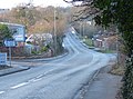
 Approaching Enderby - geograph.org.uk - 491652.jpg 640 × 499 ; 142 kio
-
 Asda Leicester Superstore - geograph.org.uk - 5454326.jpg 800 × 414 ; 83 kio
-
 Asda Supercentre, Fosse Park, Leicester - geograph.org.uk - 5030167.jpg 640 × 480 ; 50 kio
-
 Aspects at the Plough - geograph.org.uk - 491705.jpg 640 × 504 ; 98 kio
-
 Autumn trees next to the Everards Brewery - geograph.org.uk - 3750737.jpg 1 600 × 984 ; 654 kio
-
 Aylestone Playing Fields - geograph.org.uk - 441778.jpg 608 × 640 ; 136 kio
-
 B582 overbridge, M1 - geograph.org.uk - 4689427.jpg 640 × 366 ; 26 kio
-
 B582 towards Enderby - geograph.org.uk - 3855640.jpg 640 × 480 ; 73 kio
-
 B582 towards Enderby - geograph.org.uk - 3855642.jpg 640 × 480 ; 82 kio
-
 Bales at Warren Farm near Enderby - geograph.org.uk - 5691450.jpg 800 × 433 ; 94 kio
-
 Bannister Road - geograph.org.uk - 1292521.jpg 640 × 480 ; 177 kio
-
 Barr Close in Enderby - geograph.org.uk - 4329338.jpg 1 600 × 999 ; 412 kio
-
 Blaby Road bridge in Enderby - geograph.org.uk - 4162576.jpg 1 600 × 1 248 ; 550 kio
-
 Blaby Road bridge over the M1 - geograph.org.uk - 4325018.jpg 640 × 372 ; 62 kio
-
 Blaby Road crossing the M1 motorway - geograph.org.uk - 4162638.jpg 1 600 × 1 200 ; 441 kio
-
 Blaby Road in Enderby - geograph.org.uk - 4162568.jpg 1 600 × 1 337 ; 627 kio
-
 Blaby Road in Enderby - geograph.org.uk - 4192148.jpg 1 600 × 1 337 ; 324 kio
-
 Blue Bank Lock - geograph.org.uk - 4654555.jpg 640 × 421 ; 74 kio
-
 Bluebells in New Spinney - geograph.org.uk - 2056315.jpg 1 445 × 854 ; 363 kio
-
 Braunstone-Everards Sewage Pumping Station - geograph.org.uk - 2965237.jpg 640 × 480 ; 107 kio
-
 Bridge across the M69 motorway - geograph.org.uk - 3269214.jpg 3 028 × 2 192 ; 2 Mio
-

-
 Brockington College - geograph.org.uk - 5441370.jpg 1 600 × 900 ; 311 kio
-
 Brockington College netball court - geograph.org.uk - 5379872.jpg 640 × 640 ; 70 kio
-
 Bus at Fosse Park shopping centre - geograph.org.uk - 3382855.jpg 1 024 × 768 ; 119 kio
-
 Car park at Sainsbury's Fosse Park - geograph.org.uk - 5883087.jpg 640 × 425 ; 47 kio
-
 Cattle grid near Warren Cottages - geograph.org.uk - 3269225.jpg 3 790 × 2 495 ; 3,62 Mio
-
 Coleridge Drive in Enderby - geograph.org.uk - 5278538.jpg 627 × 800 ; 164 kio
-
 Construction at Fosse Park - geograph.org.uk - 6230035.jpg 800 × 453 ; 76 kio
-
 Construction at Fosse Park - geograph.org.uk - 6320863.jpg 800 × 450 ; 78 kio
-
 Construction next to Grove Way - geograph.org.uk - 6286249.jpg 800 × 452 ; 89 kio
-
 Construction next to Grove Way - geograph.org.uk - 6320862.jpg 800 × 400 ; 65 kio
-

-
 Construction on the Everards Meadows - geograph.org.uk - 5600468.jpg 800 × 462 ; 103 kio
-
 Construction work along Grove Way - geograph.org.uk - 6376198.jpg 800 × 480 ; 91 kio
-
 Construction work at Fosse Park - geograph.org.uk - 6235599.jpg 800 × 450 ; 134 kio
-
 Construction work at Fosse Park - geograph.org.uk - 6235601.jpg 800 × 453 ; 119 kio
-
 Construction work at Fosse Park - geograph.org.uk - 6376203.jpg 800 × 451 ; 90 kio
-
 Construction work at the Everards Meadows - geograph.org.uk - 5463989.jpg 800 × 549 ; 152 kio
-
 Construction work at the Everards Meadows - geograph.org.uk - 5464026.jpg 800 × 524 ; 155 kio
-
 Construction work at the Everards Meadows - geograph.org.uk - 6001571.jpg 640 × 330 ; 53 kio
-
 Construction work at the Everards Meadows - geograph.org.uk - 6235568.jpg 800 × 398 ; 72 kio
-
 Cycleway and path along Soar Valley Way - geograph.org.uk - 3750727.jpg 1 600 × 1 235 ; 934 kio
-
 Daffodils at the Everards Brewery - geograph.org.uk - 5339578.jpg 800 × 565 ; 199 kio
-
 Demolition of the Everards Brewery - geograph.org.uk - 5581095.jpg 800 × 582 ; 89 kio
-
 Demolition of the Everards Brewery - geograph.org.uk - 5581098.jpg 800 × 588 ; 74 kio
-
 Demolition of the Everards Brewery - geograph.org.uk - 5581105.jpg 800 × 514 ; 137 kio
-
 Demolition of the Everards Brewery - geograph.org.uk - 5600463.jpg 800 × 412 ; 70 kio
-
 Demolition of the Everards Brewery - geograph.org.uk - 5753007.jpg 800 × 391 ; 111 kio
-
 DFS at the Fosse Shopping Park, Enderby - geograph.org.uk - 5023907.jpg 2 560 × 1 368 ; 2,55 Mio
-
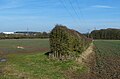
 Electricity Pylon - geograph.org.uk - 481730.jpg 480 × 640 ; 103 kio
-
 Enderby Bridge crossing the River Soar (geograph 5271960).jpg 800 × 558 ; 149 kio
-
 Enderby Dog ^ Gun - geograph.org.uk - 2858950.jpg 640 × 480 ; 85 kio
-
 Enderby Graffiti - geograph.org.uk - 2057808.jpg 2 652 × 591 ; 889 kio
-
 Enderby Hall 1790.jpg 425 × 319 ; 18 kio
-
 Enderby Methodist Church 2011.jpg 2 592 × 1 944 ; 1,52 Mio
-
 Enderby Nags Head - geograph.org.uk - 2858958.jpg 640 × 480 ; 108 kio
-
 Enderby New Inn - geograph.org.uk - 2858968.jpg 611 × 478 ; 90 kio
-
 Enderby Old building.JPG 2 304 × 1 536 ; 579 kio
-
 Enderby Parish Church - geograph.org.uk - 5463969.jpg 800 × 596 ; 130 kio
-
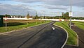
 Enderby Park and Ride - geograph.org.uk - 3269267.jpg 4 000 × 3 000 ; 3,72 Mio
-
 Enderby Park ^ Ride - geograph.org.uk - 4192195.jpg 1 600 × 1 203 ; 614 kio
-
 Enderby Plough (Aspects Restaurant) - geograph.org.uk - 2858933.jpg 640 × 480 ; 138 kio
-
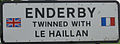 Enderby Sign.jpg 908 × 336 ; 68 kio
-
 Enderby Toby Carvery - geograph.org.uk - 2858992.jpg 640 × 480 ; 99 kio
-
 Enderby town badge.jpg 1 800 × 1 800 ; 584 kio
-
 Enderby Warren landfill site (disused) - geograph.org.uk - 3269163.jpg 3 235 × 2 378 ; 2,43 Mio
-
 Enderby Warren landfill site - geograph.org.uk - 3269183.jpg 2 794 × 1 787 ; 858 kio
-
 Enderby ^ District Social Club - geograph.org.uk - 5278536.jpg 800 × 509 ; 81 kio
-
 Etfc 1950s.jpg 3 024 × 4 032 ; 4,22 Mio
-
 ETFC Original.jpg 3 024 × 4 032 ; 4,64 Mio
-
 Everards Brewery - geograph.org.uk - 3946664.jpg 3 461 × 1 748 ; 2,78 Mio
-
 Everards Brewery at Fosse Park - geograph.org.uk - 3750731.jpg 1 600 × 1 218 ; 719 kio
-
 Everards Meadows - geograph.org.uk - 5232432.jpg 800 × 533 ; 150 kio
-
 Everards Meadows - geograph.org.uk - 5247700.jpg 800 × 586 ; 134 kio
-
 Exit road for the M69, Junction 21, M1 - geograph.org.uk - 2853664.jpg 640 × 480 ; 57 kio
-
 Farm track to Warren Cottages - geograph.org.uk - 4842507.jpg 2 000 × 1 500 ; 307 kio
-
 Farmland near Leicester Lane - geograph.org.uk - 4162454.jpg 1 600 × 1 200 ; 737 kio
-
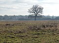
 Farmland near the Park in Enderby - geograph.org.uk - 3269234.jpg 4 000 × 3 000 ; 3,59 Mio
-
 Farmland near the Park in Enderby - geograph.org.uk - 3269242.jpg 3 665 × 2 562 ; 2,92 Mio
-
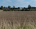
 Farmland near Warren Farm - geograph.org.uk - 5463978.jpg 800 × 418 ; 79 kio
-
 Farmland near Warren Farm - geograph.org.uk - 5691383.jpg 800 × 530 ; 106 kio
-
 Farmland next to the Fosse Way - geograph.org.uk - 4162480.jpg 1 600 × 1 264 ; 782 kio
-
 Farmland next to the Fosse Way - geograph.org.uk - 5247725.jpg 800 × 488 ; 132 kio
-
 Farmland next to the M69 motorway - geograph.org.uk - 5691307.jpg 800 × 600 ; 130 kio
-
 Field boundary at Everards Meadows - geograph.org.uk - 6248077.jpg 800 × 442 ; 137 kio
-
 Field on the Aylestone Meadows - geograph.org.uk - 5535864.jpg 800 × 450 ; 108 kio
-
 Flooded path on the Everards Meadows - geograph.org.uk - 6230211.jpg 800 × 408 ; 81 kio
-
 Flooded path on the Everards Meadows - geograph.org.uk - 6230227.jpg 800 × 450 ; 87 kio
-
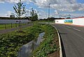
 Flooding along the River Soar - geograph.org.uk - 6286246.jpg 800 × 530 ; 116 kio
-
 Flooding on the Everards Meadows - geograph.org.uk - 6286251.jpg 800 × 450 ; 111 kio
-
 Footbridge across the M1 motorway - geograph.org.uk - 4162703.jpg 1 600 × 1 144 ; 462 kio
-
 Footbridge crossing the Lubbesthorpe Brook - geograph.org.uk - 5535858.jpg 800 × 450 ; 133 kio
-
 Footbridge over the M1 - geograph.org.uk - 4689430.jpg 640 × 390 ; 27 kio
-
 Footpath alongside Narborough Road South - geograph.org.uk - 2326410.jpg 3 253 × 2 135 ; 3,24 Mio
-
 Footpath alongside the M1 motorway - geograph.org.uk - 4162697.jpg 1 600 × 1 200 ; 652 kio
-
 Footpath at Fox Covert - geograph.org.uk - 3269190.jpg 3 536 × 2 677 ; 2,6 Mio
-
 Footpath at the back of Grove Business Park, Leicester - geograph.org.uk - 6222922.jpg 3 776 × 2 520 ; 3,18 Mio
-
 Footpath to Enderby - geograph.org.uk - 4900749.jpg 2 000 × 1 500 ; 638 kio
-
 Forest Road - geograph.org.uk - 5224477.jpg 640 × 480 ; 99 kio
-
 Forest Road - geograph.org.uk - 5224949.jpg 640 × 480 ; 59 kio
-
 Fosse Park - geograph.org.uk - 2160793.jpg 640 × 450 ; 60 kio
-

-
 Fosse Park Filling Station - geograph.org.uk - 2309852.jpg 640 × 443 ; 48 kio
-
 Fosse Park Shopping Centre - geograph.org.uk - 3858390.jpg 1 024 × 768 ; 162 kio
-
 Fosse Park shopping centre, Leicester - geograph.org.uk - 6222908.jpg 3 776 × 2 520 ; 3,22 Mio
-
 Fosse Shopping Park, Enderby - geograph.org.uk - 5023897.jpg 2 560 × 1 891 ; 2,31 Mio
-
 Fox Covert in Enderby - geograph.org.uk - 6046242.jpg 800 × 599 ; 282 kio
-
 Frozen lake at Grove Park - geograph.org.uk - 6046367.jpg 800 × 691 ; 80 kio
-
 Gate to Farmland off Leicester Lane near Enderby - geograph.org.uk - 3139902.jpg 1 024 × 911 ; 175 kio
-
 Grassland near the River Soar - geograph.org.uk - 5429488.jpg 800 × 542 ; 109 kio
-
 Grassland next to the Lubbesthorpe Brook - geograph.org.uk - 5429472.jpg 800 × 434 ; 88 kio
-
 Graveyard at the Enderby Parish Church - geograph.org.uk - 5463552.jpg 800 × 600 ; 105 kio
-
 Grove Farm Carvery Restaurant - geograph.org.uk - 5248215.jpg 800 × 582 ; 116 kio
-
 Grove Farm inn, Grove Business Park, Leicester - geograph.org.uk - 6223103.jpg 3 776 × 2 520 ; 3,3 Mio
-
 Grove Way at Fosse Park - geograph.org.uk - 5425758.jpg 800 × 450 ; 96 kio
-
 Harolds Lane and Fox Covert - geograph.org.uk - 4842496.jpg 2 000 × 1 500 ; 557 kio
-
 Harolds Lane in Enderby - geograph.org.uk - 3269137.jpg 4 000 × 3 000 ; 5,02 Mio
-
 Harolds Lane near Enderby - geograph.org.uk - 3269151.jpg 3 327 × 2 313 ; 2,5 Mio
-
 Heading down Seine Lane - geograph.org.uk - 2877650.jpg 3 264 × 2 448 ; 3,73 Mio
-
 Hedge along the Fosse Way at Enderby - geograph.org.uk - 5247778.jpg 800 × 520 ; 140 kio
-
 Horse next to Gorse Spinney - geograph.org.uk - 6046312.jpg 800 × 537 ; 99 kio
-
 Horses in a field near the River Soar - geograph.org.uk - 4218402.jpg 1 410 × 1 600 ; 848 kio
-
 Houses on Forest Road, Enderby - geograph.org.uk - 5224487.jpg 640 × 480 ; 53 kio
-
 Houses on Hall Walk - Enderby - geograph.org.uk - 3836847.jpg 4 608 × 3 456 ; 6,29 Mio
-
 Houses on Meadows Edge, Narborough - geograph.org.uk - 5224489.jpg 640 × 480 ; 64 kio
-
 Inside Fox Covert - geograph.org.uk - 3269193.jpg 4 000 × 3 000 ; 3,59 Mio
-
 Jenno's Coffee House - geograph.org.uk - 6230256.jpg 800 × 450 ; 76 kio
-
 Jenno's Coffee House - geograph.org.uk - 6286916.jpg 800 × 422 ; 82 kio
-
 Junction 21 M1, northbound - geograph.org.uk - 2252697.jpg 640 × 373 ; 31 kio
-
 Junction 21 of the M1 - geograph.org.uk - 2909851.jpg 1 658 × 1 264 ; 753 kio
-
 Kirk Lane - geograph.org.uk - 5441376.jpg 1 600 × 900 ; 344 kio
-
 Kissing gate on the Fosse Way - geograph.org.uk - 4162431.jpg 1 600 × 1 343 ; 900 kio
-
 Lake off Smith Way - geograph.org.uk - 511886.jpg 640 × 465 ; 97 kio
-
 Leicester bound section of the M69 motorway - geograph.org.uk - 4068379.jpg 1 447 × 1 140 ; 640 kio
-
 Leicester Lane beneath the M1 - geograph.org.uk - 6223085.jpg 3 776 × 2 520 ; 3,17 Mio
-
 Leicester Lane near Enderby - geograph.org.uk - 491708.jpg 640 × 555 ; 105 kio
-
 Leicester Lane near Enderby - geograph.org.uk - 491710.jpg 640 × 532 ; 121 kio
-
 Leicester Lane near Enderby - geograph.org.uk - 5691747.jpg 800 × 627 ; 183 kio
-
 Leicester Lane, Enderby - geograph.org.uk - 168743.jpg 640 × 427 ; 154 kio
-
 Leicester-Fosse Park - geograph.org.uk - 4299671.jpg 1 600 × 1 164 ; 310 kio
-
 Leicester-Fosse Park - geograph.org.uk - 4299695.jpg 1 600 × 1 054 ; 238 kio
-

-
 Lock on the Grand Union Canal - geograph.org.uk - 2121124.jpg 800 × 509 ; 147 kio
-
 Looking north along the M1 motorway - geograph.org.uk - 4162709.jpg 1 600 × 1 321 ; 452 kio
-
 Looking south along the M1 motorway - geograph.org.uk - 4162714.jpg 1 600 × 1 200 ; 467 kio
-
-
 M1 east of Enderby - geograph.org.uk - 4324939.jpg 640 × 442 ; 53 kio
-
 M1 Motorway - geograph.org.uk - 511883.jpg 640 × 397 ; 77 kio
-
 M1 motorway viewed from Blaby Road bridge - geograph.org.uk - 4162637.jpg 1 600 × 1 231 ; 334 kio
-
 M1 northbound junction 21 for M69 - geograph.org.uk - 4895801.jpg 4 200 × 3 194 ; 3,96 Mio
-
 M1, southbound near Enderby - geograph.org.uk - 4689425.jpg 640 × 346 ; 25 kio
-
 M69 motorway - B582 bridge - geograph.org.uk - 3589415.jpg 640 × 480 ; 57 kio
-
 M69 Motorway - geograph.org.uk - 491693.jpg 640 × 488 ; 92 kio
-
 M69 southwest of the B582 overbridge - geograph.org.uk - 3589419.jpg 640 × 480 ; 55 kio
-
 M69, 22 miles to Coventry - geograph.org.uk - 4587993.jpg 1 960 × 1 308 ; 872 kio
-
 Marks and Spencers - geograph.org.uk - 2160792.jpg 640 × 410 ; 54 kio
-
 Marriott Hotel - geograph.org.uk - 2536254.jpg 640 × 480 ; 72 kio
-
 Memorial to Taylor Mintus-Hubbard - geograph.org.uk - 6223079.jpg 592 × 887 ; 328 kio
-
 Mill Hill in Enderby - geograph.org.uk - 3269131.jpg 3 581 × 2 655 ; 2,85 Mio
-
 Mill Lane - geograph.org.uk - 5441378.jpg 1 600 × 900 ; 324 kio
-
 New access road to the Everards Meadows - geograph.org.uk - 5600471.jpg 800 × 536 ; 101 kio
-
 New access road to the Everards Meadows - geograph.org.uk - 5600473.jpg 800 × 450 ; 91 kio
-
 New construction next to the Park in Enderby - geograph.org.uk - 5691738.jpg 800 × 531 ; 139 kio
-
 New factory under construction - geograph.org.uk - 5691417.jpg 800 × 424 ; 118 kio
-
 New factory under construction - geograph.org.uk - 5691426.jpg 800 × 593 ; 166 kio
-
 New factory under construction - geograph.org.uk - 5691732.jpg 800 × 458 ; 114 kio
-
 New footbridge across the River Soar - geograph.org.uk - 6001585.jpg 547 × 640 ; 119 kio
-
 New footbridge across the River Soar - geograph.org.uk - 6001589.jpg 640 × 430 ; 85 kio
-
 New footbridge across the River Soar - geograph.org.uk - 6235563.jpg 800 × 488 ; 133 kio
-

-
 New road and path at the Everards Meadows - geograph.org.uk - 6230279.jpg 800 × 460 ; 72 kio
-
 New road and path at the Everards Meadows - geograph.org.uk - 6286254.jpg 800 × 548 ; 125 kio
-

-
 Next Offices - Enderby - geograph.org.uk - 3836837.jpg 3 879 × 2 395 ; 3,26 Mio
-
 Offices - Grove Park - geograph.org.uk - 2937564.jpg 2 625 × 2 131 ; 2,31 Mio
-
 Offices in Grove Park - geograph.org.uk - 2877665.jpg 2 095 × 1 503 ; 1,49 Mio
-
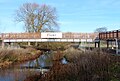
 Osiers Bridge - geograph.org.uk - 3750748.jpg 1 600 × 1 200 ; 507 kio
-
 Palmers Garden Centre, Enderby - geograph.org.uk - 2056323.jpg 1 943 × 1 051 ; 849 kio
-
 Park Lodge along Harolds Lane - geograph.org.uk - 3269144.jpg 2 817 × 2 023 ; 1,88 Mio
-
 Path at the Everards Meadows - geograph.org.uk - 6235589.jpg 800 × 470 ; 83 kio
-
 Path at the Everards Meadows - geograph.org.uk - 6248123.jpg 800 × 493 ; 104 kio
-
 Path on the Ratby Meadow - geograph.org.uk - 6251098.jpg 800 × 506 ; 152 kio
-
 Police headquarters at Enderby, Leicestershire - geograph.org.uk - 491714.jpg 622 × 640 ; 125 kio
-
 Public footpath and steps next to the M1 motorway - geograph.org.uk - 4162650.jpg 1 600 × 1 442 ; 1,06 Mio
-
 Public Footpath next to the M1 - geograph.org.uk - 511882.jpg 496 × 640 ; 100 kio
-
 Pylon from M69 - geograph.org.uk - 568718.jpg 640 × 480 ; 69 kio
-
 Quarrywood, Seine lane, Enderby - geograph.org.uk - 719610.jpg 640 × 483 ; 149 kio
-
 Ratby Meadow Lane - geograph.org.uk - 491716.jpg 640 × 480 ; 124 kio
-
 Ratby Meadows and the River Soar - geograph.org.uk - 6235477.jpg 800 × 555 ; 127 kio
-
 Recovering oak, The Park, Enderby - geograph.org.uk - 6223092.jpg 3 776 × 2 520 ; 3,14 Mio
-
 River Soar at Everards Meadows - geograph.org.uk - 6248138.jpg 800 × 443 ; 85 kio
-
 River Soar near the Soar Valley Way - geograph.org.uk - 5230968.jpg 800 × 532 ; 155 kio
-
 River Soar next to the Soar Valley Way - geograph.org.uk - 5339557.jpg 800 × 666 ; 189 kio
-
 Road works along Leicester Lane in Enderby - geograph.org.uk - 5248203.jpg 800 × 548 ; 95 kio
-
 Sainsbury's at Fosse Park - geograph.org.uk - 5883088.jpg 640 × 459 ; 70 kio


.jpg)


_-_geograph.org.uk_-_2858933.jpg)

_-_geograph.org.uk_-_3269163.jpg)


_Pandemic_-_geograph.org.uk_-_6431121.jpg)


