Category:Engadin
Vai alla navigazione
Vai alla ricerca
valle di montagna in Svizzera  | |||||
| Carica un file multimediale | |||||
| Audio della pronuncia | |||||
|---|---|---|---|---|---|
| Istanza di | |||||
| Luogo | Grigioni, Svizzera | ||||
| Situato sul mare / lago / fiume | |||||
| Consiste di |
| ||||
| Altezza sul mare |
| ||||
| sito web ufficiale | |||||
 | |||||
Sottocategorie
Questa categoria contiene le 83 sottocategorie indicate di seguito, su un totale di 83.
A
- Piz Albana (41 F)
- Piz Arpiglia (7 F)
B
C
- Cavagliasch (river) (48 F)
- Charnadüra (1 P, 9 F)
E
F
- Fuorcla Albana (9 F)
- Fuorcla Sesvenna (4 F)
G
- Piz Grevasalvas (44 F)
- Griosch (48 F)
H
- Hauptstrasse 27 (24 F)
- Historical images of Engadin (41 F)
I
- Ils Cuogns (8 F)
J
- Jakobsweg Graubünden (21 F)
- Piz Julier (107 F)
L
- Lej da Gravatscha (2 F)
- Lej da Staz (33 F)
M
- Maisasbach (6 F)
- Piz da la Margna (57 F)
- Lej Marsch (5 F)
- Piz Murtiröl (7 F)
P
- Piz d'Arpiglias (2 F)
- Piz da l'Ova Cotschna (4 F)
R
- Piz Rosatsch (16 F)
- Cima di Rosso (5 F)
S
- Piz Salacina (22 F)
T
- Piz Tschierva (38 F)
U
- Il Corn (Zuoz) (3 F)
- Piz Uter (13 F)
V
- Val Sagliains (6 F)
- Val Trupchun (51 F)
- Via Engiadina (8 F)
Pagine nella categoria "Engadin"
Questa categoria contiene le 2 pagine indicate di seguito, su un totale di 2.
File nella categoria "Engadin"
Questa categoria contiene 114 file, indicati di seguito, su un totale di 114.
-
De-Engadin.ogg 1,8 s; 18 KB
-
De-Engadin2.ogg 1,9 s; 18 KB
-
 1984 Unterengadin 04.jpg 2 201 × 1 600; 658 KB
-
 2011-07-31 14-34-32 Switzerland Crasta.jpg 4 288 × 2 848; 5,23 MB
-
 2014-10-24 07-46-19 Austria Tirol Pankrazberg Hochfügen.jpg 4 288 × 2 848; 7,16 MB
-
 2014-10-24 07-48-09 Austria Tirol Umlberg.jpg 3 935 × 2 614; 6,35 MB
-
 Bellavista.jpg 2 560 × 1 920; 284 KB
-
 Belle Epoque.jpg 1 654 × 1 325; 3,47 MB
-
 Blick-auf-Maloja-Sils von Motta.jpg 1 309 × 799; 186 KB
-
 CH cow 1.jpg 4 368 × 2 912; 4,48 MB
-
 CH cow 2 cropped.jpg 2 912 × 2 912; 4,88 MB
-
 CH cow 2 edit.jpg 2 912 × 4 368; 2,76 MB
-
 CH cow 2.jpg 2 912 × 4 368; 4,94 MB
-
 CH senecio incanus ssp. carniolicus.jpg 2 782 × 2 000; 1,08 MB
-
 CH trail marker.jpg 2 000 × 3 000; 1,01 MB
-
 CH-NB-200 Schweizer Bilder-nbdig-18634-page259.tif 1 204 × 1 665; 4,39 MB
-
 Иван Федорович Шульце - Зимнее утро в Энгадина.jpg 1 600 × 1 329; 1,3 MB
-
 Corvatsch.jpg 1 280 × 960; 297 KB
-
 Dorf im Oberengadin - CH-BAR - 3241571.tif 2 896 × 2 029; 2,21 MB
-
 DSC04563 (40326622930).jpg 6 000 × 4 000; 10,31 MB
-
 Engadin as seen from Piz da la Margna.jpg 4 000 × 2 252; 2,15 MB
-
 Engadin Ftan-Ardez 1.jpg 3 872 × 2 592; 4,35 MB
-
 Engadin Ftan-Ardez 2.jpg 3 872 × 2 592; 4,35 MB
-
 Engadin St. Moritzersee I 01.JPG 2 592 × 1 936; 1,93 MB
-
 Engadin St. Moritzersee III.JPG 2 592 × 1 936; 1,8 MB
-
 Engadin Switzerland Toblerone (128217585).jpeg 1 365 × 2 048; 923 KB
-
 Engadin — Karte für Lifte und Bahnen 1967 1968.jpg 1 728 × 3 585; 4,08 MB
-
 Engadin.jpg 2 252 × 1 795; 727 KB
-
 Engadina.jpg 2 048 × 1 536; 379 KB
-
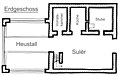 Engadiner Bauernhaus Grundriss Erdgeschoss.jpg 3 407 × 2 168; 1,06 MB
-
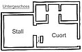 Engadiner Bauernhaus Grundriss Untergeschoss.jpg 1 698 × 1 088; 449 KB
-
 Engadintour.jpg 800 × 600; 787 KB
-
 Engandina 1995 02.jpg 1 068 × 710; 667 KB
-
 Engandina 1995 03.jpg 1 068 × 710; 1,11 MB
-
 ExampleRomanchLanguage.JPG 640 × 480; 91 KB
-
 Fuorcla Cavlocc - panoramio.jpg 6 032 × 3 307; 15,07 MB
-
 Gudench Barblan.jpg 227 × 274; 10 KB
-
 Hiking signs and Piz Lagrev.jpg 4 753 × 3 042; 2,71 MB
-
 Hotel Aussenansicht.jpg 1 000 × 500; 296 KB
-
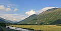
 Inn im Unterengadin zwischen Susch und Lavin (2008).jpg 3 504 × 2 336; 7,56 MB
-
 Isola, Engadine, Switzerland.jpg 3 329 × 2 497; 6,34 MB
-
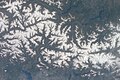
 ISS012-E-15978 - View of Switzerland.jpg 1 008 × 1 520; 218 KB
-
 ISS031-E-30409 - View of Switzerland.jpg 4 256 × 2 832; 1,59 MB
-
 ISS041-E-104170 - View of Switzerland.jpg 4 928 × 3 280; 2,8 MB
-
 ISS058-E-13130 - View of Earth.jpg 5 568 × 3 712; 3,03 MB
-
 ISS058-E-13137 - View of Earth.jpg 5 568 × 3 712; 2,96 MB
-
 ISS061-E-13469 - View of Earth.jpg 5 568 × 3 712; 2,85 MB
-
 ISS061-E-13471 - View of Earth.jpg 5 568 × 3 712; 2,9 MB
-
 Jacques Matthias Schenker, Winterlandschaft bei St. Moritz.jpg 1 137 × 800; 276 KB
-
 Lajet.JPG 3 264 × 2 448; 3,48 MB
-
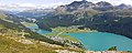
 Lake Silvaplana and St. Moritz-Bad as seen from Muttaun 1.jpg 4 032 × 3 024; 4,89 MB
-
 Lake Silvaplana and St. Moritz-Bad as seen from Muttaun 2.jpg 13 360 × 3 472; 36,83 MB
-
 Lake Silvaplana and St. Moritz-Bad as seen from Muttaun 3.jpg 5 472 × 2 208; 8,82 MB
-
 Lake St. Moritz and St. Moritz town in Switzerland.jpg 1 600 × 1 200; 392 KB
-
 Lake St. Moritz and St. Moritz town.jpg 1 600 × 1 200; 345 KB
-
 Lake St. Moritz in winter.jpg 1 600 × 1 200; 364 KB
-
 Lido Cavlocc - panoramio.jpg 8 489 × 3 599; 20,86 MB
-
 Lischana.JPG 3 264 × 2 448; 8,04 MB
-
 Lägh Cavlocc da sopra - panoramio.jpg 7 138 × 3 516; 20,54 MB
-
 Mountain River (208589025).jpeg 1 600 × 1 067; 402 KB
-
 Ober Engadin view.jpg 1 500 × 773; 780 KB
-
 Oberengadin04a.jpg 1 536 × 1 024; 920 KB
-
 Oberengadin99.jpg 1 536 × 1 024; 554 KB
-
 Orden - panoramio (1).jpg 4 251 × 2 490; 5,89 MB
-
 Panorama view from Hotel Waldhaus Sils-Engadin, Switzerland - panoramio.jpg 18 944 × 2 170; 5,25 MB
-
 Piz dal Ras E.jpg 4 592 × 2 587; 4,47 MB
-
 Piz Languard Bernina Ost.JPG 5 472 × 3 648; 7,21 MB
-
 Piz Polaschin - Piz Ela from Piz Corvatsch station.jpg 5 760 × 3 840; 6,37 MB
-
 Piz Polaschin and Piz Güglia, Silvaplana and Silvaplanersee.jpg 5 472 × 3 648; 7,2 MB
-
 Piz Vadret.jpg 1 154 × 769; 328 KB
-
 Plaun da Lej bus stop.jpg 3 434 × 5 148; 4,78 MB
-
 Raschvella 1.jpg 512 × 384; 80 KB
-
 Rock formation in Egnadin.jpg 5 472 × 3 648; 6,56 MB
-
 S-chanf at Inn (En) river with Zuoz in the background.jpg 2 592 × 1 944; 1,24 MB
-
 Samnaun Dorf (Apparthotel Nevada) - panoramio.jpg 2 048 × 1 536; 1,12 MB
-
 Saturated Engadin (15216444065).jpg 5 472 × 3 648; 5,39 MB
-
 Schweiz Engadin Weg Segantinihütte 033.jpg 2 832 × 2 128; 3,84 MB
-
 Schweiz Seen Engadin Weg Segantinihütte 014.jpg 2 832 × 2 128; 3,26 MB
-
 Schweizer Alpen Richtung Westen.JPG 3 179 × 2 176; 5,67 MB
-
 Seraplana 1.jpg 837 × 628; 237 KB
-
 Seraplana 2.jpg 2 048 × 1 536; 1,16 MB
-
 Soncha Scrittüra 1.JPG 3 000 × 4 000; 2,59 MB
-
 Soncha Scrittüra 2.JPG 4 000 × 3 000; 2,51 MB
-
 St Moritz Muottas.jpg 1 920 × 1 280; 871 KB
-
 Tafel Nationalpark Macun.JPG 3 264 × 2 448; 3,75 MB
-
 Engadin — Tageskarte für Skilifte 1968.jpg 1 631 × 3 414; 2,16 MB
-
 Tarasp 2008 10055.jpg 2 048 × 1 536; 2,13 MB
-
 Tarasp lake.JPG 1 696 × 960; 904 KB
-
 Tourenrad auf dem Inntal-Radweg im Val Mela.jpg 2 686 × 2 014; 7,58 MB
-
 Tschierva glacier 1.jpg 6 336 × 3 336; 5,74 MB
-
 Tschierva glacier rework.jpg 6 336 × 3 336; 6,28 MB
-
 Unterengadin Ardez.jpg 3 456 × 2 304; 3,68 MB
-
 Unterengadin westlich Ardez.jpg 3 279 × 2 293; 1,96 MB
-
 Unterengadin.jpg 841 × 557; 66 KB
-
 Upper Engadin as seen from Muottas Muragl.jpg 7 616 × 2 112; 11,69 MB
-
 Upper Engadin as seen from Piz Grevasalvas.jpg 8 386 × 3 194; 5,35 MB
-
 Upper Engadin as seen from Piz Lunghin.jpg 4 000 × 2 252; 2,96 MB
-
 Upper Engadin as seen from Piz Muragl.jpg 3 543 × 3 168; 1,44 MB
-
 Upper Engadin as seen from Piz Polaschin.jpg 4 352 × 3 264; 3,79 MB
-
 Upper Engadine from Piz Murtel, Graubünden, Switzerland.jpg 5 472 × 3 648; 6,15 MB
-
 Upper Engandine from Fuorcla Surlej Trail, Switzerland.jpg 5 472 × 3 648; 7,22 MB
-
 Upper Engandine from Fuorcla Surlej Trail.jpg 5 472 × 3 648; 6,96 MB
-
 Vacanze in Engadina.jpg 2 048 × 1 536; 472 KB
-
 Vadret da Morteratsch - panoramio (44).jpg 4 272 × 2 848; 10,33 MB
-
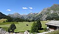
 Val da Fain 1996.jpg 1 536 × 1 024; 215 KB
-
 Val Fex Platta - panoramio.jpg 1 920 × 1 440; 2,32 MB
-
 ValMuragl.jpg 1 024 × 768; 263 KB
-
 Via dal Malögia.jpg 5 472 × 3 050; 3,78 MB
-
 View from Segantini Hut.jpg 2 736 × 1 824; 2,43 MB
-
 View Motta Salacina Maloja-Sils P1000738.JPG 1 600 × 1 200; 856 KB
-
 View towards Bos-Cha.jpg 777 × 517; 491 KB
-
 Votlastrasse Samnaun - panoramio.jpg 2 048 × 1 536; 1,25 MB
-
 Waterval Ova Fedoz.jpg 1 200 × 1 600; 693 KB
-
 Zernez-Engadin-Munt-Baselgia-20220905.jpg 3 024 × 4 032; 2,52 MB


.jpg)


.jpeg)


.jpg)


.jpeg)


.jpg)


_river_with_Zuoz_in_the_background.jpg)
_-_panoramio.jpg)
.jpg)


.jpg)


