Category:Eslohe (Sauerland)
Vai alla navigazione
Vai alla ricerca
Hochsauerlandkreis  Arnsberg · Bestwig · Brilon · Eslohe · Hallenberg · Marsberg · Medebach · Meschede · Olsberg · Schmallenberg · Sundern · Winterberg ·
comune tedesco   _COA.svg) _in_HSK.svg) | |||||
| Carica un file multimediale | |||||
| Istanza di |
| ||||
|---|---|---|---|---|---|
| Luogo | circondario dell'Alto Sauerland, Distretto governativo di Arnsberg, Renania Settentrionale-Vestfalia, Germania | ||||
| Situato sul mare / lago / fiume | |||||
| Popolazione |
| ||||
| Superficie |
| ||||
| Altezza sul mare |
| ||||
| sito web ufficiale | |||||
 | |||||
Sottocategorie
Questa categoria contiene le 16 sottocategorie indicate di seguito, su un totale di 16.
Pagine nella categoria "Eslohe (Sauerland)"
Questa categoria contiene un'unica pagina, indicata di seguito.
File nella categoria "Eslohe (Sauerland)"
Questa categoria contiene 20 file, indicati di seguito, su un totale di 20.
-
 Eslohe (Sauerland) in HSK.svg 780 × 545; 310 KB
-
 Eslohe Hof Husen Sauerland Ost 870 pk.jpg 4 288 × 2 848; 9,78 MB
-
 Eslohe, Germany - panoramio.jpg 5 312 × 2 988; 5,44 MB
-
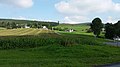 Eslohe, juli 2014 - panoramio.jpg 5 312 × 2 988; 5,68 MB
-
 Eslohe2.jpg 640 × 480; 148 KB
-
 Farm buildings - geo.hlipp.de - 29941.jpg 640 × 480; 160 KB
-
 Gedenkstein Eslohe.jpg 5 184 × 3 456; 3,82 MB
-
 Hellebruecke.JPG 1 600 × 1 200; 363 KB
-
 Homert.JPG 2 048 × 1 536; 752 KB
-
 Landenbeck Church - geo.hlipp.de - 29960.jpg 640 × 480; 58 KB
-
 Looking towards Bremke - geo.hlipp.de - 29938.jpg 640 × 480; 47 KB
-
 Nebenbahn Finnentrop-Wenholthausen (6920673670).jpg 4 928 × 3 264; 8,03 MB
-
 Old farm - geo.hlipp.de - 29939.jpg 640 × 480; 144 KB
-
 Proper tourists? - geo.hlipp.de - 29963.jpg 640 × 480; 111 KB
-
 Reiste from the hill - geo.hlipp.de - 29935.jpg 640 × 480; 56 KB
-
 Salwey (Fluss).jpg 3 312 × 2 566; 2,43 MB
-
 Totalkahlschlag Kirchhagen.JPG 2 048 × 1 536; 1,16 MB
-
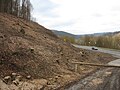 Totalkahlschlag Kirchhagen1.JPG 2 048 × 1 536; 1,08 MB
-
 Village nameboard - geo.hlipp.de - 29965.jpg 640 × 480; 101 KB
-
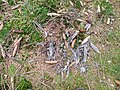 Waldschnepfenrupfung.JPG 3 648 × 2 736; 4,03 MB


.jpg)


.jpg)


