Category:EuroVelo 12
Aller à la navigation
Aller à la recherche

itinéraire cyclable autour de la mer du Nord   | |||||
| Téléverser des médias | |||||
| Nature de l’élément | |||||
|---|---|---|---|---|---|
| Partie de | |||||
| Lieu |
| ||||
| Opérateur | |||||
| Maintenance assurée par | |||||
| Date de fondation ou de création |
| ||||
| Longueur |
| ||||
| Coïncide partiellement avec | |||||
| site officiel | |||||
| |||||
Deutsch: Die EuroVelo-Route 12 ist der internationale Nordseeküstenradweg (engl. North Sea Cycle Route). In den einzelnen Staaten hat er meist eigene Namen und Ausschilderungen. Die Route bildet einen Rundweg auf 5.942 km.
English: EuroVelo route 12 is the international North Sea Cycle Route, surrounding the sea on 5.942 km. In the different countries, it has regional subroutes with proper names and route signs.
Sous-catégories
Cette catégorie comprend 6 sous-catégories, dont les 6 ci-dessous.
Média dans la catégorie « EuroVelo 12 »
Cette catégorie comprend 36 fichiers, dont les 36 ci-dessous.
-
 A View Point from the A836 Tain to Ardgay Road - geograph.org.uk - 233587.jpg 640 × 480 ; 317 kio
-
 Anglia Water private road to Whitlingham - geograph.org.uk - 90302.jpg 640 × 480 ; 57 kio
-
 Auchterflow fields - geograph.org.uk - 408980.jpg 640 × 314 ; 47 kio
-
 Beach Huts on a Winter's Day - geograph.org.uk - 101679.jpg 640 × 482 ; 52 kio
-
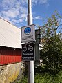
 Beelsby signpost - geograph.org.uk - 95411.jpg 640 × 458 ; 172 kio
-
 Caistor Road - geograph.org.uk - 62913.jpg 640 × 480 ; 136 kio
-
 Corner of forest - geograph.org.uk - 492085.jpg 640 × 480 ; 126 kio
-
 Corner of forest - geograph.org.uk - 493034.jpg 640 × 480 ; 102 kio
-
 Cross Roads - geograph.org.uk - 52142.jpg 640 × 480 ; 98 kio
-
 Crossroads near Wootton Wold - geograph.org.uk - 164480.jpg 640 × 426 ; 109 kio
-
 EuroVelo 12 - Nordsøruten bjergpas.jpg 3 000 × 2 250 ; 5,11 Mio
-
 EuroVelo 12 - Nordsøruten vej.jpg 3 000 × 2 250 ; 4,62 Mio
-
 EuroVelo 12 - Nordsøruten.jpg 3 000 × 2 250 ; 3,02 Mio
-
 EuroVelo Route 12.svg 652 × 694 ; 323 kio
-
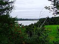
 Farmland east of Gorseness Road - geograph.org.uk - 513682.jpg 640 × 425 ; 135 kio
-
 Fähre Horten - Moss.jpg 800 × 600 ; 81 kio
-
 Gerri's ice-cream parlour - geograph.org.uk - 400941.jpg 442 × 640 ; 146 kio
-
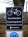 Ginstleden.jpg 1 944 × 2 592 ; 1,26 Mio
-
 Langley war memorial - geograph.org.uk - 148128.jpg 640 × 477 ; 72 kio
-
 Lingdale United Reform Church - geograph.org.uk - 56198.jpg 640 × 480 ; 52 kio
-
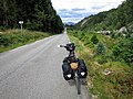
 NCSR follow Ginstleden.jpg 1 920 × 2 560 ; 2,04 Mio
-
 North Sea Cycle Route Icon.svg 190 × 209 ; 8 kio
-
 North Sea Cycle Route Logo.svg 251 × 300 ; 15 kio
-
 NSCR-logo.jpg 276 × 316 ; 42 kio
-
 Princess Street, Thurso - geograph.org.uk - 653360.jpg 640 × 480 ; 176 kio
-
 Radwegschild Sandefjord.jpg 320 × 240 ; 20 kio
-
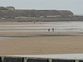 Seaburn Beach - geograph.org.uk - 139163.jpg 640 × 480 ; 65 kio
-
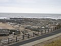 Seaburn Wave Cut Platform - geograph.org.uk - 139165.jpg 640 × 480 ; 117 kio
-
 Sign EV12.svg 525 × 525 ; 5 kio
-
 Sjosanden.jpg 2 560 × 1 920 ; 1,64 Mio
-
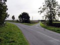
 Stonehill Road leading to Roxwell village. - geograph.org.uk - 699749.jpg 640 × 444 ; 47 kio
-
 Strathy's area on summer - panoramio.jpg 4 896 × 2 754 ; 6,17 Mio
-
 Vestkystruten Rudbøl 2.JPG 800 × 600 ; 130 kio
-
 Vestkystruten-EuroVelo12.jpg 640 × 855 ; 130 kio
-
 Weather Station - geograph.org.uk - 381670.jpg 640 × 500 ; 72 kio
-
 Wegweiser National Route 1.jpg 235 × 174 ; 22 kio


