Category:Exminster
Aller à la navigation
Aller à la recherche
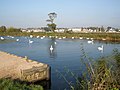
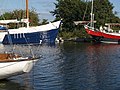
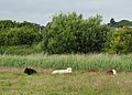
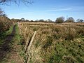
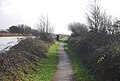
English: Exminster is a village situated on the southern edge of the City of Exeter on the western side of the Exeter ship canal and River Exe in the county of Devon, England. It is around 6 km (3 miles) south of the centre of Exeter, and has a population of 3,084 (census 2001). The rare Cirl Bunting can be found here. Exminster Marshes, to the east of the village, are a major site for birds, especially migratory ones.
village britannique  | |||||
| Téléverser des médias | |||||
| Nature de l’élément | |||||
|---|---|---|---|---|---|
| Lieu | Teignbridge, Devon, Angleterre du Sud-Ouest, Angleterre | ||||
| À ne pas confondre avec | |||||
| Réputé identique à | Exminster | ||||
 | |||||
Sous-catégories
Cette catégorie comprend 8 sous-catégories, dont les 8 ci-dessous.
D
- Devington Park (10 F)
E
- Exminster railway station (18 F)
M
- St Martin's Church, Exminster (21 F)
P
T
- Towsington Barton (5 F)
Média dans la catégorie « Exminster »
Cette catégorie comprend 997 fichiers, dont les 200 ci-dessous.
(page précédente) (page suivante)-
 "The Turf Hotel" - geograph.org.uk - 4544696.jpg 3 888 × 5 184 ; 5,61 Mio
-
 A bend on the Exeter Canal - geograph.org.uk - 37324.jpg 640 × 480 ; 85 kio
-
 A bull on Exminster Marshes - geograph.org.uk - 4544708.jpg 3 783 × 4 860 ; 6,02 Mio
-

-
 A fast cyclist - geograph.org.uk - 3771769.jpg 1 024 × 768 ; 408 kio
-
 A herd of swans, on Exeter Canal - geograph.org.uk - 1003653.jpg 640 × 480 ; 76 kio
-

-
 A30 - geograph.org.uk - 5254239.jpg 640 × 426 ; 60 kio
-
 A30 - geograph.org.uk - 5254248.jpg 640 × 426 ; 63 kio
-
 A30 - Motorway or Non-motorway^ - geograph.org.uk - 6225978.jpg 807 × 631 ; 106 kio
-
 A30 about to pass under the end of the M5 - geograph.org.uk - 4036328.jpg 640 × 336 ; 55 kio
-
 A30 at Pearce's Hill, Exeter - geograph.org.uk - 130948.jpg 640 × 480 ; 103 kio
-
 A30 bypassing Alphington - geograph.org.uk - 6433991.jpg 1 600 × 1 200 ; 676 kio
-
 A30 footbridge at Pearce's Hill - geograph.org.uk - 3183607.jpg 3 648 × 2 736 ; 1,63 Mio
-
 A30 heading under the end of the M5 - geograph.org.uk - 3649357.jpg 1 905 × 1 189 ; 1,08 Mio
-
 A30 northwest of M5 Junction 31 - geograph.org.uk - 4676559.jpg 512 × 640 ; 89 kio
-
 A30, Okehampton 24 miles - geograph.org.uk - 3649368.jpg 1 824 × 1 165 ; 1,19 Mio
-
 A379 and M5 Exminster viaduct - geograph.org.uk - 6431248.jpg 1 600 × 1 200 ; 635 kio
-
 A379 Bridge, A30 - geograph.org.uk - 5254250.jpg 640 × 426 ; 59 kio
-
 A379 Bridge, A38 - geograph.org.uk - 3016698.jpg 640 × 430 ; 34 kio
-
 A379 Bridge, Devon Expressway - geograph.org.uk - 3096428.jpg 640 × 430 ; 30 kio
-

-
 A379 dual carriageway at Peamore - geograph.org.uk - 2164686.jpg 640 × 480 ; 266 kio
-
 A379 Near Matford Bridge - geograph.org.uk - 1368595.jpg 640 × 455 ; 102 kio
-
 A379 Overbridge, A38 - geograph.org.uk - 4765474.jpg 640 × 349 ; 30 kio
-
 A379, Matford - geograph.org.uk - 1370087.jpg 640 × 455 ; 104 kio
-
 A379, Near Matford Bridge - geograph.org.uk - 1368588.jpg 640 × 455 ; 81 kio
-
 A379, North of A30 - geograph.org.uk - 1368578.jpg 640 × 455 ; 73 kio
-
 A38 Devon Expressway, Northbound - geograph.org.uk - 6108768.jpg 800 × 533 ; 519 kio
-
 A38 from Little Silver Cross - geograph.org.uk - 130957.jpg 640 × 480 ; 109 kio
-
 A38 heading west close to the end of the M5 - geograph.org.uk - 2164672.jpg 640 × 480 ; 208 kio
-
 A38 near Exminster - geograph.org.uk - 2284192.jpg 2 350 × 1 540 ; 2,67 Mio
-
 A38, Days Pottle Lane Bridge - geograph.org.uk - 3016705.jpg 640 × 430 ; 39 kio
-
 A38, Devon Expressway - geograph.org.uk - 3016703.jpg 640 × 430 ; 44 kio
-
 Abandoned boat by River Exe opposite Topsham - geograph.org.uk - 1256323.jpg 640 × 480 ; 179 kio
-
 Across the Exe - geograph.org.uk - 3266100.jpg 3 648 × 2 736 ; 4,6 Mio
-
 Alphin Brook - geograph.org.uk - 292326.jpg 640 × 480 ; 95 kio
-

-
 An old river channel - geograph.org.uk - 5841630.jpg 1 024 × 681 ; 128 kio
-
 Angular concrete - geograph.org.uk - 3736582.jpg 3 511 × 2 494 ; 2,21 Mio
-
 Another view of the Driving range, Exminster Golf Centre - geograph.org.uk - 1975420.jpg 2 048 × 1 536 ; 1,23 Mio
-
 Approaching Countess Wear Bridge - geograph.org.uk - 4544732.jpg 5 184 × 3 888 ; 6,21 Mio
-

-
 Approaching the M5 north east of Exminster - geograph.org.uk - 4544722.jpg 4 944 × 3 579 ; 5,12 Mio
-
 Approaching the railway bridge on public footpath to Exminster - geograph.org.uk - 6259999.jpg 4 000 × 3 000 ; 4,88 Mio
-
 Approaching the Turf Basin - geograph.org.uk - 3378573.jpg 640 × 430 ; 71 kio
-
 Autumn colour by Exeter Canal - geograph.org.uk - 6327323.jpg 1 600 × 1 200 ; 969 kio
-
 Bare tree - geograph.org.uk - 5841645.jpg 1 024 × 681 ; 131 kio
-
 Barns near Matford House - geograph.org.uk - 5564642.jpg 2 048 × 1 536 ; 390 kio
-
 Basin above Turf Lock - geograph.org.uk - 1224100.jpg 480 × 640 ; 61 kio
-
 Behind the Devon Hotel, Matford Bridge, Exeter - geograph.org.uk - 4676087.jpg 640 × 480 ; 105 kio
-
 Below the M5 - geograph.org.uk - 5937290.jpg 1 024 × 532 ; 105 kio
-
 Below the M5 flyover - geograph.org.uk - 6040434.jpg 1 024 × 681 ; 145 kio
-
 Below the M5 Viaduct - geograph.org.uk - 5294222.jpg 640 × 426 ; 58 kio
-
 Beneath the M5 motorway, near Exminster - geograph.org.uk - 1654940.jpg 640 × 480 ; 68 kio
-
 Berrybrook garage - geograph.org.uk - 955222.jpg 640 × 480 ; 55 kio
-
 Berrybrook Meadow, Exminster - geograph.org.uk - 949559.jpg 640 × 480 ; 80 kio
-
 Between the Exe and the railway line - geograph.org.uk - 3347301.jpg 640 × 271 ; 21 kio
-
 Between the Exe Estuary and the Exeter Canal - geograph.org.uk - 3381519.jpg 640 × 430 ; 58 kio
-
 Bird hide beside Exeter Canal - geograph.org.uk - 2299361.jpg 800 × 600 ; 522 kio
-
 Boardwalk to the Topsham Ferry - geograph.org.uk - 2438534.jpg 1 024 × 768 ; 211 kio
-
 Boat and reflection, Turf, Exe Estuary - geograph.org.uk - 82394.jpg 478 × 640 ; 152 kio
-
 Boat at Turf Lock - geograph.org.uk - 2089723.jpg 480 × 640 ; 84 kio
-
 Boat by the Exe estuary - geograph.org.uk - 2089803.jpg 640 × 480 ; 90 kio
-
 Boat entering canal basin at Turf Lock - geograph.org.uk - 2089738.jpg 640 × 506 ; 124 kio
-
 Boats at Topsham Lock - geograph.org.uk - 4307212.jpg 640 × 480 ; 52 kio
-
 Boats in the basin above the Turf Lock - geograph.org.uk - 1285771.jpg 640 × 480 ; 68 kio
-
 Boats in Turf Basin - geograph.org.uk - 2089826.jpg 640 × 480 ; 109 kio
-
 Boats in Turf Basin - geograph.org.uk - 2090148.jpg 640 × 468 ; 62 kio
-

-
 Boats moored in the basin near the Turf hotel (2) - geograph.org.uk - 2438522.jpg 1 024 × 768 ; 142 kio
-
 Boats moored in the basin near the Turf hotel - geograph.org.uk - 2438520.jpg 1 024 × 768 ; 159 kio
-
 Boats Moored in Turf Basin - geograph.org.uk - 2407327.jpg 768 × 1 024 ; 173 kio
-
 Boats, Turf basin - geograph.org.uk - 3378578.jpg 640 × 430 ; 46 kio
-
 Boats, Turf basin - geograph.org.uk - 3381500.jpg 640 × 430 ; 60 kio
-

-
 Bridge at the start of the M5 Motorway - geograph.org.uk - 6108773.jpg 800 × 533 ; 553 kio
-
 Bridge over Exeter Canal - geograph.org.uk - 5203569.jpg 4 896 × 3 672 ; 5,88 Mio
-
 Bridge over M5 - geograph.org.uk - 594888.jpg 640 × 480 ; 87 kio
-
 Bridge over the A30 - geograph.org.uk - 4436673.jpg 3 850 × 1 958 ; 3,82 Mio
-
 Bridge over the A379, near Exminster - geograph.org.uk - 1654898.jpg 640 × 480 ; 76 kio
-
 Bridge over the A38 near Kennford - geograph.org.uk - 6108765.jpg 800 × 533 ; 558 kio
-
 Bridge over the M5 at Junction 31 (northbound) - geograph.org.uk - 6109263.jpg 800 × 533 ; 548 kio
-
 Bridge over the M5 at Junction 31 (southbound) - geograph.org.uk - 6109256.jpg 800 × 600 ; 575 kio
-

-
 Bridges and gantry over A30 at M5 junction - geograph.org.uk - 4036330.jpg 640 × 368 ; 61 kio
-
 Brownlees, Exminster - geograph.org.uk - 1027255.jpg 640 × 480 ; 149 kio
-
 Building a bridge under the M5 - geograph.org.uk - 5489380.jpg 1 600 × 1 200 ; 774 kio
-
 Business Park near Exminster - geograph.org.uk - 2299327.jpg 800 × 600 ; 388 kio
-
 By the M5 - geograph.org.uk - 5321594.jpg 640 × 426 ; 52 kio
-
 Cafe on the Corner, Victory Hall Annexe, Main Road - geograph.org.uk - 6259948.jpg 4 000 × 3 000 ; 5,11 Mio
-
 Canal Basin above the Turf Lock - geograph.org.uk - 957962.jpg 640 × 480 ; 60 kio
-
 Canal Basin above the Turf Lock - geograph.org.uk - 957969.jpg 640 × 480 ; 54 kio
-
 Canal basin, near Turf Lock - geograph.org.uk - 1003665.jpg 640 × 480 ; 75 kio
-
 Canal Basin, Turf Lock - geograph.org.uk - 1224254.jpg 640 × 495 ; 95 kio
-
 Canal User near Topsham - geograph.org.uk - 5105051.jpg 1 600 × 1 200 ; 452 kio
-
 Canoeist on The Exeter Canal - geograph.org.uk - 4544697.jpg 4 953 × 3 658 ; 5,48 Mio
-
 Canoes, Exeter Canal - geograph.org.uk - 2090189.jpg 640 × 441 ; 100 kio
-
 Car Park on Exminster Marshes - geograph.org.uk - 2407371.jpg 1 024 × 768 ; 249 kio
-
 Cattle on Exminster Marshes - geograph.org.uk - 4544710.jpg 3 735 × 4 904 ; 5,47 Mio
-
 Cattle on Exminster Marshes - geograph.org.uk - 949685.jpg 640 × 480 ; 103 kio
-
 Cattle resting near The Exe Valley Way - geograph.org.uk - 4544706.jpg 4 940 × 3 560 ; 5,27 Mio
-
 Cattle under the M5 - geograph.org.uk - 4544724.jpg 4 490 × 3 399 ; 3,52 Mio
-
 Causeway to the passenger ferry to Topsham - geograph.org.uk - 6259963.jpg 4 000 × 3 000 ; 4,75 Mio
-

-
 Chicken houses, Exminster - geograph.org.uk - 3845981.jpg 1 920 × 1 115 ; 358 kio
-
 Church of St Margaret, Topsham - geograph.org.uk - 3376503.jpg 640 × 430 ; 71 kio
-
 Church of St Martin - geograph.org.uk - 5151033.jpg 640 × 426 ; 43 kio
-
 Church of St Martin - geograph.org.uk - 5450180.jpg 640 × 426 ; 37 kio
-
 Church of St Martin - geograph.org.uk - 5772384.jpg 640 × 425 ; 49 kio
-
 Church of St Martin of Tours, Exminster - geograph.org.uk - 4544717.jpg 3 888 × 5 184 ; 6,18 Mio
-
 Church Stile House.jpg 5 568 × 3 712 ; 12,27 Mio
-
 Clearing felled branches on the Exe Valley Way - geograph.org.uk - 5131180.jpg 1 600 × 1 200 ; 742 kio
-
 Club House, Exminster Golf Centre - geograph.org.uk - 4668098.jpg 1 024 × 768 ; 225 kio
-
 Construction site, new boathouse for Exeter University - geograph.org.uk - 3078792.jpg 1 000 × 750 ; 707 kio
-
 Coracle, Turf Lock - geograph.org.uk - 2089744.jpg 480 × 640 ; 117 kio
-

-
 Cottage, at Luccumbs Farm - geograph.org.uk - 1057761.jpg 640 × 480 ; 73 kio
-
 Cottage, Days Pottles Lane - geograph.org.uk - 3845993.jpg 1 920 × 2 667 ; 812 kio
-
 Cottages in Station Road Exminster - geograph.org.uk - 2023364.jpg 640 × 427 ; 91 kio
-
 Cottages, Exminster - geograph.org.uk - 2090664.jpg 640 × 500 ; 106 kio
-
 Cottages, Exminster - geograph.org.uk - 2090670.jpg 640 × 473 ; 77 kio
-
 Countess Wear - FGW 142068.jpg 1 024 × 768 ; 247 kio
-
 Cows and a dovecot - geograph.org.uk - 4066512.jpg 1 024 × 768 ; 245 kio
-
 Cows graze in a field near Exminster - geograph.org.uk - 2662544.jpg 640 × 480 ; 93 kio
-
 Crablake Farm buildings and driveway - geograph.org.uk - 5599597.jpg 640 × 480 ; 182 kio
-
 Cumulus clouds, above Exminster - geograph.org.uk - 1348052.jpg 640 × 480 ; 34 kio
-
 Curlew-shaped cycle stands - geograph.org.uk - 3771764.jpg 1 024 × 768 ; 363 kio
-
 Cutting, M5 - geograph.org.uk - 5356114.jpg 640 × 426 ; 49 kio
-
 Cycle and car parking, Exminster Marsh - geograph.org.uk - 3442647.jpg 1 024 × 768 ; 281 kio
-
 Cycle path alongside Exeter Canal - geograph.org.uk - 1560834.jpg 640 × 480 ; 237 kio
-
 Cycle path alongside Exeter Canal - geograph.org.uk - 1560847.jpg 640 × 480 ; 232 kio
-
 Cycle racks at Turf Locks - geograph.org.uk - 4084417.jpg 1 200 × 1 600 ; 313 kio
-
 Cycle stands at Turf Locks - geograph.org.uk - 1364614.jpg 640 × 480 ; 304 kio
-
-
 Cyclists on the Exe Estuary cycle path - geograph.org.uk - 1003702.jpg 640 × 480 ; 83 kio
-
 Dawlish Road and Matford Bridge - geograph.org.uk - 2164604.jpg 640 × 480 ; 305 kio
-

-
 Days Pottle Lane, at Peamore Arch - geograph.org.uk - 2164651.jpg 640 × 480 ; 323 kio
-
 Days Pottle Lane, crossing the A38 - geograph.org.uk - 2164667.jpg 640 × 480 ; 251 kio
-
 Days Pottle Lane, near Peamore Arch - geograph.org.uk - 2164656.jpg 640 × 480 ; 270 kio
-
 Days Pottles Lane Bridge, A38 - geograph.org.uk - 4765475.jpg 640 × 371 ; 36 kio
-
 Dead tree - geograph.org.uk - 5529562.jpg 640 × 426 ; 53 kio
-
 Dead tree - geograph.org.uk - 5759527.jpg 640 × 425 ; 46 kio
-
 Dead tree and pylon - geograph.org.uk - 2090543.jpg 480 × 640 ; 77 kio
-
 Deepway Lane Bridge, M5 - geograph.org.uk - 3096417.jpg 640 × 430 ; 33 kio
-
 Derelict on the Exe - geograph.org.uk - 3482613.jpg 640 × 430 ; 33 kio
-
 Devon lane near Exminster - geograph.org.uk - 154348.jpg 640 × 480 ; 95 kio
-
 Disused boats, Topsham - geograph.org.uk - 2459093.jpg 640 × 480 ; 77 kio
-
 Double-headed steamtrain passes Exminster - geograph.org.uk - 2662548.jpg 640 × 480 ; 95 kio
-
 Drain, Exminster marshes - geograph.org.uk - 1219284.jpg 480 × 640 ; 85 kio
-
 Drain, Exminster Marshes - geograph.org.uk - 1222837.jpg 640 × 480 ; 97 kio
-
 Drain, Exminster Marshes - geograph.org.uk - 1222852.jpg 480 × 640 ; 97 kio
-
 Drain, Milbury Lane - geograph.org.uk - 1219272.jpg 640 × 480 ; 87 kio
-
 Drainage channel, Exminster Marshes - geograph.org.uk - 2090435.jpg 640 × 480 ; 118 kio
-
 Drainage channel, on Exminster Marshes - geograph.org.uk - 1654918.jpg 640 × 480 ; 96 kio
-
 Driving on the A379 heading south - geograph.org.uk - 1477204.jpg 640 × 480 ; 187 kio
-
 Driving range, Exminster Golf Centre - geograph.org.uk - 1974505.jpg 2 048 × 1 536 ; 1,28 Mio
-
 Ducks, Exeter Canal - geograph.org.uk - 3378560.jpg 640 × 430 ; 58 kio
-
 Eagle sculpture and building materials - geograph.org.uk - 82982.jpg 601 × 640 ; 258 kio
-
 East Devon , Fields and Sheep - geograph.org.uk - 1445578.jpg 640 × 480 ; 31 kio
-
 East Devon , Grassy Field ^ Marshes - geograph.org.uk - 3381268.jpg 4 288 × 2 848 ; 4,42 Mio
-
 East Devon , M5 Motorway and Fields - geograph.org.uk - 1185292.jpg 640 × 480 ; 57 kio
-

-
 East Devon , The M5 Motorway - geograph.org.uk - 1416315.jpg 640 × 364 ; 36 kio
-
 East Devon , The M5 Motorway - geograph.org.uk - 1416320.jpg 640 × 366 ; 31 kio
-
 East Devon , The M5 Motorway - geograph.org.uk - 1445585.jpg 640 × 480 ; 46 kio
-
 Eastbound A30 nearing M5 junction - geograph.org.uk - 6263151.jpg 1 024 × 684 ; 223 kio
-
 Edge of Exminster Marshes - geograph.org.uk - 1222826.jpg 640 × 480 ; 109 kio
-
 Elegant footbridge on A30 - geograph.org.uk - 3649365.jpg 2 256 × 1 496 ; 756 kio
-
 Emmanuel Evangelical church - geograph.org.uk - 2416511.jpg 1 024 × 768 ; 121 kio
-
 Entrance to a field - geograph.org.uk - 5010301.jpg 1 024 × 768 ; 206 kio
-
 Entry to the lock at Turf - geograph.org.uk - 2299331.jpg 800 × 600 ; 356 kio
-
 Evening Mail train - geograph.org.uk - 1592662.jpg 640 × 427 ; 100 kio
-
 Exe Estuary - geograph.org.uk - 282141.jpg 640 × 480 ; 30 kio
-
 Exe Estuary - geograph.org.uk - 282146.jpg 480 × 640 ; 23 kio
-
 Exe Estuary at Turf.jpg 4 120 × 2 848 ; 3,47 Mio
-
 Exe estuary sculpture - geograph.org.uk - 3771761.jpg 768 × 1 024 ; 219 kio
-
 Exe Estuary Trail directions - geograph.org.uk - 5762025.jpg 2 048 × 1 536 ; 2,31 Mio
-
 Exe Estuary Trail footbridge to the Turf Locks public house - geograph.org.uk - 5762028.jpg 1 600 × 1 200 ; 298 kio
-
 Exe Estury at high tide - panoramio.jpg 2 048 × 1 536 ; 896 kio
-
 Exe Valley Walk by the canal - geograph.org.uk - 3376398.jpg 640 × 430 ; 52 kio
-
 Exe Valley Way - geograph.org.uk - 3367767.jpg 640 × 430 ; 98 kio
-
 Exe Valley Way - geograph.org.uk - 3370461.jpg 640 × 430 ; 65 kio
-
 Exe Valley Way - geograph.org.uk - 3375058.jpg 640 × 430 ; 80 kio
-
 Exe Valley Way - geograph.org.uk - 3376387.jpg 640 × 430 ; 91 kio
-
 Exe Valley Way - geograph.org.uk - 3378533.jpg 640 × 430 ; 54 kio
-
 Exe Valley Way - geograph.org.uk - 3378545.jpg 640 × 430 ; 58 kio
-
 Exe Valley Way - geograph.org.uk - 3378569.jpg 640 × 430 ; 58 kio
-
 Exe Valley Way and Exeter Canal - geograph.org.uk - 3378547.jpg 640 × 430 ; 50 kio
-
 Exeter , BP Petrol Station - geograph.org.uk - 1345054.jpg 640 × 480 ; 71 kio
-
 Exeter , Bridge Road - geograph.org.uk - 3682544.jpg 3 264 × 1 840 ; 1,81 Mio
-
 Exeter , Countess Wear Scenery - geograph.org.uk - 2297172.jpg 4 288 × 2 848 ; 5,47 Mio
-
 Exeter , Exeter City Scenery - geograph.org.uk - 2297168.jpg 4 288 × 2 848 ; 4,31 Mio
-
 Exeter , Grange Jaguar ^ Aston Martin - geograph.org.uk - 2297179.jpg 4 288 × 2 848 ; 5,24 Mio
-
 Exeter , Makro ^ Football Pitches - geograph.org.uk - 2297174.jpg 4 288 × 2 848 ; 5,61 Mio
-
 Exeter , Marsh Barton Trading Estate - geograph.org.uk - 2297167.jpg 4 288 × 2 848 ; 5,3 Mio
-
 Exeter , Marsh Barton Trading Estate - geograph.org.uk - 2297182.jpg 4 288 × 2 848 ; 4,57 Mio
-
 Exeter , Marsh Barton Trading Estate ^ Exeter Scenery - geograph.org.uk - 2297176.jpg 4 288 × 2 848 ; 5,24 Mio
-
 Exeter , Marsh Barton ^ Cityscape - geograph.org.uk - 2297178.jpg 4 288 × 2 848 ; 5,3 Mio


s_Jefferys,_Geographer_to_his_Majesty_;_To_John_Baring_of..._-_btv1b53056953n_(07_of_12).jpg)


_-_geograph.org.uk_-_2438522.jpg)


_at_the_Turf_Hotel_-_geograph.org.uk_-_1560840.jpg)


_-_geograph.org.uk_-_6109263.jpg)
_-_geograph.org.uk_-_6109256.jpg)


