Category:Expressways in China
Zur Navigation springen
Zur Suche springen
Staaten in Asien: Bangladesch · Indien · Japan · Malaysia · Philippinen · Sri Lanka · Südkorea · Türkei‡ · Vietnam · Volksrepublik China
Begrenzte Anerkennung: Republik China – Weitere Gebiete: Hongkong
‡: teilweise in Asien
Begrenzte Anerkennung: Republik China – Weitere Gebiete: Hongkong
‡: teilweise in Asien
Autobahnenen in China | |||||
| Medium hochladen | |||||
| Ist ein(e) | |||||
|---|---|---|---|---|---|
| Unterklasse von | |||||
| Ort |
| ||||
| |||||
English: Expressways of China.
日本語: 中華人民共和国の高速道路
中文:中华人民共和国高速公路
Unterkategorien
Es werden 8 von insgesamt 8 Unterkategorien in dieser Kategorie angezeigt:
In Klammern die Anzahl der enthaltenen Kategorien (K), Seiten (S), Dateien (D)
Medien in der Kategorie „Expressways in China“
Folgende 59 Dateien sind in dieser Kategorie, von 59 insgesamt.
-
 AH31&G15 sign in Dalian.jpg 324 × 577; 108 KB
-
 Airport Expressway of Chengdu.jpg 1.800 × 1.180; 540 KB
-
 Changzhou section of S38 Changshu-Hefei Expressway-20180716.jpg 4.608 × 3.456; 2,4 MB
-
 ChengGuan Expressway.jpg 3.072 × 1.728; 3,03 MB
-
 DFTianjinFwySignWP.jpg 640 × 480; 74 KB
-
 Exit 138 (Sayram Lake) of G30 Highway of China.jpg 3.991 × 1.322; 1,01 MB
-

-
 Expwy S25 sign with name in Guangdong.svg 354 × 340; 15 KB
-
 FengningServiceArea.jpg 2.736 × 2.736; 2,87 MB
-
 G1521 Changshu-Jiaxing Expressway near Chenfeng Road.jpg 7.296 × 5.472; 6,06 MB
-
 G30 Expressway Map.png 706 × 600; 154 KB
-
 G50 Expressway Map.png 717 × 415; 81 KB
-
 Guizhou Expwy S38 sign no name.svg 512 × 410; 7 KB
-
 Guizhou Expwy S52 sign no name.svg 512 × 410; 6 KB
-
 Guizhou Expwy S57 sign no name.svg 512 × 410; 6 KB
-
 Guizhou Expwy S59 sign no name.svg 512 × 410; 6 KB
-
 Guizhou Expwy S61 sign no name.svg 512 × 410; 6 KB
-
 Guizhou Expwy S63 sign no name.svg 512 × 410; 7 KB
-
 Guizhou Expwy S67 sign no name.svg 512 × 410; 6 KB
-
 Guizhou Expwy S69 sign no name.svg 512 × 410; 7 KB
-
 Guizhou Expwy S72 sign no name.svg 512 × 410; 6 KB
-
 Guizhou Expwy S74 sign no name.svg 512 × 410; 5 KB
-
 Guizhou Expwy S79 sign no name.svg 512 × 410; 6 KB
-
 Inner Mongolia Expwy Map(2019-2030).svg 973 × 691; 5,42 MB
-
 Jingshi Expressway July 2004.jpg 639 × 479; 132 KB
-
 Jingshi Expressway Old Font.jpg 640 × 479; 96 KB
-
 Jingshi Expwy Hebei.jpg 640 × 480; 107 KB
-
 Liaoning Expwy.png 354 × 340; 8 KB
-
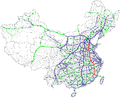
 Map of China NTHS Expressway G10.png 2.677 × 2.183; 488 KB
-
 Map of China NTHS Expressway G12.png 2.677 × 2.183; 488 KB
-
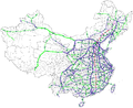
 Map of China NTHS Expressway G3.png 2.677 × 2.183; 488 KB
-
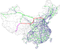
 Map of China NTHS Expressway G4.png 2.677 × 2.183; 489 KB
-
 Map of China NTHS Expressway G45.png 2.677 × 2.183; 489 KB
-
 Map of China NTHS Expressway G5.png 2.677 × 2.183; 488 KB
-
 Map of China NTHS Expressway G55.png 2.677 × 2.183; 489 KB
-
 Map of China NTHS Expressway G6.png 2.677 × 2.183; 454 KB
-
 Map of China NTHS Expressway G65.png 2.677 × 2.183; 489 KB
-
 Map of China NTHS Expressway G7.png 2.677 × 2.183; 488 KB
-
 Map of China NTHS Expressway G75.png 2.677 × 2.183; 489 KB
-
 Map of China NTHS Expressway G85.png 2.677 × 2.183; 489 KB
-
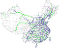
 Map of NTHS Expressways of China.png 2.677 × 2.183; 350 KB
-
 Nanping Expressway.jpg 4.000 × 3.000; 1,64 MB
-
 PRC Expressway.jpg 640 × 480; 115 KB
-
 Provincial Expwy SXX sign no name.svg 354 × 283; 4 KB
-
 Qingdao ExpressWay Network.svg 694 × 884; 261 KB
-
 S46 20150313 133442.jpg 4.160 × 3.120; 2,92 MB
-
 S55 Nanjing-Xuancheng Expressway-20180716.jpg 4.608 × 3.456; 2,6 MB
-
 Shuiquan.jpg 2.736 × 2.736; 2,17 MB
-
 Tangjin Expressway Jan2005.jpg 639 × 479; 103 KB
-
 Wuhan Tianhe Airport Expressway & Wuhan Tianhe Airport 2nd Expressway.JPG 4.752 × 3.168; 3,27 MB
-
 京沪高速沂南服务区.jpg 4.000 × 2.992; 2,28 MB
-
 在西延高速上看西延高速并行线渭河大桥 01.jpg 4.608 × 3.456; 3,82 MB
-
 在西延高速上看西延高速并行线渭河大桥 02.jpg 4.608 × 3.456; 3,82 MB
-
 新七道梁隧道.jpg 5.472 × 3.648; 1,22 MB
-
 未央 机场专用高速和荷花.jpg 5.152 × 3.864; 7,94 MB
-
 沈海高速莱西段.jpg 4.160 × 3.120; 4,46 MB
-
 渭城 西安机场专用高速秦汉出入口.jpg 5.152 × 3.864; 7,79 MB
-
 荣潍高速莱西段.jpg 4.160 × 3.120; 3,62 MB
-
 长江经济带综合立体交通走廊规划(2014-2020年)附图4.JPG 1.241 × 869; 171 KB


_Expwy._at_Shaxi_JCT(G75_Lanhai(Lanzhou-Haikou)_Expwy.,_G8515Guanglu(Guangan-Luzhou)_Expwy._and_(CQ)S80_Chongqing_3rd._Ring_Expwy.),_Hechuan,_Chongqing,_P.R.china.jpg)


.svg)


_of_G30_Highway_of_China.jpg)