Category:Exton, Hampshire
Vai alla navigazione
Vai alla ricerca
village and civil parish in Hampshire, UK  | |||||
| Carica un file multimediale | |||||
| Istanza di | |||||
|---|---|---|---|---|---|
| Luogo | Winchester, Hampshire, Sud Est dell'Inghilterra, Inghilterra | ||||
 | |||||
Sottocategorie
Questa categoria contiene le 4 sottocategorie indicate di seguito, su un totale di 4.
File nella categoria "Exton, Hampshire"
Questa categoria contiene 200 file, indicati di seguito, su un totale di 466.
(pagina precedente) (pagina successiva)-
 Above the Punch Bowl - geograph.org.uk - 5488535.jpg 1 024 × 768; 141 KB
-
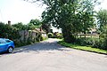
 Allens Farm Lane, Exton - geograph.org.uk - 423771.jpg 640 × 427; 185 KB
-

-

-
 At Lomer Farm - geograph.org.uk - 4579615.jpg 1 142 × 857; 467 KB
-
 Barns above Allens Farm, Corhampton - geograph.org.uk - 99546.jpg 640 × 427; 97 KB
-
 Barns at Peake Farm - geograph.org.uk - 4066191.jpg 1 024 × 768; 197 KB
-
 Barns at Wind Farm - geograph.org.uk - 3645709.jpg 1 600 × 1 064; 564 KB
-
 Beacon Hill from Wheely Down - geograph.org.uk - 5173367.jpg 2 048 × 1 536; 808 KB
-

-
 Beacon Hill Lane near Exton - geograph.org.uk - 5243441.jpg 2 048 × 1 536; 1,48 MB
-
 Beacon Hill Lane near Exton - geograph.org.uk - 5243445.jpg 2 048 × 1 536; 990 KB
-
 Beacon Hill Lane, Exton (1) - geograph.org.uk - 3056821.jpg 3 872 × 2 592; 4,74 MB
-
 Beacon Hill Lane, Exton (2) - geograph.org.uk - 3056828.jpg 3 872 × 2 592; 4,43 MB
-
 Beacon Hill Lane, Exton (3) - geograph.org.uk - 3056832.jpg 3 872 × 2 592; 4,69 MB
-
 Beacon Hill Lane, Exton - geograph.org.uk - 3948119.jpg 640 × 427; 121 KB
-
 Beacon Hill triangulation pillar - geograph.org.uk - 2792178.jpg 1 024 × 640; 132 KB
-
 Beacon Hill trig - geograph.org.uk - 4579619.jpg 857 × 1 142; 386 KB
-
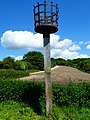
 Beacon on Beacon Hill above Exton - geograph.org.uk - 5612088.jpg 5 184 × 2 920; 4,99 MB
-
 Beaconhill farm seen from Beacon Hill - geograph.org.uk - 4014089.jpg 800 × 600; 162 KB
-

-
 Beaconhill Lane reaches the farm - geograph.org.uk - 4014224.jpg 800 × 600; 109 KB
-
 BeaconHillPunchbowl.jpg 3 008 × 2 000; 1,13 MB
-
 BeaconHillSEcombe1.jpg 3 008 × 2 000; 1,81 MB
-
 BeaconHillSEcombe2.jpg 3 008 × 2 000; 1,51 MB
-
 Beech woodland alongside Love Lane - geograph.org.uk - 391342.jpg 480 × 640; 160 KB
-
 Beeches on Beacon Hill - geograph.org.uk - 4290054.jpg 534 × 640; 322 KB
-
 Blossom in the sunshine - geograph.org.uk - 5349976.jpg 3 640 × 2 730; 5,6 MB
-
 Bottom north of Lone Barn Lane - geograph.org.uk - 3914975.jpg 640 × 480; 113 KB
-
 Bridleway into the woods - geograph.org.uk - 3750542.jpg 640 × 480; 183 KB
-
 Car park, The Shoe - geograph.org.uk - 4134199.jpg 640 × 480; 92 KB
-
 Cattle seeking shade on a sunny day - geograph.org.uk - 4065979.jpg 1 024 × 768; 233 KB
-
 Church Lane, Exton (1) - geograph.org.uk - 3055772.jpg 3 872 × 2 592; 4,64 MB
-
 Church Lane, Exton (2) - geograph.org.uk - 3055795.jpg 3 872 × 2 592; 4,8 MB
-
 Church Lane, Exton (3) - geograph.org.uk - 3055806.jpg 3 872 × 2 592; 4,71 MB
-
 Church Lane, Exton (4) - geograph.org.uk - 3055812.jpg 3 872 × 2 592; 4,51 MB
-
 Church Lane, Exton - geograph.org.uk - 830766.jpg 640 × 425; 108 KB
-
 Church Lane, Exton - geograph.org.uk - 830777.jpg 640 × 426; 100 KB
-
 Church sign - geograph.org.uk - 5786355.jpg 640 × 480; 94 KB
-
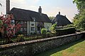 Church View Cottage, Church Lane, Exton - geograph.org.uk - 423766.jpg 640 × 427; 160 KB
-
 Cleared scrub on Old Winchester Hill - geograph.org.uk - 5803751.jpg 1 024 × 768; 395 KB
-
 Close-up of the beacon on Beacon Hill - geograph.org.uk - 5173361.jpg 2 048 × 1 536; 617 KB
-
 Clouds over Beacon Hill - geograph.org.uk - 5182909.jpg 4 608 × 3 456; 2,32 MB
-
 Cottage on Beacon Hill Lane - geograph.org.uk - 4013824.jpg 800 × 600; 167 KB
-
 Cottages on Church Lane, Exton - geograph.org.uk - 1430780.jpg 427 × 640; 89 KB
-
 Cottages, Exton - geograph.org.uk - 830757.jpg 640 × 426; 102 KB
-
 Covered reservoir on Love Lane - geograph.org.uk - 391339.jpg 640 × 480; 121 KB
-

-
 Cows grazing on the South Downs Way - geograph.org.uk - 3948139.jpg 640 × 427; 108 KB
-
 Cows on the lower slopes of Beacon Hill - geograph.org.uk - 5182910.jpg 4 608 × 3 456; 5,06 MB
-
 Dandelions at Wind Farm - geograph.org.uk - 1902005.jpg 4 000 × 3 000; 2,89 MB
-
 Disappearing path by the A32 - geograph.org.uk - 4014475.jpg 800 × 600; 217 KB
-
 Disused dwelling on Allens Farm Lane - geograph.org.uk - 4015803.jpg 800 × 600; 186 KB
-
 Disused Railway crosses the South Downs Way - geograph.org.uk - 1882368.jpg 2 816 × 2 112; 2,85 MB
-

-
-
 Downland orchid - geograph.org.uk - 4014160.jpg 600 × 800; 236 KB
-
 Downland, Exton - geograph.org.uk - 2818249.jpg 640 × 480; 160 KB
-
-
 Dwelling at the west end of Church Lane - geograph.org.uk - 4013831.jpg 800 × 600; 137 KB
-
 Edge of Millbarrow Plantation - geograph.org.uk - 4269816.jpg 640 × 480; 88 KB
-
 Eggs for sale at Peake Farm - geograph.org.uk - 4025892.jpg 800 × 600; 159 KB
-
 End of short footpath at Exton - geograph.org.uk - 4013881.jpg 800 × 600; 134 KB
-

-
 Entering the Meon Valley - geograph.org.uk - 1905699.jpg 4 000 × 3 000; 2,5 MB
-
 Exton Beacon - geograph.org.uk - 3948199.jpg 640 × 427; 82 KB
-
 Exton beacon - geograph.org.uk - 4013948.jpg 600 × 800; 149 KB
-
 Exton Beacon.jpg 2 000 × 3 000; 1,08 MB
-
 Exton church - geograph.org.uk - 4014513.jpg 600 × 800; 119 KB
-
 Exton Ford - geograph.org.uk - 3748365.jpg 3 872 × 2 592; 4,82 MB
-
 Exton Post Office fades into history - geograph.org.uk - 423701.jpg 640 × 460; 232 KB
-
 Exton, Hampshire - geograph.org.uk - 2896523.jpg 3 504 × 2 336; 759 KB
-
 Exton, Hampshire - geograph.org.uk - 2896528.jpg 3 196 × 2 131; 699 KB
-
 Exton, Hampshire - geograph.org.uk - 2896534.jpg 3 243 × 2 162; 979 KB
-
 Exton, Hampshire - geograph.org.uk - 2896556.jpg 3 504 × 2 336; 982 KB
-
 Exton, Hants - Shoe Ln - geograph.org.uk - 5612039.jpg 5 184 × 2 920; 5,1 MB
-
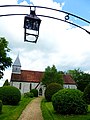
 Exton, Hants - St Peter ^ St Paul Church - geograph.org.uk - 5612072.jpg 5 184 × 2 920; 5,95 MB
-
 Exton, King's Copse, Betty Mundy's Bottom.jpg 3 000 × 1 995; 2,81 MB
-
 Exton, Littleton Copse.jpg 3 000 × 1 995; 3,04 MB
-
 Exton, the Vineyard.jpg 3 000 × 1 741; 1,72 MB
-
 ExtonHampshire1.jpg 3 008 × 2 000; 1,62 MB
-
 Farm buildings at Manor Farm, Exton - geograph.org.uk - 423737.jpg 640 × 352; 104 KB
-
 Farm gate by South Downs Way - geograph.org.uk - 4013980.jpg 800 × 600; 170 KB
-

-
 Farm track off Beaconhill Lane - geograph.org.uk - 4014237.jpg 800 × 600; 153 KB
-
 Farmhouse at Manor Farm - geograph.org.uk - 4014506.jpg 800 × 500; 90 KB
-
 Farmland to the south of Lomer Farm - geograph.org.uk - 391530.jpg 640 × 480; 69 KB
-
 Farmland, Exton - geograph.org.uk - 2817524.jpg 640 × 480; 228 KB
-
 Farmland, Exton - geograph.org.uk - 2817541.jpg 640 × 480; 146 KB
-
 Fast downhill bit next - geograph.org.uk - 4579772.jpg 857 × 1 142; 408 KB
-
 Field at Beaconhill Farm - geograph.org.uk - 4014193.jpg 800 × 600; 150 KB
-
 Field by the A32 - geograph.org.uk - 4014457.jpg 800 × 600; 143 KB
-
 Field by woodland on Peake New Road - geograph.org.uk - 4025865.jpg 800 × 600; 208 KB
-
 Field of flints north of St. Clair's Farm - geograph.org.uk - 6096960.jpg 1 024 × 576; 311 KB
-
 Field of young trees, Exton - geograph.org.uk - 3751035.jpg 640 × 428; 188 KB
-
 Fields above Betty Mundy's Bottom - geograph.org.uk - 391525.jpg 640 × 480; 103 KB
-
 Fingerpost on Beacon Hill - geograph.org.uk - 1881233.jpg 2 816 × 2 112; 2,11 MB
-
 Flint Wall, Exton - geograph.org.uk - 1881289.jpg 2 816 × 2 112; 1,57 MB
-
 Footbridge on the South Downs Way - geograph.org.uk - 3645445.jpg 1 600 × 1 064; 562 KB
-
 Footpath departs from Exton Farm - geograph.org.uk - 4015791.jpg 800 × 600; 229 KB
-
 Footpath junction north of Exton - geograph.org.uk - 4013883.jpg 800 × 600; 184 KB
-
 Footpath leaves road at Peake Farm - geograph.org.uk - 4025895.jpg 600 × 800; 224 KB
-
 Footpath leaves road north west of Exton - geograph.org.uk - 4013877.jpg 800 × 600; 151 KB
-

-
 Garden Hill Lane - geograph.org.uk - 4065985.jpg 1 024 × 768; 186 KB
-

-
 Gate to river on Church Lane - geograph.org.uk - 4014502.jpg 800 × 600; 242 KB
-
 Gated footpath on Beacon Hill - geograph.org.uk - 4014056.jpg 800 × 600; 216 KB
-
 Grassland north of Garden Hill Lane - geograph.org.uk - 4065988.jpg 965 × 724; 143 KB
-
 Harvestgate Farm - geograph.org.uk - 372740.jpg 640 × 480; 86 KB
-
 Harvestgate Farm - geograph.org.uk - 372764.jpg 640 × 480; 71 KB
-
 Hedgerow on Beacon Hill Lane near Exton - geograph.org.uk - 5243446.jpg 1 809 × 1 357; 1,1 MB
-
 Horse and rider on Allens Farm Lane - geograph.org.uk - 4013843.jpg 800 × 600; 164 KB
-
 Horse jumps and oilseed rape fields - geograph.org.uk - 3948067.jpg 640 × 427; 80 KB
-
 House on Beacon Hill Lane - geograph.org.uk - 4013855.jpg 800 × 600; 183 KB
-
 How long is temporary^ - geograph.org.uk - 4013969.jpg 800 × 600; 247 KB
-
 I was being watched^ - geograph.org.uk - 4014168.jpg 800 × 600; 143 KB
-
 Iron age hillfort on Old Winchester Hill - geograph.org.uk - 24985.jpg 640 × 480; 304 KB
-

-

-
 Junction of Church and Beacon Hill Lanes - geograph.org.uk - 4013827.jpg 800 × 600; 111 KB
-

-

-
 Kilmeston Down - geograph.org.uk - 1878248.jpg 2 816 × 2 112; 1,81 MB
-
 Kilmeston Down - geograph.org.uk - 2427980.jpg 640 × 480; 176 KB
-
 Kissing gate on the South Downs Way - geograph.org.uk - 3948155.jpg 640 × 427; 99 KB
-
 Lomer Farm, Exton - geograph.org.uk - 2817543.jpg 640 × 480; 149 KB
-
 Lomer Village and Lomer Farm - geograph.org.uk - 1905638.jpg 4 000 × 3 000; 2,85 MB
-
 Lomer, deserted village - geograph.org.uk - 3645652.jpg 1 600 × 1 064; 422 KB
-
 Lone Barn Lane - geograph.org.uk - 3914990.jpg 640 × 480; 147 KB
-
 Long barn at Peake Farm - geograph.org.uk - 4025893.jpg 800 × 600; 153 KB
-

-
 Looking along Church Lane towards Exton - geograph.org.uk - 4014488.jpg 800 × 600; 217 KB
-

-

-

-
 Looking east on Peake New Road - geograph.org.uk - 4025862.jpg 800 × 600; 209 KB
-
 Looking north on Allens Farm Lane - geograph.org.uk - 4015815.jpg 800 × 600; 188 KB
-
-
 Looking south on Allens Farm Lane - geograph.org.uk - 4015811.jpg 800 × 600; 155 KB
-

-
 Looking towards Beacon Hill - geograph.org.uk - 3948172.jpg 640 × 427; 63 KB
-
 Lorry route to Exton - geograph.org.uk - 4015844.jpg 800 × 600; 141 KB
-
 Love Lane - geograph.org.uk - 391347.jpg 480 × 640; 123 KB
-

-
 Luxuriant greenery in Church Lane, Exton - geograph.org.uk - 423746.jpg 640 × 427; 237 KB
-
 Manor Farm - geograph.org.uk - 3750486.jpg 640 × 480; 122 KB
-
 Manor Farm, Church Lane, Exton - geograph.org.uk - 423611.jpg 640 × 427; 143 KB
-
 Manor Farmhouse, Exton (NHLE Code 1095546) (July 2019).JPG 2 600 × 1 800; 2,22 MB
-
 Meon Valley Trail - geograph.org.uk - 830524.jpg 640 × 426; 124 KB
-
 Meon Valley Trail - geograph.org.uk - 830580.jpg 640 × 426; 146 KB
-
 Meon Valley Trail - geograph.org.uk - 830586.jpg 640 × 426; 151 KB
-
 Meon Valley Trail, Exton, Hampshire.jpg 2 587 × 1 940; 2,49 MB
-
 Meon Valley view from near the beacon on Beacon Hill - geograph.org.uk - 5182911.jpg 4 608 × 3 456; 5,7 MB
-
 Millennium tree on Church Lane - geograph.org.uk - 4014494.jpg 600 × 800; 258 KB
-
 Monarch's Way approaching Old Winchester Hill - geograph.org.uk - 5350053.jpg 4 000 × 3 000; 4,8 MB
-
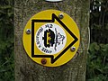 Monarch's Way Logo - geograph.org.uk - 1881210.jpg 2 816 × 2 112; 1,49 MB
-
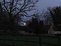 Moonrise over Exton, Christmas Eve - geograph.org.uk - 5500124.jpg 1 600 × 1 200; 346 KB
-
 Narrow section of Beacon Hill Lane - geograph.org.uk - 4013837.jpg 800 × 600; 200 KB
-
 New South Downs Way footpath to Beacon Hill - geograph.org.uk - 1905682.jpg 4 000 × 3 000; 2,88 MB
-
 No wide vehicles sign, The White Way, Exton, Hampshire.jpg 2 000 × 1 333; 554 KB
-

-
 Not quite so cold as a decade ago - geograph.org.uk - 6062541.jpg 640 × 480; 74 KB
-

-

-
 Old Winchester Hill - geograph.org.uk - 2155231.jpg 640 × 480; 178 KB
-
 Old Winchester Hill - geograph.org.uk - 2666579.jpg 640 × 427; 126 KB
-
 Old Winchester Hill - geograph.org.uk - 3964993.jpg 1 600 × 1 200; 477 KB
-
 Old Winchester Hill - geograph.org.uk - 5173323.jpg 2 048 × 1 536; 1,2 MB
-
 Old Winchester Hill - geograph.org.uk - 692815.jpg 640 × 480; 134 KB
-
 Old Winchester Hill - geograph.org.uk - 692820.jpg 640 × 480; 112 KB
-
 Old Winchester Hill from the Monarch's Way - geograph.org.uk - 5173372.jpg 2 048 × 1 536; 761 KB
-
 Old Winchester Hill Nature Reserve - geograph.org.uk - 1884144.jpg 2 816 × 2 112; 2,1 MB
-
 Old Winchester Hill Nature Reserve - geograph.org.uk - 1913925.jpg 4 000 × 3 000; 2,87 MB
-
 On Old Winchester Hill - geograph.org.uk - 1884139.jpg 2 816 × 2 112; 2,33 MB
-
 On South Downs Way approaching Lomer Farm, W of Warnford - geograph.org.uk - 5612096.jpg 5 184 × 2 920; 4,69 MB
-

-
 OS flush bracket - Beacon Hill trig - geograph.org.uk - 4579621.jpg 764 × 1 019; 478 KB
-

-
 Parallel bridleways south of Peake Farm - geograph.org.uk - 5182921.jpg 4 608 × 3 456; 4,5 MB
-
 Pasture and farm buildings, Exton - geograph.org.uk - 2818454.jpg 640 × 480; 129 KB
-
 Pasture, Exton - geograph.org.uk - 2818244.jpg 640 × 480; 170 KB
-
 Pasture, Exton - geograph.org.uk - 2818520.jpg 640 × 480; 165 KB
-
 Path on Old Winchester Hill - geograph.org.uk - 5803756.jpg 768 × 1 024; 493 KB
-
 Path to Old Winchester Hill - geograph.org.uk - 5349971.jpg 3 640 × 2 730; 4,21 MB
-

-
-
 Pit (dis) on Beacon Hill - geograph.org.uk - 4015739.jpg 800 × 600; 149 KB
-
 Ploughed Field on Beacon Hill - geograph.org.uk - 1881244.jpg 2 816 × 2 112; 2,11 MB
-
 Preshaw Estate Roman Catholic Chapel - geograph.org.uk - 3139442.jpg 3 461 × 2 627; 2,25 MB
-

-
 River Meon - geograph.org.uk - 3645457.jpg 1 600 × 1 064; 524 KB
-
 River Meon at Exton - geograph.org.uk - 5803753.jpg 768 × 1 024; 332 KB
-
 River Meon in Exton - geograph.org.uk - 1881709.jpg 2 816 × 2 112; 1,62 MB
-
 River running through the village of Exton - geograph.org.uk - 5182908.jpg 4 608 × 3 456; 4,34 MB
-
 Sailor's Lane - geograph.org.uk - 5292832.jpg 640 × 480; 234 KB
-
 Salt Lane - geograph.org.uk - 5067733.jpg 1 024 × 768; 240 KB
-
 Salt Lane within Saltlane Plantation - geograph.org.uk - 3245020.jpg 3 482 × 2 221; 1,54 MB
-
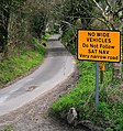
 Sat Nav warning - geograph.org.uk - 4013860.jpg 800 × 600; 212 KB
-


_-_geograph.org.uk_-_3055772.jpg)
_-_geograph.org.uk_-_3055795.jpg)
_-_geograph.org.uk_-_3055806.jpg)
_-_geograph.org.uk_-_3055812.jpg)


_(July_2019).JPG)


_-_geograph.org.uk_-_3056821.jpg)
_-_geograph.org.uk_-_3056828.jpg)
_-_geograph.org.uk_-_3056832.jpg)
_on_Beacon_Hill_-_geograph.org.uk_-_4015739.jpg)