Category:Eyke
Aller à la navigation
Aller à la recherche
English: Eyke is a village and a civil parish in the Suffolk Coastal District, in the English county of Suffolk. It is located on the A1152 road near the town of Woodbridge. Eyke has a primary school, a place of worship and a pub.
localité britannique du comté anglais de Suffolk  | |||||
| Téléverser des médias | |||||
| Nature de l’élément | |||||
|---|---|---|---|---|---|
| Lieu |
| ||||
| Réputé identique à | Eyke (page en doublon, paroisse civile) | ||||
 | |||||
Sous-catégories
Cette catégorie comprend 5 sous-catégories, dont les 5 ci-dessous.
A
- All Saints Church, Eyke (8 F)
E
- Elephant and Castle, Eyke (6 F)
L
- Low Farm, Eyke (3 F)
R
- RAF Woodbridge (38 F)
V
- Eyke Village Sign (6 F)
Média dans la catégorie « Eyke »
Cette catégorie comprend 157 fichiers, dont les 157 ci-dessous.
-
 A shelterbelt of pine trees, Eyke - geograph.org.uk - 2553350.jpg 640 × 480 ; 202 kio
-
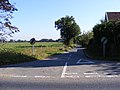
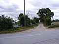
 A1152 Eyke Road - geograph.org.uk - 2430669.jpg 3 072 × 2 304 ; 1,61 Mio
-
 A1152 Eyke Road - geograph.org.uk - 2430675.jpg 3 072 × 2 304 ; 1,39 Mio
-
 A1152 The Street - geograph.org.uk - 2430729.jpg 3 072 × 2 304 ; 1,33 Mio
-
 A1152 The Street - geograph.org.uk - 2430731.jpg 3 072 × 2 304 ; 1,22 Mio
-
 A1152 The Street, Eyke - geograph.org.uk - 2424108.jpg 3 072 × 2 304 ; 1,39 Mio
-
 Access Road on Daisy's Circular Walk - geograph.org.uk - 2535445.jpg 3 072 × 2 304 ; 1,39 Mio
-
 Access Road on Daisy's Circular Walk - geograph.org.uk - 2535446.jpg 3 072 × 2 304 ; 1,41 Mio
-
 All Saints Church Hall, Eyke - geograph.org.uk - 2430834.jpg 3 072 × 2 304 ; 1,4 Mio
-
 Ash Road - geograph.org.uk - 2670797.jpg 2 304 × 3 072 ; 1,49 Mio
-
 Ash Road junction with the B1084 - geograph.org.uk - 2670792.jpg 3 072 × 2 304 ; 1,63 Mio
-
 B1084 junction with Hollesley Road - geograph.org.uk - 3550313.jpg 3 040 × 2 431 ; 1,06 Mio
-
 B1084 passes Spratts Cottage - geograph.org.uk - 3550333.jpg 3 396 × 2 260 ; 940 kio
-
 B1084 passes through Rendlesham Forest - geograph.org.uk - 3550354.jpg 3 521 × 2 606 ; 1,3 Mio
-
 B1084 Woodbridge Road - geograph.org.uk - 2538741.jpg 3 072 × 2 304 ; 1,32 Mio
-
 Barley field on Cracks Lane - geograph.org.uk - 6179606.jpg 6 000 × 4 000 ; 6,66 Mio
-
 Barn at Sink Farm - geograph.org.uk - 2628097.jpg 3 072 × 2 304 ; 1,29 Mio
-
 Bracken on the edge of the playing field in Eyke - geograph.org.uk - 2553343.jpg 640 × 480 ; 262 kio
-
 Bridge Road Level Crossing - geograph.org.uk - 2628120.jpg 3 072 × 2 304 ; 1,44 Mio
-
 Bridge Road ^ Barn at Sink Farm - geograph.org.uk - 2628092.jpg 3 072 × 2 304 ; 1,42 Mio
-
 Broken Tree - geograph.org.uk - 4247498.jpg 1 024 × 768 ; 301 kio
-
 Byway to Woodbridge Airfield ^ Entrance to Claypond Cottage - geograph.org.uk - 2538642.jpg 2 304 × 3 072 ; 1,4 Mio
-
 Castle Hill - geograph.org.uk - 3974104.jpg 768 × 1 024 ; 259 kio
-
 Cattle grazing in the Deben valley - geograph.org.uk - 6179590.jpg 6 000 × 4 000 ; 7,2 Mio
-
 Church Farm, Eyke - geograph.org.uk - 2478867.jpg 3 648 × 2 736 ; 3,22 Mio
-
 Church Lane, Eyke - geograph.org.uk - 2430823.jpg 2 304 × 3 072 ; 1,29 Mio
-
 Church Lane, Eyke - geograph.org.uk - 2430827.jpg 3 072 × 2 304 ; 1,39 Mio
-
 Cottages - geograph.org.uk - 3974108.jpg 1 024 × 768 ; 290 kio
-
 Cottages on the B1084 at Spratt's Street - geograph.org.uk - 6192645.jpg 6 000 × 4 000 ; 6,71 Mio
-
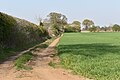
 Cracks Lane - geograph.org.uk - 2430737.jpg 3 072 × 2 304 ; 1,28 Mio
-
 Cracks Lane - geograph.org.uk - 3974027.jpg 1 024 × 768 ; 201 kio
-
 Cracks Lane approaching Friday Street - geograph.org.uk - 6179612.jpg 6 000 × 4 000 ; 6,88 Mio
-
 Cracks Lane, Eyke - geograph.org.uk - 2628155.jpg 3 072 × 2 304 ; 1,38 Mio
-
 Cracks Lane, Eyke - geograph.org.uk - 2628175.jpg 2 304 × 3 072 ; 1,29 Mio
-
 Cracks Lane, Eyke - geograph.org.uk - 2628179.jpg 2 304 × 3 072 ; 1,29 Mio
-
 Cracks Lane, Rendlesham - geograph.org.uk - 2670654.jpg 3 072 × 2 304 ; 1,41 Mio
-
 Crossroads on the A1152 The Street, Eyke - geograph.org.uk - 2628156.jpg 3 072 × 2 304 ; 1,45 Mio
-
 Daisy's Circular Walk - geograph.org.uk - 2535408.jpg 2 304 × 3 072 ; 1,5 Mio
-
 Daisy's Circular Walk - geograph.org.uk - 2535412.jpg 2 304 × 3 072 ; 1,31 Mio
-
 Daisy's Circular Walk - geograph.org.uk - 2535413.jpg 2 304 × 3 072 ; 1,41 Mio
-
 Daisy's Circular Walk - geograph.org.uk - 2535422.jpg 2 304 × 3 072 ; 1,56 Mio
-
 Daisy's Circular Walk - geograph.org.uk - 2535436.jpg 2 304 × 3 072 ; 1,51 Mio
-
 Daisy's Circular Walk - geograph.org.uk - 2535438.jpg 2 304 × 3 072 ; 1,36 Mio
-
 Daisy's Circular Walk - geograph.org.uk - 2535442.jpg 2 304 × 3 072 ; 1,69 Mio
-
 Daisy's Circular Walk - geograph.org.uk - 2535453.jpg 2 304 × 3 072 ; 1,34 Mio
-
 Deben valley water-meadows near Ufford, from the railway - geograph.org.uk - 5605725.jpg 1 600 × 1 064 ; 302 kio
-
 Deben valley water-meadows, Ufford, from the railway - geograph.org.uk - 5566575.jpg 1 600 × 1 064 ; 219 kio
-
 Derelict farm building at Rookery Farm - geograph.org.uk - 4409436.jpg 1 024 × 768 ; 429 kio
-
 Derelict farm building at Rookery Farm - geograph.org.uk - 4409437.jpg 1 024 × 768 ; 511 kio
-
 Drain near Low Farm - geograph.org.uk - 4735604.jpg 640 × 421 ; 39 kio
-
 Entrance to a caravan site - geograph.org.uk - 4409548.jpg 1 024 × 768 ; 453 kio
-
 Eyke - geograph.org.uk - 1407594.jpg 640 × 480 ; 110 kio
-
 Eyke Telephone Exchange - geograph.org.uk - 2430662.jpg 3 072 × 2 304 ; 1,39 Mio
-
 Eyke Telephone Exchange - geograph.org.uk - 2430663.jpg 3 072 × 2 304 ; 1,35 Mio
-
 Eyke, Suffolk - geograph.org.uk - 72609.jpg 640 × 480 ; 94 kio
-
 Farm buildings at Rookery Farm - geograph.org.uk - 4409418.jpg 1 024 × 768 ; 477 kio
-
 Farm track on Sheepdrift Road - geograph.org.uk - 6190573.jpg 6 000 × 4 000 ; 6,45 Mio
-
 Field by Sink Farm - geograph.org.uk - 5731216.jpg 6 000 × 4 000 ; 5,07 Mio
-
 Field to the North of Woodbridge Airfield - geograph.org.uk - 4520144.jpg 4 000 × 3 000 ; 5,45 Mio
-
 Fields next to Daisy's Circular Walk - geograph.org.uk - 2535416.jpg 3 072 × 2 304 ; 1,31 Mio
-
 Fleece covered and irrigated field near Bromeswell - geograph.org.uk - 6190591.jpg 6 000 × 4 000 ; 6,58 Mio
-
 Fleece covered field at Spratt's Street - geograph.org.uk - 6192639.jpg 6 000 × 4 000 ; 6,34 Mio
-
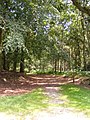
 Footpath on the edge of the forest - geograph.org.uk - 2578021.jpg 3 648 × 2 736 ; 3,4 Mio
-
 Footpath Sign - geograph.org.uk - 3974056.jpg 1 024 × 768 ; 226 kio
-
 Footpath Sign And Footpath - geograph.org.uk - 4247442.jpg 768 × 1 024 ; 218 kio
-
 Footpath to Church Lane, Eyke - geograph.org.uk - 2670674.jpg 3 072 × 2 304 ; 1,35 Mio
-
 Footpath to Hollesley Road ^ Church Lane - geograph.org.uk - 2628173.jpg 3 072 × 2 304 ; 1,62 Mio
-
 Footpath to Hollesley Road ^ Church Lane - geograph.org.uk - 2628184.jpg 2 304 × 3 072 ; 1,47 Mio
-
 Footpath to Rookery Old House ^ the A1152 in Eyke - geograph.org.uk - 2538709.jpg 2 304 × 3 072 ; 1,32 Mio
-
 Footpath to Rookery Old House ^ the A1152 in Eyke - geograph.org.uk - 2538710.jpg 2 304 × 3 072 ; 1,24 Mio
-
 Footpath to Rookery Old House ^ the A1152 in Eyke - geograph.org.uk - 2538713.jpg 3 072 × 2 304 ; 1,32 Mio
-
 Footpath to Stone Hall, Eyke - geograph.org.uk - 4409422.jpg 1 024 × 768 ; 316 kio
-
 Footpath to The Street - geograph.org.uk - 2628169.jpg 3 072 × 2 304 ; 1,66 Mio
-
 Footpath to The Street - geograph.org.uk - 2628183.jpg 2 304 × 3 072 ; 1,4 Mio
-
 Footpath ^ Entrance to Stone Hall ^ Friday Street - geograph.org.uk - 2670685.jpg 3 072 × 2 304 ; 1,33 Mio
-
 Forest Gate - geograph.org.uk - 4247469.jpg 1 024 × 768 ; 304 kio
-
 Forest Track - geograph.org.uk - 4247465.jpg 1 024 × 768 ; 243 kio
-
 Forest Track - geograph.org.uk - 4247481.jpg 1 024 × 768 ; 237 kio
-
 Forestry Commission road - geograph.org.uk - 4144533.jpg 4 320 × 3 240 ; 2,9 Mio
-
 Friday Street, Eyke - geograph.org.uk - 2628196.jpg 3 072 × 2 304 ; 1,42 Mio
-
 Friday Street, Eyke - geograph.org.uk - 2628205.jpg 2 304 × 3 072 ; 1,52 Mio
-
 Friday Street, Eyke - geograph.org.uk - 2628234.jpg 3 072 × 2 304 ; 1,42 Mio
-
 Gorse and birch beside a ride in Rendlesham Forest - geograph.org.uk - 6192665.jpg 6 000 × 4 000 ; 6,66 Mio
-
 Heathland - geograph.org.uk - 4247477.jpg 1 024 × 768 ; 229 kio
-
 Hedge surrounding playing field, Eyke - geograph.org.uk - 2553342.jpg 640 × 480 ; 241 kio
-
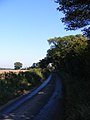
 Hollesley Road - geograph.org.uk - 2670715.jpg 3 072 × 2 304 ; 1,28 Mio
-
 Hollesley Road - geograph.org.uk - 4247433.jpg 1 024 × 768 ; 210 kio
-
 Hollesley Road junction with the B1084 - geograph.org.uk - 2670702.jpg 3 072 × 2 304 ; 1,32 Mio
-
 Hollesley Road to Rendlesham - geograph.org.uk - 2538636.jpg 3 072 × 2 304 ; 1,29 Mio
-
 Hollesley Road ^ footpath and entrance to Stone Hall ^ Friday Street - geograph.org.uk - 2670682.jpg 3 072 × 2 304 ; 1,25 Mio
-
 Hollesley Road ^ the Staverton Vineyard Sales Building - geograph.org.uk - 2670669.jpg 3 072 × 2 304 ; 1,35 Mio
-
 Hollesley Road, Eyke - geograph.org.uk - 2628190.jpg 3 072 × 2 304 ; 1,43 Mio
-
 Hollesley Road, Eyke - geograph.org.uk - 4409424.jpg 1 024 × 768 ; 250 kio
-
 Hollesley Road, Eyke - geograph.org.uk - 4409427.jpg 1 024 × 768 ; 336 kio
-
 Hollesley Road, Rendlesham - geograph.org.uk - 2670652.jpg 3 072 × 2 304 ; 1,33 Mio
-
 Irrigated fields on Hollesley Road - geograph.org.uk - 6192631.jpg 6 000 × 4 000 ; 6,66 Mio
-
 Irrigation cannon and hose near Rookery Farm - geograph.org.uk - 6192608.jpg 6 000 × 4 000 ; 6,94 Mio
-
 Irrigation Pump - geograph.org.uk - 3974063.jpg 1 024 × 768 ; 304 kio
-
 Joggers - geograph.org.uk - 3974043.jpg 1 024 × 768 ; 290 kio
-
 Junction on Daisy's Circular Walk - geograph.org.uk - 2535435.jpg 3 072 × 2 304 ; 1,62 Mio
-
 Just off Daisy's Circular Walk - geograph.org.uk - 2535428.jpg 2 304 × 3 072 ; 1,65 Mio
-
 Long Straight Track - geograph.org.uk - 4247492.jpg 1 024 × 768 ; 276 kio
-
 Marsh View, Bridge Road - geograph.org.uk - 2628107.jpg 3 072 × 2 304 ; 1,46 Mio
-
 New Forest Track - geograph.org.uk - 4246194.jpg 768 × 1 024 ; 400 kio
-
 Newly-emerging maize crop, Cracks Lane - geograph.org.uk - 6179600.jpg 6 000 × 4 000 ; 7,68 Mio
-
 Notice Board of All Saints Church,Eyke - geograph.org.uk - 2430833.jpg 2 304 × 3 072 ; 1,49 Mio
-
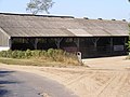
 Old barn, Eyke.jpg 5 184 × 3 456 ; 8,02 Mio
-

-
 Open Field - geograph.org.uk - 4246190.jpg 1 024 × 768 ; 277 kio
-
 Ordnance Survey map of Eyke Suffork.png 731 × 622 ; 738 kio
-
 Plastic field, Spratt's Street, Suffolk - geograph.org.uk - 2949202.jpg 1 600 × 1 198 ; 470 kio
-
 Playing field in Eyke - geograph.org.uk - 2553352.jpg 640 × 480 ; 196 kio
-
 Potato field near Broom Hill, Eyke - geograph.org.uk - 6168446.jpg 4 934 × 3 289 ; 3,43 Mio
-
 Pumping Station in Ufford Road - geograph.org.uk - 2628135.jpg 3 072 × 2 304 ; 1,68 Mio
-
 Ragwort and Viper's bugloss, Ekye - geograph.org.uk - 2553344.jpg 640 × 480 ; 263 kio
-
 Red roofed black barn across the brown field - geograph.org.uk - 4409442.jpg 1 024 × 768 ; 248 kio
-
 Rendlesham Forest - geograph.org.uk - 1245395.jpg 640 × 460 ; 179 kio
-
 Road junction in Ufford Road - geograph.org.uk - 2628146.jpg 3 072 × 2 304 ; 1,39 Mio
-
 Roadsign on the B1084 - geograph.org.uk - 2670706.jpg 2 304 × 3 072 ; 1,3 Mio
-
 Roadsign on the B1084 Woodbridge Road - geograph.org.uk - 2538619.jpg 2 304 × 3 072 ; 1,6 Mio
-
 Roadsigns on Sheepdrift Road - geograph.org.uk - 2628075.jpg 3 072 × 2 304 ; 1,56 Mio
-
 Rookery Farm - geograph.org.uk - 1407602.jpg 640 × 480 ; 68 kio
-
 Sandy Lane on the left and a sandy lane on the right - geograph.org.uk - 4409406.jpg 1 024 × 768 ; 275 kio
-
 Seat on Daisy's Circular Walk - geograph.org.uk - 2535418.jpg 3 072 × 2 304 ; 1,64 Mio
-
 Seat on Daisy's Circular Walk - geograph.org.uk - 2535485.jpg 2 304 × 3 072 ; 1,67 Mio
-
 Sheepdrift Road crossroads ahead - geograph.org.uk - 4409328.jpg 1 024 × 768 ; 428 kio
-
 Sheepdrift Road sign - geograph.org.uk - 2628077.jpg 3 072 × 2 304 ; 1,61 Mio
-
 Sheepdrift Road, Eyke - geograph.org.uk - 2430654.jpg 3 072 × 2 304 ; 1,35 Mio
-
 Sink Farm - geograph.org.uk - 1407591.jpg 640 × 480 ; 71 kio
-
 Sink Farm Cottage, Ufford Road - geograph.org.uk - 2628133.jpg 3 072 × 2 304 ; 1,32 Mio
-
 Sink Farm sign - geograph.org.uk - 2628094.jpg 3 072 × 2 304 ; 1,4 Mio
-
 Spratt's Cottage - geograph.org.uk - 4144521.jpg 4 320 × 3 240 ; 4,02 Mio
-
 Spratt's Cottages in Spratt Street - geograph.org.uk - 4409440.jpg 1 024 × 768 ; 333 kio
-
 Spratt's Street - geograph.org.uk - 1407605.jpg 640 × 480 ; 67 kio
-
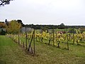
 Staverton Vineyard - geograph.org.uk - 2670723.jpg 3 072 × 2 304 ; 1,32 Mio
-
 Staverton Vineyard - geograph.org.uk - 2670724.jpg 3 072 × 2 304 ; 1,29 Mio
-
 Staverton Vineyard - geograph.org.uk - 2670726.jpg 3 072 × 2 304 ; 1,32 Mio
-
 Staverton Vineyard - geograph.org.uk - 2670727.jpg 3 072 × 2 304 ; 1,27 Mio
-
 The farmhouse, Church Farm, Eyke - geograph.org.uk - 2955143.jpg 1 024 × 674 ; 97 kio
-
 The playing field in Eyke - geograph.org.uk - 2553338.jpg 640 × 480 ; 241 kio
-
 The Street Eyke George V Postbox - geograph.org.uk - 2424089.jpg 2 304 × 3 072 ; 1,4 Mio
-
 The Street Eyke George V Postbox - geograph.org.uk - 2424092.jpg 2 304 × 3 072 ; 1,39 Mio
-
 The Street Eyke George V Postbox - geograph.org.uk - 2424098.jpg 2 304 × 3 072 ; 1,39 Mio
-
 There goes the train^ - geograph.org.uk - 4409285.jpg 1 024 × 768 ; 435 kio
-
 Track and maize - geograph.org.uk - 4247423.jpg 1 024 × 768 ; 241 kio
-
 Track in Rendlesham Forest - geograph.org.uk - 1407607.jpg 640 × 480 ; 140 kio
-
 Track to Eyke Common - geograph.org.uk - 2258610.jpg 640 × 427 ; 198 kio
-
 Tractor and trailer, Spratt's Street, Suffolk - geograph.org.uk - 2949200.jpg 1 600 × 1 122 ; 497 kio
-
 Ufford Road - geograph.org.uk - 3974118.jpg 1 024 × 768 ; 286 kio
-
 Ufford Road, Eyke - geograph.org.uk - 2628148.jpg 3 072 × 2 304 ; 1,35 Mio
-
 View across the playing field, Eyke - geograph.org.uk - 2553345.jpg 640 × 480 ; 255 kio
-
 Village shop in Eyke - geograph.org.uk - 4068178.jpg 1 536 × 1 152 ; 1,01 Mio
-
 Viper's bugloss (Echium vulgare) - geograph.org.uk - 2553355.jpg 640 × 480 ; 343 kio
-

-
 Wild flowers growing on the playing field, Eyke - geograph.org.uk - 2553347.jpg 640 × 480 ; 263 kio
-
 Wild flowers on the playing field, Eyke - geograph.org.uk - 2553351.jpg 640 × 480 ; 251 kio
-
 Winter in Rendlesham Forest - geograph.org.uk - 2107681.jpg 2 684 × 1 852 ; 2,67 Mio


_-_geograph.org.uk_-_2553355.jpg)


