Category:Farlam
Vai alla navigazione
Vai alla ricerca
village and civil parish in Cumbria, United Kingdom  | |||||
| Carica un file multimediale | |||||
| Istanza di | |||||
|---|---|---|---|---|---|
| Luogo | City of Carlisle, Cumbria, Nord Ovest dell'Inghilterra, Inghilterra | ||||
 | |||||
Sottocategorie
Questa categoria contiene le 3 sottocategorie indicate di seguito, su un totale di 3.
H
T
- St Thomas a Becket, Farlam (4 F)
- Tindale, Cumbria (18 F)
File nella categoria "Farlam"
Questa categoria contiene 200 file, indicati di seguito, su un totale di 214.
(pagina precedente) (pagina successiva)-
 A cold day on the water - geograph.org.uk - 1132356.jpg 640 × 480; 74 KB
-
 A cul-de-sac path near Highfell - geograph.org.uk - 2938479.jpg 800 × 600; 103 KB
-
 A monument to the Roachburn Pit Disaster - geograph.org.uk - 2938495.jpg 800 × 600; 155 KB
-
 A path to Hallbankgate - geograph.org.uk - 2938470.jpg 800 × 600; 82 KB
-
 A683 at Quarry entrance - geograph.org.uk - 4001788.jpg 640 × 334; 44 KB
-
 A683 entering Coalfell - geograph.org.uk - 4001790.jpg 640 × 346; 60 KB
-
 A683 leaving Hallbankgate - geograph.org.uk - 4001750.jpg 640 × 361; 57 KB
-
 Barn conversions at Farlam - geograph.org.uk - 1132374.jpg 640 × 480; 98 KB
-
 Beck Cottages by Milton Beck - geograph.org.uk - 4001712.jpg 640 × 356; 45 KB
-
 Belted Will Inn, Hallbankgate - geograph.org.uk - 1893610.jpg 600 × 450; 236 KB
-
 Bird observatory, Talkin Tarn - geograph.org.uk - 1055938.jpg 640 × 480; 298 KB
-
 Bird observatory, Talkin Tarn - geograph.org.uk - 2913782.jpg 1 600 × 1 067; 341 KB
-
 Black Rigg (2) - geograph.org.uk - 2901028.jpg 640 × 480; 74 KB
-
 Black Rigg - geograph.org.uk - 2901025.jpg 640 × 480; 75 KB
-
 Black Rigg north of Stanniston Hill - geograph.org.uk - 2901022.jpg 640 × 480; 70 KB
-
 Blind Tarn - geograph.org.uk - 3308200.jpg 640 × 480; 168 KB
-
 Bluegate Cottage - geograph.org.uk - 898706.jpg 600 × 450; 113 KB
-
 Bog Cottages - geograph.org.uk - 5168902.jpg 4 000 × 3 000; 3,6 MB
-
 Boon Hill - geograph.org.uk - 1132366.jpg 640 × 480; 91 KB
-
 Bridleway on Stoop Rigg - geograph.org.uk - 898726.jpg 600 × 450; 66 KB
-
 Bridleway through two plantations - geograph.org.uk - 898641.jpg 600 × 450; 67 KB
-
 Bridleway to unmarked plantation - geograph.org.uk - 898736.jpg 600 × 450; 72 KB
-
 Bridleway towards Stoop Rigg - geograph.org.uk - 1890490.jpg 600 × 450; 234 KB
-
 Buttercup-rich meadow - geograph.org.uk - 1932233.jpg 640 × 480; 82 KB
-
 Buttercup-rich meadow at Greenside - geograph.org.uk - 1932547.jpg 640 × 480; 87 KB
-
 Carnetley Farm - geograph.org.uk - 1894534.jpg 600 × 450; 237 KB
-
 Carnetley Farm - geograph.org.uk - 1894539.jpg 931 × 450; 322 KB
-
 Carnetley Farmhouse - geograph.org.uk - 1894537.jpg 600 × 450; 246 KB
-

-
 Cleskett Holme - geograph.org.uk - 3308036.jpg 640 × 480; 164 KB
-
 Cleskett Holme - geograph.org.uk - 6029721.jpg 5 184 × 3 888; 764 KB
-
 Cleskett Holme - geograph.org.uk - 6029722.jpg 5 184 × 3 888; 909 KB
-
 Cleugh Head - geograph.org.uk - 1485464.jpg 640 × 314; 63 KB
-
 Clowsgill Holme - geograph.org.uk - 1485180.jpg 640 × 399; 87 KB
-
 Clowsgill Holme - geograph.org.uk - 2024452.jpg 600 × 450; 254 KB
-
 Cocklit Hill - geograph.org.uk - 2901252.jpg 640 × 480; 68 KB
-

-

-
 Cottage for Sale, Hallbankgate - geograph.org.uk - 1893586.jpg 600 × 450; 266 KB
-
 Cotton grass on Tarnhouse Rigg - geograph.org.uk - 4495286.jpg 640 × 480; 490 KB
-
 Covered reservoir near Greenlea Cross - geograph.org.uk - 3308061.jpg 640 × 480; 153 KB
-
 Covered reservoir near Greenlea Cross - geograph.org.uk - 3308063.jpg 640 × 480; 142 KB
-
 Curdiff - geograph.org.uk - 3308171.jpg 702 × 480; 147 KB
-

-

-

-

-
 Entering Farlam from the north - geograph.org.uk - 2921989.jpg 816 × 612; 124 KB
-
 Entering the North Pennines on the A689 - geograph.org.uk - 2938485.jpg 800 × 600; 109 KB
-
-

-
 Farlam from viewpoint above the village - geograph.org.uk - 535824.jpg 640 × 480; 162 KB
-
 Farlam Hall Hotel (geograph 7158557).jpg 5 184 × 3 888; 3,19 MB
-
 Farlam Old Churchyard - geograph.org.uk - 4971940.jpg 640 × 480; 488 KB
-
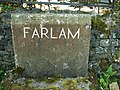 Farlam Parish marker stone - geograph.org.uk - 536827.jpg 640 × 480; 182 KB
-
 Farlam, village noticeboard and signpost - geograph.org.uk - 534701.jpg 640 × 482; 164 KB
-
 Field south of Crossgates Road - geograph.org.uk - 2753929.jpg 1 024 × 768; 222 KB
-
 Field walls, Kirkhouse - geograph.org.uk - 4971914.jpg 640 × 480; 375 KB
-
 Follysyke Cottages from A689 - geograph.org.uk - 4001797.jpg 640 × 438; 55 KB
-
 Footbridge over Back Dike - geograph.org.uk - 1890475.jpg 600 × 450; 347 KB
-
 Footpath and Track to Carnetley - geograph.org.uk - 1894518.jpg 600 × 450; 288 KB
-
 Footpath and Track to Clowshill Holme - geograph.org.uk - 1893568.jpg 600 × 450; 306 KB
-
 Footpath to Bowbank Wood - geograph.org.uk - 3308211.jpg 640 × 480; 162 KB
-
 Footpath to New Garth - geograph.org.uk - 1894525.jpg 600 × 450; 399 KB
-
 Footpath towards Denton Fell Forest - geograph.org.uk - 1890483.jpg 600 × 450; 242 KB
-
 Former Wesleyan Chapel - geograph.org.uk - 1893619.jpg 600 × 450; 266 KB
-
 Generator House, old Roachburn Colliery - geograph.org.uk - 1828635.jpg 640 × 480; 178 KB
-
 Greenside - geograph.org.uk - 1492776.jpg 640 × 325; 63 KB
-
 Greenside Nook - geograph.org.uk - 1890498.jpg 600 × 450; 315 KB
-
 Haining Burn near Tindale - geograph.org.uk - 2024372.jpg 600 × 450; 294 KB
-
 Haining House - geograph.org.uk - 4675016.jpg 1 024 × 768; 196 KB
-
 Hartleyburn Common from Stanniston Hill - geograph.org.uk - 4675019.jpg 1 024 × 766; 218 KB
-
 Heading south-east on the A689 - geograph.org.uk - 4050116.jpg 640 × 480; 88 KB
-
 Highfell - geograph.org.uk - 2938467.jpg 800 × 600; 114 KB
-
 House at the old Roachburn Colliery - geograph.org.uk - 1828639.jpg 640 × 480; 91 KB
-
 Impressive barn at Greenside Farm - geograph.org.uk - 898720.jpg 600 × 450; 91 KB
-

-
 Junction for Kirkhouse from A689 - geograph.org.uk - 4001727.jpg 640 × 420; 66 KB
-
 Junction for Talkin at Hallbankgate - geograph.org.uk - 4001746.jpg 640 × 416; 151 KB
-
 Junction for Tindale from A689 - geograph.org.uk - 4001828.jpg 640 × 321; 93 KB
-
 Kellah Burn - geograph.org.uk - 4675046.jpg 1 024 × 768; 322 KB
-
 Kellah Burn east of Cocklit Hill - geograph.org.uk - 4675058.jpg 1 024 × 768; 210 KB
-
 Kirkhouse Farm - geograph.org.uk - 4971876.jpg 640 × 480; 325 KB
-
 Kirkhouse Farmhouse - geograph.org.uk - 5169006.jpg 4 000 × 3 000; 3,55 MB
-
 Kirkhouse Gasworks - geograph.org.uk - 5168872.jpg 3 000 × 4 000; 4,44 MB
-
 Lacy Thompson Memorial Hall - geograph.org.uk - 1893603.jpg 1 170 × 450; 466 KB
-
 Lane near Clement Leazes - geograph.org.uk - 2754029.jpg 1 024 × 768; 249 KB
-
 Late Autumn at Talkin Tarn - geograph.org.uk - 277895.jpg 640 × 480; 139 KB
-
 Limekilns at Foresthead Quarries - geograph.org.uk - 3308189.jpg 640 × 480; 156 KB
-
 Log seats - geograph.org.uk - 1132379.jpg 640 × 480; 159 KB
-
 Looking east along the A689 at Woodend Bridge - geograph.org.uk - 3813078.jpg 1 600 × 1 064; 310 KB
-
-
 Looking towards Furlamfell - geograph.org.uk - 3308059.jpg 640 × 480; 151 KB
-
 Looking towards Talkin Tarn - geograph.org.uk - 2921999.jpg 816 × 612; 100 KB
-
 Looking towards Tindale from the A689 at Woodend Bridge - geograph.org.uk - 3115325.jpg 1 600 × 1 064; 309 KB
-
 Low Lonning - geograph.org.uk - 1492783.jpg 640 × 421; 72 KB
-
 Low Lonning - geograph.org.uk - 4237851.jpg 3 849 × 2 535; 1,73 MB
-
 Lowthian Hall, Kirkhouse - geograph.org.uk - 4971919.jpg 640 × 480; 313 KB
-
 Lowtown Farm - geograph.org.uk - 5877074.jpg 2 268 × 3 343; 1,97 MB
-
 Meander on the Haining Burn - geograph.org.uk - 1828645.jpg 640 × 480; 91 KB
-
 Memorial for the Roachburn Pit Disaster - geograph.org.uk - 1893547.jpg 600 × 450; 345 KB
-
-
 Memorial to a Soldier of WW1 - geograph.org.uk - 5189754.jpg 3 000 × 4 000; 3,55 MB
-
-

-

-

-
 Moorland east of Cocklit Hill - geograph.org.uk - 2900122.jpg 640 × 480; 66 KB
-
 Moss Hill Wood - geograph.org.uk - 1492397.jpg 640 × 384; 69 KB
-
 New Garth near Hallbankgate - geograph.org.uk - 1893627.jpg 600 × 450; 214 KB
-
 Office Cottage, Kirkhouse - geograph.org.uk - 4971895.jpg 640 × 480; 389 KB
-
 Old Building at Kirkhouse Gasworks - geograph.org.uk - 5168928.jpg 2 756 × 3 521; 2,1 MB
-
 Old mine shaft, Roachburn Colliery - geograph.org.uk - 1828638.jpg 640 × 480; 151 KB
-
 Old Roachburn Colliery - geograph.org.uk - 1828637.jpg 640 × 480; 93 KB
-
 Old Tindale Spelter Works - geograph.org.uk - 4495315.jpg 480 × 640; 552 KB
-
 Old Tindale Spelter Works - geograph.org.uk - 4495318.jpg 640 × 480; 532 KB
-
 Pasture near Carnetley - geograph.org.uk - 1894513.jpg 600 × 450; 207 KB
-
 Pasture, Farlam - geograph.org.uk - 4342066.jpg 640 × 480; 202 KB
-
 Pastures at Farlam - geograph.org.uk - 821315.jpg 640 × 480; 85 KB
-
 Plank bridge on the Haining Burn - geograph.org.uk - 1828647.jpg 640 × 480; 100 KB
-
 Plantation near Greenside - geograph.org.uk - 1890503.jpg 600 × 450; 218 KB
-
 Plantation on Whamoss Rigg - geograph.org.uk - 2900091.jpg 640 × 480; 64 KB
-
 Plaque - geograph.org.uk - 424007.jpg 640 × 480; 96 KB
-
 Pond and woodland south-east of Clement Leazes - geograph.org.uk - 2754036.jpg 1 024 × 768; 208 KB
-

-
 Railway Bridge near Cowsgill Holme - geograph.org.uk - 2024456.jpg 600 × 450; 282 KB
-
 Reds at Talkin Tarn - geograph.org.uk - 806205.jpg 640 × 480; 92 KB
-
 Riggfoot Farm - geograph.org.uk - 1485213.jpg 640 × 383; 93 KB
-
 Roachburn Cottages - geograph.org.uk - 4001803.jpg 640 × 393; 115 KB
-
 Roachburn Farm - geograph.org.uk - 1495785.jpg 640 × 360; 45 KB
-
 Roachburn Farm - geograph.org.uk - 1828640.jpg 640 × 480; 59 KB
-
 Road at Highfell - geograph.org.uk - 3308193.jpg 640 × 480; 150 KB
-
 Road near High Cleugh Head - geograph.org.uk - 3308198.jpg 640 × 480; 124 KB
-
 Road near Limeholme Burn - geograph.org.uk - 3308213.jpg 640 × 480; 143 KB
-
 Road near Maryholme - geograph.org.uk - 1931729.jpg 640 × 480; 113 KB
-
 Road to Farlam - geograph.org.uk - 3308214.jpg 640 × 480; 152 KB
-
 Rough pasture above Cleshkett Beck - geograph.org.uk - 2754117.jpg 3 000 × 1 622; 1,18 MB
-
 Rowantree Hill - geograph.org.uk - 1492612.jpg 640 × 357; 74 KB
-
 Ruins at the old Roachburn Colliery - geograph.org.uk - 1828633.jpg 640 × 480; 113 KB
-
 Shaw Brow - geograph.org.uk - 1931731.jpg 640 × 480; 87 KB
-
 Sheep - geograph.org.uk - 423984.jpg 640 × 480; 99 KB
-
 Sheep pasture north of Forest Head - geograph.org.uk - 3308181.jpg 640 × 480; 135 KB
-
 Silver Side Farm - geograph.org.uk - 1893641.jpg 600 × 450; 266 KB
-
 Silver Side Farm - geograph.org.uk - 1893645.jpg 600 × 450; 239 KB
-
 Silver Side near Hallbankgate - geograph.org.uk - 1893640.jpg 600 × 450; 229 KB
-
 Silver Top near Hallbankgate - geograph.org.uk - 1893634.jpg 600 × 450; 292 KB
-
 Sink hole by Crossgates Road - geograph.org.uk - 2753998.jpg 1 024 × 768; 289 KB
-
 Talkin - geograph.org.uk - 19300.jpg 424 × 318; 20 KB
-
 Talkin Tarn - geograph.org.uk - 135610.jpg 640 × 167; 18 KB
-
-
 Tarn Beck - geograph.org.uk - 4495302.jpg 640 × 480; 456 KB
-

-
 Tarn Beck, Tindale - geograph.org.uk - 1828631.jpg 640 × 480; 108 KB
-
 Tarnhouse Rigg - geograph.org.uk - 1485436.jpg 640 × 393; 103 KB
-
 Tarnhouse Rigg - geograph.org.uk - 1492323.jpg 640 × 427; 169 KB
-
 Tarnhouse Rigg - geograph.org.uk - 1492618.jpg 640 × 357; 82 KB
-
 Tarnhouse Rigg - geograph.org.uk - 4495282.jpg 640 × 480; 456 KB
-
 Tarnside Farm, Farlam - geograph.org.uk - 1132390.jpg 640 × 480; 106 KB
-
 Telephone box at Kirkhouse - geograph.org.uk - 4971925.jpg 640 × 480; 488 KB
-
 Terraced Houses at Coalfell - geograph.org.uk - 1893560.jpg 600 × 450; 265 KB
-
 Terraced Houses, Coalfell - geograph.org.uk - 1890509.jpg 600 × 450; 314 KB
-
 Terraced Houses, Tindale - geograph.org.uk - 2024387.jpg 600 × 450; 272 KB
-

-
 The A689 west of Milton - geograph.org.uk - 2926287.jpg 816 × 612; 112 KB
-
 The Arlots - geograph.org.uk - 898711.jpg 600 × 450; 84 KB
-
 The cleugh of Black Dike (2) - geograph.org.uk - 2901265.jpg 640 × 480; 43 KB
-
 The cleugh of Black Dike (3) - geograph.org.uk - 2901270.jpg 640 × 480; 57 KB
-
 The cleugh of Black Dike (4) - geograph.org.uk - 2901277.jpg 640 × 480; 65 KB
-
 The cleugh of Black Dike - geograph.org.uk - 2900118.jpg 640 × 480; 66 KB
-
 The cleugh of Black Dike - geograph.org.uk - 2901259.jpg 640 × 480; 52 KB
-
 The Park from the south-east - geograph.org.uk - 2754055.jpg 1 024 × 768; 238 KB
-

-
 The track to Greenside - geograph.org.uk - 2938492.jpg 800 × 600; 186 KB
-

-
 The valley of Kellah Burn - geograph.org.uk - 2669816.jpg 640 × 480; 82 KB
-
 The village sign at Hallbankgate - geograph.org.uk - 2938481.jpg 800 × 600; 114 KB
-
 Thorn (sheep pens) - geograph.org.uk - 2024478.jpg 600 × 450; 278 KB
-
 Tindale - geograph.org.uk - 1828641.jpg 640 × 480; 95 KB
-
 Tindale Wesleyan Chapel (former) - geograph.org.uk - 2024384.jpg 600 × 450; 254 KB
-
 Towards Williamgill Wood - geograph.org.uk - 3308208.jpg 640 × 480; 170 KB
-
 Track at The Park - geograph.org.uk - 2754045.jpg 1 024 × 769; 281 KB
-
 Track leading to Rowantree Hill - geograph.org.uk - 2024435.jpg 600 × 450; 263 KB
-
 Tree seat, Talkin Tarn, Brampton - geograph.org.uk - 1149554.jpg 480 × 640; 132 KB
-
 Trees on the left mark the Lord Carlisle's Railway - geograph.org.uk - 5169044.jpg 4 000 × 3 000; 2,97 MB
-
 TV repeater station near Greenlea Cross - geograph.org.uk - 3308057.jpg 640 × 480; 121 KB
-
 Valley of Kellah Burn near Black Rigg - geograph.org.uk - 4675033.jpg 1 024 × 769; 281 KB
-
 Valley of the Haining Burn - geograph.org.uk - 1828643.jpg 640 × 480; 91 KB
-
 Valley of the Howgill Beck - geograph.org.uk - 4494422.jpg 640 × 480; 433 KB
-
 Victorian postbox, Kirkhouse - geograph.org.uk - 4971902.jpg 640 × 480; 401 KB
-
 View across fields to Talkin Tarn - geograph.org.uk - 536801.jpg 640 × 480; 162 KB
-
 View north-west from Tarnhouse Rigg - geograph.org.uk - 4494433.jpg 640 × 480; 457 KB
-
 View towards Whinnyfell - geograph.org.uk - 6029731.jpg 5 184 × 3 888; 418 KB
-
 Whinnyfell - geograph.org.uk - 6029724.jpg 5 184 × 3 888; 446 KB
-
 Woodend - geograph.org.uk - 1492307.jpg 640 × 396; 99 KB
-
 Woodend Cottage - geograph.org.uk - 1932574.jpg 640 × 480; 74 KB
-
 Woodend on A689 - geograph.org.uk - 4001817.jpg 640 × 277; 109 KB
-
 A corner of Brampton Golf Course - geograph.org.uk - 1237905.jpg 640 × 480; 87 KB
-
 A Tolkien creation, perhaps - geograph.org.uk - 1149722.jpg 640 × 480; 131 KB
-
 Brown Fell - geograph.org.uk - 426674.jpg 640 × 480; 67 KB
-
 Cairn on Currick Fell Top - geograph.org.uk - 1445055.jpg 640 × 480; 62 KB


_-_geograph.org.uk_-_2901028.jpg)


.jpg)


_-_geograph.org.uk_-_2938477.jpg)


_-_geograph.org.uk_-_2900136.jpg)


_-_geograph.org.uk_-_2901265.jpg)
_-_geograph.org.uk_-_2901270.jpg)
_-_geograph.org.uk_-_2901277.jpg)


_-_geograph.org.uk_-_2901038.jpg)


_-_geograph.org.uk_-_2024478.jpg)

_-_geograph.org.uk_-_2024384.jpg)


