Category:Farnham, Suffolk
Aller à la navigation
Aller à la recherche
English: Farnham is a village and civil parish about 4 km South-South West of Saxmundham in Suffolk, England on the A12
localité britannique du comté anglais de Suffolk  | |||||
| Téléverser des médias | |||||
| Nature de l’élément | |||||
|---|---|---|---|---|---|
| Lieu |
| ||||
 | |||||
Sous-catégories
Cette catégorie comprend 6 sous-catégories, dont les 6 ci-dessous.
B
- Burnt House Farm Bridge (7 F)
G
- George and Dragon, Farnham (3 F)
L
- Langham Bridge, Suffolk (4 F)
M
R
V
Média dans la catégorie « Farnham, Suffolk »
Cette catégorie comprend 209 fichiers, dont les 200 ci-dessous.
(page précédente) (page suivante)-
 1GL Bolt Farnham St Marys Church - geograph.org.uk - 5684013.jpg 2 231 × 2 231 ; 3,13 Mio
-
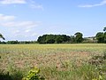
 A Field Of Rape - geograph.org.uk - 4030907.jpg 1 024 × 768 ; 342 kio
-
 A strip of pines twixt road and field - geograph.org.uk - 4440214.jpg 1 024 × 768 ; 452 kio
-
 A12 near Stratford Bridge - geograph.org.uk - 3865026.jpg 640 × 480 ; 316 kio
-
 A12 passes Elm Tree Cottage - geograph.org.uk - 3598801.jpg 3 569 × 2 532 ; 1,19 Mio
-
 A12 through Farnham - geograph.org.uk - 5457978.jpg 5 202 × 3 465 ; 3,26 Mio
-
 Approaching Farnham on the A12 road - geograph.org.uk - 2804696.jpg 640 × 621 ; 156 kio
-
 Approaching the A12 - geograph.org.uk - 4030838.jpg 1 024 × 768 ; 212 kio
-
 Blaxhall Road south of Friday Street, Farnham - geograph.org.uk - 2287045.jpg 760 × 570 ; 272 kio
-
 Botany Farm - geograph.org.uk - 2336997.jpg 3 072 × 2 304 ; 1,41 Mio
-
 Botany Wood - geograph.org.uk - 2620139.jpg 3 264 × 2 448 ; 1,2 Mio
-
 Bull In Field - geograph.org.uk - 4030741.jpg 768 × 1 024 ; 243 kio
-
 Burnt House Farm from the railway, on a drizzly morning - geograph.org.uk - 5603651.jpg 1 600 × 776 ; 192 kio
-

-
 Caravan dealer by A12 at Farnham - geograph.org.uk - 4063511.jpg 1 536 × 924 ; 736 kio
-
 Cottages in Farnham - geograph.org.uk - 2804681.jpg 640 × 495 ; 200 kio
-
 Cultivated fields by St Mary's church, Farnham - geograph.org.uk - 2804664.jpg 640 × 480 ; 199 kio
-
 David Hope Caravans at Farnham - geograph.org.uk - 2323951.jpg 3 648 × 2 736 ; 3,28 Mio
-
 Entrance to Botany Farm ^ Restricted Byway to the A1094 Farnham Road - geograph.org.uk - 2336988.jpg 3 072 × 2 304 ; 1,38 Mio
-
 Entrance to Greenwood Burial Ground - geograph.org.uk - 2337020.jpg 3 072 × 2 304 ; 1,43 Mio
-
 Entrance ^ Footpath to Farnham Hall - geograph.org.uk - 2332320.jpg 3 072 × 2 304 ; 1,61 Mio
-
 Farmland adjacent to St Mary, Farnham - geograph.org.uk - 2012189.jpg 640 × 480 ; 88 kio
-
 Farmland and pylons - geograph.org.uk - 4734402.jpg 640 × 414 ; 44 kio
-
 Farmland by The Belt, Farnham, Suffolk - geograph.org.uk - 5620410.jpg 5 184 × 2 920 ; 3,97 Mio
-
 Farnham from the church hill - geograph.org.uk - 1048243.jpg 640 × 480 ; 123 kio
-
 Farnham Industrial Estate - geograph.org.uk - 1063140.jpg 3 072 × 2 304 ; 1,29 Mio
-
 Farnham Industrial Estate - geograph.org.uk - 1063141.jpg 3 072 × 2 304 ; 1,29 Mio
-
 Farnham PO Postbox - geograph.org.uk - 1406556.jpg 2 304 × 3 072 ; 2,89 Mio
-
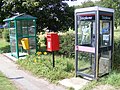 Farnham Post Office Postbox, Telephone Box and Bus Shelter - geograph.org.uk - 1406549.jpg 3 072 × 2 304 ; 1,63 Mio
-
 Farnham, dropping into the village from the church - geograph.org.uk - 5719819.jpg 1 600 × 1 064 ; 373 kio
-
 Farnham, Suffolk, St Mary's Church - geograph.org.uk - 5620407.jpg 5 184 × 2 920 ; 1,44 Mio
-
 Farnham, The Street (A12) - geograph.org.uk - 3865024.jpg 640 × 480 ; 299 kio
-
 Field gate adjacent to Burnter's Covert - geograph.org.uk - 4440212.jpg 1 024 × 768 ; 410 kio
-
 Footpath And Gate - geograph.org.uk - 4030747.jpg 768 × 1 024 ; 234 kio
-
 Footpath Crossing Point - geograph.org.uk - 4030967.jpg 1 024 × 768 ; 227 kio
-
 Footpath crossing the railway - geograph.org.uk - 2336968.jpg 3 072 × 2 304 ; 1,48 Mio
-
 Footpath crossing the Restricted Byway - geograph.org.uk - 2336975.jpg 3 072 × 2 304 ; 1,36 Mio
-
 Footpath Next To The Bulls - geograph.org.uk - 4031028.jpg 1 024 × 768 ; 262 kio
-
 Footpath stile - geograph.org.uk - 2337200.jpg 2 304 × 3 072 ; 1,51 Mio
-
 Footpath to Benhall Stock Cottages - geograph.org.uk - 2341242.jpg 3 072 × 2 304 ; 1,28 Mio
-
 Footpath to Benhall Stock Cottages - geograph.org.uk - 2341257.jpg 3 072 × 2 304 ; 1,31 Mio
-
 Footpath to Botany Cottage - geograph.org.uk - 2336906.jpg 3 072 × 2 304 ; 1,42 Mio
-
 Footpath to Botany Cottage - geograph.org.uk - 2336914.jpg 2 304 × 3 072 ; 1,61 Mio
-
 Footpath to Botany Cottage - geograph.org.uk - 2336956.jpg 2 304 × 3 072 ; 1,5 Mio
-
 Footpath to Botany Cottage - geograph.org.uk - 2336970.jpg 3 072 × 2 304 ; 1,34 Mio
-
 Footpath to Botany Farm Drive - geograph.org.uk - 2332274.jpg 3 072 × 2 304 ; 1,28 Mio
-
 Footpath to Elm Tree Farm - geograph.org.uk - 2341258.jpg 3 072 × 2 304 ; 1,29 Mio
-
 Footpath to Farnham - geograph.org.uk - 2341658.jpg 3 072 × 2 304 ; 1,37 Mio
-
 Footpath to Farnham Hall - geograph.org.uk - 2315378.jpg 3 072 × 2 304 ; 1,7 Mio
-
 Footpath to Farnham Hall - geograph.org.uk - 2337012.jpg 3 072 × 2 304 ; 1,38 Mio
-
 Footpath to Farnham Hall ^ entrance to Farnham Hall Farm - geograph.org.uk - 2331998.jpg 3 072 × 2 304 ; 1,53 Mio
-
 Footpath to Farnham Hall ^ entrance to Farnham Hall Farm - geograph.org.uk - 2332014.jpg 3 072 × 2 304 ; 1,37 Mio
-
 Footpath to Farnham ^ entrance to Glemham Hall Estate - geograph.org.uk - 2332231.jpg 3 072 × 2 304 ; 1,45 Mio
-
 Footpath to Farnham ^ entrance to Glemham Hall Estate - geograph.org.uk - 2332264.jpg 3 072 × 2 304 ; 1,46 Mio
-
 Footpath to Hall Farm ^ Burnter's Covert - geograph.org.uk - 2315385.jpg 3 072 × 2 304 ; 1,49 Mio
-
 Footpath to Hall Farm ^ Burnter's Covert - geograph.org.uk - 2315391.jpg 3 072 × 2 304 ; 1,46 Mio
-
 Footpath to Harrow Lane Restricted Byway - geograph.org.uk - 2322195.jpg 3 072 × 2 304 ; 1,27 Mio
-
 Footpath to Hill Farm Road - geograph.org.uk - 2332075.jpg 3 072 × 2 304 ; 1,62 Mio
-
 Footpath to Hill Farm Road - geograph.org.uk - 2337191.jpg 3 072 × 2 304 ; 1,45 Mio
-
 Footpath to Hill Farm Road - geograph.org.uk - 2337193.jpg 2 304 × 3 072 ; 1,42 Mio
-
 Footpath to Hill Farm Road - geograph.org.uk - 2337204.jpg 2 304 × 3 072 ; 1,69 Mio
-
 Footpath to Hill Farm Road - geograph.org.uk - 2337208.jpg 3 072 × 2 304 ; 1,66 Mio
-
 Footpath to Hill Farm Road - geograph.org.uk - 2341248.jpg 3 072 × 2 304 ; 1,29 Mio
-
 Footpath to Manor Farm ^ Aldercar Lane - geograph.org.uk - 2330276.jpg 3 072 × 2 304 ; 1,41 Mio
-
 Footpath to Manor Farm ^ Aldercar Lane - geograph.org.uk - 2330280.jpg 3 072 × 2 304 ; 1,29 Mio
-
 Footpath To Monks Valley House - geograph.org.uk - 2332020.jpg 3 072 × 2 304 ; 1,51 Mio
-
 Footpath to Monks Valley House - geograph.org.uk - 2332023.jpg 3 072 × 2 304 ; 1,66 Mio
-
 Footpath to Monks Valley House - geograph.org.uk - 2341653.jpg 2 304 × 3 072 ; 1,66 Mio
-
 Footpath to Monks Valley House entrance - geograph.org.uk - 2341649.jpg 2 304 × 3 072 ; 1,67 Mio
-
 Footpath to Monks Valley House entrance - geograph.org.uk - 2341650.jpg 2 304 × 3 072 ; 1,62 Mio
-
 Footpath to New Road - geograph.org.uk - 2336910.jpg 3 072 × 2 304 ; 1,42 Mio
-
 Footpath to New Road - geograph.org.uk - 2337153.jpg 2 304 × 3 072 ; 1,65 Mio
-
 Footpath to New Road - geograph.org.uk - 2337157.jpg 2 304 × 3 072 ; 1,64 Mio
-
 Footpath to New Road - geograph.org.uk - 2337162.jpg 3 072 × 2 304 ; 1,67 Mio
-
 Footpath to New Road - geograph.org.uk - 2337164.jpg 3 072 × 2 304 ; 1,43 Mio
-
 Footpath to New Road - geograph.org.uk - 2337176.jpg 2 304 × 3 072 ; 1,47 Mio
-
 Footpath to New Road - geograph.org.uk - 2337183.jpg 3 072 × 2 304 ; 1,32 Mio
-
 Footpath to New Road - geograph.org.uk - 2341237.jpg 3 072 × 2 304 ; 1,44 Mio
-
 Footpath to Racewalk Covert ^ Gromford - geograph.org.uk - 2332048.jpg 3 072 × 2 304 ; 1,48 Mio
-
 Footpath to Racewalk Covert ^ Gromford - geograph.org.uk - 2332049.jpg 3 072 × 2 304 ; 1,66 Mio
-
 Footpath to Racewalk Covert ^ Gromford - geograph.org.uk - 2332051.jpg 3 072 × 2 304 ; 1,35 Mio
-
 Footpath to the A1094 Farnham Road - geograph.org.uk - 2331973.jpg 2 304 × 3 072 ; 1,44 Mio
-
 Footpath to the A1094 Farnham Road - geograph.org.uk - 2341656.jpg 3 072 × 2 304 ; 1,53 Mio
-
 Footpath to the U2321 - geograph.org.uk - 2336992.jpg 3 072 × 2 304 ; 1,33 Mio
-
 Footpath to the U2321 - geograph.org.uk - 2337167.jpg 2 304 × 3 072 ; 1,64 Mio
-
 Footpath to the U2321 - geograph.org.uk - 2337168.jpg 2 304 × 3 072 ; 1,66 Mio
-
 Footpath to the U2321 - geograph.org.uk - 2337170.jpg 2 304 × 3 072 ; 1,36 Mio
-
 Footpath to the U2321 - geograph.org.uk - 2341659.jpg 3 072 × 2 304 ; 1,54 Mio
-
 Footpath to U2321 - geograph.org.uk - 2341651.jpg 3 072 × 2 304 ; 1,67 Mio
-
 Footpath to Walk Barn - geograph.org.uk - 2337017.jpg 3 072 × 2 304 ; 1,23 Mio
-
 Footpath ^ entrance to Monks Valley House - geograph.org.uk - 2330243.jpg 3 072 × 2 304 ; 1,7 Mio
-
 Footpath ^ entrance to Monks Valley House - geograph.org.uk - 2330254.jpg 3 072 × 2 304 ; 1,63 Mio
-
 Footpath ^ entrance to Monks Valley House - geograph.org.uk - 2333584.jpg 3 072 × 2 304 ; 1,63 Mio
-
 Footpath ^ Gemham Hall Estate sign - geograph.org.uk - 2332649.jpg 2 304 × 3 072 ; 1,44 Mio
-
 Footpaths to Walk Barn Farm - geograph.org.uk - 2332052.jpg 2 304 × 3 072 ; 1,48 Mio
-
 Former Shop - geograph.org.uk - 4030843.jpg 1 024 × 768 ; 174 kio
-
 Former shop in Farnham - geograph.org.uk - 2804686.jpg 640 × 480 ; 142 kio
-
 Former Village Shop - geograph.org.uk - 1063149.jpg 3 072 × 2 304 ; 1,23 Mio
-
 Fragment of a rood screen - geograph.org.uk - 4942015.jpg 1 500 × 1 004 ; 810 kio
-
 Gate And Sign - geograph.org.uk - 4031046.jpg 768 × 1 024 ; 228 kio
-
 Gemham Hall Estate sign - geograph.org.uk - 2332289.jpg 2 304 × 3 072 ; 1,51 Mio
-
 George and Dragon stables, Farnham - geograph.org.uk - 5457973.jpg 4 513 × 2 874 ; 2,45 Mio
-
 Grazing near Gorse Farm - geograph.org.uk - 4735610.jpg 640 × 409 ; 34 kio
-
 Greenwood Burial Ground - geograph.org.uk - 2337025.jpg 3 072 × 2 304 ; 1,46 Mio
-
 Heavy traffic grinds through Farnham - geograph.org.uk - 5969361.jpg 1 600 × 1 064 ; 314 kio
-
 Heavy traffic grinds through Farnham - geograph.org.uk - 5969362.jpg 1 600 × 1 064 ; 381 kio
-
 Hill Farm Road, Farnham - geograph.org.uk - 2315396.jpg 3 072 × 2 304 ; 1,5 Mio
-
 Hill Farm Road, Farnham - geograph.org.uk - 2315397.jpg 3 072 × 2 304 ; 1,65 Mio
-
 Hill Farm Road, Farnham - geograph.org.uk - 2332258.jpg 3 072 × 2 304 ; 1,42 Mio
-
 Hill Farm Road, Farnham - geograph.org.uk - 2332272.jpg 3 072 × 2 304 ; 1,54 Mio
-
 Hill Farm Road, Farnham - geograph.org.uk - 2332278.jpg 3 072 × 2 304 ; 1,36 Mio
-
 Hill Farm Road, Farnham - geograph.org.uk - 2337220.jpg 2 304 × 3 072 ; 1,3 Mio
-
 Hill Farm Road, Farnham - geograph.org.uk - 2337224.jpg 3 072 × 2 304 ; 1,25 Mio
-
 Hill Farm Road, Farnham - geograph.org.uk - 2337231.jpg 2 304 × 3 072 ; 1,39 Mio
-
 Hill Farm Road, Farnham - geograph.org.uk - 2337232.jpg 3 072 × 2 304 ; 1,36 Mio
-
 Hill Farm Road, Farnham - geograph.org.uk - 2337237.jpg 3 072 × 2 304 ; 1,46 Mio
-
 House, Botany Farm - geograph.org.uk - 4735611.jpg 640 × 378 ; 41 kio
-
 Into The Distance - geograph.org.uk - 4030944.jpg 768 × 1 024 ; 293 kio
-
 Lane to the A12 road, Farnham - geograph.org.uk - 2804676.jpg 640 × 480 ; 156 kio
-
 Level Crossing Gates - geograph.org.uk - 4031128.jpg 1 024 × 768 ; 254 kio
-
 Level Crossing on the Restricted Byway to Botany Farm - geograph.org.uk - 2336839.jpg 3 072 × 2 304 ; 1,34 Mio
-
 Level Crossing on the Restricted Byway to the U2321 - geograph.org.uk - 2336865.jpg 3 072 × 2 304 ; 1,32 Mio
-
 Looking South - geograph.org.uk - 4030997.jpg 1 024 × 768 ; 347 kio
-
 Looking towards the A12 The Street - geograph.org.uk - 2337181.jpg 3 072 × 2 304 ; 1,32 Mio
-

-
 Low-lying fields by the railway line - geograph.org.uk - 5616221.jpg 1 600 × 1 064 ; 267 kio
-
 Low-lying fields by the railway line - geograph.org.uk - 5616224.jpg 1 600 × 1 064 ; 254 kio
-
 Map of Farnham from 1837.png 505 × 301 ; 327 kio
-
 New Road looking towards Burnt House Farm - geograph.org.uk - 2332056.jpg 3 072 × 2 304 ; 1,38 Mio
-
 New Road looking towards Burnt House Farm - geograph.org.uk - 2332181.jpg 3 072 × 2 304 ; 1,25 Mio
-
 New Road looking towards the A1094 Farnham Road - geograph.org.uk - 2332055.jpg 3 072 × 2 304 ; 1,36 Mio
-
 New Road looking towards the Greenwood Burial Ground - geograph.org.uk - 2331989.jpg 3 072 × 2 304 ; 1,27 Mio
-
 Notice at Greenwood Burial Ground - geograph.org.uk - 2337022.jpg 2 304 × 3 072 ; 1,33 Mio
-
 Old Milestone - geograph.org.uk - 2212498.jpg 1 600 × 1 200 ; 574 kio
-
 Old warehouse, Farnham - geograph.org.uk - 2804678.jpg 640 × 480 ; 147 kio
-
 One track road near Farnham church - geograph.org.uk - 1048230.jpg 480 × 640 ; 163 kio
-
 Path off the footpath to Botany Cottage - geograph.org.uk - 2336913.jpg 3 072 × 2 304 ; 1,59 Mio
-
 Path off the footpath to Botany Farm - geograph.org.uk - 2337003.jpg 3 072 × 2 304 ; 1,52 Mio
-
 Pedestrian Level Crossing - geograph.org.uk - 2336959.jpg 3 072 × 2 304 ; 1,32 Mio
-
 Private road at Farnham - geograph.org.uk - 1048235.jpg 480 × 640 ; 174 kio
-
 Railway line to Saxmundham Railway Station - geograph.org.uk - 2336848.jpg 3 072 × 2 304 ; 1,36 Mio
-
 Railway Line to Saxmundham Railway Station - geograph.org.uk - 2336961.jpg 3 072 × 2 304 ; 1,34 Mio
-
 Railway Line to Wickham Market Railway Station - geograph.org.uk - 2336852.jpg 3 072 × 2 304 ; 1,19 Mio
-
 Railway Line to Wickham Market Railway Station - geograph.org.uk - 2336858.jpg 3 072 × 2 304 ; 1,13 Mio
-
 Railway Line to Wickham Market Railway Station - geograph.org.uk - 2336963.jpg 3 072 × 2 304 ; 1,2 Mio
-
 Railway Lines to Saxmundham - geograph.org.uk - 2336995.jpg 3 072 × 2 304 ; 1,38 Mio
-
 Restricted Byway sign to Botany Farm - geograph.org.uk - 2330301.jpg 2 304 × 3 072 ; 1,34 Mio
-
 Restricted Byway to Botany Farm - geograph.org.uk - 2330294.jpg 3 072 × 2 304 ; 1,4 Mio
-
 Restricted Byway to Botany Farm - geograph.org.uk - 2332069.jpg 3 072 × 2 304 ; 1,35 Mio
-
 Restricted Byway to Botany Farm - geograph.org.uk - 2336854.jpg 3 072 × 2 304 ; 1,46 Mio
-
 Restricted Byway to Botany Farm - geograph.org.uk - 2336982.jpg 3 072 × 2 304 ; 1,34 Mio
-
 Restricted Byway to the Level Crossing ^ U2321 - geograph.org.uk - 2336984.jpg 3 072 × 2 304 ; 1,33 Mio
-
 Restricted Byway to the U2321 - geograph.org.uk - 2336862.jpg 3 072 × 2 304 ; 1,32 Mio
-
 Restricted Byway ^ entrance to Botany Farm - geograph.org.uk - 2330308.jpg 3 072 × 2 304 ; 1,55 Mio
-
 River Alde from Stratford bridge - geograph.org.uk - 5457966.jpg 5 202 × 3 465 ; 4,11 Mio
-
 Road To The Sunshine - geograph.org.uk - 4030924.jpg 768 × 1 024 ; 184 kio
-

-
 Rural lane in Farnham - geograph.org.uk - 2804666.jpg 640 × 480 ; 201 kio
-
 Rural lane to Farnham - geograph.org.uk - 2804667.jpg 640 × 480 ; 225 kio
-
 Sheep On Footpath - geograph.org.uk - 4031060.jpg 1 024 × 768 ; 225 kio
-
 St Mary's church noticeboard, Farnham - geograph.org.uk - 5457981.jpg 5 202 × 3 465 ; 2,71 Mio
-
 St Mary's church, Farnham, Suffolk - geograph.org.uk - 5719817.jpg 1 600 × 1 064 ; 431 kio
-
 St Mary's churchyard looking south - geograph.org.uk - 5457993.jpg 5 202 × 3 465 ; 3,08 Mio
-
 Stile on the footpath near the pedestrian level crossing - geograph.org.uk - 2336958.jpg 3 072 × 2 304 ; 1,25 Mio
-
 Stop Look Listen - geograph.org.uk - 4031003.jpg 768 × 1 024 ; 323 kio
-
 Straight Path - geograph.org.uk - 4030884.jpg 1 024 × 768 ; 250 kio
-
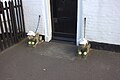 Tennis-loving guard demons, Farnham - geograph.org.uk - 5458001.jpg 5 202 × 3 465 ; 3,65 Mio
-
 Terraced cottages along the A12 road in Farnham - geograph.org.uk - 2804694.jpg 640 × 488 ; 168 kio
-
 The A1094 bridge over the railway - geograph.org.uk - 2333570.jpg 3 072 × 2 304 ; 1,36 Mio
-
 The A12 passing through Farnham - geograph.org.uk - 3864780.jpg 640 × 480 ; 325 kio
-
 The A12 road past Farnham Industrial Estate - geograph.org.uk - 2804688.jpg 640 × 480 ; 135 kio
-
 The A12 road through Farnham - geograph.org.uk - 2804682.jpg 640 × 480 ; 144 kio
-
 The A12, Farnham - geograph.org.uk - 5379026.jpg 2 216 × 1 604 ; 910 kio
-
 The A12, Farnham - geograph.org.uk - 5379030.jpg 2 206 × 1 588 ; 936 kio
-
 The bridge at Snape Watering - geograph.org.uk - 4070048.jpg 1 536 × 1 153 ; 1,06 Mio
-
 The Farnham Industrial Estate - geograph.org.uk - 2804689.jpg 640 × 497 ; 148 kio
-
 The Farnham industrial estate - geograph.org.uk - 5373615.jpg 2 266 × 1 676 ; 1,02 Mio
-
 The Greenwood Burial Ground sign - geograph.org.uk - 2332027.jpg 2 304 × 3 072 ; 1,65 Mio
-
 The Old Post Office in Farnham - geograph.org.uk - 2804673.jpg 640 × 480 ; 213 kio
-
 The Old Post Office, Farnham - geograph.org.uk - 2804679.jpg 640 × 480 ; 197 kio
-
 The Pelican of Farnham - geograph.org.uk - 3052285.jpg 3 072 × 2 304 ; 1,23 Mio
-
 The Pelican of Farnham - geograph.org.uk - 3052286.jpg 3 072 × 2 304 ; 1,06 Mio
-
 The R Alde at Langham Bridge near Blaxhall - geograph.org.uk - 5620412.jpg 5 184 × 2 920 ; 5,76 Mio
-
 The rear of Brian Fuller Caravan Dealer - geograph.org.uk - 1221086.jpg 3 072 × 2 304 ; 1,46 Mio
-
 The rear of Linden Farm - geograph.org.uk - 1050212.jpg 3 072 × 2 304 ; 1,4 Mio
-
 The River Alde - geograph.org.uk - 4031153.jpg 1 024 × 768 ; 360 kio
-
 The River Alde at Langham Bridge - geograph.org.uk - 4440256.jpg 1 024 × 768 ; 469 kio
-
 The River Alde at Langham Bridge - geograph.org.uk - 4440260.jpg 1 024 × 768 ; 661 kio
-
 The U2321 looking towards the A1094 Farmham Road - geograph.org.uk - 2331982.jpg 3 072 × 2 304 ; 1,65 Mio
-
 Three Ways To Go - geograph.org.uk - 4030860.jpg 768 × 1 024 ; 359 kio
-
 Through The Barley - geograph.org.uk - 4030868.jpg 768 × 1 024 ; 266 kio
-
 Track to Mollett's Farm - geograph.org.uk - 2655097.jpg 3 648 × 2 736 ; 2 Mio
-
 View across fields from St Mary's churchyard, Farnham - geograph.org.uk - 5457987.jpg 5 202 × 3 465 ; 3,71 Mio
-
 Wheat Field And Track - geograph.org.uk - 4030760.jpg 1 024 × 768 ; 208 kio
-
 Whin Covert - geograph.org.uk - 2417352.jpg 3 072 × 2 304 ; 1,39 Mio
-
 A12 Benhall Bypass - geograph.org.uk - 1433042.jpg 3 072 × 2 304 ; 1,23 Mio
-
 A12 road round Glemham Park - geograph.org.uk - 1003963.jpg 640 × 480 ; 93 kio
-
 A12 Stratford Corner and Stratford Corner Postbox - geograph.org.uk - 1433049.jpg 3 072 × 2 304 ; 1,46 Mio
-
 A12 The Street, Farnham - geograph.org.uk - 1406494.jpg 3 072 × 2 304 ; 1,4 Mio
-
 Across the valley towards Hill Farm - geograph.org.uk - 1147733.jpg 640 × 480 ; 194 kio


_-_geograph.org.uk_-_3865024.jpg)


