Category:Farthingstone
Aller à la navigation
Aller à la recherche
English: Farthingstone is a village in the district of West Northamptonshire in the county of Northamptonshire in England. It is close to the major trunk routes of the M1 junction 16, M40 motorway, and A5 road, in secluded location at the head of a picturesque valley,
village britannique  | |||||
| Téléverser des médias | |||||
| Nature de l’élément | |||||
|---|---|---|---|---|---|
| Lieu | West Northamptonshire, Northamptonshire, Midlands de l'Est, Angleterre | ||||
| Population |
| ||||
| Superficie |
| ||||
| Réputé identique à | Farthingstone (page en doublon, paroisse civile) | ||||
 | |||||
Sous-catégories
Cette catégorie comprend 2 sous-catégories, dont les 2 ci-dessous.
S
T
Média dans la catégorie « Farthingstone »
Cette catégorie comprend 85 fichiers, dont les 85 ci-dessous.
-
 Blue Bell Woods - geograph.org.uk - 1871638.jpg 769 × 1 024 ; 398 kio
-
 Castle Dykes Farm - geograph.org.uk - 6253817.jpg 1 600 × 1 066 ; 349 kio
-
 Cold Mantels Heath - geograph.org.uk - 2189505.jpg 3 504 × 1 572 ; 382 kio
-
 Cottage and garden on Maidford Road - geograph.org.uk - 6180134.jpg 1 600 × 1 066 ; 465 kio
-
 Crossroads south of Weedon - geograph.org.uk - 101765.jpg 640 × 480 ; 83 kio
-
 DTY - Daventry VOR-DME Farthingstone - geograph.org.uk - 2976920.jpg 640 × 480 ; 78 kio
-
 Everdon Stubbs - geograph.org.uk - 4169415.jpg 768 × 1 024 ; 223 kio
-
 Everdon Stubbs, path junction - geograph.org.uk - 4169422.jpg 1 024 × 768 ; 216 kio
-
 Farmhouse and pond by the Knightley Way - geograph.org.uk - 6180159.jpg 1 600 × 1 066 ; 483 kio
-
 Farmland near Stowe Lodge - geograph.org.uk - 2150655.jpg 640 × 480 ; 79 kio
-
 Farthingstone Baptist Chapel - geograph.org.uk - 2147830.jpg 640 × 480 ; 101 kio
-
 Farthingstone Baptist Chapel - geograph.org.uk - 6179866.jpg 1 600 × 1 066 ; 427 kio
-
 Farthingstone Main Street - geograph.org.uk - 2157428.jpg 640 × 480 ; 77 kio
-
 Farthingstone Main Street - geograph.org.uk - 2159587.jpg 640 × 480 ; 53 kio
-
 Farthingstone Road with a stream beneath - geograph.org.uk - 6178382.jpg 1 600 × 1 066 ; 416 kio
-
 Farthingstone Village - geograph.org.uk - 2157419.jpg 640 × 480 ; 94 kio
-
 Farthingstone Woodland - geograph.org.uk - 2147879.jpg 640 × 480 ; 162 kio
-
 Farthingstone, Agricultural panorama (1) - geograph.org.uk - 4365641.jpg 640 × 480 ; 85 kio
-
 Farthingstone, Agricultural panorama (2) - geograph.org.uk - 4365650.jpg 640 × 480 ; 90 kio
-

-
 Farthingstone, Former school - geograph.org.uk - 4371018.jpg 640 × 480 ; 75 kio
-
 Farthingstone, Pansion Row - geograph.org.uk - 4370982.jpg 640 × 480 ; 77 kio
-
 Farthingstone-Everdon Road - geograph.org.uk - 2157424.jpg 640 × 512 ; 60 kio
-
 Farthingstone-Maidford Road - geograph.org.uk - 2157432.jpg 640 × 480 ; 118 kio
-
 Farthingstone-Pansion Row - geograph.org.uk - 2157435.jpg 640 × 480 ; 69 kio
-
 Fields - geograph.org.uk - 1258810.jpg 427 × 640 ; 44 kio
-
 Footpath round Farthingstone - geograph.org.uk - 6180126.jpg 1 600 × 1 066 ; 475 kio
-
 Footpath to Farthingstone - geograph.org.uk - 5368461.jpg 1 024 × 768 ; 264 kio
-
 Footpath to Farthingstone - geograph.org.uk - 6180142.jpg 1 600 × 1 066 ; 410 kio
-
 Footpath to Heath Farm - geograph.org.uk - 6253807.jpg 1 600 × 1 066 ; 487 kio
-
 Footpath to Maidford Road - geograph.org.uk - 6180147.jpg 1 600 × 1 066 ; 560 kio
-
 Footpath towards Knightley Wood - geograph.org.uk - 6180145.jpg 1 600 × 1 066 ; 541 kio
-
 Footpath towards Knightley Wood - geograph.org.uk - 6180172.jpg 1 600 × 1 066 ; 527 kio
-
 Former water tower - geograph.org.uk - 4634919.jpg 3 240 × 4 320 ; 4,05 Mio
-
 From Everdon Stubbs - geograph.org.uk - 1871636.jpg 1 024 × 530 ; 190 kio
-
 Knightley Way goes on to the golf course - geograph.org.uk - 6255664.jpg 1 600 × 1 066 ; 681 kio
-
 Knightley way heading towards the golf course - geograph.org.uk - 6180122.jpg 1 600 × 1 066 ; 482 kio
-
 Knightley Way leaving Farthingstone - geograph.org.uk - 6180132.jpg 1 600 × 1 066 ; 509 kio
-
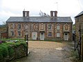
 Little Court, Farthingstone - geograph.org.uk - 2932206.jpg 3 648 × 2 736 ; 1,23 Mio
-
 MacMillan Way heading for Church Stowe - geograph.org.uk - 6252480.jpg 1 600 × 1 066 ; 618 kio
-
 MacMillan Way leaving Farthingstone - geograph.org.uk - 6180167.jpg 1 600 × 1 066 ; 476 kio
-
 MacMillan Way stile and signpost - geograph.org.uk - 6252481.jpg 1 600 × 1 066 ; 724 kio
-
 Maidford Road approaches Little Court Farm complex - geograph.org.uk - 2932205.jpg 3 417 × 2 294 ; 822 kio
-
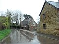 Maidford Road enters Farthingstone - geograph.org.uk - 2932211.jpg 3 648 × 2 736 ; 1,42 Mio
-
 Maidford Road south of Little Court Farm - geograph.org.uk - 2932204.jpg 3 472 × 2 642 ; 1,47 Mio
-
 Memory of a Daughter - geograph.org.uk - 2944204.jpg 3 504 × 2 336 ; 614 kio
-
 Near Everdon Stubbs - geograph.org.uk - 4634927.jpg 4 320 × 3 240 ; 5,37 Mio
-
 Oilseed rape and Daventry DVOR - geograph.org.uk - 5394166.jpg 1 024 × 768 ; 239 kio
-
 Passion Row, Farthingstone - geograph.org.uk - 490407.jpg 640 × 477 ; 90 kio
-
 Path through Mantles Heath - geograph.org.uk - 6255645.jpg 1 600 × 1 066 ; 490 kio
-
 Paths cross on the track to the clubhouse - geograph.org.uk - 6180156.jpg 1 600 × 1 066 ; 339 kio
-
 Pond on the golf course - geograph.org.uk - 6255669.jpg 1 600 × 1 066 ; 466 kio
-
 Scrubby land south west of Little Court Farm - geograph.org.uk - 493851.jpg 640 × 477 ; 106 kio
-
 Seat in Farthingstone - geograph.org.uk - 493845.jpg 640 × 477 ; 115 kio
-
 Sheepfold in the valley - geograph.org.uk - 5216584.jpg 640 × 480 ; 176 kio
-
 Small area of woodland close to Knightley Wood - geograph.org.uk - 5394154.jpg 1 024 × 768 ; 190 kio
-
 Stream winding its way through the harvested fields - geograph.org.uk - 6254034.jpg 1 600 × 1 066 ; 357 kio
-
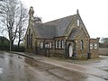
 The old school, Farthingstone - geograph.org.uk - 490392.jpg 640 × 477 ; 106 kio
-
 Track and bridleway to Farthingstone - geograph.org.uk - 6180153.jpg 1 600 × 1 066 ; 601 kio
-
 Trees round the burial ground - geograph.org.uk - 6180169.jpg 1 600 × 1 066 ; 512 kio
-
 Un-named lane west of Stowe Lodge - geograph.org.uk - 2933921.jpg 3 648 × 2 736 ; 1,25 Mio
-
 View to St Mary's from the footpath - geograph.org.uk - 6180129.jpg 1 600 × 1 066 ; 495 kio
-
 View towards distant water tower - geograph.org.uk - 5216602.jpg 640 × 428 ; 165 kio
-
 View towards Woodland near Glebe Farm - geograph.org.uk - 5377073.jpg 1 024 × 768 ; 156 kio
-
 We come in peace - geograph.org.uk - 5371482.jpg 1 024 × 768 ; 201 kio
-
 Weedon Road approaches crossroads south of Castle Dykes Farm - geograph.org.uk - 2933904.jpg 3 648 × 2 549 ; 1,57 Mio
-
 Weedon Road north of Farthingstone - geograph.org.uk - 2932277.jpg 3 496 × 2 581 ; 1,19 Mio
-
 Woodland bench in Everdon Stubbs - geograph.org.uk - 6254028.jpg 1 600 × 1 066 ; 523 kio
-
 Woodland by Glebe Farm - geograph.org.uk - 6180164.jpg 1 600 × 1 066 ; 403 kio
-
 Woodland round Castle Dykes - geograph.org.uk - 6253815.jpg 1 600 × 1 066 ; 496 kio
-
 A prominent barn - geograph.org.uk - 490304.jpg 640 × 477 ; 121 kio
-
 A slippery stile on the Macmillan Way - geograph.org.uk - 127101.jpg 640 × 480 ; 151 kio
-
 Entrance to Little Court Farm - geograph.org.uk - 490411.jpg 640 × 477 ; 86 kio
-
 Entrance to Stowe Heights Farm - geograph.org.uk - 490224.jpg 640 × 477 ; 93 kio
-
 Farmland north of Farthingstone - geograph.org.uk - 490333.jpg 640 × 477 ; 93 kio
-
 Footpath across England - geograph.org.uk - 490353.jpg 640 × 477 ; 85 kio
-
 Footpath towards Farthingstone - geograph.org.uk - 490317.jpg 640 × 477 ; 97 kio
-
 Footpath towards Farthingstone - geograph.org.uk - 490338.jpg 640 × 477 ; 125 kio
-
 Into Lodge Plantation - geograph.org.uk - 490258.jpg 640 × 477 ; 164 kio
-
 Longwall House, Farthingstone - geograph.org.uk - 490360.jpg 640 × 477 ; 100 kio
-
 Macmillan Way footpath near Stowe Lodge - geograph.org.uk - 101684.jpg 640 × 480 ; 41 kio
-
 Macmillan Way signpost - geograph.org.uk - 490283.jpg 640 × 477 ; 141 kio
-
 Shed and sheep - geograph.org.uk - 493854.jpg 640 × 477 ; 88 kio
-
 Snowy footpath - geograph.org.uk - 127095.jpg 640 × 480 ; 83 kio
-
 What is this^ - geograph.org.uk - 127098.jpg 640 × 402 ; 60 kio


_-_geograph.org.uk_-_4365641.jpg)
_-_geograph.org.uk_-_4365650.jpg)


