Category:Fawkham Green
Aller à la navigation
Aller à la recherche
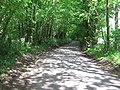
English: Fawkham Green is the main village within the civil parish of Fawkham in the Sevenoaks District of Kent, England. The village is located approximately ten miles (16km) northeast of Sevenoaks town.
village britannique .jpg) | |||||
| Téléverser des médias | |||||
| Nature de l’élément | |||||
|---|---|---|---|---|---|
| Lieu | Fawkham, Sevenoaks, Kent, Angleterre du Sud-Est, Angleterre | ||||
 | |||||
Média dans la catégorie « Fawkham Green »
Cette catégorie comprend 20 fichiers, dont les 20 ci-dessous.
-
 Entrance to The Grove - geograph.org.uk - 324230.jpg 640 × 428 ; 106 kio
-
 Fawkham Green, after rain (geograph 3726985).jpg 1 024 × 768 ; 302 kio
-
 Fawkham Manor, Kent - geograph.org.uk - 261298.jpg 640 × 427 ; 113 kio
-
 M20 Bridge over Brands Hatch Road - geograph.org.uk - 323331.jpg 640 × 428 ; 103 kio
-
 Mussenden Lane in Horton Wood - geograph.org.uk - 1314896.jpg 640 × 480 ; 129 kio
-
 Red Metal fencing on footpath - geograph.org.uk - 1178508.jpg 640 × 481 ; 103 kio
-
 The Rising Sun and Inglenook Restaurant, Fawkham Green - geograph.org.uk - 1862284.jpg 2 048 × 1 536 ; 1,03 Mio
-
 Behind Brands Hatch - geograph.org.uk - 323349.jpg 640 × 428 ; 113 kio
-
 Byway off Canada Farm Road - geograph.org.uk - 324411.jpg 640 × 428 ; 152 kio
-
 Canada Farm Road and Threegates Road - geograph.org.uk - 324239.jpg 640 × 428 ; 136 kio
-
 Entrance to Brands Hatch Paddocks. - geograph.org.uk - 324205.jpg 640 × 428 ; 93 kio
-
 Farningham Above Ground Installation - geograph.org.uk - 324221.jpg 640 × 428 ; 139 kio
-
 M20, towards London - geograph.org.uk - 324210.jpg 640 × 428 ; 86 kio
-
 M20, towards the Channel Ports - geograph.org.uk - 324430.jpg 640 × 428 ; 84 kio
-
 Road Closed - geograph.org.uk - 324247.jpg 640 × 428 ; 81 kio
-
 Slated Cottages, West Kingsdown - geograph.org.uk - 323363.jpg 640 × 429 ; 103 kio
-
 Springham's Cottages, West Kingsdown - geograph.org.uk - 323372.jpg 640 × 428 ; 132 kio
-

-

-
 Woodland Park - geograph.org.uk - 324223.jpg 640 × 428 ; 153 kio


