Category:Fawley, Buckinghamshire
Vai alla navigazione
Vai alla ricerca
Voce principale su Wikipedia: Fawley, Buckinghamshire.
village and civil parish in Buckinghamshire, UK  | |||||
| Carica un file multimediale | |||||
| Istanza di | |||||
|---|---|---|---|---|---|
| Luogo |
| ||||
 | |||||
Sottocategorie
Questa categoria contiene le 8 sottocategorie indicate di seguito, su un totale di 8.
File nella categoria "Fawley, Buckinghamshire"
Questa categoria contiene 151 file, indicati di seguito, su un totale di 151.
-
 3-4 mile marker, Regatta Course - geograph.org.uk - 5937777.jpg 1 024 × 681; 126 KB
-

-
 A4155 south of Fawley Court Farm - geograph.org.uk - 3407327.jpg 3 648 × 2 736; 2,02 MB
-

-
 Bare trees south of Coxlease Farm - geograph.org.uk - 1573663.jpg 640 × 435; 69 KB
-
 Benham's Lane - geograph.org.uk - 5205244.jpg 4 000 × 3 000; 3,52 MB
-
 Benhams Lane north of Fawley Court Farm - geograph.org.uk - 3407340.jpg 3 359 × 2 627; 1,96 MB
-
 Benhams Lane passes Fawley Green - geograph.org.uk - 3408525.jpg 3 648 × 2 736; 3,08 MB
-
 Benhams Lane passes through a coppice - geograph.org.uk - 3408531.jpg 3 306 × 2 631; 2,55 MB
-
 Benhams Lane, Fawley - geograph.org.uk - 1016038.jpg 640 × 480; 150 KB
-
 Benhams Wood - a mixture of species - geograph.org.uk - 3407359.jpg 3 648 × 2 736; 3,78 MB
-
 Between Bucks ^ Oxon - geograph.org.uk - 3705479.jpg 1 024 × 728; 206 KB
-
 Bridleway into Great Wood - geograph.org.uk - 1546489.jpg 640 × 480; 85 KB
-
 Bridleway to Reservoir Hill - geograph.org.uk - 1353139.jpg 640 × 480; 103 KB
-
 Building in the woods - geograph.org.uk - 3422583.jpg 640 × 480; 58 KB
-
 By the River Thames - geograph.org.uk - 4736678.jpg 640 × 426; 82 KB
-
 Car-boat regatta near Remenham - geograph.org.uk - 5280992.jpg 4 677 × 3 219; 2,3 MB
-
 Carousel at Fawley Hill - geograph.org.uk - 5513862.jpg 1 600 × 1 200; 600 KB
-
 Chiltern Scenery near Bosmore Farm - geograph.org.uk - 5982720.jpg 4 915 × 3 101; 3,39 MB
-
 Cottages in Dobson's Lane, Fawley - geograph.org.uk - 5287062.jpg 4 376 × 2 814; 5,84 MB
-
 Cow and calf near Crockmore Farm - geograph.org.uk - 5287078.jpg 4 381 × 2 879; 1,76 MB
-
 Coxlease Farm - geograph.org.uk - 5982737.jpg 1 600 × 1 034; 585 KB
-
 Coxlease Farm, Fawley - geograph.org.uk - 735653.jpg 640 × 427; 149 KB
-
 Crockmore Farmhouse - geograph.org.uk - 3664746.jpg 2 454 × 1 581; 932 KB
-
 Crossing a secondary road on the Oxfordshire Way - geograph.org.uk - 2830003.jpg 3 968 × 2 976; 3,12 MB
-
 Cruiser on Henley Reach - geograph.org.uk - 4721876.jpg 640 × 426; 103 KB
-
 Deer park, Fawley - geograph.org.uk - 295274.jpg 640 × 480; 157 KB
-
 Didcot Power Station from above Assendon - geograph.org.uk - 3639972.jpg 3 264 × 2 448; 2,79 MB
-
 Dobson's Lane, Fawley - geograph.org.uk - 295271.jpg 480 × 640; 101 KB
-
 Dobson's Lane, Fawley - geograph.org.uk - 295272.jpg 480 × 640; 168 KB
-
 Engines at Fawley Hill - geograph.org.uk - 5515131.jpg 1 600 × 1 200; 523 KB
-
 Entrance, Four Oaks Caravan Club site, Henley - geograph.org.uk - 1950498.jpg 3 648 × 2 736; 2,25 MB
-
 Facilities Block, Four Oaks Caravan Club site, Henley - geograph.org.uk - 1950516.jpg 3 648 × 2 736; 2,09 MB
-
 Fallen-down tree off part of the Oxfordshire Way - geograph.org.uk - 2829999.jpg 3 968 × 2 976; 3,16 MB
-
 Farmland, Assendon - geograph.org.uk - 6073177.jpg 1 024 × 768; 272 KB
-
 Farmland, Fawley - geograph.org.uk - 5989582.jpg 1 024 × 768; 334 KB
-
 Farmland, Fawley - geograph.org.uk - 6073185.jpg 1 024 × 768; 180 KB
-
 Farmland, Fawley - geograph.org.uk - 6073191.jpg 1 024 × 768; 227 KB
-
 Farmland, Fawley - geograph.org.uk - 626662.jpg 640 × 480; 106 KB
-
 Farmland, Fawley - geograph.org.uk - 737094.jpg 640 × 480; 149 KB
-
 Fawley Bottom Lane - geograph.org.uk - 61390.jpg 640 × 480; 246 KB
-
 Fawley Bottom Lane approaches Jubilee Plantation - geograph.org.uk - 2892663.jpg 3 511 × 2 542; 2,79 MB
-
 Fawley Bottom Lane beside Eversdown - geograph.org.uk - 2892010.jpg 3 648 × 2 736; 2,77 MB
-
 Fawley Bottom Wood - geograph.org.uk - 3834511.jpg 640 × 480; 167 KB
-
 Fawley Court - geograph.org.uk - 4736677.jpg 640 × 426; 68 KB
-
 Fawley Court - geograph.org.uk - 4744048.jpg 640 × 426; 83 KB
-
 Fawley Court - geograph.org.uk - 5250214.jpg 640 × 426; 83 KB
-
 Fawley Court - geograph.org.uk - 5250248.jpg 640 × 415; 85 KB
-
 Fawley Court - geograph.org.uk - 5270232.jpg 640 × 426; 97 KB
-
 Fawley Court - geograph.org.uk - 5564210.jpg 640 × 426; 67 KB
-
 Fawley Court - geograph.org.uk - 5564484.jpg 640 × 426; 79 KB
-
 Fawley Court - geograph.org.uk - 5937502.jpg 1 024 × 681; 202 KB
-
 Fawley Court reach - geograph.org.uk - 947942.jpg 640 × 427; 182 KB
-
 Fawley Manor from the Thames Path - geograph.org.uk - 5383695.jpg 2 994 × 2 592; 1,39 MB
-
 Fawley Village Hall - geograph.org.uk - 5287051.jpg 4 966 × 3 254; 7,38 MB
-
 Fields at Fawley Hill - geograph.org.uk - 5514339.jpg 1 600 × 1 200; 408 KB
-

-
 Footbridge below Fawley Court - geograph.org.uk - 4278029.jpg 3 660 × 2 528; 2,18 MB
-
 Footbridge, Fawley Hill - geograph.org.uk - 5515186.jpg 1 600 × 1 200; 506 KB
-
 Footpath near Coxlease Farm - geograph.org.uk - 295282.jpg 640 × 480; 122 KB
-
 Footpath through Farm - geograph.org.uk - 1546507.jpg 640 × 480; 68 KB
-
 Footpath to Middle Assendon - geograph.org.uk - 1981944.jpg 640 × 425; 58 KB
-
 Gate in the Corner - geograph.org.uk - 3664692.jpg 2 560 × 1 920; 1,75 MB
-
 Great Wood - geograph.org.uk - 1546468.jpg 640 × 480; 135 KB
-
 Great Wood House - geograph.org.uk - 3664644.jpg 1 600 × 1 178; 365 KB
-
 Great Wood, Fawley - geograph.org.uk - 1032873.jpg 640 × 480; 194 KB
-
 Great Wood, Fawley - geograph.org.uk - 1032902.jpg 640 × 480; 223 KB
-
 Great Wood, Fawley - geograph.org.uk - 1032905.jpg 640 × 480; 206 KB
-
 Great Wood, Hambleden - geograph.org.uk - 5989580.jpg 1 024 × 768; 314 KB
-
 Henley Reach - geograph.org.uk - 4721878.jpg 640 × 426; 58 KB
-
 Henley Reach - geograph.org.uk - 4736680.jpg 640 × 426; 59 KB
-
 Henley Reach - geograph.org.uk - 4740410.jpg 640 × 426; 70 KB
-
 Henley Reach - geograph.org.uk - 4740420.jpg 640 × 426; 68 KB
-
 Henley Reach - geograph.org.uk - 4740597.jpg 640 × 426; 40 KB
-
 Henley Reach - geograph.org.uk - 4740601.jpg 640 × 426; 56 KB
-
 Henley Reach - geograph.org.uk - 4740608.jpg 640 × 426; 38 KB
-
 Henley Reach - geograph.org.uk - 5564232.jpg 640 × 426; 54 KB
-
 Henley Reach - geograph.org.uk - 5564483.jpg 640 × 426; 61 KB
-
 Henley Reach - geograph.org.uk - 5607080.jpg 640 × 426; 77 KB
-
 Henley Reach - geograph.org.uk - 5931651.jpg 1 024 × 681; 149 KB
-
 Henley Reach - geograph.org.uk - 5931694.jpg 1 024 × 681; 137 KB
-
 Henley Reach - geograph.org.uk - 5960604.jpg 1 024 × 681; 155 KB
-
 Henley Regatta Course - geograph.org.uk - 5564185.jpg 640 × 426; 63 KB
-
 Horse jumps in Oaken Grove - geograph.org.uk - 3422573.jpg 640 × 480; 103 KB
-
 Ironhedge - Fawley Hill - geograph.org.uk - 5515226.jpg 1 600 × 1 200; 258 KB
-
 Jubilee Plantation - geograph.org.uk - 36337.jpg 640 × 481; 40 KB
-
 Lane to Henley - geograph.org.uk - 1353084.jpg 640 × 480; 123 KB
-
 Maize seedlings in a Chilterns landscape - geograph.org.uk - 886814.jpg 640 × 480; 251 KB
-
 Maize seedlings near Coxlease Farm - geograph.org.uk - 886805.jpg 640 × 480; 266 KB
-
 Marquees - Fawley Hill - geograph.org.uk - 5515202.jpg 1 600 × 1 200; 260 KB
-
 Marshall Sons & Co traction engine powered timber saw picture.jpg 2 448 × 3 264; 3,52 MB
-
 Narrowboat, River Thames - geograph.org.uk - 5960613.jpg 1 024 × 681; 235 KB
-
 Oaken Grove - geograph.org.uk - 1353034.jpg 640 × 480; 116 KB
-
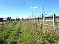
 Oaken Grove vineyard - geograph.org.uk - 3407404.jpg 3 648 × 2 736; 2,77 MB
-
 Office, Four Oaks Caravan Club site, Henley - geograph.org.uk - 1950507.jpg 3 648 × 2 736; 1,68 MB
-
 Openwater swimmers, Henley Reach - geograph.org.uk - 5607074.jpg 640 × 426; 74 KB
-
 Openwater swimmers, Henley Reach - geograph.org.uk - 5607077.jpg 640 × 426; 102 KB
-
 Orange Way after Wiltshire (369) - geograph.org.uk - 3617375.jpg 800 × 600; 81 KB
-
 Orange Way after Wiltshire (371) - geograph.org.uk - 3617382.jpg 800 × 600; 97 KB
-
 Paddock, Fawley - geograph.org.uk - 1016026.jpg 640 × 480; 142 KB
-
 Paddocks and stables, by Oxfordshire Way - geograph.org.uk - 1897809.jpg 1 280 × 960; 650 KB
-
 Pasture northeast of Coxleas farm - geograph.org.uk - 2892680.jpg 3 648 × 2 736; 1,97 MB
-
 Pasture, Fawley - geograph.org.uk - 2333251.jpg 640 × 480; 159 KB
-
 Pasture, Fawley - geograph.org.uk - 5989584.jpg 1 024 × 768; 244 KB
-
 Pasture, Fawley - geograph.org.uk - 735591.jpg 640 × 480; 160 KB
-
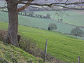
 Pastures near Fawley - geograph.org.uk - 1050837.jpg 640 × 480; 146 KB
-
 Path into Buckinghamshire - geograph.org.uk - 3666436.jpg 1 024 × 768; 262 KB
-
 Public bridleway south of Coxlease Farm – view north - geograph.org.uk - 2831693.jpg 3 968 × 2 976; 3,19 MB
-
 Public bridleway to Stonar - geograph.org.uk - 3834524.jpg 640 × 480; 165 KB
-
 Quarter mile marker, Henley Regatta course - geograph.org.uk - 5931652.jpg 1 024 × 681; 154 KB
-
 Reducing the Pressure - geograph.org.uk - 3664572.jpg 1 600 × 1 126; 579 KB
-
 Regatta course - geograph.org.uk - 5937776.jpg 1 024 × 681; 183 KB
-
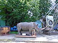 Rhinoceros model - Fawley Hill - geograph.org.uk - 5514348.jpg 1 600 × 1 200; 662 KB
-
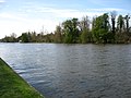
 River Thames - Henley Reach - geograph.org.uk - 5937461.jpg 1 024 × 681; 156 KB
-
 River Thames at Henley Reach - geograph.org.uk - 4439138.jpg 2 592 × 1 944; 1,47 MB
-
 River Thames at Henley Reach - geograph.org.uk - 4439143.jpg 2 592 × 1 944; 1,49 MB
-
 Road to Bosmore Farm - geograph.org.uk - 5982727.jpg 5 184 × 3 456; 3,97 MB
-
 Roothouse Wood - geograph.org.uk - 61382.jpg 640 × 480; 208 KB
-
 Round House, Fawley - geograph.org.uk - 3574790.jpg 1 600 × 1 163; 470 KB
-
 Roundhouse Farm - geograph.org.uk - 36341.jpg 640 × 481; 47 KB
-
 Rowe Wood - geograph.org.uk - 61392.jpg 640 × 480; 253 KB
-
 Rowe Wood, Fawley - geograph.org.uk - 1032913.jpg 640 × 480; 194 KB
-
 Rowers on the Regatta course - geograph.org.uk - 5937463.jpg 1 024 × 681; 195 KB
-
 Sheep grazing near Upper Woodend Farm - geograph.org.uk - 97373.jpg 640 × 480; 79 KB
-
 Signal Box at Fawley Hill - geograph.org.uk - 5514307.jpg 1 600 × 1 200; 480 KB
-
 Somersham Station - Fawley Hill - geograph.org.uk - 5514321.jpg 1 600 × 1 200; 428 KB
-
 St Mary the Virgin church, Fawley - geograph.org.uk - 5287069.jpg 4 960 × 3 030; 7,17 MB
-
 Steep pasture east of Bosmore Farm - geograph.org.uk - 3409214.jpg 3 648 × 2 736; 2,6 MB
-
 Stonor Estate Land - geograph.org.uk - 3668719.jpg 1 024 × 768; 225 KB
-

-
 The Assendon valley - geograph.org.uk - 295285.jpg 640 × 480; 150 KB
-

-

-
 The green, Fawley - geograph.org.uk - 1050841.jpg 640 × 480; 260 KB
-
 The Old Bakehouse - geograph.org.uk - 2892653.jpg 3 648 × 2 736; 2,23 MB
-
 The Oxfordshire Way near Assendon - geograph.org.uk - 3666350.jpg 1 024 × 768; 270 KB
-
 The Regatta Course, Henley - geograph.org.uk - 5250217.jpg 640 × 426; 47 KB
-
 The Regatta Course, Henley - geograph.org.uk - 5250218.jpg 640 × 426; 67 KB
-
 The River Thames, Fawley - geograph.org.uk - 1015535.jpg 640 × 480; 153 KB
-
 The River Thames, Fawley - geograph.org.uk - 1015543.jpg 640 × 480; 162 KB
-
 The Upper Thames Rowing Club - geograph.org.uk - 4277977.jpg 1 600 × 1 045; 613 KB
-
 The Walnut Tree - geograph.org.uk - 3408550.jpg 3 648 × 2 736; 1,99 MB
-
 The well and green Fawley - geograph.org.uk - 1050848.jpg 640 × 480; 259 KB
-
 Toad Hall Garden Centre - geograph.org.uk - 6109422.jpg 3 840 × 2 160; 4,36 MB
-
 Toad Hall Garden Centre - geograph.org.uk - 6109428.jpg 3 617 × 1 976; 3,23 MB
-
 Track into Oaken Grove - geograph.org.uk - 5205234.jpg 1 600 × 1 200; 956 KB
-
 Trees felled by wind, Gussetts Wood - geograph.org.uk - 886541.jpg 480 × 640; 348 KB
-
 Un-named lane passes Roundhouse Farm - geograph.org.uk - 3409205.jpg 3 578 × 2 523; 1,8 MB
-
 View west from Fawley Bottom Lane - geograph.org.uk - 3834505.jpg 640 × 480; 91 KB
-
 Wallaby in Rowe Wood, Fawley - geograph.org.uk - 1032918.jpg 640 × 480; 203 KB
-
 Woodland, Fawley - geograph.org.uk - 295275.jpg 640 × 480; 147 KB


_-_geograph.org.uk_-_3617375.jpg)
_-_geograph.org.uk_-_3617382.jpg)


