Category:Featherstone, Staffordshire
Aller à la navigation
Aller à la recherche
English: Featherstone is a small village in the district of South Staffordshire, England, near to the border with Wolverhampton. Originally a farming community consisting of a few scattered farms. It is mentioned in the Doomsday Book of 1086, and was owned by the Clergy of Wolverhampton Church. It is possible that the population numbers were fairly static until the opening of a new mine, Hilton Main, in the 1920's, it closed in 1969.
village britannique  | |||||
| Téléverser des médias | |||||
| Nature de l’élément | |||||
|---|---|---|---|---|---|
| Lieu | South Staffordshire, Staffordshire, Midlands de l'Ouest, Angleterre | ||||
| Réputé identique à | Featherstone (page en doublon, paroisse civile) | ||||
 | |||||
Sous-catégories
Cette catégorie comprend seulement la sous-catégorie ci-dessous.
M
Média dans la catégorie « Featherstone, Staffordshire »
Cette catégorie comprend 109 fichiers, dont les 109 ci-dessous.
-
 'X' marks another spot - geograph.org.uk - 259853.jpg 600 × 450 ; 285 kio
-
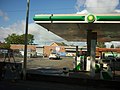 A BP garage on the A460 at Featherstone - geograph.org.uk - 2617572.jpg 800 × 600 ; 255 kio
-
 A rare quiet moment - geograph.org.uk - 4103329.jpg 1 142 × 857 ; 398 kio
-
 A460, Featherstone - geograph.org.uk - 3862936.jpg 640 × 480 ; 242 kio
-
 Access road to Hilton Cross Business Park - geograph.org.uk - 2121348.jpg 640 × 480 ; 114 kio
-
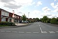 Baneberry Drive, Featherstone - geograph.org.uk - 2454586.jpg 640 × 428 ; 51 kio
-
 Bee skep - geograph.org.uk - 5164526.jpg 800 × 600 ; 165 kio
-
 Behind Moseley - geograph.org.uk - 2513715.jpg 4 000 × 3 000 ; 6,01 Mio
-
 Brookhouse Lane becomes The Avenue - geograph.org.uk - 4102871.jpg 1 142 × 857 ; 277 kio
-
 Buildings at Moseley Old Hall - geograph.org.uk - 6296842.jpg 1 024 × 768 ; 289 kio
-
 Campion Drive, Featherstone - geograph.org.uk - 4102865.jpg 1 142 × 857 ; 351 kio
-
 Cannock Road - geograph.org.uk - 6389195.jpg 800 × 600 ; 105 kio
-
 Cannock Road Lights - geograph.org.uk - 3444972.jpg 800 × 600 ; 82 kio
-
 Cat and Kittens Lane, Featherstone - geograph.org.uk - 2454575.jpg 640 × 428 ; 57 kio
-
 Coming into Featherstone - geograph.org.uk - 4102857.jpg 1 142 × 857 ; 503 kio
-
 East along Brookhouse Lane - geograph.org.uk - 4102833.jpg 979 × 734 ; 359 kio
-
 Entrance to Featherstone Lane - geograph.org.uk - 2454382.jpg 640 × 428 ; 79 kio
-
 Extending Featherstone Prison - geograph.org.uk - 2121345.jpg 640 × 480 ; 87 kio
-
 Featherstone 2 Under Constructin.jpg 640 × 480 ; 74 kio
-
 Featherstone Farm.jpg 640 × 428 ; 111 kio
-
 Featherstone Lane Sign - geograph.org.uk - 3111103.jpg 800 × 600 ; 120 kio
-
 Featherstone Methodist Church - geograph.org.uk - 3862930.jpg 640 × 480 ; 232 kio
-
 Featherstone Methodist Church - geograph.org.uk - 867345.jpg 640 × 480 ; 89 kio
-
 Featherstone Post Office - geograph.org.uk - 867356.jpg 640 × 480 ; 74 kio
-
 Featherstone Post Office - geograph.org.uk - 867359.jpg 640 × 480 ; 85 kio
-
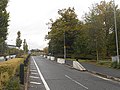
 Featherstone roundabout at junction 1 - geograph.org.uk - 4563504.jpg 640 × 388 ; 41 kio
-
 Field Scene - geograph.org.uk - 6389239.jpg 800 × 600 ; 135 kio
-
 Fields west of Shareshill, Staffordshire - geograph.org.uk - 663368.jpg 640 × 401 ; 110 kio
-
 Finger post at a crossroads - geograph.org.uk - 2121349.jpg 480 × 640 ; 78 kio
-
 Footpath from Featherstone Hall Farm - geograph.org.uk - 501955.jpg 640 × 480 ; 299 kio
-
 Footpath Gate - geograph.org.uk - 6389227.jpg 800 × 600 ; 208 kio
-

-
 Health Club on the Broadlands Development - geograph.org.uk - 327614.jpg 600 × 450 ; 185 kio
-

-
 In the garden of Moseley Old Hall - geograph.org.uk - 6297471.jpg 6 139 × 4 212 ; 3,44 Mio
-
 Island View - geograph.org.uk - 6389205.jpg 800 × 600 ; 79 kio
-
 M54 approaching Junction 1 - geograph.org.uk - 3107508.jpg 640 × 430 ; 51 kio
-
 M54 approaching Junction 1 - geograph.org.uk - 3107509.jpg 640 × 430 ; 49 kio
-
 M54 approaching junction 1 - geograph.org.uk - 4563479.jpg 640 × 365 ; 37 kio
-
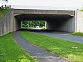
 M54 Bridge - geograph.org.uk - 5338710.jpg 800 × 600 ; 136 kio
-
 M54 eastbound junction 1 - geograph.org.uk - 4225370.jpg 640 × 353 ; 38 kio
-
 M54 Junction 1 - geograph.org.uk - 3107515.jpg 640 × 430 ; 45 kio
-
-
 M54 motorway - lane drop at junction 1 - geograph.org.uk - 3501464.jpg 640 × 480 ; 63 kio
-
 M54 motorway crossed by power lines - geograph.org.uk - 3501455.jpg 640 × 480 ; 63 kio
-
 M54 near Featherstone, Staffordshire - geograph.org.uk - 391701.jpg 640 × 458 ; 116 kio
-
 M54 north of Hilton Cross Business Park - geograph.org.uk - 3707929.jpg 3 385 × 2 608 ; 1 017 kio
-
 M54 View - geograph.org.uk - 672225.jpg 640 × 480 ; 94 kio
-
 M54, Junction 1 - geograph.org.uk - 3112001.jpg 640 × 430 ; 48 kio
-
 M54, junction 1 roundabout - geograph.org.uk - 4103057.jpg 1 142 × 857 ; 386 kio
-
 Moseley Gate - geograph.org.uk - 2513696.jpg 3 000 × 4 000 ; 4,6 Mio
-
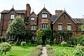
 Moseley Old Hall - geograph.org.uk - 6296841.jpg 1 024 × 768 ; 320 kio
-
 Moseley Old Hall - geograph.org.uk - 6297465.jpg 6 000 × 4 000 ; 3,99 Mio
-
 Moseley Old Hall - geograph.org.uk - 6297467.jpg 6 000 × 4 000 ; 3,92 Mio
-
 Moseley Old Hall - geograph.org.uk - 6297468.jpg 6 000 × 4 000 ; 3,43 Mio
-
 Moseley Old Hall - geograph.org.uk - 6297469.jpg 6 000 × 4 000 ; 3,47 Mio
-
 Moseley Old Hall - geograph.org.uk - 6297470.jpg 6 000 × 4 000 ; 3,82 Mio
-
 Moseley Old Hall - geograph.org.uk - 6316303.jpg 1 080 × 810 ; 246 kio
-
 Moseley Old Hall Repairs - geograph.org.uk - 6389314.jpg 800 × 600 ; 164 kio
-
 Moseley Old Hall, Wolverhampton (NT) - geograph.org.uk - 6231116.jpg 2 000 × 1 333 ; 2,75 Mio
-
 Narrow lane leading to Moseley Old Hall - geograph.org.uk - 2595702.jpg 640 × 428 ; 116 kio
-
 National Grid's Bushbury D substation - geograph.org.uk - 4101317.jpg 979 × 734 ; 354 kio
-
 Old Bridge - geograph.org.uk - 5338725.jpg 800 × 600 ; 136 kio
-
 Paradise Lane passing HMP Oakwood - geograph.org.uk - 4142286.jpg 1 142 × 857 ; 390 kio
-
 Paradise Lane south of Slade Heath - geograph.org.uk - 4142288.jpg 1 142 × 857 ; 418 kio
-
 Pillbox in Cat and Kittens Lane - geograph.org.uk - 236667.jpg 600 × 493 ; 349 kio
-
 Pond in the grounds of Moseley Old Hall - geograph.org.uk - 5164571.jpg 800 × 600 ; 225 kio
-
 Power lines crossing M54 - geograph.org.uk - 4563473.jpg 640 × 360 ; 39 kio
-
 Prison View - geograph.org.uk - 5338747.jpg 800 × 600 ; 83 kio
-
 Public Bridleway to Featherstone - geograph.org.uk - 2595613.jpg 640 × 428 ; 146 kio
-
 Red White and Blue on Cannock Road - geograph.org.uk - 4563987.jpg 640 × 427 ; 88 kio
-
-
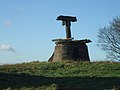 Ruins of old windmill - geograph.org.uk - 294064.jpg 600 × 450 ; 197 kio
-
 Shops on The Avenue - geograph.org.uk - 4103053.jpg 1 142 × 857 ; 370 kio
-
 Slip road at junction 1 - geograph.org.uk - 4563494.jpg 640 × 412 ; 40 kio
-

-
 That's clear enough - geograph.org.uk - 4102849.jpg 979 × 734 ; 358 kio
-
 The Avenue - geograph.org.uk - 4103056.jpg 1 142 × 857 ; 400 kio
-
 The grounds of Moseley Old Hall - geograph.org.uk - 6295101.jpg 6 000 × 4 000 ; 2,95 Mio
-
 The grounds of Moseley Old Hall - geograph.org.uk - 6295104.jpg 6 000 × 4 000 ; 3,63 Mio
-
 The Knot Garden at Moseley Old Hall - geograph.org.uk - 6297466.jpg 6 000 × 4 000 ; 4,12 Mio
-
 The Knot Garden at Moseley Old Hall - geograph.org.uk - 6297472.jpg 6 000 × 4 000 ; 4,14 Mio
-
 The M54 crosses Cat ^ Kittens Lane - geograph.org.uk - 4101325.jpg 1 142 × 857 ; 526 kio
-
 The M54 heading east - geograph.org.uk - 5442109.jpg 1 500 × 993 ; 139 kio
-
 The M54 heading east - geograph.org.uk - 5442111.jpg 1 500 × 999 ; 132 kio
-
 The M54 heading east - geograph.org.uk - 5442113.jpg 1 500 × 993 ; 120 kio
-
 The M54 heading east - geograph.org.uk - 5442116.jpg 1 500 × 999 ; 129 kio
-
 The M54 heading east - geograph.org.uk - 5442118.jpg 1 500 × 975 ; 123 kio
-
 The old Cannock Road - geograph.org.uk - 4103333.jpg 857 × 1 142 ; 519 kio
-
 Under the safety net - geograph.org.uk - 383679.jpg 600 × 450 ; 223 kio
-
 Whitgreave Primary School - geograph.org.uk - 4102881.jpg 1 142 × 857 ; 414 kio
-
 Worcester Black Pear tree - geograph.org.uk - 5165130.jpg 1 024 × 680 ; 440 kio
-
 Worcester Black Pear tree - geograph.org.uk - 5165133.jpg 531 × 800 ; 212 kio
-
 Worcester Black Pear trees - geograph.org.uk - 5165132.jpg 800 × 531 ; 202 kio
-
 Blue Cottage - geograph.org.uk - 259867.jpg 640 × 480 ; 285 kio
-
 Bridge 69 at Coven Heath - geograph.org.uk - 259844.jpg 600 × 450 ; 258 kio
-
 Bridge 71, Staffs and Worcs Canal - geograph.org.uk - 501984.jpg 640 × 480 ; 310 kio
-
 Bridge 71, Staffs and Worcs Canal - geograph.org.uk - 501992.jpg 640 × 480 ; 252 kio
-
 Concrete Blocks Awaiting Delivery - geograph.org.uk - 236647.jpg 640 × 480 ; 253 kio
-
 Cycle path, Featherstone. - geograph.org.uk - 12734.jpg 640 × 480 ; 73 kio
-
 Entrance to Manor Farm and Garden Centre - geograph.org.uk - 501962.jpg 640 × 480 ; 256 kio
-
 Featherstone Hall Farm - geograph.org.uk - 501948.jpg 640 × 480 ; 330 kio
-
 Industrial units near M54 Junction 1 - geograph.org.uk - 236675.jpg 565 × 460 ; 284 kio
-
 M54 Junction 1 - geograph.org.uk - 236641.jpg 575 × 445 ; 200 kio
-
 Northycote Farm, Bushbury - geograph.org.uk - 14978.jpg 640 × 480 ; 93 kio
-
 Oaklands Farm - geograph.org.uk - 182965.jpg 640 × 427 ; 84 kio
-
 Sandstone Wall around Hilton Park - geograph.org.uk - 236637.jpg 640 × 480 ; 269 kio
-
 Telephone Masts - geograph.org.uk - 193486.jpg 640 × 480 ; 85 kio
-
 The Granny Run - geograph.org.uk - 298286.jpg 640 × 480 ; 236 kio


_-_geograph.org.uk_-_2350891.jpg)


_-_geograph.org.uk_-_6231116.jpg)


